The Raleigh Terminal Doppler Weather Radar has been added.
The Current Conditions page has been updated to include a new surface observing location. We are now receiving a METAR from Siler City.
Added Updated hour-by-hour forecasts links to the main menu. The data can be accessed by clicking on the link for the preferred area or click the link for other areas.
The Current Conditions page has been updated to include two new surface observing locations. We are now receiving a METAR from the Tarboro, NC and the Piney Island Bomb Range, NC.
Interface to Hourly Weather Graph has been updated. The data can be accessed via a link on the left side menu.
Created the NWS Raleigh Products & Services Guide web page which highlights all of the Outlooks, Watches, Warnings and Advisories we issue explaining the criteria, WMO codes, VTEC coding and in some cases forecast confidence needed.
Updated the Drought Monitoring page which contains information on the current drought situation, river and streamflow information, precipitation and temperature outlooks, fire danger hazards, and agricultural impact.
Added and updated several reference charts on the Science Page inclduing: SREF - Short Range Ensemble Forecasting Reference, High Resolution WRF Configuration and Details, and Tropical Cyclone Track and Intensity Model Reference.
Updated the Raleigh (RDU) Daily Records in HTML (best for viewing) and Raleigh (RDU) Daily Records in Excel (best for copying data) on the local climate page.
Added the NOAA/NWS Eastern Region Aviation Weather Climate Graphics to the NWS Raleigh Aviation page.
Added the Daily Temperature and Precipitation Maps This web page contains daily maps of Precipitation, Maximum Temperature, and Minimum Temperature. The page also contains the ability to view archived maps for a particular date.
Updated and added new data to the Local Climate Data (LCD) Form F-6 page. The web page now contains historical data for Raleigh, Greensboro, and Fayetteville that includes Preliminary Monthly LCD's, Historical Monthly LCD's, and Historical Annual LCD's.
Added a new publication to the NWS Raleigh Science page. A paper entitled "Helical Circulations in the Typhoon Boundary Layer" was published in the Journal of Geophysical Research - Paper
Added a Terminal Information Board and a link to the Aviation Weather Center - Weather Outlook for central NC to the NWS Raleigh Aviation Forecast page.
Added 3 new sites to the NWS Raleigh Bufkit page. These sites are Lumberton, NC (LBT), Halifax, NC (KIXA), and Rockingham, NC (KRCZ).
An updated version of the NWS Raleigh local forecast model is now available at the NWS Raleigh WRF Modeling Page. The 4km WRF-NMM, is run every 6 hours out 24 hours with no convective parameterization. More information is available on the NWS Raleigh WRF Modeling Page.
Added a new publication to the NWS Raleigh Science page. A paper entitled "Water Vapor Fluxes and Orographic Precipitation over Northern California Associated with a Landfalling Atmospheric River" was published in the Monthly Weather Review - Abstract
A new NWS Raleigh Science page has been added to the web site which contains a history of the NWS Raleigh science program and collaborations with NC State; a discussion of large research projects including CSTAR, Comet, and others; various components of science infusion and sharing; and a list of science presentations, posters, and publications by NWS Raleigh staff.
The Satellite Data page has been updated to include a new Special Raleigh/Central North Carolina Sector and other data.
The Real Time Predominant P-type Nomogram Plots and Partial Thickness Data page has been updated to include observed thickness values from FFC, WAL, and IAD.
Updated the North Carolina NOAA Weather Radio Network Web Page to reflect changes to the broadcast area of the various NOAA Weather Radio transmitters.
Updated the Bufkit page to include bufkit files from the RAH 12km WRF-NMM and the 4km WRF-NMM.
Updated the Photo Gallery page to include photos from several recent events.
NWS Raleigh local forecast model data is now available at the NWS Raleigh Local Models Page. Two models are being produced; a 12km WRF-NMM, run every 6 hours out 36 hours and a 4km WRF-NMM, run every 6 hours out 24 hours. More information is available on the NWS Raleigh Local Models Page.
Added LAMP Forecast Meteograms and LAMP Probabilities and Thresholds for Flight Categories to the MOS page.
Canadian GEM Global Forecasts have been added to the Real Time Predominant P-type Nomogram Plots and Partial Thickness Data Updated page. This page is intended for use with the TREND technique which uses the Partial Thickness Predominant P-type Nomogram. A reference document which contains a thorough review of the TREND technique along with a discussion of the technique, how it is used, its limitations, along with a new method to visualize the nomogram is available at https://www.meas.ncsu.edu/nws/www/trend.
Added a viewer window to display the aviation section of the current Area Forecast Discussion to the Aviation page.
Updated several links on the MOS page to reflect new pages at MDL and to account for the implementation of the new NAM-WRF MOS.
Aviation conditional climatologies for the major airports in central North Carolina have been added to the Local Climate Studies section of the Local Climate Data page on the web site.
The Point and Click Forecasts now use Google Earth. A document has been created to explain some of the changes.
New Marine Observations NOAA's New Marine Weather Web site have been added to the web site.
New Storm Report Maps Experimental Storm Report Maps have been added to the web site.
New Experimental NAM-WRF MOS has been added to the MOS page. MDL is testing new MOS products based on the NAM-WRF which will replace the legacy ETA MET MOS guidance.
New NOAA Weather Radio All Hazards Monitoring Web Page has been added to the web site.
Interface to Forecast Meteograms and Interactive Hourly Weather Forecast Graphs has been added to the web site. The data can be accessed via a link on the left side menu.
Link to the Experimental Graphical GFS MOS Guidance has been added to the MOS page. This data is a product of the National Digital Guidance Database.
The Real Time Predominant P-type Nomogram Plots and Partial Thickness Data Updated page has been added to the web site. This page is intended for use with the TREND technique which uses the Partial Thickness Predominant P-type Nomogram. A reference document which contains a thorough review of the TREND technique along with a discussion of the technique, how it is used, its limitations, along with a new method to visualize the nomogram is available at https://www.meas.ncsu.edu/nws/www/trend.
Climate plots have been updated to include year 2008 data.
Climate plots are available for Raleigh-Durham, Greensboro, and Fayetteville.
New Real Time Predominant P-type Nomogram Plots and Partial Thickness Data page has been added to the web site. This page is intended for use with the TREND technique which uses the Partial Thickness Predominant P-type Nomogram. A reference document which contains a thorough review of the TREND technique along with a discussion of the technique, how it is used, its limitations, along with a new method to visualize the nomogram is available at https://www.meas.ncsu.edu/nws/www/trend.
GFS MOS-Based LAMP guidance has been added to the NWS Raleigh MOS web page.
Daily Records for Raleigh and Greensboro have been updated. The new pages are available from the local climate data page have the date in various formats to making viewing, printing, and data manipulation easier.
Raleigh (RDU) Daily Records in HTML (best for viewing)
Raleigh (RDU) Daily Records in Excel (best for copying data)
Raleigh (RDU) Daily Records in Excel (best for copying data)
Greensboro (GSO) Daily Records in HTML (best for viewing)
Greensboro (GSO) Daily Records in Excel (best for copying data)
Greensboro (GSO) Daily Records in Adobe PDF (best for printing)
The November 22, 1992 North Carolina Tornado Outbreak case study has been updated with additional analysis and imagery.
The CoCoRaHS Precipitation Network Data is now available via the AWIPS product RDULCORAH as well as links on the Hydrology page and the Climate page.
Created a new Drought Monitoring page which contains information on the current drought situation, river and streamflow information, precipitation and temperature outlooks, fire danger hazards, and agricultural impact.
Added a link to Charlotte Terminal Doppler Weather Radar Data.
Added a new Virtual Tour of the NWS Raleigh. We've created a virtual tour of our facility so you can learn more about what our mission is, what our office does, who works here, and what tools we use to monitor and forecast the weather. NWS Raleigh Virtual Tour.
Added a search mechanism to search the "This Date in central North Carolina Weather History" database via the new This Date in central North Carolina Weather History Search page.
Links to the Area Forecast Discussion (AFD) have been redirected to a new web site that allows users to see what changes have been made to the most recent product.
The Advanced Hydrologic Prediction Service (AHPS) page has been updated to include data from various new gages. Background maps for counties and cities have also been improved.
Updated the NWS Raleigh Cooperative Observer Program Web Page to include more detailed information, a map of cooperative observer locations, and links to other information.
Carolinas Coast, a new experimental marine web portal providing marine observations, hazards and forecasts along the coasts of North and South Carolina, is now available.
A link to the 2007 Fire Weather Operating Plan in Adobe PDF format has been added to the fire weather page.
New climate plots have been added to our web site. These plots contain temperature and precipitation data plotted over various time scales for Raleigh-Durham, Greensboro, and Fayetteville. Record data is also plotted for Raleigh-Durham and Greensboro.
Climate plots are available for Raleigh-Durham, Greensboro, and Fayetteville.
A link to the NWS Raleigh, NC Office Brochure has been added to the left hand side menu in the Office Information section.
A link to the NOAA in the Carolinas Web site has been added to the web site.
The Advanced Hydrologic Prediction Service (AHPS) page has been updated to include data from dozens of new gages. Background maps for counties and cities have also been improved.
A link to the NOAA in the Carolinas Web site has been added to the web site.
A Spanish version of our web site has been developed. It can be accessed at https://www.erh.noaa.gov/rah/espanol/
The Current Conditions page has been updated to include a new surface observing location. We are now receiving a METAR from Wadesboro, Anson County Airport (KAFP).
Several Event Summaries and Case Studies have been added to the WFO Raleigh Past Events page.
Updated the WFO Raleigh Satellite Data page. New links to satellite imagery over the Carolinas, East Coast, the Atlantic Ocean and a variety of other imagery.
The NWS Raleigh photo gallery has been updated with additional contact and submission information. NWS Raleigh Photo Gallery.
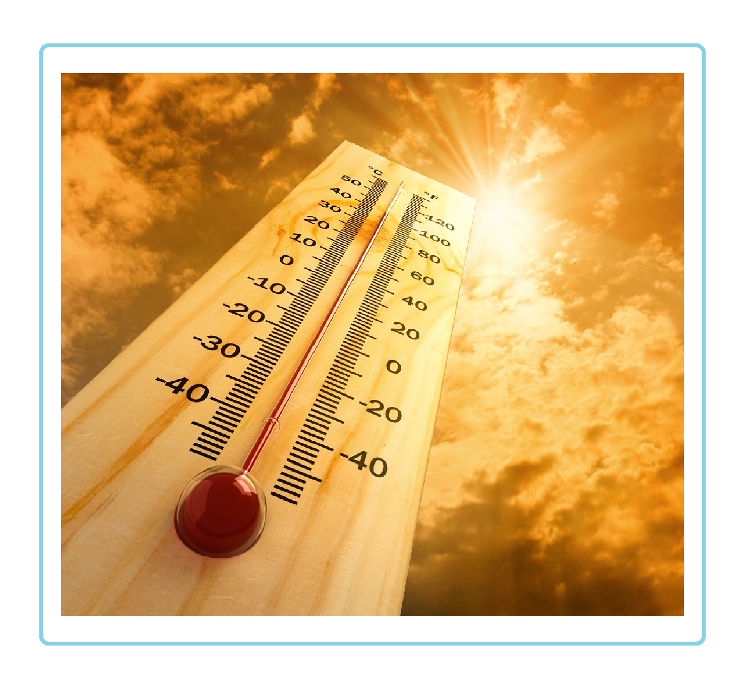
The NWS Raleigh Heat Awareness and Safety Web Page was updated with information about the late July/August 2006 heat wave.
The NWS Raleigh photo gallery has been updated with additional contact and submission information. NWS Raleigh Photo Gallery.
Experimental Graphical GFS MOS Guidance has been added to the NWS Raleigh MOS web page.
The NWS Raleigh photo gallery has been updated with photographs of funnel clouds, flooding from Alberto, along with hail and wind damage. NWS Raleigh Photo Gallery.
Updated the Preparedness and Weather Safety page for Lightning Safety Awareness Week information.
The NWS Raleigh Text Product Database has been updated with links that point to new servers that allow users to easily view multiple versions and previous version of products.
Updated the Preparedness and Weather Safety page for Hurricane Preparedness Week information.
Updated the WFO Raleigh Satellite Data page. Link added to NASA's Interactive Global Geostationary Weather Satellite Images page.
The Current Conditions page has been updated to change the station ID for the Rockingham-Hamlet Airport from K45J to KRCZ.
Updated the Preparedness and Weather Safety page to reflect new dates for Severe Weather Awareness Week (March 12-18, 2006).
The Current Conditions page has been updated to include the METAR at Reidsville, Rockingham County - Shiloh Airport (KSIF).
Upadted the links on the left hand side for the various climate resources. The new menu layout conforms to a new national format.
Added a link to the NOAA in the Carolinas Web Page to the left hand side menu.
Updated the NWS Raleigh NOAA Weather Radio Network Web Page and the North Carolina NOAA Weather Radio Network Web Page to reflect changes to the broadcast area of the Fayetteville, Garner, and Henderson transmitters.
Updated the NWS Raleigh Frequently Asked Questions Page to include additional information on careers with the National Weather Service.
Added information pertaining to North Carolina's Winter Weather Preparedness Week (December 4-10, 2005) which is on our Preparedness and Weather Safety page.
Forecast Page Now Includes the Point Forecast Product. Updated the NWS Raleigh Forecast Page to include the Point Forecast Matrix product.
Bufkit Page Includes a Link to Software Download Information: Updated the NWS Raleigh Bufkit Page to include a link to download the Bufkit software.
New Experimental National Precipitation Graphics Suite: Data from standard rain gages is combined with hourly precipitation estimates from Doppler Radar to derive multisensor precipitation estimates. Precipitation estimates are available in graphical, GIS and NetCDF formats. The suite of graphics includes precipitation for the last day, last 7-days, last 14-days, month-to-date and year-to-date along with archived data. Experimental National Precipitation Graphics Suite
Preliminary Climatology Data (CF6) or LCD data is now updating routinely on the Observed Weather Section of the Raleigh Climate Web Page.
Updated the page layout for the Experimental Forecast Images Web Page. This page is now updating every hour and it uses the same format as regional or national displays of the Experimental Forecast Images.
Updated the WFO Raleigh Satellite Data page. New links to satellite imagery over North Carolina, the Atlantic Ocean and a variety of other imagery.
Information on the Raleigh Climate Web Page will be arranged in a tab format that will include observed weather, climate prediction, climate resources, local information, and astronomical data. A transition document is available to show users where information was formerly located and where that information is located on the new climate web page.
Information on Hurricane Ophelia added to the case study section of the web site.
Maximum Wind Gust Map | Precipitation Map
The Advanced Hydrologic Prediction Services (AHPS) web page has been upgraded to release 2.0. Raleigh AHPS Web Page
Additional enhancements have been made to the RAH Bufkit Data for the Mid Atlantic page. Boone, NC was added to the station list and the creation time of the forecast products has been pushed forward.
Summer 2005 Issue of Changing Skies released. Changing Skies is the new newsletter from NWS Raleigh, that is published three times a year and covers items of interest to emergency managers, weather spotters, and other partners.
Updated the Preparedness and Weather Safety page for Lightning Safety Awareness Week information.
Added Experimental RIDGE Radar Display: RIDGE (Radar Integrated Display with Geospatial Elements) allows radar imagery to be combined with geospatial elements such as topography maps, interstate highways, and rivers. RIDGE also adds the ability to overlay polygon warnings (which outline the locations where a severe thunderstorm or tornado warning is in effect) issued by the National Weather Service.
Experimental Raleigh (RAX) RIDGE Radar | National RIDGE Radar Sites
View the Product Description Document (PDF)
Added Mesoscale Analysis data and imagery from the Storm Prediction Center to the left hand side menu.
Updated the Preparedness and Weather Safety page for Hurricane Preparedness Week information.
Added an Air Quality Forecast Page. Air Quality Forecasts produced by the North Carolina Division of Air Quality and the Forsyth County Environmental Affairs Department are now available on the Air Quality Forecast Page. The Air Quality Forecast will be available as a Text Product (AEUS72 KRAH or RDUAQIRAH) through the NOAA Weather Wire, on our Web Site, and on NOAA Weather Radio.
Updated the Point and Click Forecast Map on the NWS Raleigh Home Page. The forecast map has been updated and improved. The forecasts are dynamically created from gridded forecast fields available in the National Digital Forecast Database (NDFD) which is prepared by NWS Meteorologists. Carefully click on a location in the map below and a specific forecast for that point will be created. Once there, check out the additional forecast options in the lower right hand portion of the page (some examples of these options for Raleigh include... Grid Point Forecast | Hourly Weather Chart | Printable Forecast | Text Only Forecast )
Updated the NWS Raleigh Skywarn Page to announce the Spring Skywarn Training Classes.
Updated the NWS Raleigh Skywarn Page to announce the Spring Skywarn Training Classes.
Updated the NWS Raleigh Preparedness and Weather Safety to announce Flood Safety Awareness Week (March 21-25, 2005).
Updated the Preparedness and Weather Safety page to reflect new dates for Severe Weather Awareness Week (March 13-19, 2005).
Updated the NWS Raleigh Skywarn Page to announce the Spring Skywarn Training Classes.
Updated the NWS Raleigh NOAA Weather Radio Network Web Page and the North Carolina NOAA Weather Radio Network Web Page to reflect the change in the NWR Transmitter ID for the Garner transmitter which is now known as WNG 706.
Updated the Hazards Pages to reflect changes in web addresses and to add additional winter weather information.
Updated the NWS Raleigh NOAA Weather Radio Network Web Page and the North Carolina NOAA Weather Radio Network Web Page to reflect recent changes in transmitter service. This page contains information on all of the NOAA Weather Radios that serve North Carolina.
Updated the Preparedness and Weather Safety page to reflect new dates Flood Safety Awareness Week (March 21-25, 2005).
Updated the NWS Raleigh NOAA Weather Radio Network Web Page to now include Experimental NOAA Weather Radio Audio.
Added NOAA Weather Radio Audio to the web site. New technology has enabled the creation of NWR audio MP3 files that can be accessed on the NOAA Weather Radio (NWR) section of the NWS Raleigh Web Site. Details...
Added a link to the National Digital Forecast Database (NDFD) on the left hand side menu across the web site. The NDFD is a seamless mosaic of official NWS digital forecasts that provides high resolution forecast data across the nation. The database contains information for a variety of weather elements (temperature, wind, clouds, chance of precipitation, etc.) out through 7 days and it is continuously updated. NDFD link
Updated the WFO Raleigh Satellite Data page. New links to satellite imagery over North Carolina, the Atlantic Ocean and a variety of other imagery.
Added a page to our web site that allows users to request tours of our office. This page makes it easier for the group requesting the tour to understand the tour policies and requirements. It also allows the NWS Raleigh to respond to these requests in a more timely and efficient manner. Tour Requests...
More Convenient Way to Access Our Site: Users can now access the National Weather Service Raleigh web site with a much more intuitive and easier to remember address ... weather.gov/raleigh
Updated links for numerous products to reflect the changes to several communications identifiers which occurred on November 9, 2004.
Numerous pages including the Aviation, Fire Weather, Forecast, Hydrology, Text Products, and others have been updated to reflect changes to the products. Details...
Added links to "Storm Reports" and "Snow/Ice Reports" to the menu on the left hand side of the web site under the "Current Conditions" section. The "Storm Reports" link connects users to recent Local Storm Reports that contain reports of severe local storms such as Tornadoes, Flash Flooding, Wind, and Hail. The "Snow/Ice Reports" link connects users to recent Public Information Statements that contain snow and ice accumulation reports when appropriate.
Added MOS - Model Output Statistics Page. A new section has been added to the menu on the left hand side of the webpage for Model Output Statistics (MOS). Model Output Statistics (MOS) is a technique used to objectively interpret numerical model output and produce site-specific guidance.
Added a Reference Page for Common Abbreviations and Contractions. Forecasters have been discouraged from using abbreviations and contractions in National Weather Service (NWS) products, however, some NWS products including the Area Forecast Discussion (AFD), may occasionally have abbreviations or contractions contained within them. This list contains many of the common abbreviations and contractions that users may see in products such as the AFD.
Added Links for Wireless Users. A new section has been added to the menu on the left hand side of the webpage for wireless users. This section contains links to web pages that have been designed to work with wireless web browsers.
NWS Raleigh Photo Gallery Updated
The photo gallery has been updated with photographs of flooding in Fayetteville partially resulting from Hurricane Charley and the Spout Springs (Harnett County) Tornado. NWS Raleigh Photo Gallery.
The Current Conditions page has been updated with some new METAR locations. Several Buoys and coastal stations have been added as well.
NWS Raleigh Photo Gallery Updated
Several photographs of thunderstorms over Scotland, Robeson, and Chatham Counties on July 9 and July 11, 2004 have been added to the NWS Raleigh Photo Gallery. These photographs are courtesy of John Hamilton of Triad Skywarn.
NWS Raleigh is putting the focus on the dangers of summer heat. Over the last decade, excessively hot weather has been the number one weather-related killer, causing more deaths than flooding, hurricanes, or tornadoes. NWS Raleigh has launched an awareness and education campaign to inform the public of the dangers posed by excessive heat. To find out more about the NWS’s alert program, get heat index forecasts, and learn ways to protect yourself and your loved ones from deadly heat illnesses go to the Heat Awareness and Safety Program Web Page www.erh.noaa.gov/rah/heat .
Three text products that NWS Raleigh issues will change names and communication identifiers on July 1st...
The State Weather Summary (SWSNC) will change to the Weather Summary (RWSRAH), the State Temperature and Precipitation Summary (STPNC) will change to the Max/Min Temperature and Precipitation Table (RTPNC), and the State Weather Roundup (SWRNC) will change to the Weather Roundup (RWRNC). Details...
Created a new section to our web page containing Ultraviolet (UV) Index Forecasts and Related Information. This section will contain text, graphics, and maps of Ultraviolet (UV) Index Forecasts as well as Answers to common questions about the UV Index and UV radiation and other information.
Created a new section to our web page containing Frequently Asked Questions. This section will try to address the most common questions we receive, such as...
--How can I contact the National Weather Service in Raleigh ?
--What are the criteria for the issuance of a Watch, Warning, and Advisory ?
--Where can I find historical weather data ?
Updated the Preparedness and Weather Safety page. for Hurricane Preparedness Week information.
Updated the Photo page. Damage photos from the May 2, 2004 F1 Tornado near Kipling, in Harnett County, NC.
Additional enhancements have been made to the RAH Bufkit Data for the Mid Atlantic page. Additional locations have been added and the creation time of the forecast products has been pushed forward.
The WFO Raleigh County Warning Area Severe Weather Climatology has been added to the Climate Page.
Added a link to recent "North Carolina Monthly Summaries" released by the NWS in Raleigh, NC. This information is located with the Climate Page.
Updated the Current Conditions page. Two new observations were added to this page: Currituck, Currituck County Airport (9W7) and Rockingham, Rockingham-Hamlet Airport (45J) .
Updated the WFO Raleigh Satellite Data page. New links to satellite imagery over North Carolina along with additional enhancements of Infared (IR) and Water Vapor imagery.
Updated the Current Conditions page. Two new observations were added to this page: Kill Devil Hills, First Flight Airport (FFA) and Franklin, Macon County Airport (1A5).
Updated the RAH Bufkit Data for the Mid Atlantic page. Additional locations and an easier to use interface were added.
Created the North Carolina NOAA Weather Radio Network Web Page. This page contains information on all of the NOAA Weather Radios that serve North Carolina.
Changed the link to Watches/Warnings on the left hand side menu bar to a new server which should make it easier for users to track down information for their location.
Updated the Experimental Graphical Forecast Table. This improved version runs more smoothly and provides more detailed data for our users.
Created a new page that contains RAH Bufkit Data for the Mid Atlantic.
The National Weather Service in Raleigh, NC has begun issuing two new products, the Area Forecast Matrices (AFM) and the Point Forecast Matrices (PFM) . Additional information is available here.
Added information pertaining to North Carolina's Winter Weather Preparedness Week (December 1-7, 2003) which is on our Preparedness and Weather Safety page.
Several new events are reviewed on the NWS Raleigh Past Events Web Page including 1992 North Carolina Tornado Outbreak and the 1984 Carolinas Tornado Outbreak.
Added a section on our web page for the office newsletter Changing Skies.
Added links to NCEP Model data.
Several new events are reviewed on the NWS Raleigh Past Events Web Page including several winter storms during the early 1980's.
Updated the Photo Gallery to include Hurricane Isabel photos.
Added a link to the NC Streamflow data available from the USGS.
A brief overview of Hurricane Isabel is available in a Event Summary.
Updated the Photo Gallery.
Created the Weather Camera.
Updated the NC Observations section to includes new observations from KLHZ (Louisburg, NC) and other locations.
Updated the WFO Raleigh Text Products page to reflect changes in the server structure.
Updated the WFO Raleigh Fire Weather Forecast page.
Updated the WFO Raleigh Satellite Data page.
Created the NWS Raleigh Preparedness and Weather Safety Web Page.
Added materials for Hurricane Awareness Week (May 18-24, 2003).
Photos from the hail storm that moved across Laurinburg, NC on May 3, 2003 are available in the Photo Section of the web page. Scroll down to the bottom of the photo page to view some images of the hail storm and its aftermath.
The Advanced Hydrologic Predictions Services (AHPS) is the National Weather Service’s (NWS) frontline solution to provide improved river and flood forecasting and water information. This service is now available for central NC and links to the data have been added to the web site. at the NWS Raleigh AHPS Data.
Added new materials detailing the Daily and Monthly Temperature and Precipitation Normals for Raleigh and Greensboro. The materials are available for each day or month and are presented in a web page format or in Excel format.
Updated the WFO Raleigh Text Products section on the NWS Raleigh Web Page. Links now include multiple previous versions and a summary list of products for recent days.
Created the Page Updates section on the NWS Raleigh Web Page.
Added new elements to the Experimental Forecast Images Web Page. These new elements include Relative Humidity, Heat Index, Wind Chill and Wind Gusts.
Redesigned the front pages of the NWS Raleigh Web Page to include imagery and direct links to Radar, Text Products, and Experimental Forecast Images Web Pages.
Updated the NWS Raleigh Web Site Map.
Overhauled the NWS Raleigh Past Events Web Page.
Updated both the Satellite and the Radar Web Pages.
Forecast Web Page has been updated.
NOAA Weather Radio Web Page (NWR) has been updated.
Research portions of the NWS Raleigh Web Page have been updated.
Climate Page has been updated.
Hazards Pages have been created.
Current Conditions Page has been updated.
Initiated a complete overhaul of the NWS Raleigh Web Page.


 Heat Safety
 Statewide Maps
 Forecaster Discussion