Virtual Tour Navigation: Go Back | Go Forward | Tour Directory
Page: 1 2 3 4 5 6 7 8 9 10 11 12 13 14 15 16 17 18
The weather we experience on the ground is produced by dynamic processes that take place throughout the atmosphere. Much like a surface weather observation to record the weather, we need to know what is taking place through the entire depth of the atmosphere. For over 60 years, upper air observations have been made by the National Weather Service (NWS) with radiosondes. Additional information is available at the NWS Upper-air Observations Program web site. In North Carolina, radiosondes are launched twice daily from Greensboro and Morehead City. Other nearby locations where radiosondes are launched include Charleston, South Carolina and Blacksburg, Virginia.

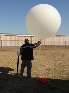
The radiosonde is a small, expendable instrument package that is suspended below a six foot wide balloon filled with hydrogen or helium. As the radiosonde rises at about 1,000 feet/minute (300 meters/minute), sensors on the radiosonde measure profiles of pressure, temperature, and relative humidity. These sensors are linked to a battery powered transmitter that sends the measurements to a ground receiver. By tracking the position of the radiosonde in flight, information on wind speed and direction aloft is also obtained. Observations where winds aloft are also obtained are called "rawinsonde" observations.
The radiosonde flight can last in excess of two hours, and during this time the radiosonde can ascend to over 115,000 feet (35,000 meters) and drift more than 125 miles (200 km) from the release point. During the flight, the radiosonde is exposed to temperatures as cold as -130ºF (-92ºC) and an air pressure only a few thousandths of what is found on the Earth's surface.
At liftoff the balloon is around 5 feet tall and 4 feet wide. Because the pressure lessens as the balloon goes higher in the atmosphere, the balloon expands. By the time the balloon reaches 100,000 feet it has grown to the height of a two story building. When the balloon has expanded beyond its elastic limit and bursts, a small parachute slows the descent of the radiosonde, minimizing the danger to lives and property.
Only about 20 percent of the approximately 75,000 radiosondes released by the NWS each year are found and returned to the NWS for reconditioning. These rebuilt radiosondes are used again, saving the NWS the cost of a new instrument. If you find a radiosonde, follow the mailing instructions printed on the side of the instrument.
 How is radiosonde data used? Understanding and accurately predicting changes in the atmosphere requires adequate observations of the upper atmosphere. Radiosonde observations are the primary source of upper-air data and will remain so into the foreseeable future. Maps of upper air data from radiosondes is available from the Storm Prediction Center web site at https://spc.noaa.gov/obswx/maps/
Radiosonde observations are used over a broad spectrum of efforts including:
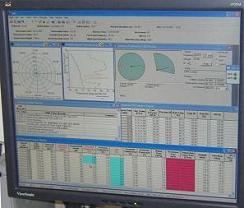
Here is an example of radiosonde data plotted on a chart. The red line shows temperature as you go up higher in the atmosphere, and the green line shows the dewpoint, or a measure of how moist the atmosphere is at a particular level. Wind barbs as you go up are also depicted.