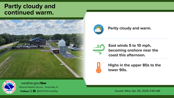
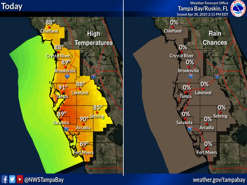
National Weather Service United States Department of Commerce

Dangerous Heat in the Central and Eastern U.S.; Severe Thunderstorms in the Great Lakes

Thunderstorms with strong wind gusts and hail will be possible today from Michigan into the Lower Great Lakes region. A significant and dangerous heat wave will expand from the Central U.S. into the Eastern U.S this weekend through much of next week. Numerous daily record highs and warm lows are likely. Read More >

Click a location below for detailed forecast.

Last Map Update: Sat, Jun 21, 2025 at 9:20:26 am EDT

There are no watches, warnings, or advisories at this time.

Developing showers and storms this afternoon through evening.
Partly to mostly cloudy with scattered showers and thunderstorms. Highs in the lower 90s.
Scattered evening showers and thunderstorms, becoming partly cloudy after midnight. Lows in the lower to mid 70s.
Partly to mostly cloudy with scattered showers and thunderstorms. Highs in the low to mid 90s.
Climate for today, June 21: Long-term average highs and lows. Record highs and lows. Record rainfall.


Text Product Selector 


Radar
Radar
Current Weather
Current Weather
Rivers & Lakes
Rivers & Lakes
Satellite
Satellite
Weather Information Display
Weather Info Display
Forecast Maps
Forecast Maps
Hour by Hour Forecast
Wave Prediction
Weather Hazard Briefing
NOAA PORTS®
Forecaster's Discussion
Tropical Weather
Tropical
Marine Observations and Forecasts
Marine
Beach and Rip Current Forecast
Beach & Surf
Fire Weather
Fire Weather

 
Drought Page
Drought

 
NOAA Weather Radio
NOAA Weather Radio

 
NWS Skywarn Storm Spotter Program
Skywarn

 
Storm Report
Submit Storm Report