NWS All NOAA
Greenville-Spartanburg, SC
Weather Forecast Office
Severe Weather
Winter Weather
EM Briefing
Heavy Rainfall
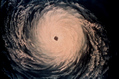
Tropical Weather
Day One Outlook
SPC Convective Outlooks (Details)
NWS GSP Data: Stream & Lake Levels and Mainstem Forecasts | Local Radar (KGSP) | TDWR Radar (TCLT)
| National Radar | Satellite |
NWS GSP Products: Hazardous Weather Outlook | Flash Flood Warning | Flood Warning | Flood Watch | | Tornado Warning | Severe Thunderstorm Warning | Severe Weather Statement | | Local Storm Reports | Area Forecast Discussion | Public Information Statement |
Decision Support Pages
US National Weather Service Greenville-Spartanburg SC


