NWS All NOAA
Houston/Galveston, TX
Weather Forecast Office
Last Map Update: Sun, May 18, 2025 at 9:44:18 pm CDT


 Local Radar
 Weather Map
 TX Satellite Imagery
 Monthly Hydrologic Reports
 Hurricane Preparedness
 CONUS Satellite Imagery
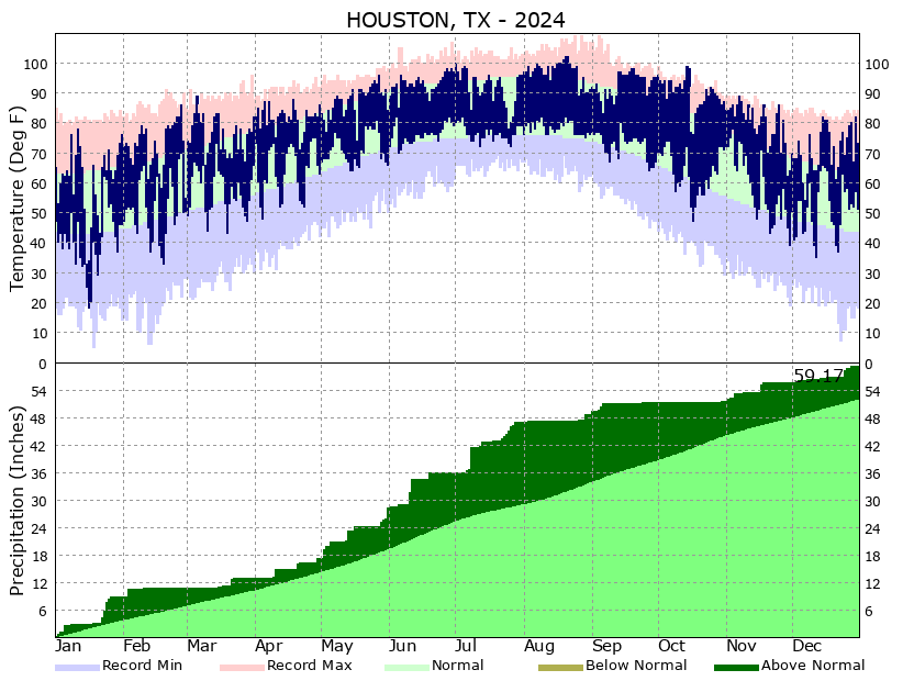 Climate Graphs
 Climate Summaries