Scattered showers and thunderstorms are expected late Monday into Tuesday as another disturbance and associated cold front pushes through Southeast TX. Some storms will have the potential to becoming strong to severe. In addition, locally heavy rain will be possible. The greatest risk of strong to severe storms will generally be along and north of the I-10 corridor.


 Local Radar
 Weather Map
 TX Satellite Imagery
 Monthly Hydrologic Reports
 Hurricane Preparedness
 CONUS Satellite Imagery
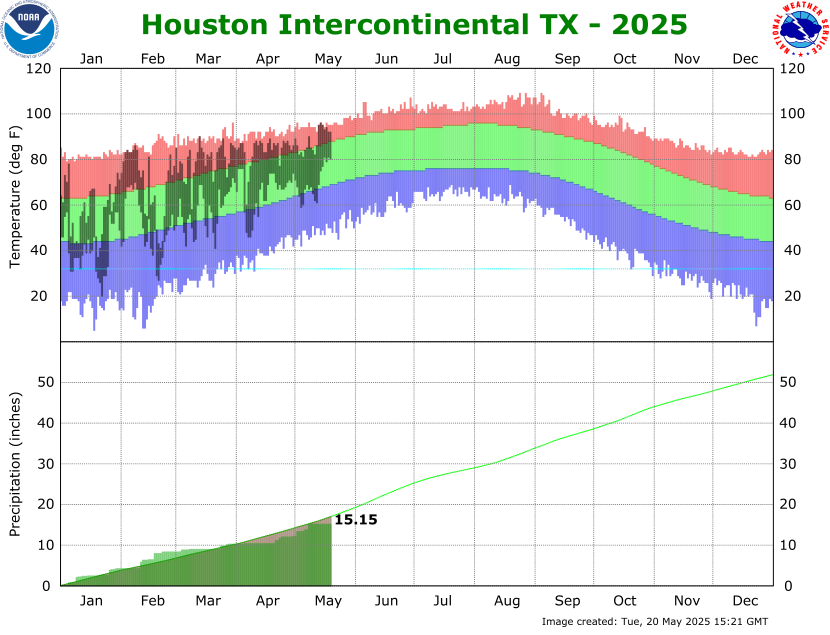 Climate Graphs
 Climate Summaries