National Weather Service United States Department of Commerce

Severe Thunderstorm and Heavy Rainfall Threats for the Center of the Nation; Near Record Warmth for the East

Active weather for the center of the nation today. Severe thunderstorms and flash flooding concerns over portions of the Central and Southern Plains into the Mississippi Valley today into tonight. Meanwhile, cool and snowy in parts of the Northwest and Great Basin with above average and potentially record breaking temperatures for the Ohio Valley and Mid-Atlantic. Read More >

Winter weather awareness week banner

November 27 to December 1, 2023 is Winter Weather Awareness Week in Delaware. The Delaware Emergency Management Agency, Delaware Department of Transportation, National Weather Service, and county emergency management agencies are teaming up to share important information and resources so people can be prepared and stay safe during cold weather, snow, ice, and other emergencies. 


Each day during this week will emphasize a different weather hazard and provide you with associated safety tips:

On Monday, the topic will be winter preparedness.
On Tuesday, the topic will be heavy snow.
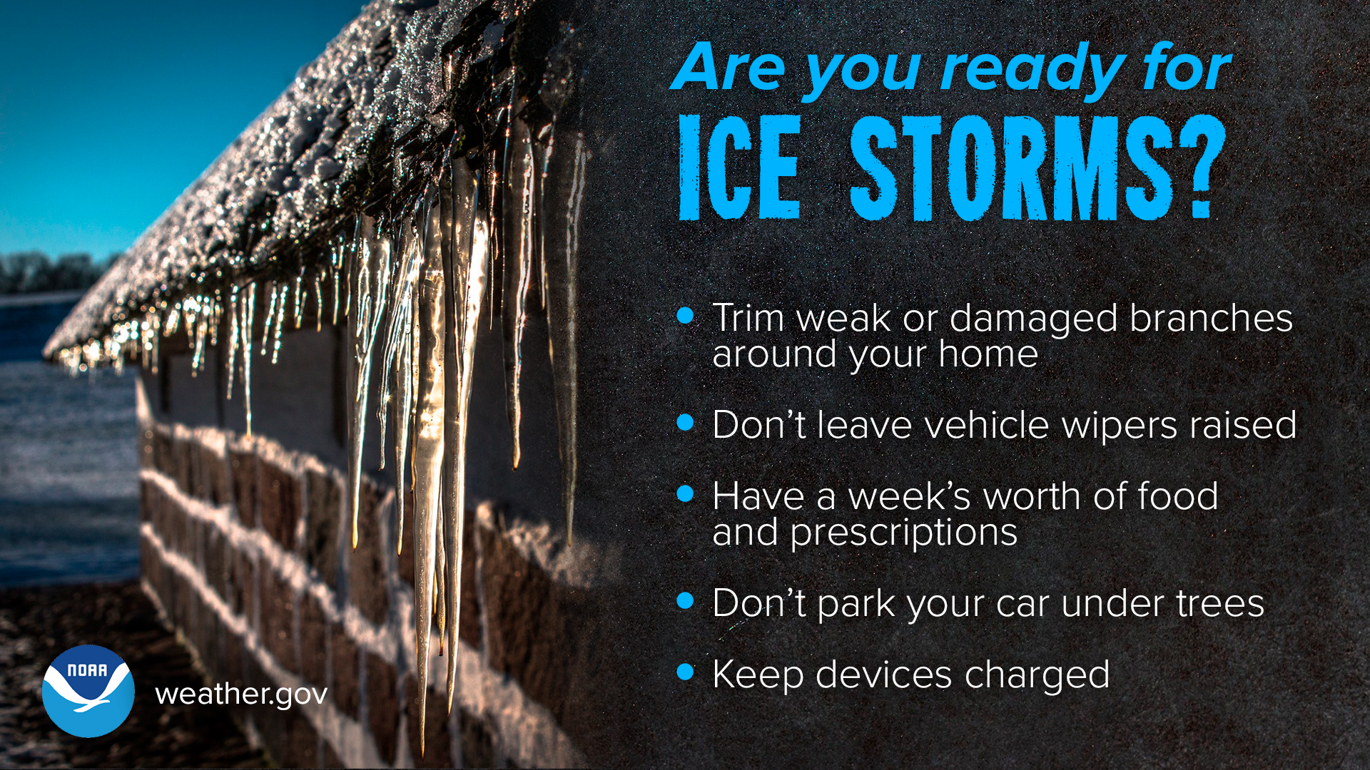
On Wednesday, the topic will be ice.
On Thursday, the topic will be extreme cold.
On Friday, the topic will be on Nor'easters and other coastal storms. 

A few days out: if the forecast calls for winter weather, start preparing now. Have emergency supplies for your home & car. Check your smoke and carbon monoxide detectors. Replenish fuel for your car and heating sources. The day before: forecast accuracy continues to improve, so keep checking the latest. Adjust plans. Have multiple ways to receive Warnings. Bring pets indoors and ensure they have water. During and after: remain vigilant and stay informed. Drive only if necessary. Check on neighbors and family. Properly ventilate emergency heat sources. Keep generators at least 20 feet from your home. Take it easy when shoveling.


Winter Preparedness

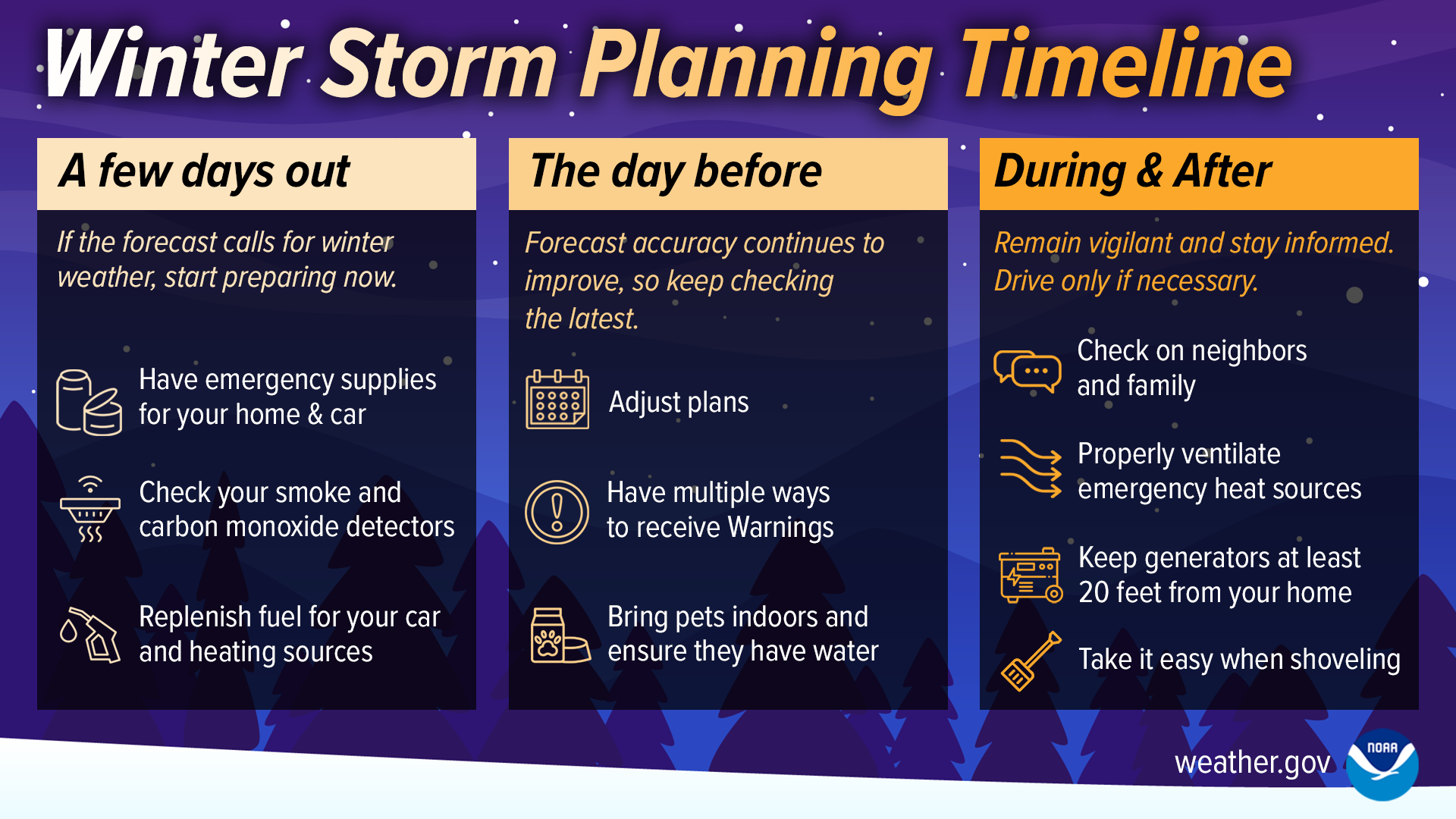
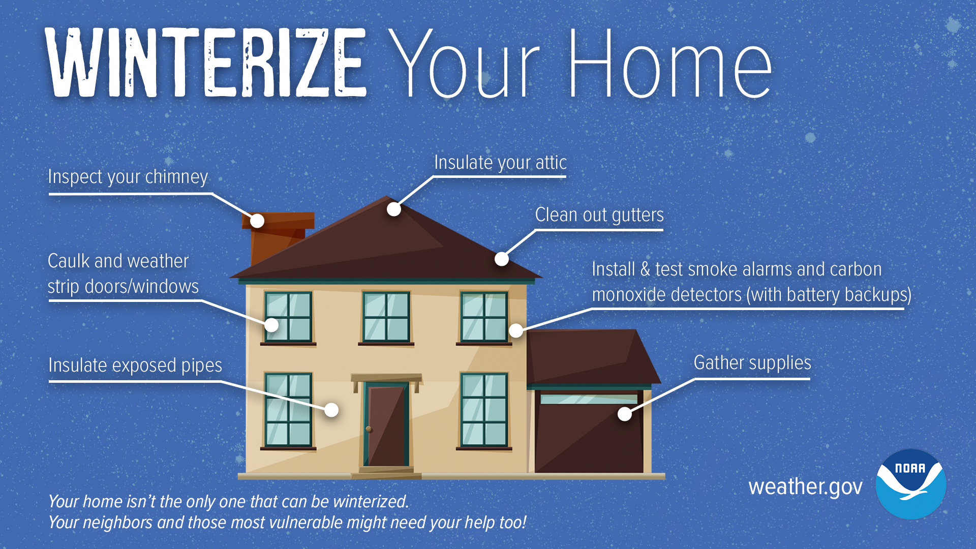
Before the first snowflakes even fall, there are steps we can take to prepare for winter weather! Read the list below. Even if you have completed these in years past, it is important to review these items to ensure everything is up to date!


Preseason Winter Readiness Checklist:

  • Build your personal emergency plan
  • Have a plan to stay informed of winter weather conditions and forecasts! 
    • Have a trusted source for weather forecast information, including commercial radio, TV, weather radio, NWS webpage, or another trusted source. More ways to connect with DelDOT, DEMA, and NWS are available below.
    • Sign up for the Delaware Emergency Notification System (DENS) at de.gov/dens to learn about emergency closings and hazardous conditions
    • Download the DelDOT Mobile App to check ahead for road conditions during hazardous weather.
    • Download the FEMA App to set up local alerts.
  • Build and stock a basic emergency kit and vehicle emergency kit for all people, animals, and vehicles in your household
  • Prepare your vehicle for winter weather and cold temperatures by checking and/or replacing lights, tires, and wiper blades and ensuring that it is otherwise in good working order
  • Winterize your home and area around your hole by weather proofing your house, removing dead or weak limbs and branches.


Winterize your home. Inspect your chimney. Caulk and weather strip doors/windows. Insulate exposed pipes. Insulate your attic. Clean out gutters. Install and test smoke alarms and carbon monoxide detectors (with battery backups). Gather supplies

Stay Connected!


Additional winter preparedness resources

NWS Winter Safety Page

PrepareDE.org information on natural hazards 


Heavy Snow

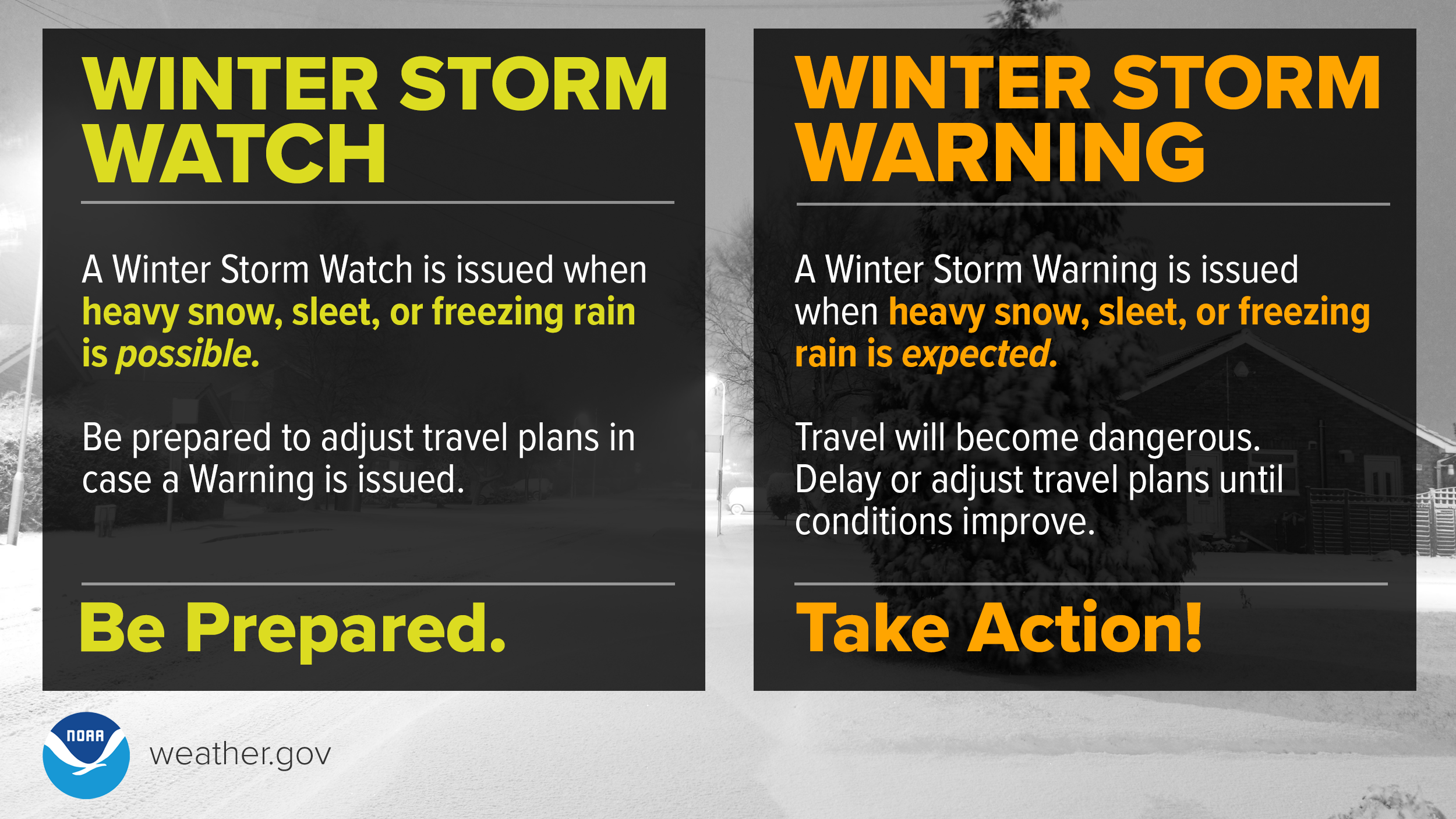
Even though the winter of 2022-2023 brought us some of the least snow on record, our region can be prone to heavy snow. If a winter storm watch has been issued, that means a combination of heavy snow, sleet, and/or freezing rain enough to cause significant impacts is possible; with winter storm watches, stay tuned the forecast and be prepared to adjust travel plans if a warning is issued.  Below are some tips to keep in mind for dealing with heavy snow. If a winter storm warning is issued, that means that a combination of heavy snow, sleet, or freezing rain enough to cause significant impacts is expected soon or already occurring. Travel will become (or already) dangerous.

Winter Storm Watch means be prepared. A Winter Storm Watch is issued when heavy snow, sleet, or freezing rain is possible. Be prepared to adjust travel plans in case a Warning is issued. Winter Storm Warning means take action! A Winter Storm Warning is issued when heavy snow, sleet, or freezing rain is expected. Travel will become dangerous. Delay or adjust travel plans until conditions improve.


At Home

During a winter storm, it is best to stay home. Even at home though, there are important safety tips to keep in mind. 

  • Don't overexert when shoveling and clearing snow from your property. Many people suffer back injuries or heart attacks every year when shoveling snow. Be sure to dress warmly, take frequent breaks, and move small amounts of snow with each pass of the shovel.
  • Ensure that any heat sources are well ventilated. If you use a generator, keep it at least 20 feet away from your home.
  • Check in on neighbors, especially those that may be more vulnerable to winter weather impacts.  


Shovel smart! Shoveling heavy, wet snow can cause back injuries and heart attacks. Don’t push yourself! Dress warmly, making sure to cover your head, fingers and toes. Stay hydrated, but avoid heavy meals right before or after shoveling. Move only small amounts of snow with each pass of the shovel. Take frequent breaks. Stop shoveling entirely if you feel exhausted! Cold Impacts: Vulnerable Populations: Everyone is at risk from the dangers of extreme cold, but these groups are more vulnerable than most: newborns, the elderly, people with chronic illness, outdoor workers, and the unhoused. Age and certain conditions make the body less able to regulate temperature. Dress in loose layers and cover all exposed skin. Consume hot foods and warm drinks, but avoid caffeine and alcohol. Limit or avoid time outdoors. Check on family, friends and neighbors.


Travel and Heavy Snow

If you have travel plans, adjust plans so you won't be driving in heavy snow or on snow covered roads. If you must travel during or just after heavy snow, give plows plenty of space on the roads, and take the time to remove snow and ice from your vehicle before traveling. The DelDOT mobile app and webpage provide access to more than 100 cameras statewide to view current road conditions before traveling. 


Additional information on heavy snow safety can be found at:

PrepareDE.org

NWS snow safety page

Ready.gov

Ice

Just a few degrees can mean the difference between rain, freezing rain, sleet, and snow! It isn't just the temperature at the ground level either that is important, but temperatures in the layer from the ground up to the bottom of the cloud. In our region, Nor'easters and coastal storms will frequently result in a layer of warm air in between the ground and the cloud which can result in sleet or freezing rain. Sleet and freezing rain bring their own issues and impacts.
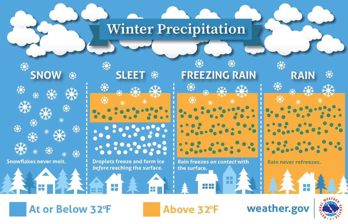
Winter Precipitation: Below 32°F, snowflakes never melt. With sleet, droplets freeze and form ice before reaching the surface. Freezing rain is caused by rain, above 32°F in the sky, freezing on contact with the cold surface. If the surface temperature is above 32°F, rain will not freeze.


Freezing Rain

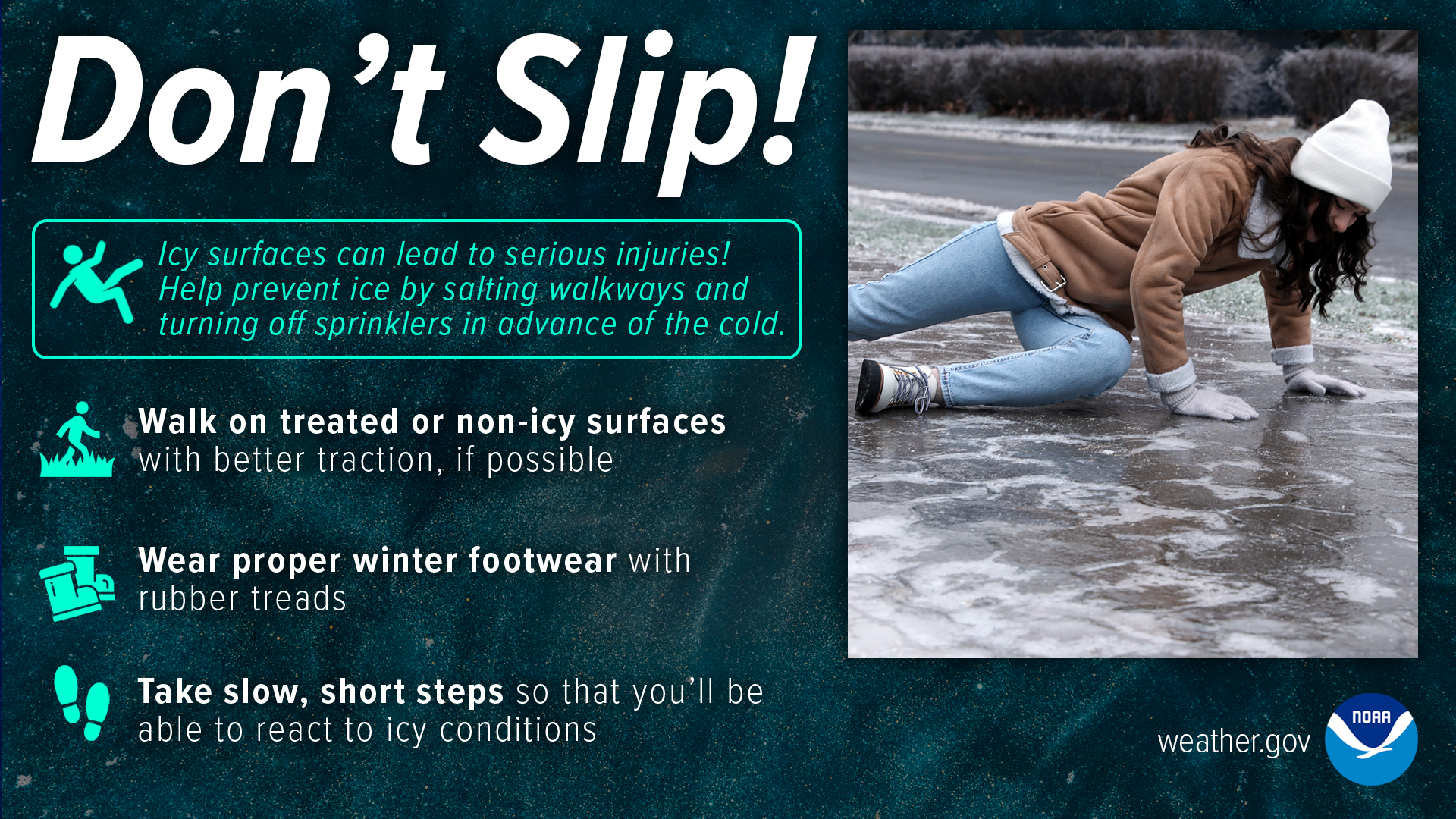
Freezing rain is when precipitation falls as rain, but then freezes when coming into contact with the ground or other objects. It results in a glaze of ice that can be incredibly hazardous for driving or even just walking outdoors! Even very small amounts of freezing rain can result in very treacherous driving conditions. The best thing to do during freezing rain is shelter at home! 

Don’t slip! Icy surfaces can lead to serious injuries! Help prevent ice by salting walkways and turning off sprinklers in advance of the cold. Walk on treated or non-icy surfaces with better traction, if possible. Wear proper winter footwear with rubber treads. Take slow, short steps so that you’ll be able to react to icy conditions.

Freezing rain, more than other types of winter weather, can cause long duration power outages, affecting both you and the surrounding area. That's why it is so important to have an emergency kit in your home and a supply of food and medications ahead of the storm! Be careful with heat and light sources, as some commonly used ones, like candles and space heaters are fire risks. 
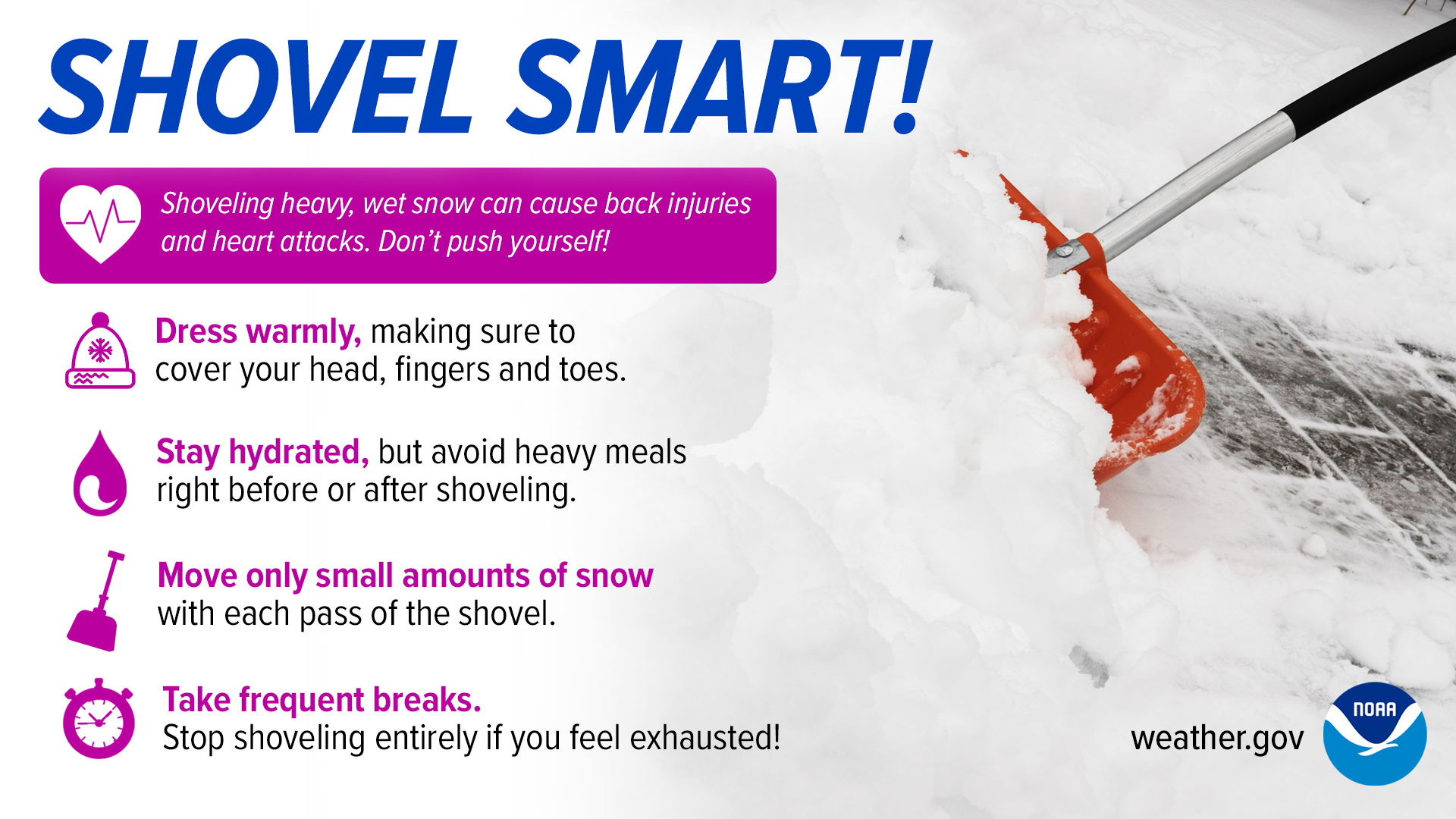
 

Are you ready for ice storms? Trim weak or damaged branches around your home. Don't leave vehicle wipers raised. Have a week's worth of food and prescriptions. Don't park your car under trees. Keep devices charged.


Sleet

Similar to freezing rain, sleet melts in a layer of warm air above the surface. Unlike freezing rain though, when sleet forms, there is a deep layer of cold air below the warm air that allows the precipitation to refreeze as tiny transparent or translucent pellets of ice. Sleet can have it's own sets of hazards. Like snow, it can accumulate enough to require shoveling to clear driveways and pathways. However, it is far denser than snow making it more challenging to clear. It is critical to take frequent breaks when shoveling sleet. Sleet can also result in very treacherous driving conditions.

Don’t underestimate sleet dangers! Take it easy when shoveling. Sleet can be much more dense than snow. Go slowly and don’t overexert yourself. Use extreme caution when driving. Sleet can cause dangerous road conditions and reduced visibility. Reduce speed, allow plenty of stopping distance, and do not use cruise control.


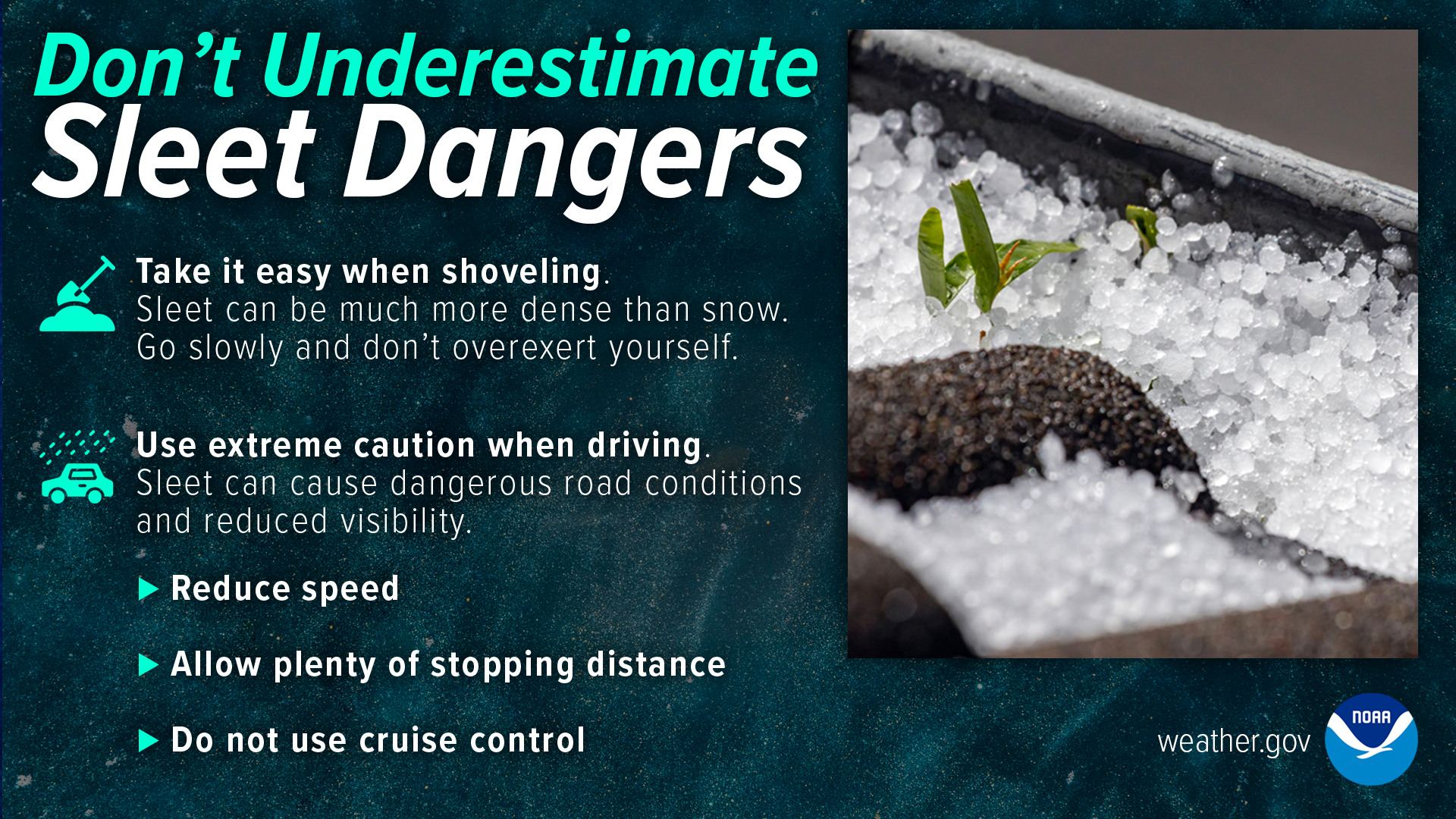
More information on sleet and freezing rain safety is available here

Extreme Cold and Wind Chill


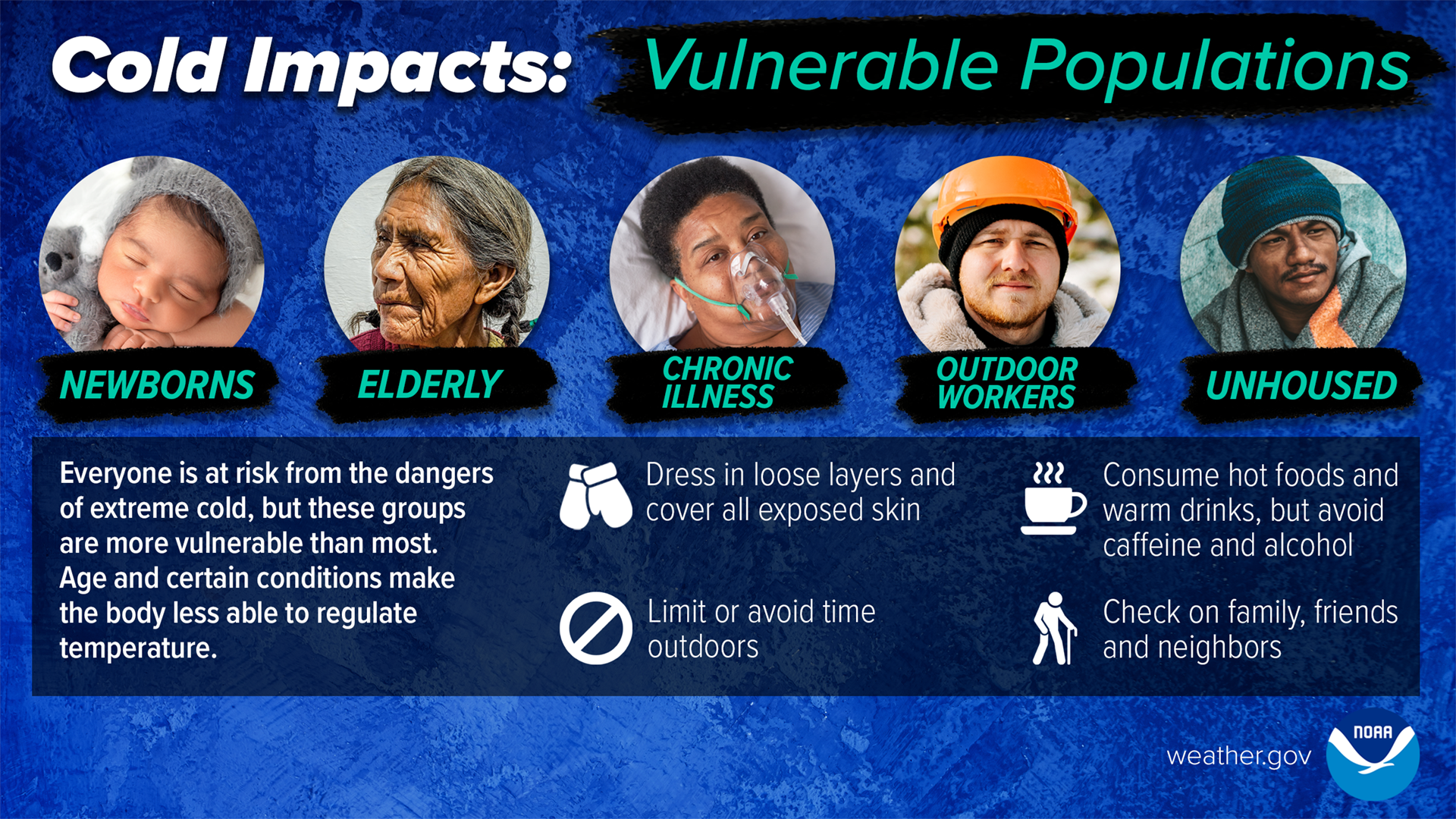
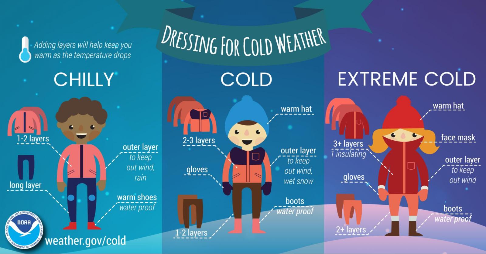
Even if the area isn't experiencing snow, sleet, or freezing rain, cold weather can bring hazards and impacts. People exposed to extreme cold are susceptible to frostbite and can succumb to hypothermia in a matter of minutes. If you are heading outdoors, be sure to dress warmly. Its important to dress in multiple layers as the layers of air in between the clothing layers act as additional insulation to the cold.

Dressing for the Cold - Infographic. Adding layers will help keep you warm as the temperature drops. Chilly: 1-2 layers; outer layer to keep out wind, rain; long layer on legs; warm shoes (water proof). Cold: 2-3 layers; warm hat; gloves; outer layer to keep out wind, wet snow; 1-2 long layers on legs; boots (water-proof). Extreme cold: 3+ layers (1 insulating); warm hat; gloves; outer layer to keep out wind; 2+ long layers on legs; boots (water proof).


It is important to know the signs of frostbite and hypothermia and the appropriate actions to take if someone may have those conditions!

If someone might have frostbite or hypothermia, seek medical attention immediately! Get to a warm area. Remove wet clothing. Warm up with dry layers of blankets or clothing. Place skin affected by frostbite in warm water (not hot). Frostbite caution: do not use fireplaces or artificial heat sources for warming. Do not rub or put pressure on areas with frostbite.


Warnings signs of hypothermia: confusion, shivering, difficulty speaking, sleepiness, stiff muscles.


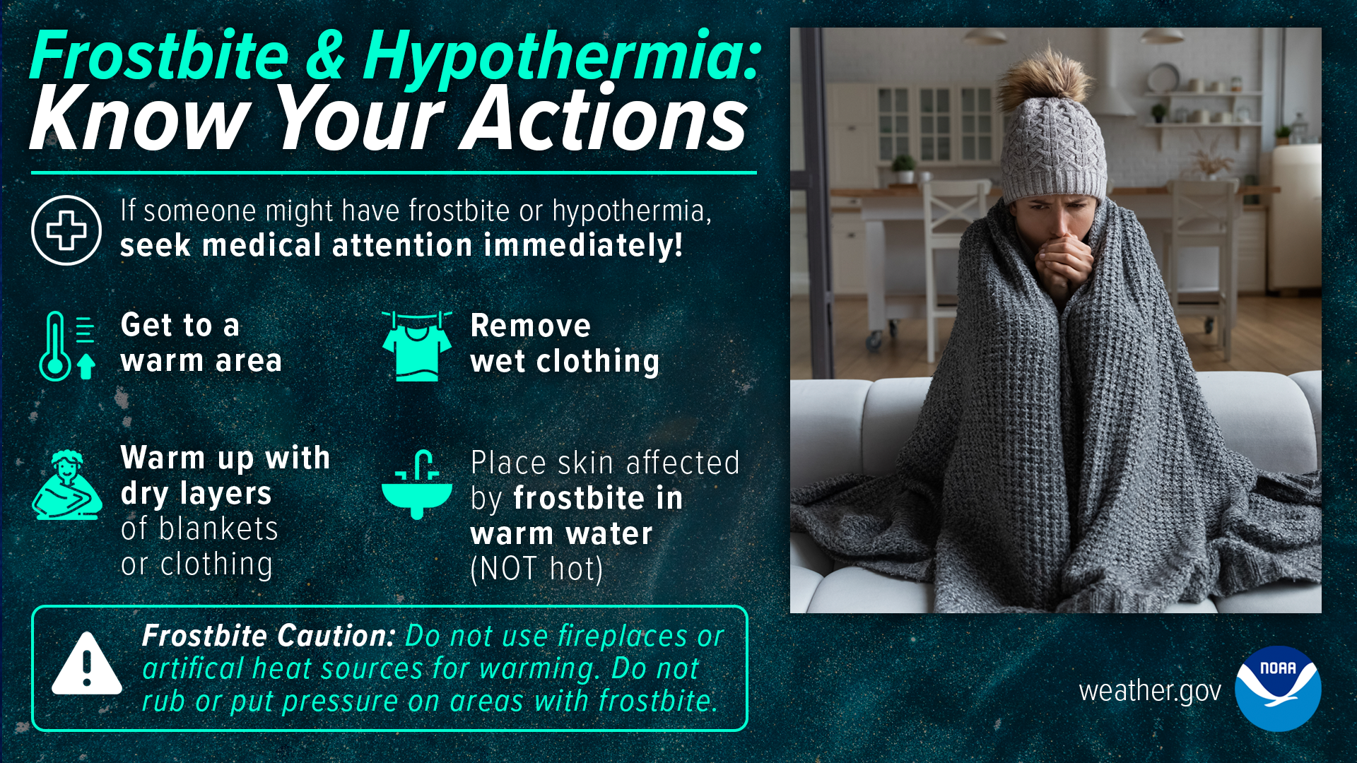
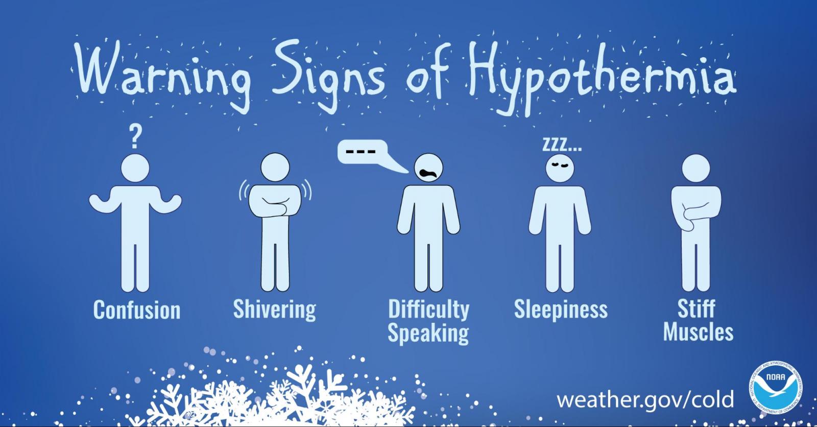
For more information on cold weather safety, visit the safety page here

Nor'easters and Coastal Storms


The most impactful types of winter storms in our region are Nor'easters and other coastal storms. These are storms that track along or near our coast. Because of this track, these storms tend to have a lot of moisture and can be slow moving. These types of storms are also prone to seeing a mix of precipitation types including rain, freezing rain, sleet, and snow - and can vary over just a matter of a few miles!  

Winter’s Fury - Nor’easters: Not many winter storms have the potential to bury 100 million people in 1-2 feet of snow in a single day. Nor'easters are notorious for packing big wind and copious amounts of moisture they get from the Atlantic. The heavily populated region between Washington D.C., Philadelphia, New York and Boston, the 'I-95 Corrdior', is especially impacted by Nor'easters.


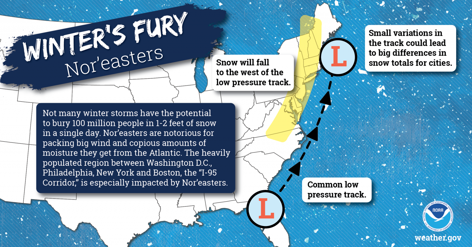
Not only do they have the potential to bring heavy wintry precipitation, but they can bring other hazards too including coastal/tidal flooding and high winds. In addition to preparedness tips mentioned previously for wintry precipitation and cold weather, ahead of Nor'easters, you'll also want to take the following precautions:

  • Secure loose outdoor objects like outdoor furniture, trampolines, trash cans, and decorations before any strong winds develop.
  • Use extra caution if driving in strong winds, especially on bridges and overpasses and especially with high profile vehicles. Winds will only further exacerbate any treacherous driving conditions due to wintry precipitation.
  • Strong winds will make marine navigation especially difficult as winds will increase wave heights, and any precipitation could restrict visibility.
  • If you are in an area vulnerable to tidal or coastal flooding, pay close attention to the tide forecast here. Move vehicles from areas susceptible to coastal flooding and don't drive through flooded roadways. 


Additional resources:

What is a Nor'easter

Coastal High Winds