
Wildfire smoke will push into the Midwest, worsening air quality. A frontal system brings severe storms from the Northern Plains to the Mid‑Atlantic the next few days. Heavy Gulf Coast rain is possible as Tropical Depression Two has formed, while monsoonal storms persist in the Southwest with heavy rainfall. Hazardous heat expands from the Plains into the Lower Mississippi Valley. Read More >
|
|
|
|
|
|
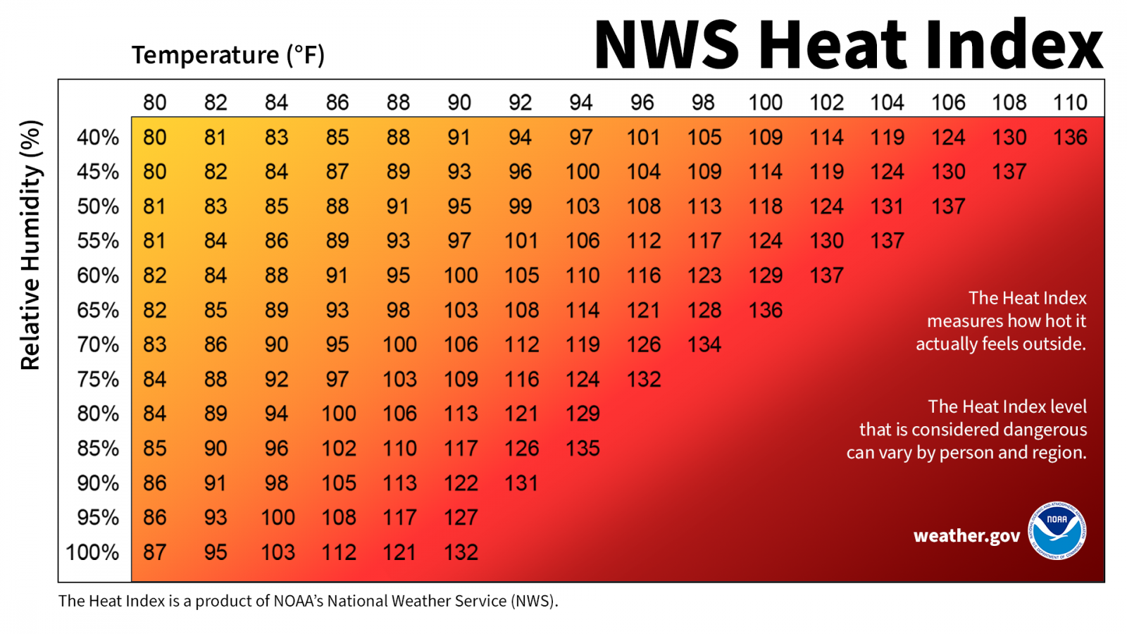
| Heat Safety Information | |
| The State College NWS Office will issue Advisories and Warnings under the header "PHLNPWCTP (WWUS71 KCTP)" for the following: | |
|
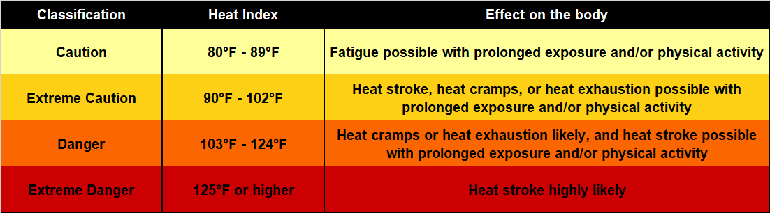
Extreme Heat Warning: Heat Index values will attain or exceed 105°F. Extreme Heat Watch: Possibility that Extreme Heat Warning Criteria may be met at longer ranges (12 to 48 hrs out). |
|
|
Heat Advisory: Heat Index will be equal to or greater than 100°F, but less than 105°F. |
|
|
|
|
|
|
 |
|
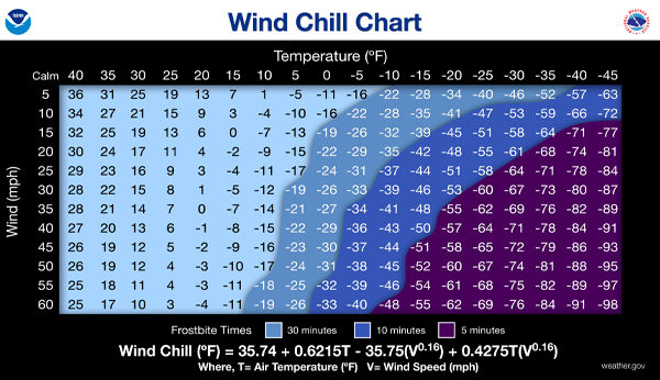
| Cold Weather Safety Information | |
| The State College NWS Office will issue Advisories and Warnings under the header "PHLNPWCTP (WWUS71 KCTP)" for the following: | |
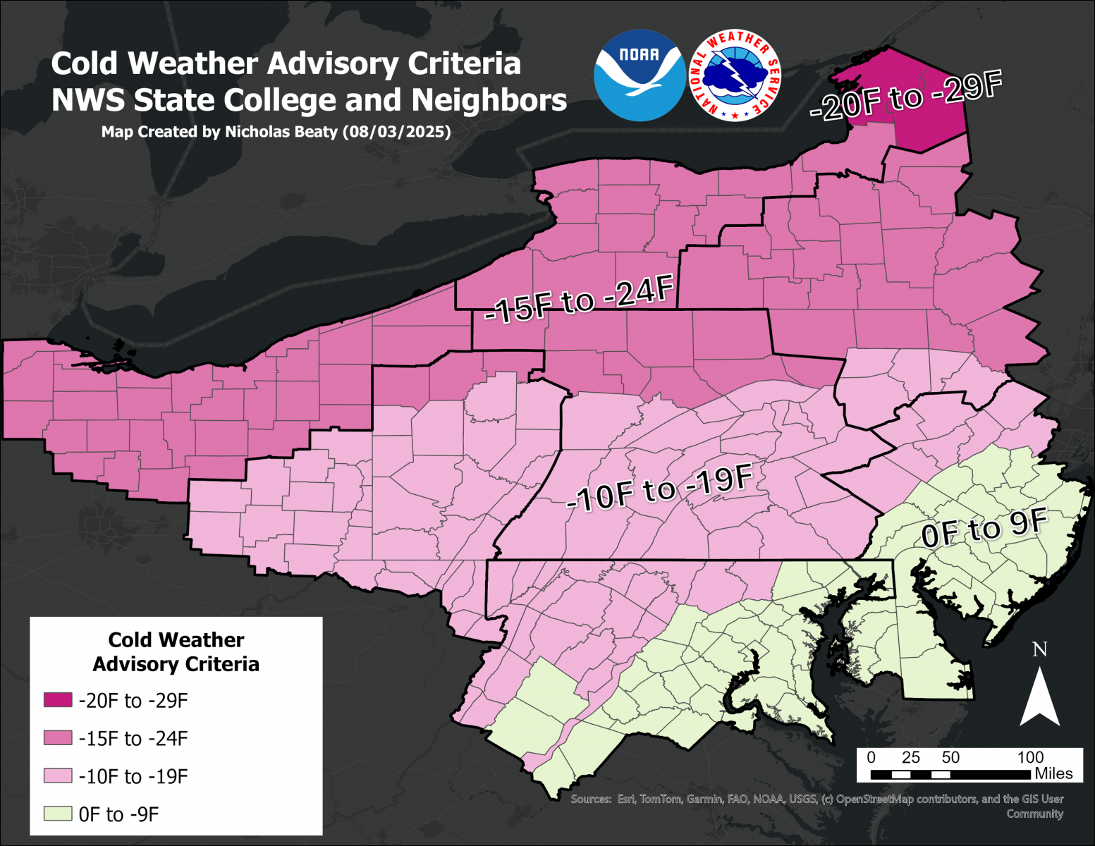
| Either wind chill or temperatures can meet these criteria (i.e. if there is light/no wind, temperatures alone can trigger these products) | |
|
Extreme Cold Warning Values of -20 F or colder along and south of I-80, and -25 F or colder for areas north of I-80 |
|
|
Cold Weather Advisory Values of -10 F or colder along and south of I-80, and -15 F or colder for areas north of I-80 |
|


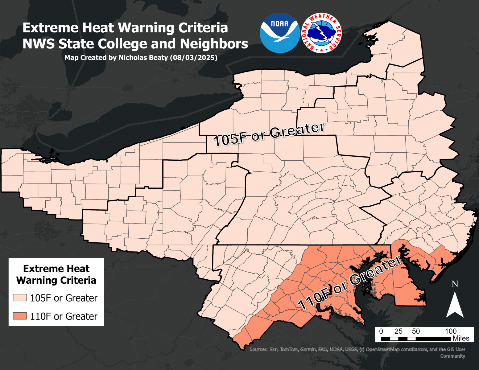 Map of Extreme Heat Warning Criteria
 Map of Heat Advisory Threshold
 Send Us a Report