Overview
|
Severe thunderstorms impacted Southeast Texas on April 13, 2019. In addition to numerous straight-line wind damage and hail reports, three tornadoes were confirmed in Houston County. These storms were the initial portion of a much broader severe weather event that stretched across the southeastern states through April 13 and continued into the Mid-Atlantic on April 14. A damage survey team went to Houston county on April 14, and surveyed damage tracks from the three tornadoes. Two of those surveys were coordinated with the results of surveys by WFO Shreveport, as the storms that produced the tornadoes crossed the boundary between the two offices' areas of responsibility and produced tornadoes in each area. More details on the portions of the tracks not in the Houston/Galveston county warning area are available from the website of WFO Shreveport. |
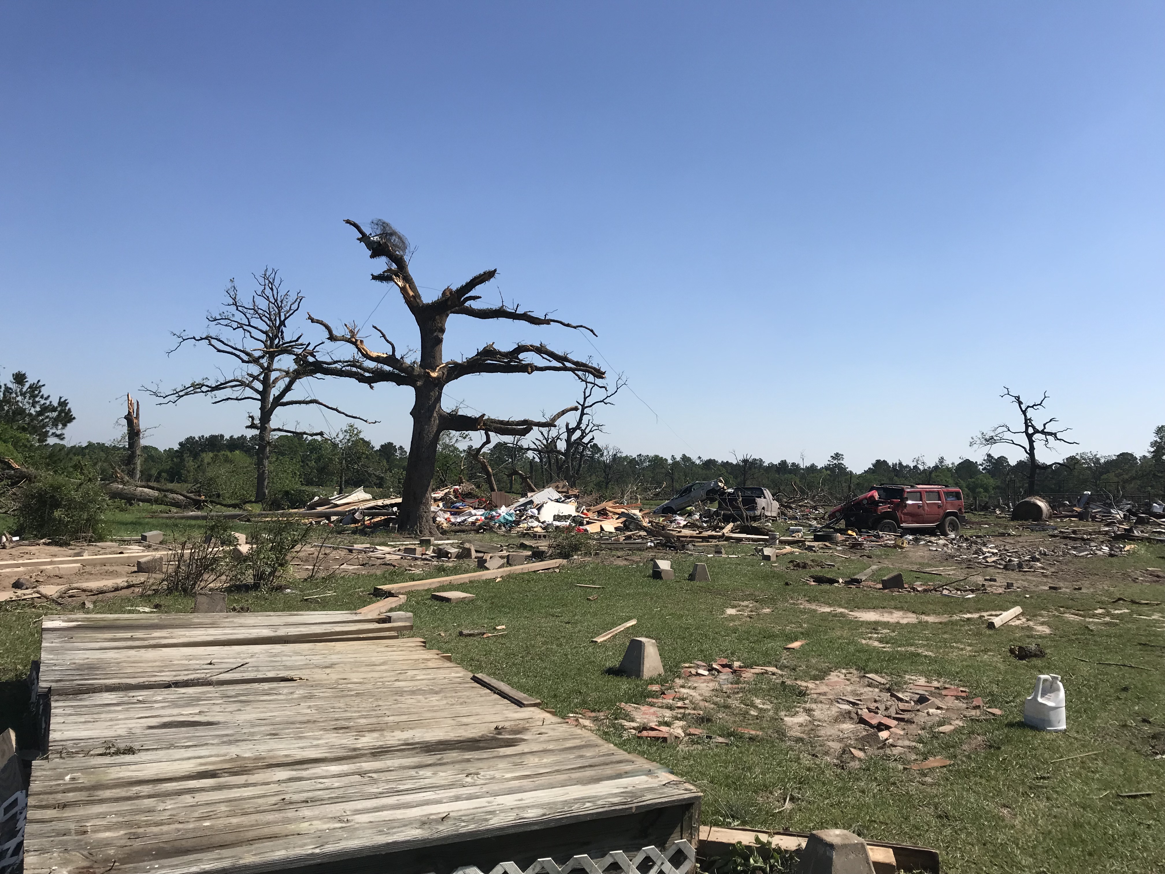
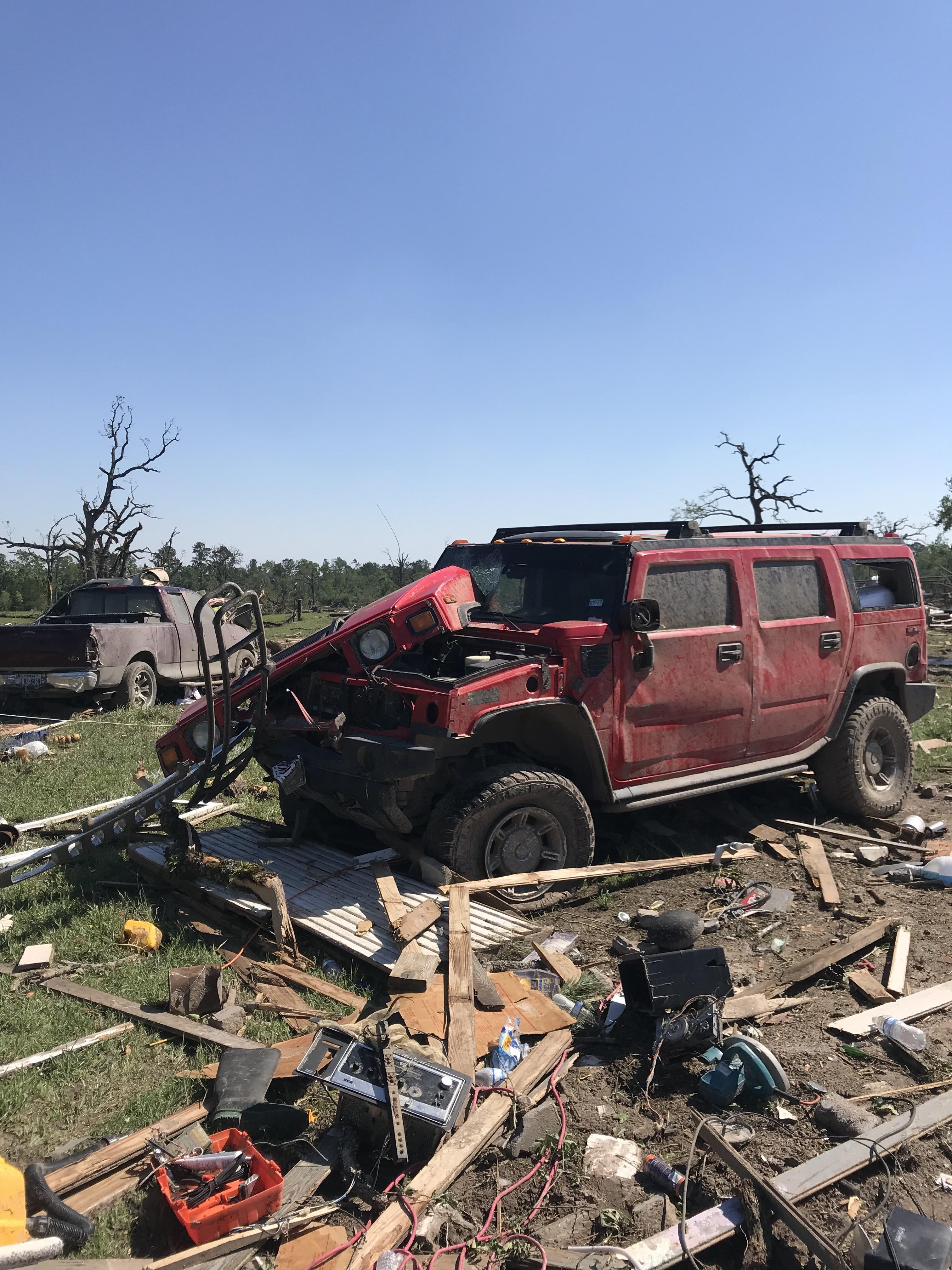
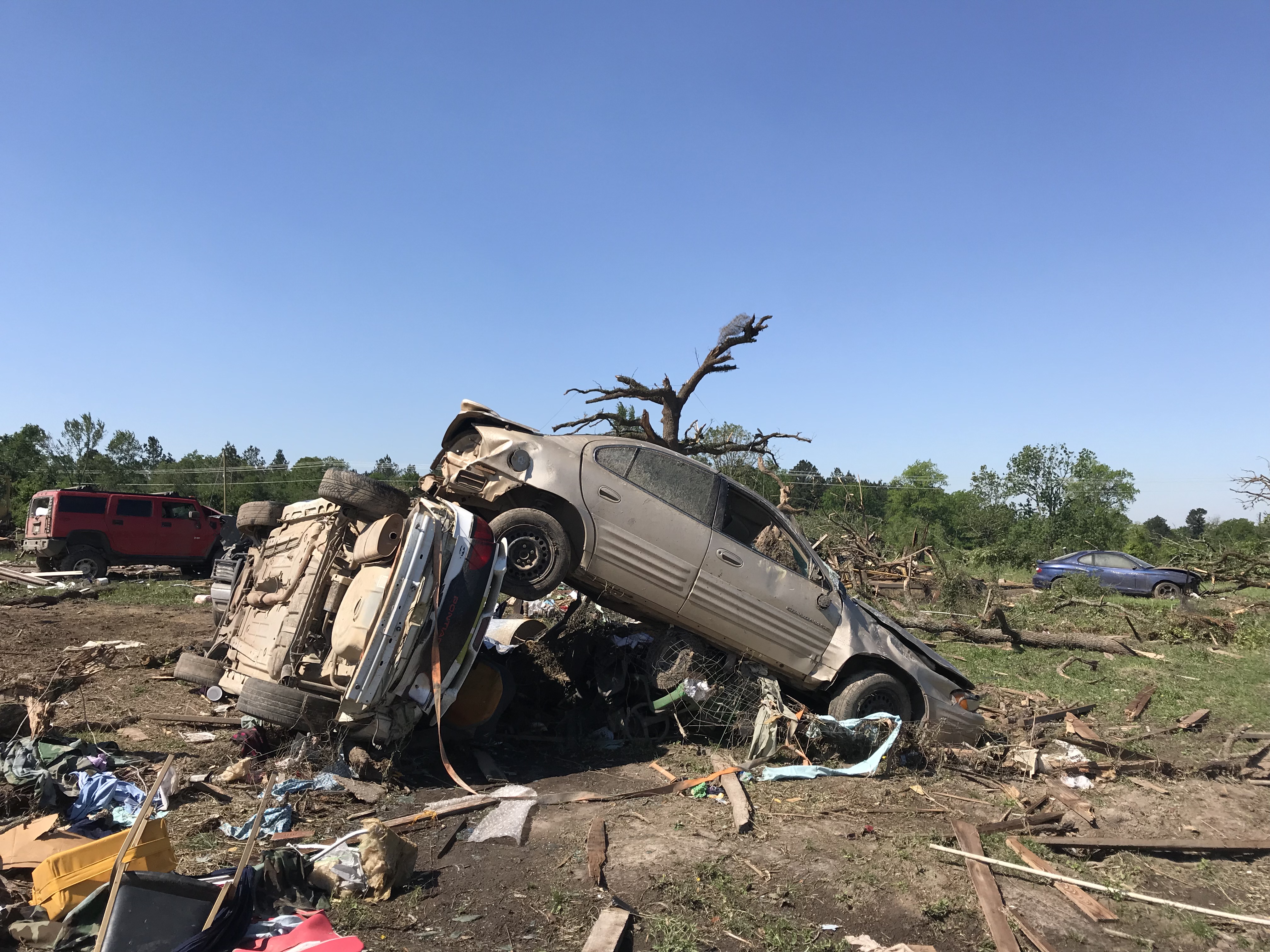 Damaged Cars from the Lovelady Area |
Tornadoes:
|
Tornado - Weches
Track Map 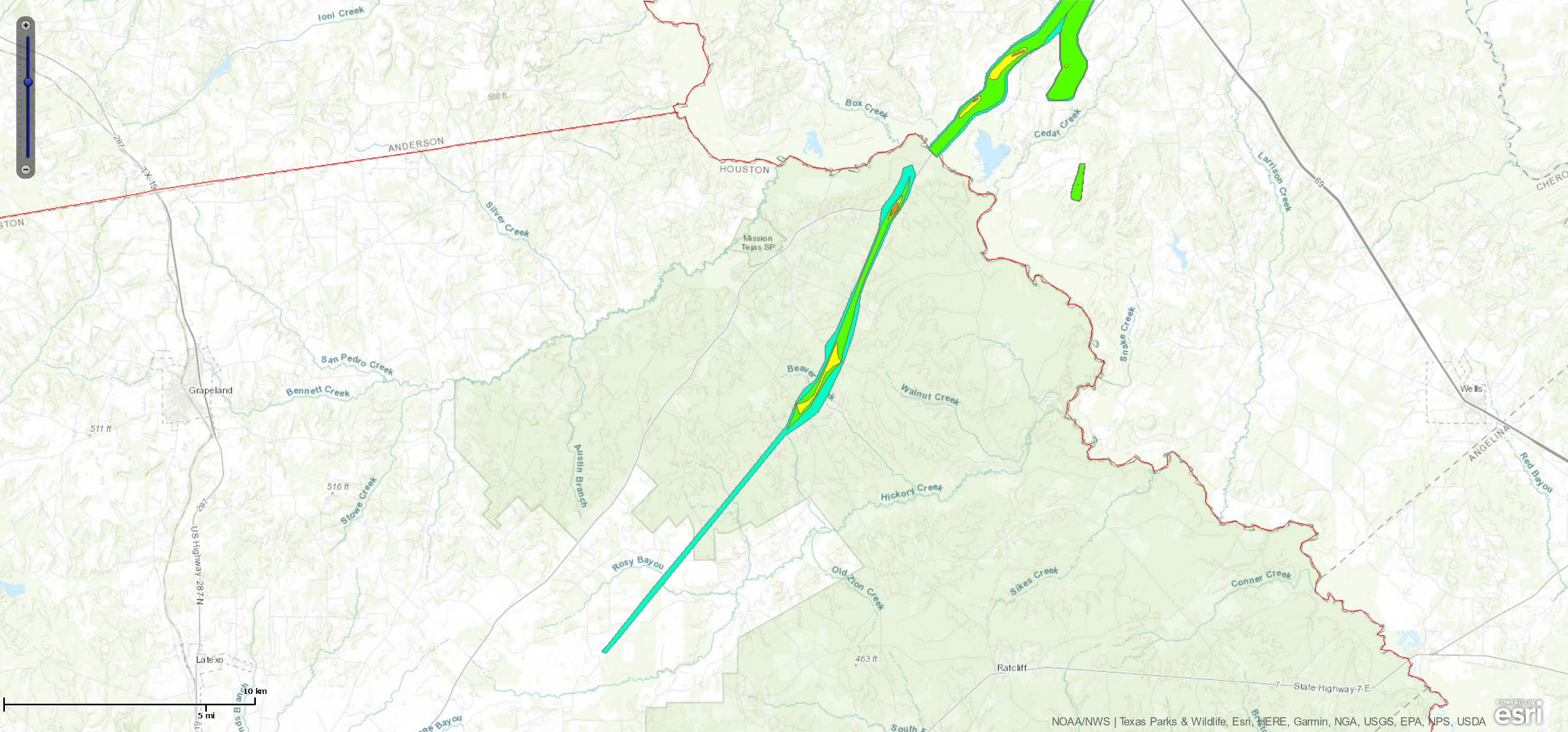 
Downloadable KMZ File |
||||||||||||||||
|
Tornado - Lovelady
Track Map 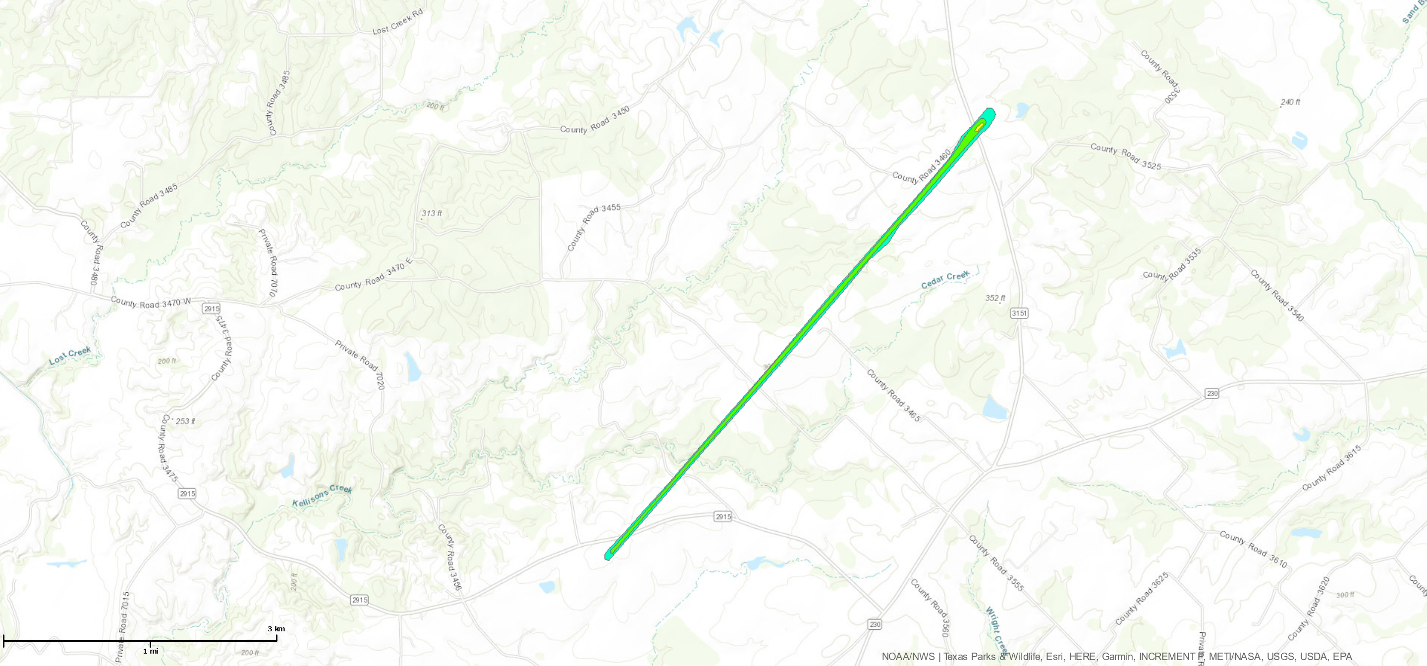
Downloadable KMZ File |
||||||||||||||||
|
Tornado - Tadmor
Track Map 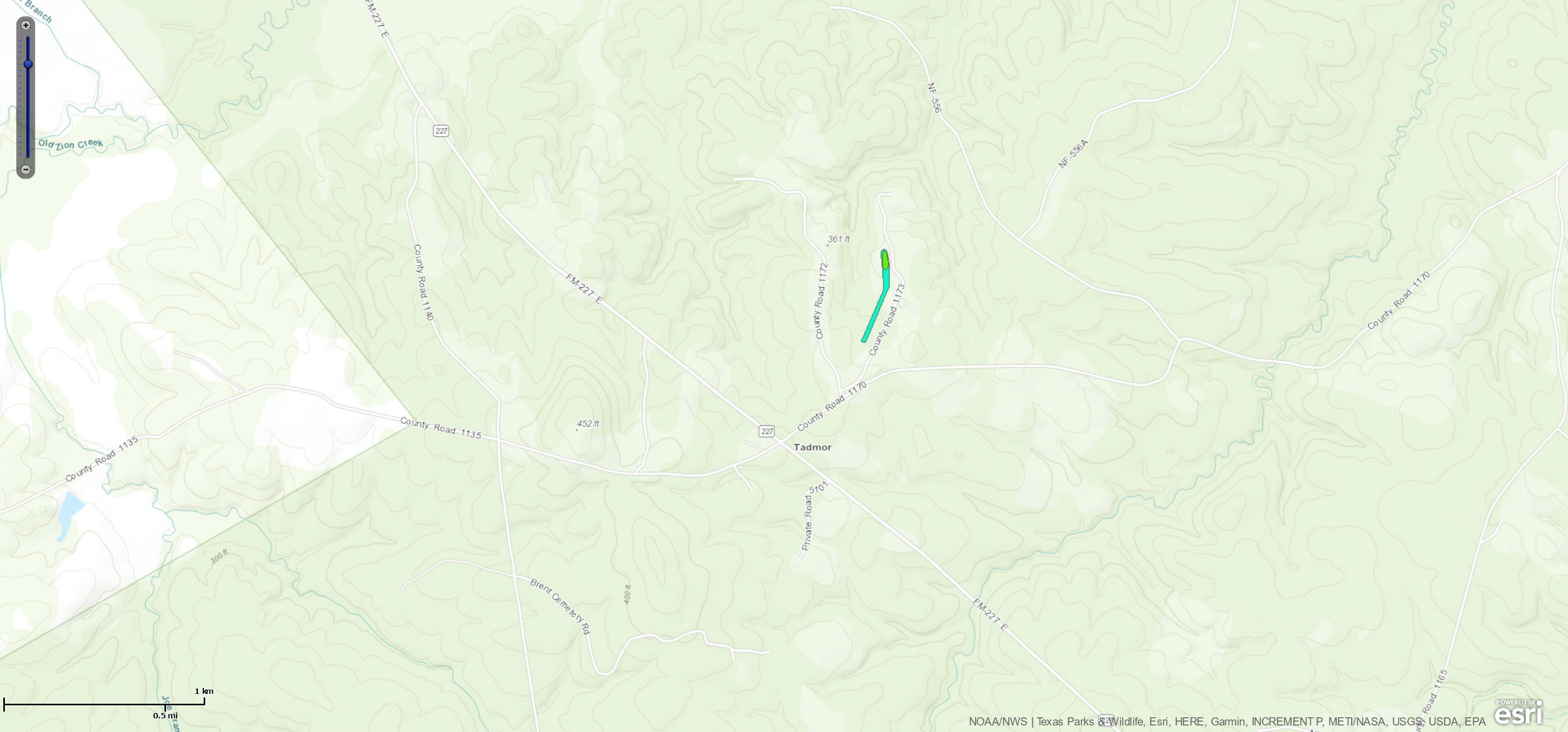
Downloadable KMZ File |
||||||||||||||||
The Enhanced Fujita (EF) Scale classifies tornadoes into the following categories:
| EF0 Weak 65-85 mph |
EF1 Moderate 86-110 mph |
EF2 Significant 111-135 mph |
EF3 Severe 136-165 mph |
EF4 Extreme 166-200 mph |
EF5 Catastrophic 200+ mph |
 |
|||||
Wind & Hail:
In addition to the tornadoes, additional straight-line wind damage reports were received in Trinity and Houston counties. As the focus for storms drifted towards the coast, the character of the storms changed such that the highest threat became hail, rather than winds and tornadoes. Multiple severe hail reports were received in the southwest portion of the Houston metro area.
PRELIMINARY LOCAL STORM REPORT...SUMMARY
NATIONAL WEATHER SERVICE HOUSTON/GALVESTON TX
750 PM CDT SAT APR 13 2019

..TIME...   ...EVENT...      ...CITY LOCATION...     ...LAT.LON...
..DATE...   ....MAG....      ..COUNTY LOCATION..ST.. ...SOURCE....
            ..REMARKS..

0145 PM     TSTM WND DMG     5 E RATCLIFF            31.39N 95.05W
04/13/2019                   HOUSTON            TX   LAW ENFORCEMENT

            SWATH OF TREES DOWN BLOCKING STATE HIGHWAY 7
            NEARLY A DAMAGE EXTENDS TO THE NECHES RIVER.
            TRAFFIC HROUGH AND SOME VEHICLES ARE STUCK
            BETWEEN TREES BLOCK THE ROAD. TIME
            ESTIMATED.

0135 PM     TSTM WND DMG     TRINITY                 30.94N 95.37W
04/13/2019                   TRINITY            TX   LAW ENFORCEMENT

            NUMEROUS REPORTS OF TREES DOWN, POWERLINES
            DOWN AND A OME IN TRINITY. TIME ESTIMATED.

1226 PM     TSTM WND DMG     5 WNW LOVELADY          31.15N 95.52W
04/13/2019                   HOUSTON            TX   LAW ENFORCEMENT

            TREES AND POWERLINES DOWN ON FM 3151
            WEST-NORTHWEST OF IME ESTIMATED.

1140 AM     TSTM WND DMG     RATCLIFF                31.39N 95.14W
04/13/2019                   HOUSTON            TX   LAW ENFORCEMENT

            POWERLINES DOWN NEAR RATCLIFF.

1125 AM     TSTM WND DMG     1 W KENNARD             31.36N 95.20W
04/13/2019                   HOUSTON            TX   LAW ENFORCEMENT

            MULTIPLE TREES DOWN ON THE WEST SIDE OF
            KENNARD.

1135 AM     TORNADO          RATCLIFF                31.39N 95.14W
04/13/2019                   HOUSTON            TX   LAW ENFORCEMENT

            *** 3 INJ *** 3 INJURED WITH A TORNADO BADLY
            DAMAGING RATCLIFF. TIME ESTIMATED.

0120 PM     LIGHTNING        CROCKETT                31.32N 95.46W
04/13/2019                   HOUSTON            TX   LAW ENFORCEMENT

            HOME DAMAGED BY LIGHTNING IN CROCKETT. TIME
            ESTIMATED.

0303 PM     HAIL             2 NW BUNKER HILL VILLAG 29.78N 95.56W
04/13/2019  E1.00 INCH       HARRIS             TX   PUBLIC


0256 PM     HAIL             3 NW SHARPSTOWN         29.73N 95.54W
04/13/2019  M1.00 INCH       HARRIS             TX   PUBLIC

            QUARTER HAIL IN WESTCHASE AREA NEAR BELTWAY
            8 AND LLWAY.

0254 PM     HAIL             MISSION BEND            29.69N 95.66W
04/13/2019  E1.25 INCH       FORT BEND          TX   TRAINED SPOTTER

            SKYWARN SPOTTER HALF DOLLAR SIZED HAIL.

0252 PM     HAIL             MISSION BEND            29.69N 95.66W
04/13/2019  M1.00 INCH       FORT BEND          TX   TRAINED SPOTTER

            SKYWARN SPOTTER REPORT.
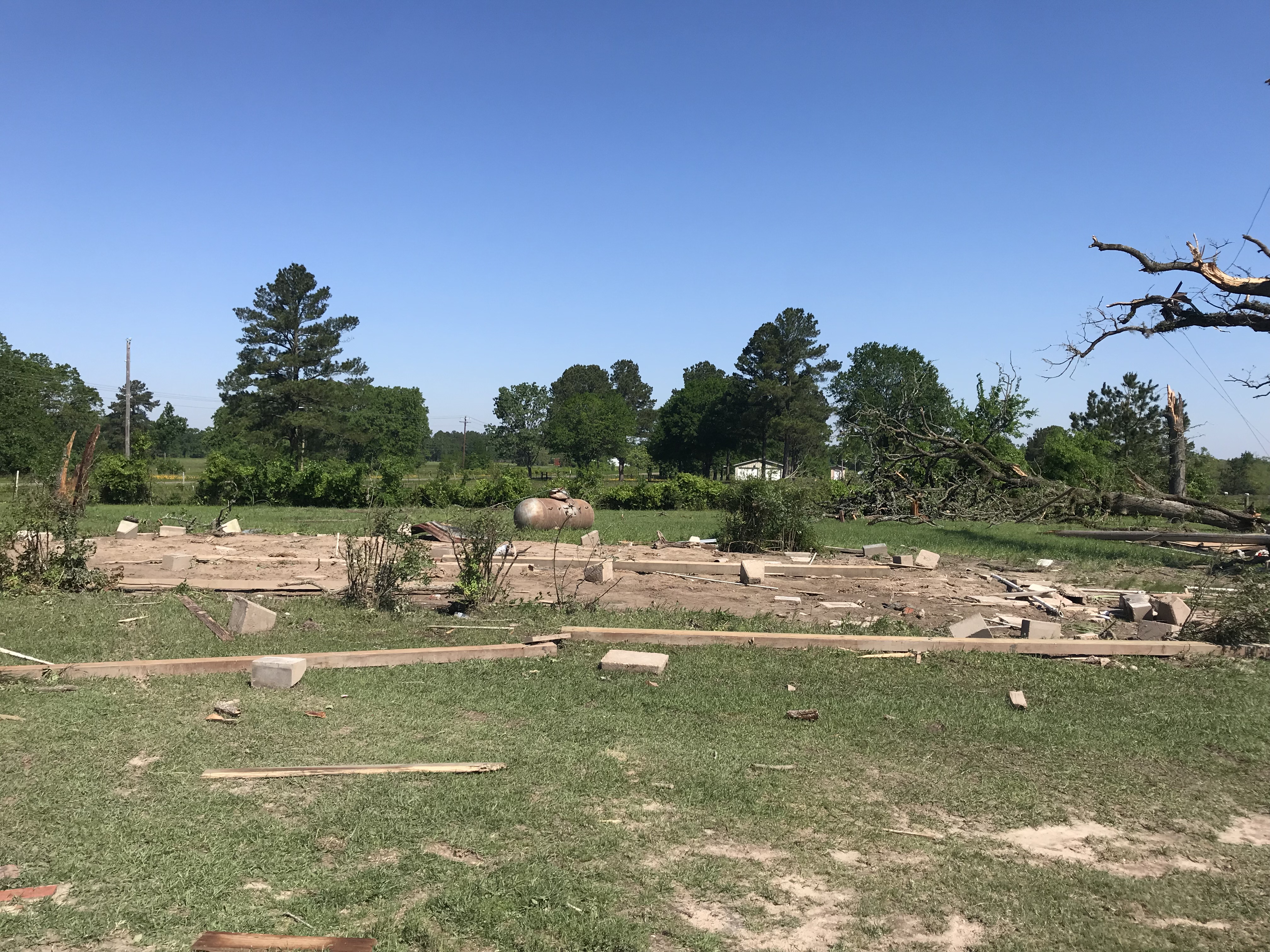
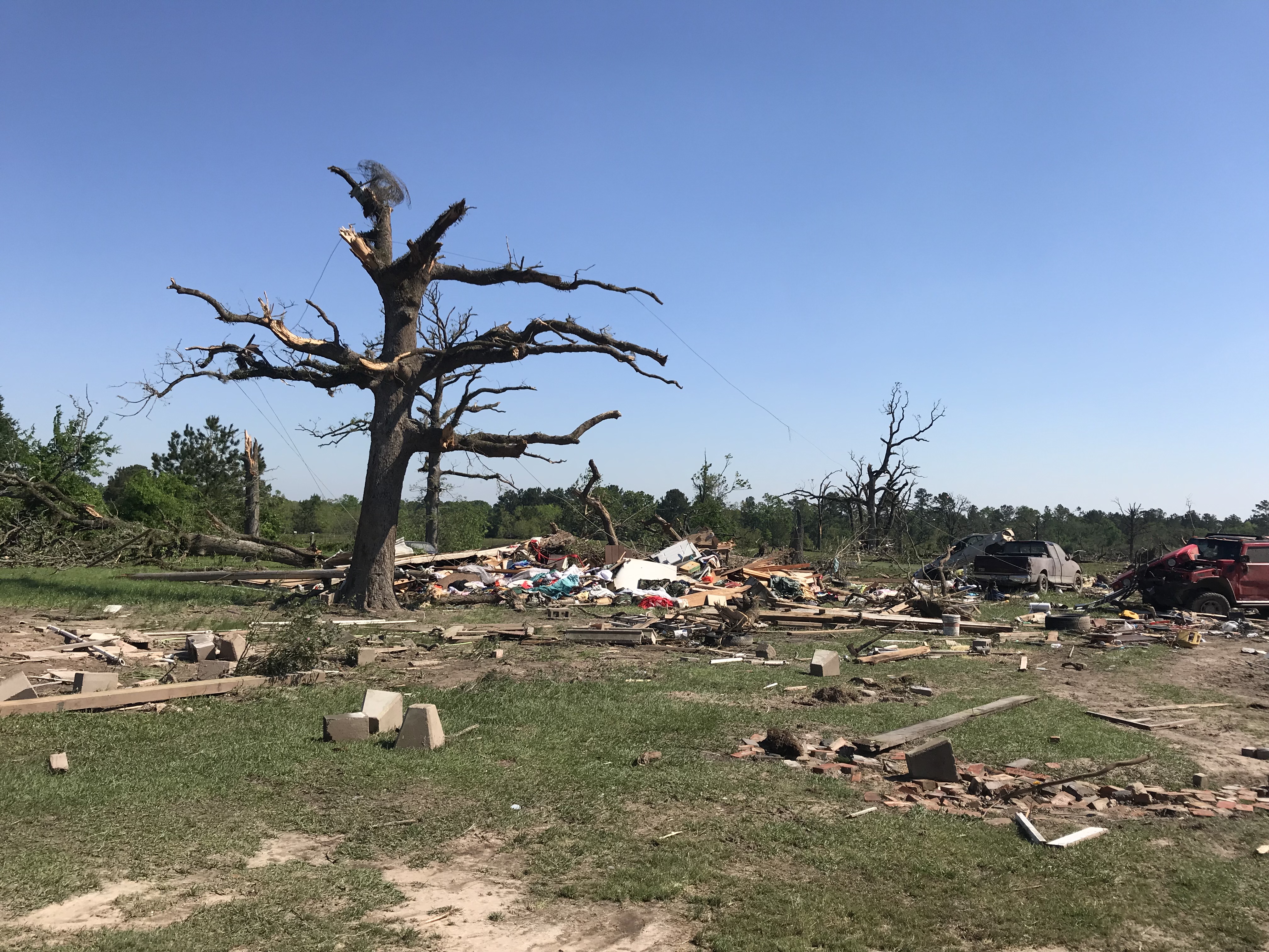
Photos & Video
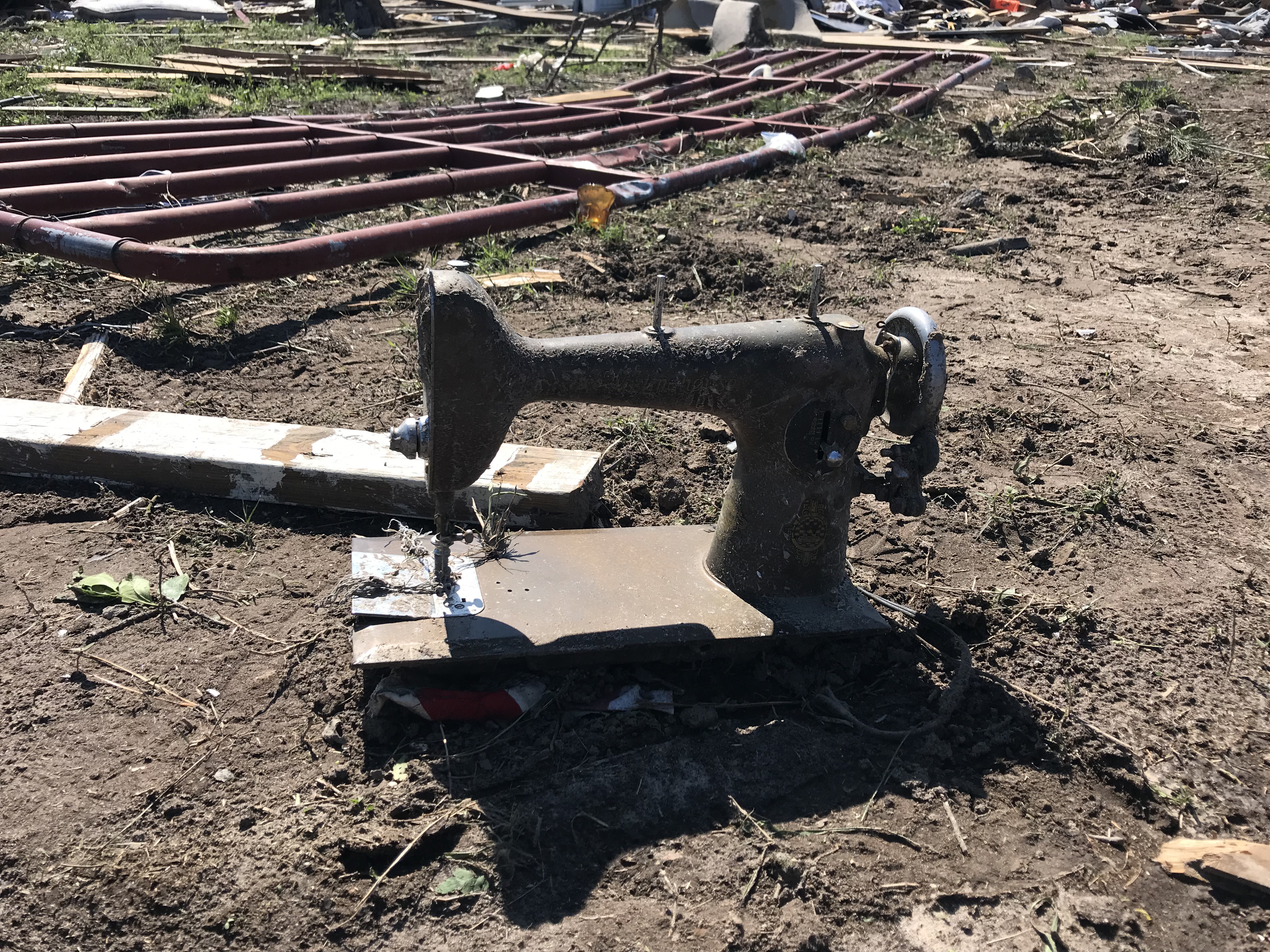
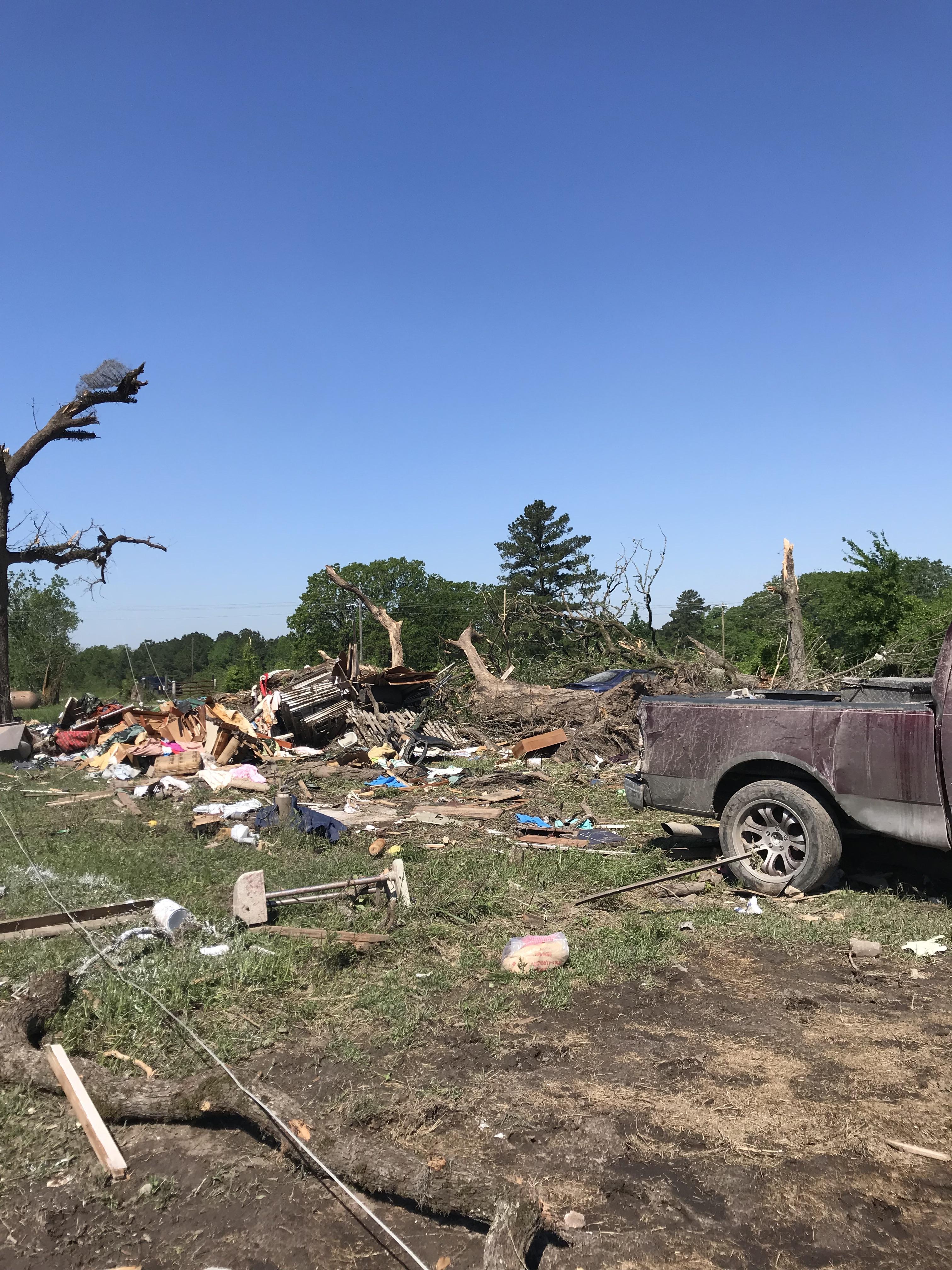
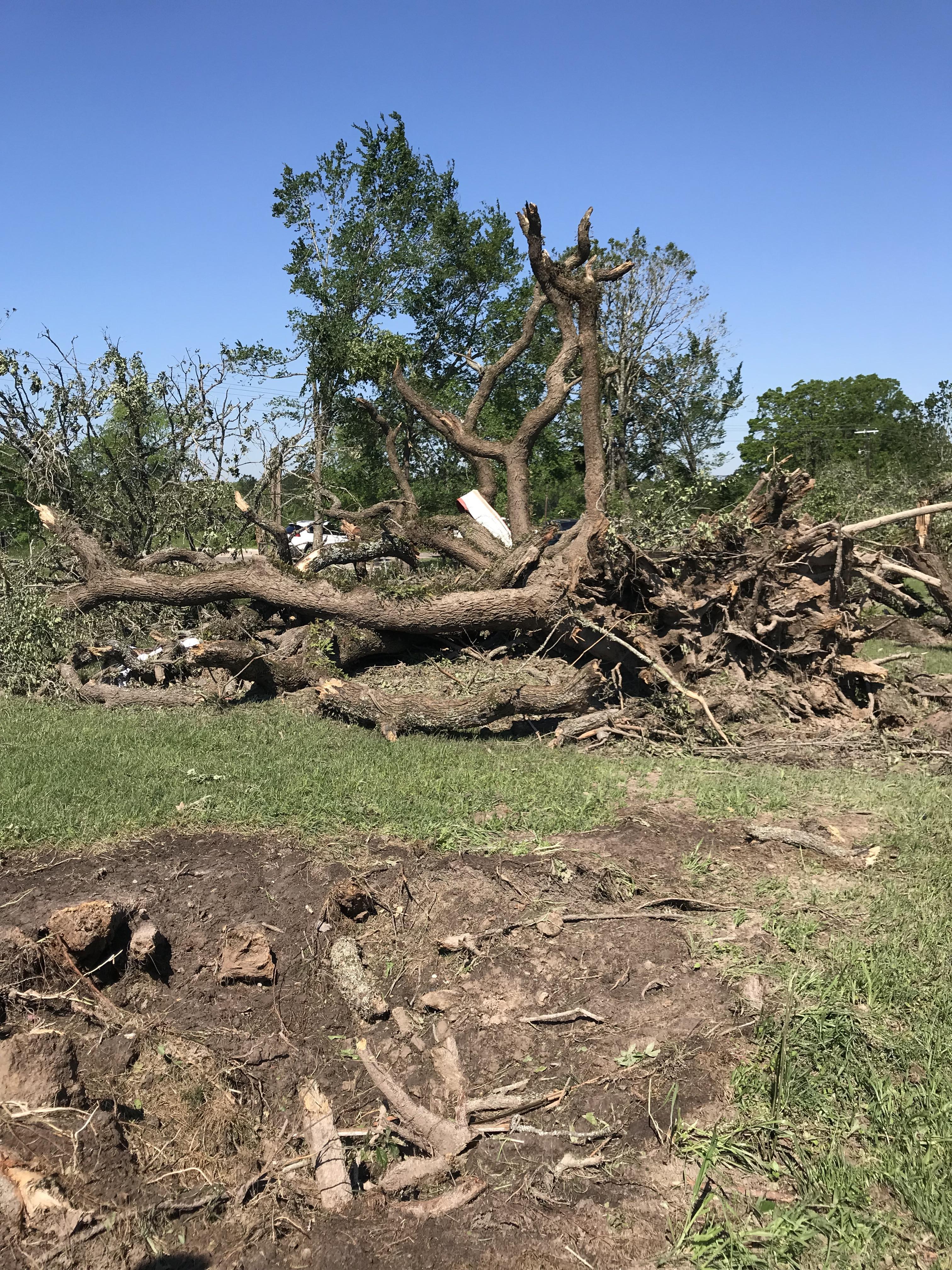
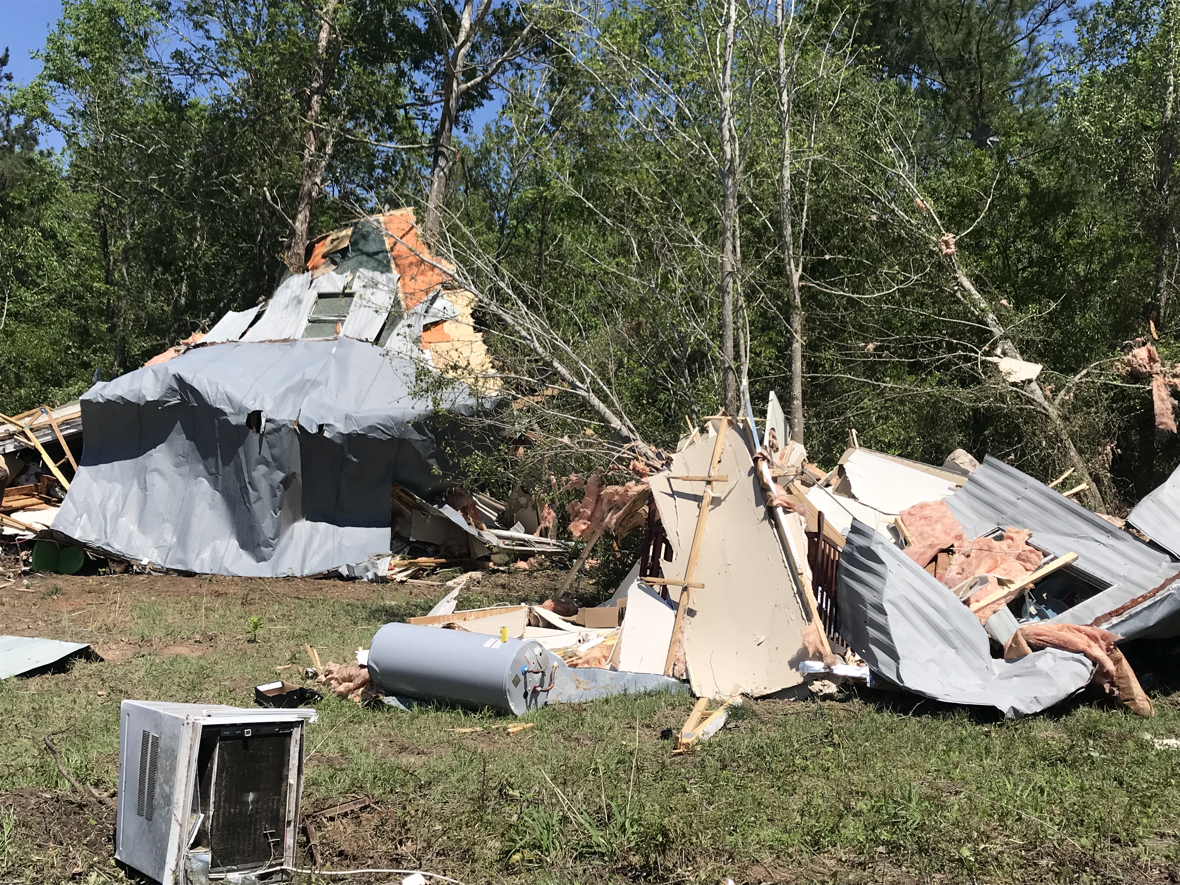
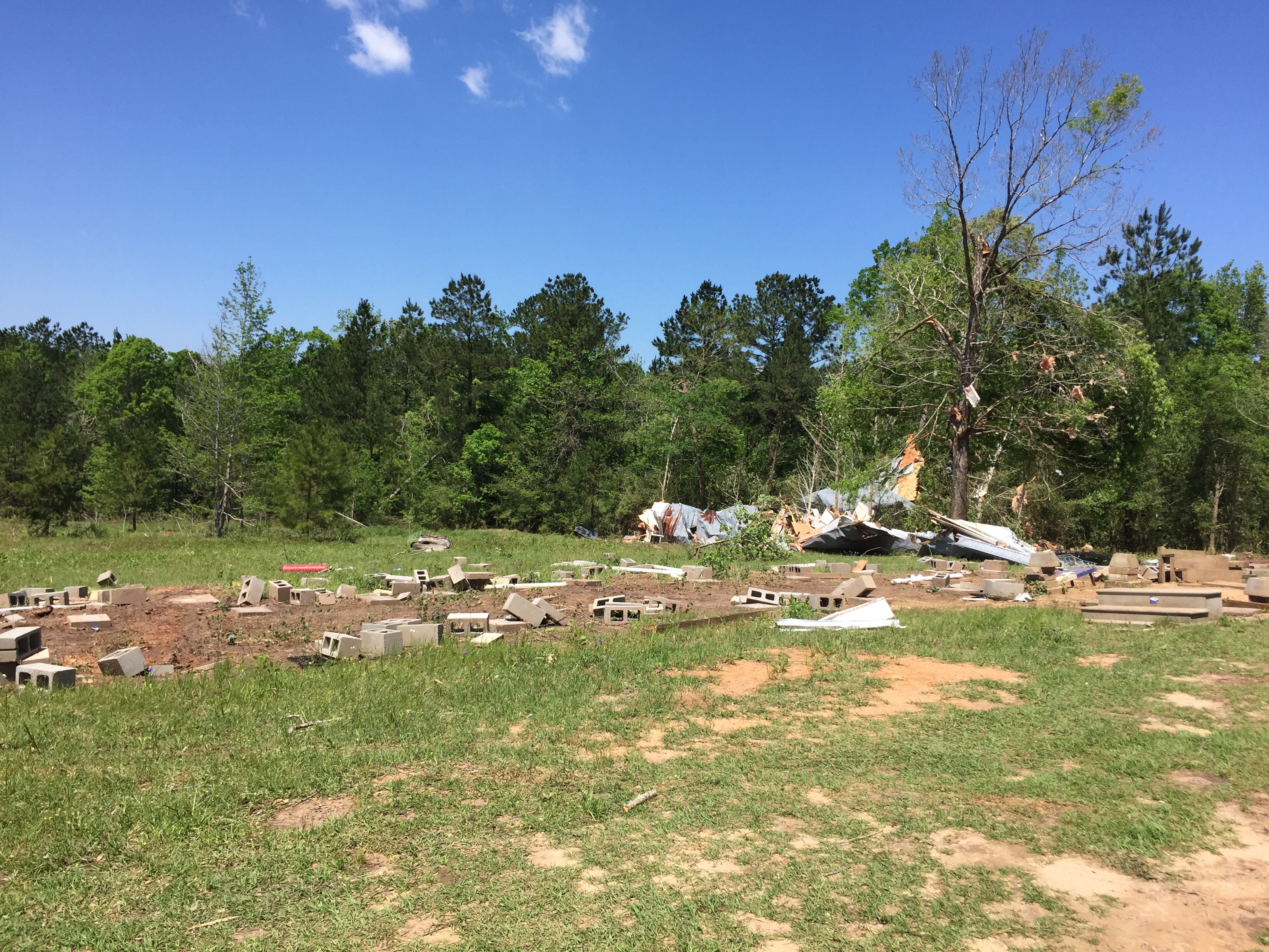
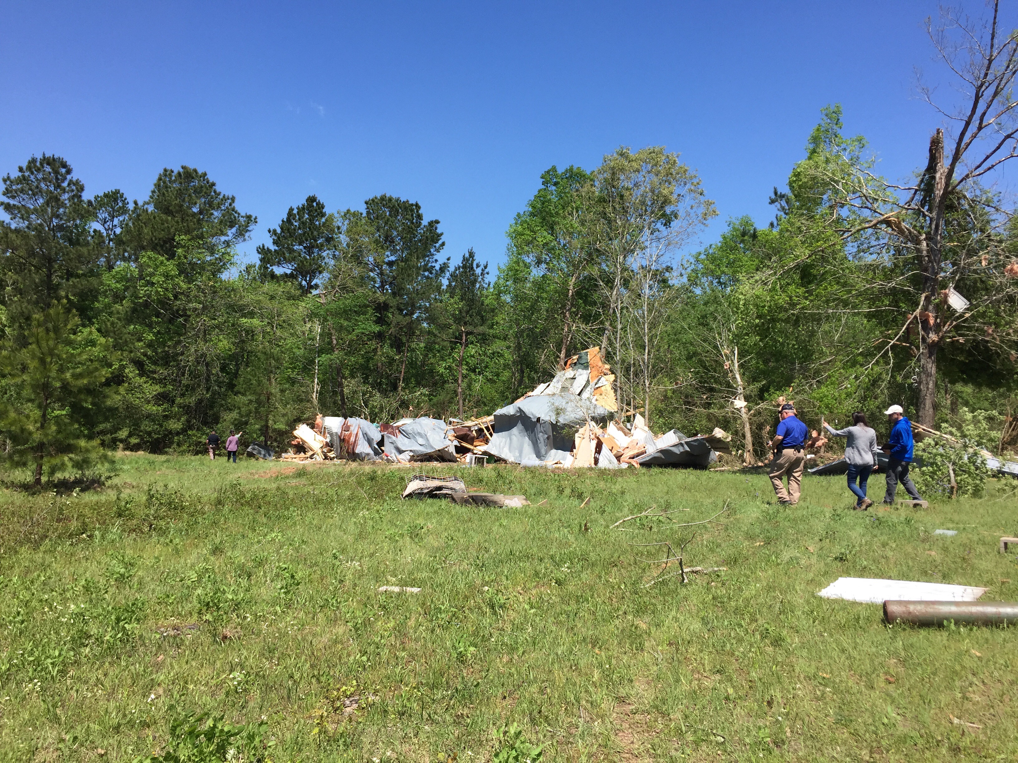
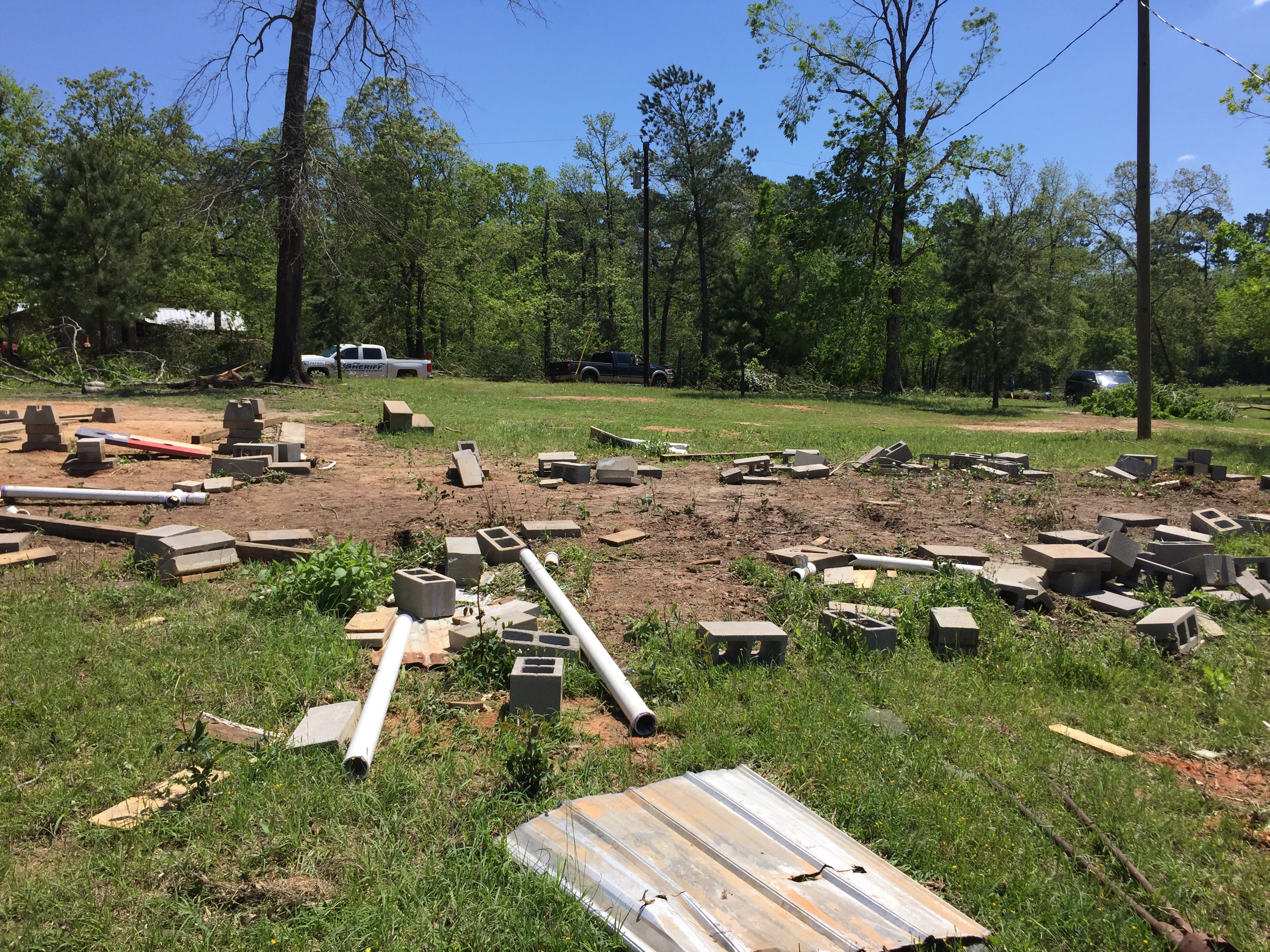
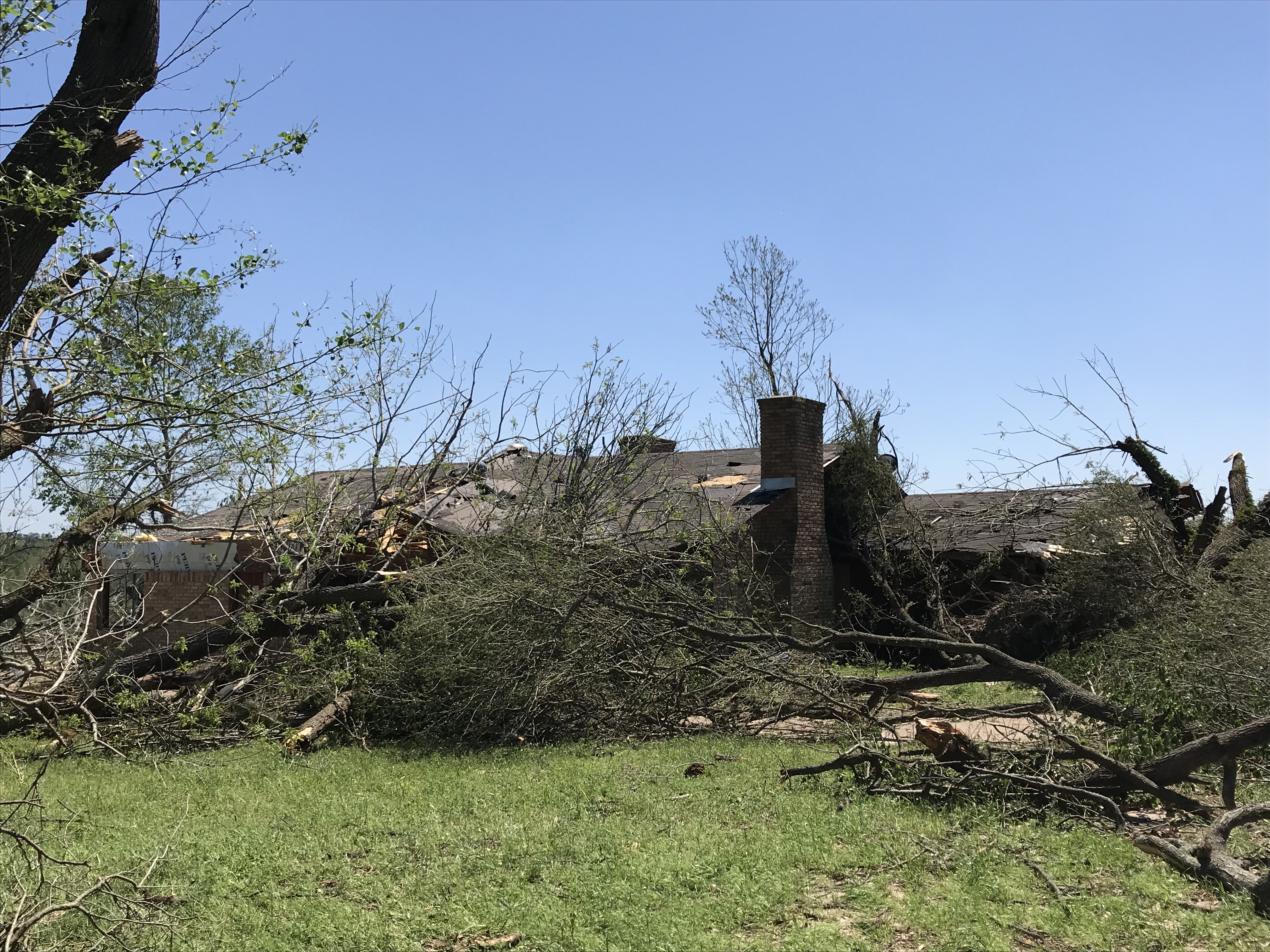
Lovelady Area
(All photos were captured during an official NWS Houston/Galveston storm survey.)
 |
 |
 |
 |
 |
 |
 |
 |
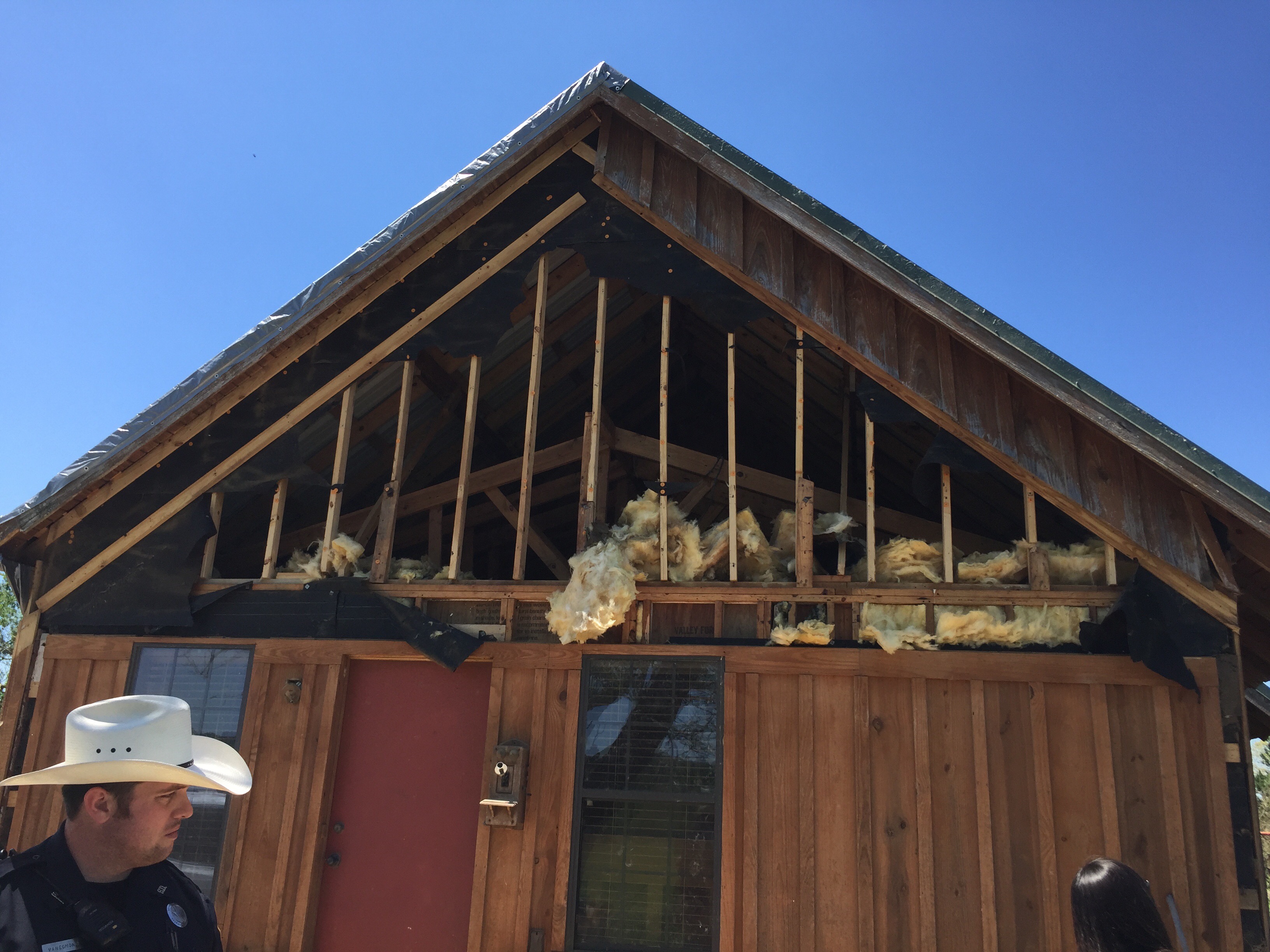
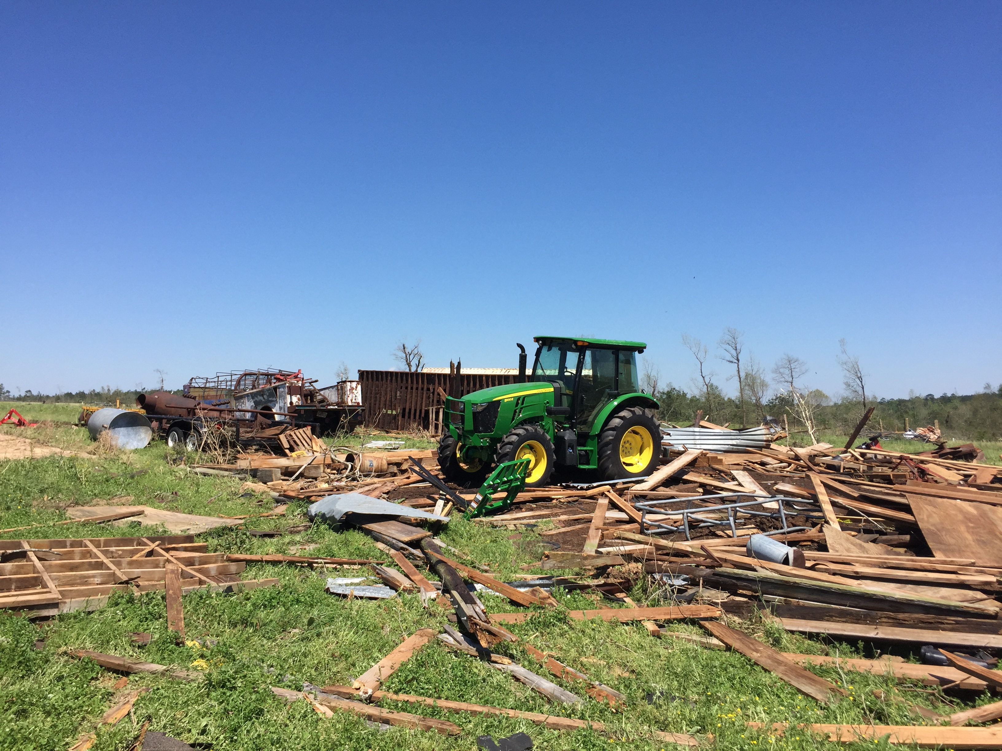
Kennard Area
 |
 |
 |
 |
Grapeland Area
 |
 |
 |
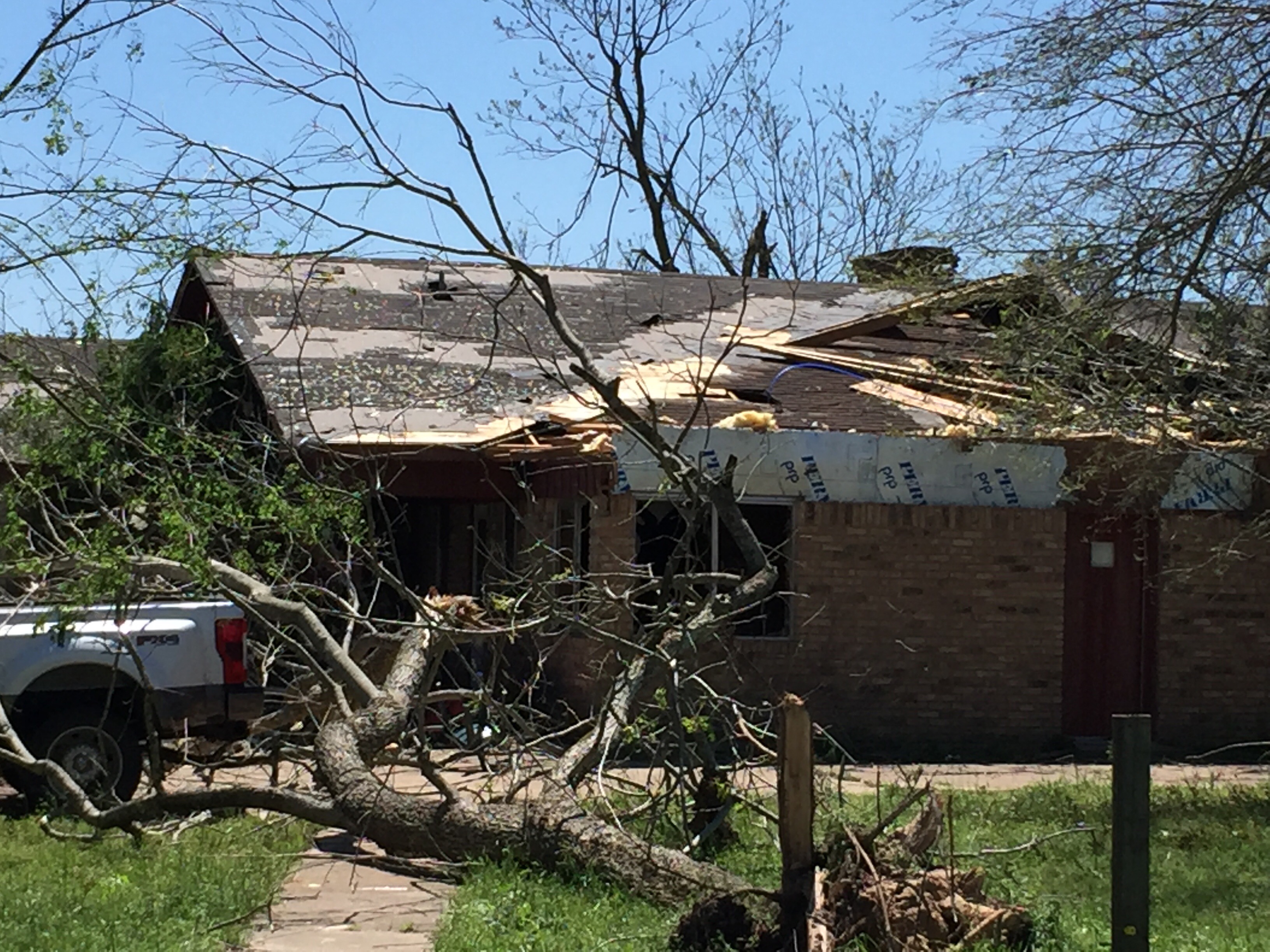 |
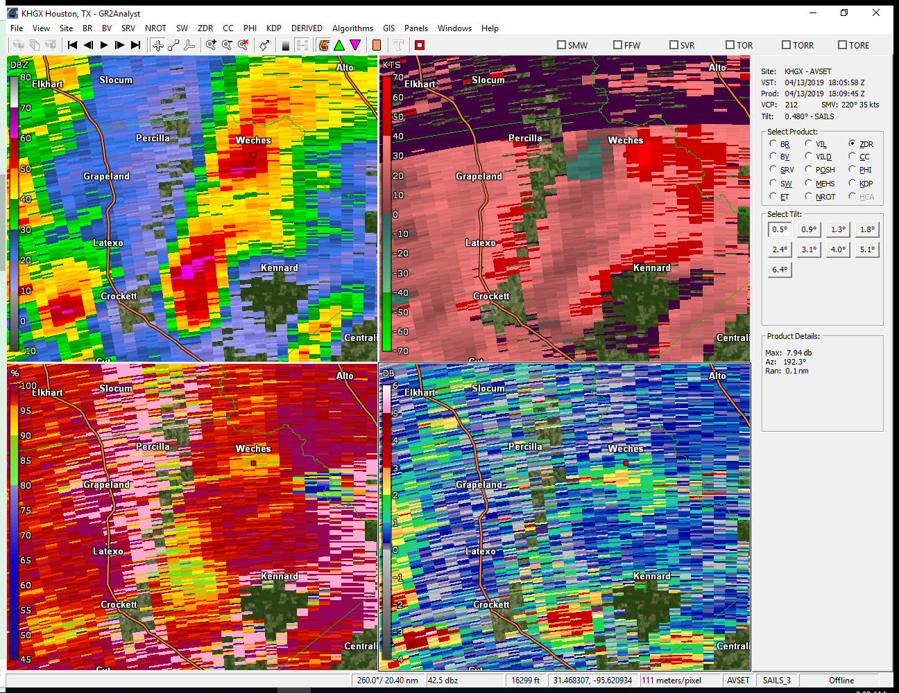
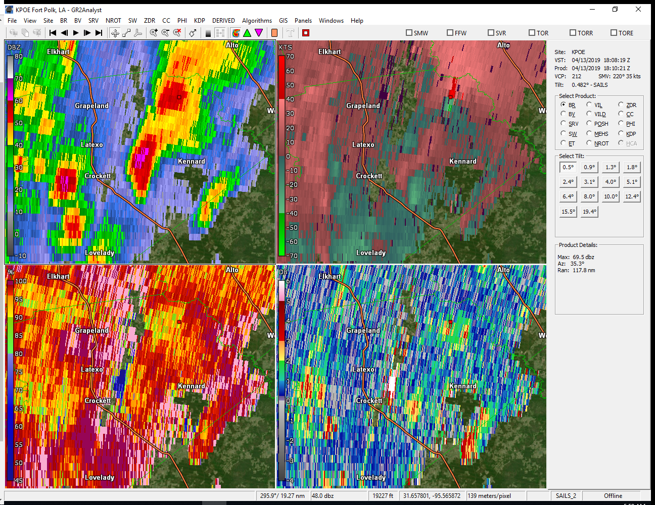
Radar
Four Looks at One Storm
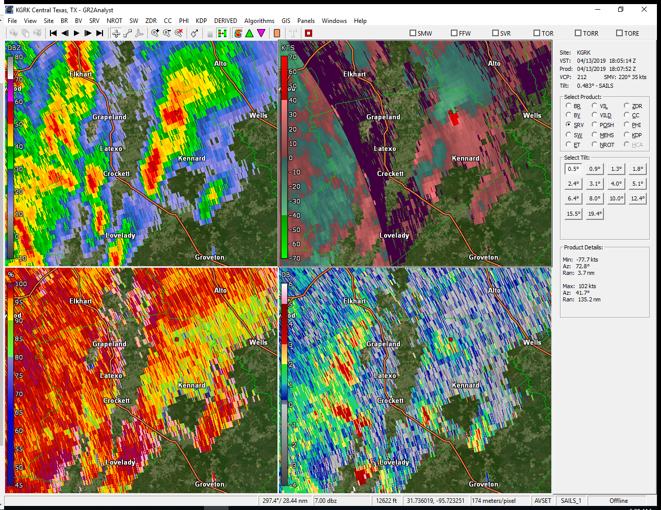 |
 |
 |
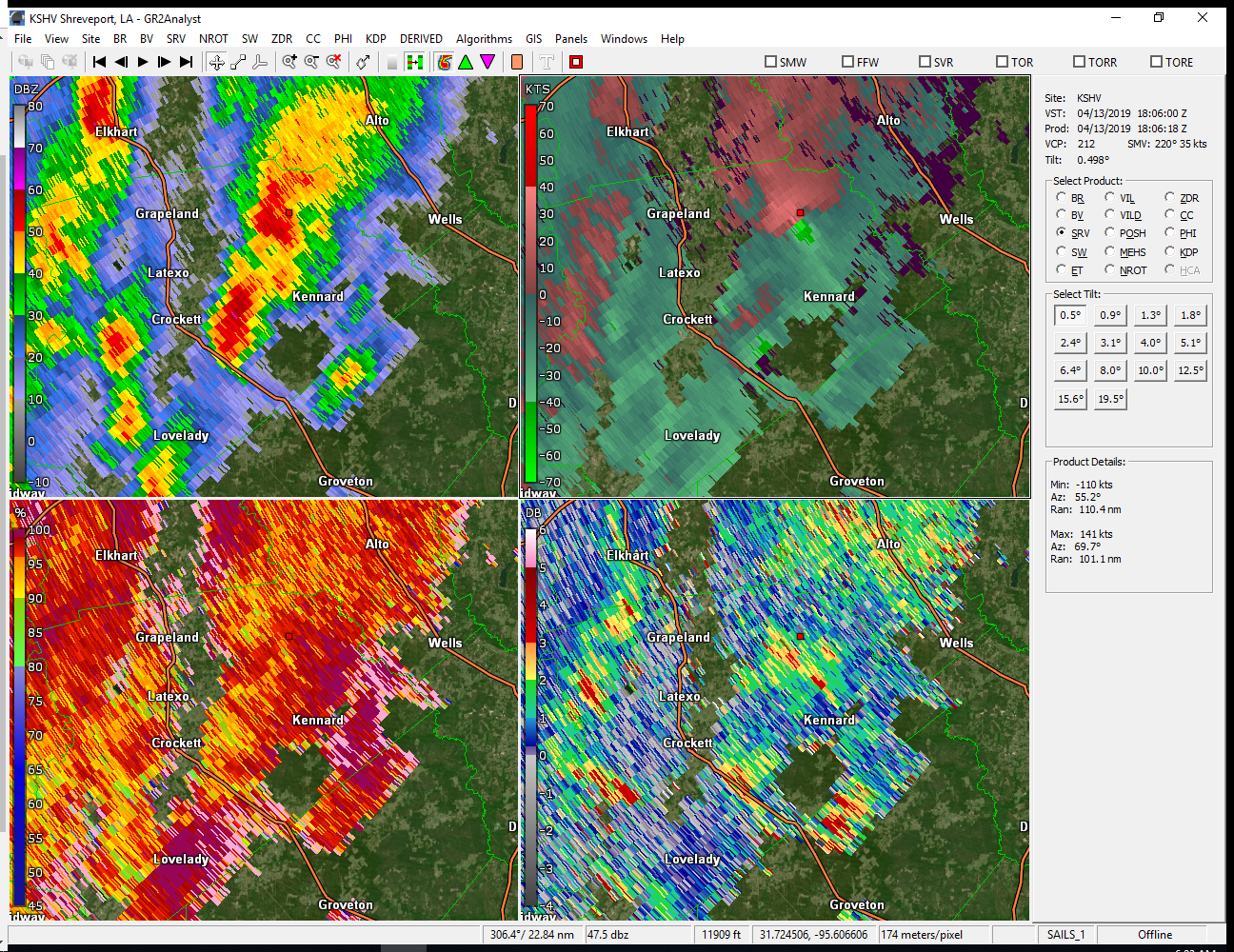 |
| Ft. Hood, TX Radar - Click to Enlarge | Houston, TX Radar - Click to Enlarge | Shreveport, LA Radar - Click to Enlarge | Ft. Polk Radar - Click to Enlarge |
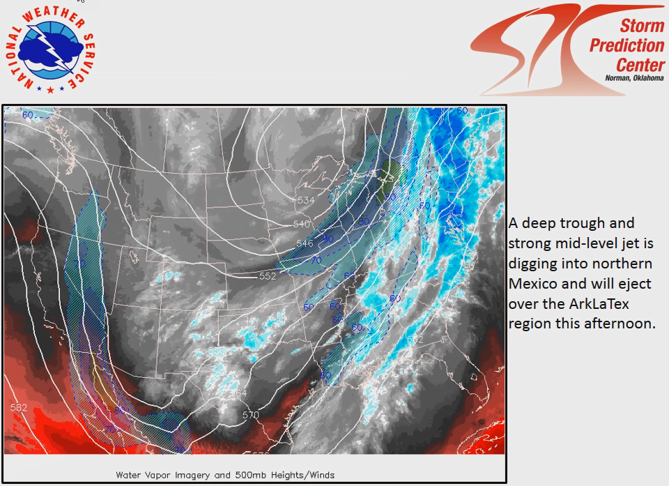
Environment
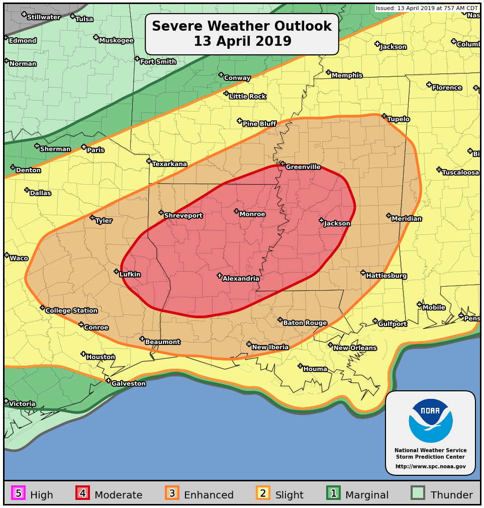
The synoptic environment was very favorable for the development of severe thunderstorms across the western and northern Gulf Coast. All modes of severe weather were possible, summarized by the SPC outlook for the day. Though the best parameters were focused north and east of our area, the environment was still favorable enough over parts of Southeast Texas to justify an "Enhanced" risk area, a level 3 threat on a scale of 1-5.
 |
 |
 |
| Click to Enlarge | Click to Enlarge | Click to Enlarge |
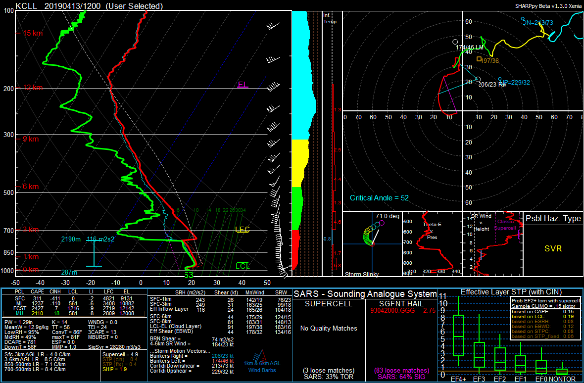
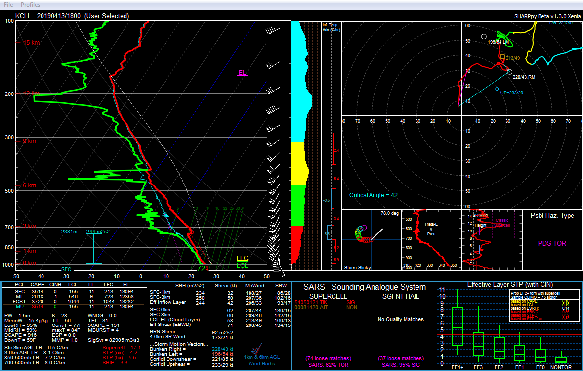
Texas A&M Meteorology launched soundings on this day as part of the VORTEX-SE tornado field research project. This provided a local look at the environment as it evolved from the morning (left sounding) to very near the time of the tornadoes at mid-day (right). The main change was that an inversion, or cap, that existed in the morning eroded and allowed developing storms to tap into copious instability. Deep layer shear (the change in winds with height) also increased, which would help storm updrafts stay organized long enough to become severe.
 |
 |
|
| Click to Enlarge | Click to Enlarge |
Shortly before the tornadoes in Southeast Texas occurred, a tornado watch was coordinated with SPC, as indicated with this mesoscale discussion and the watch issued as storms began to develop.
 |
 |
|
| Click to Enlarge | Click to Enlarge |
 |
Media use of NWS Web News Stories is encouraged! Please acknowledge the NWS as the source of any news information accessed from this site. |
|

