Houston/Galveston, TX
Weather Forecast Office
An important feature to the weather in Southeast Texas is the influence of the Gulf of America. The Gulf has a profound ability to impact winds, humidity, precipitation, and fog potential. There are also hazards unique to the coast, like storm surge. As part of our continuous efforts to bring the best weather and forecast information to the residents of this area, the Houston/Galveston forecast office proposes to change the structure of our public and fire weather zones to better reflect the unique influences of the Gulf on our weather. This involves the creation of several "coastal zones", or areas that are near the Gulf and most strongly affected by its influences on the weather. This change will help us provide more specific forecast information and provide warnings to those that need them the most. This change will become effective on May 1, 2018.
This image shows the old configuration of the zones along the coast in our forecast area. Each zone is matched to an entire county:
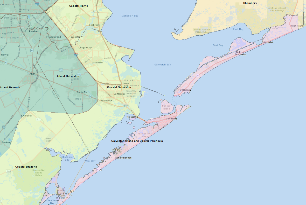
This image shows the proposed structure of our forecast zones along the coast. Coastal counties now have multiple zones based on how close they are to the coast:
.png)
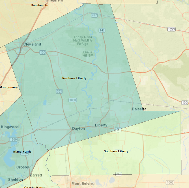
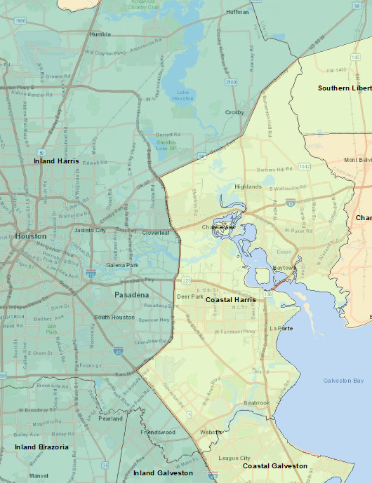
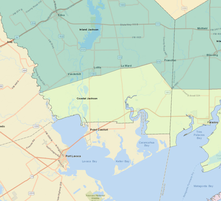
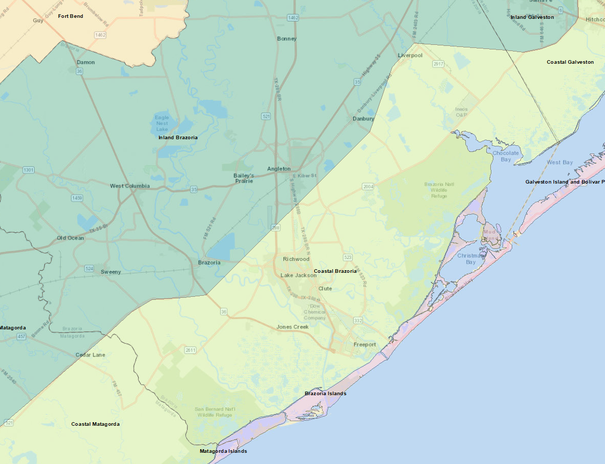
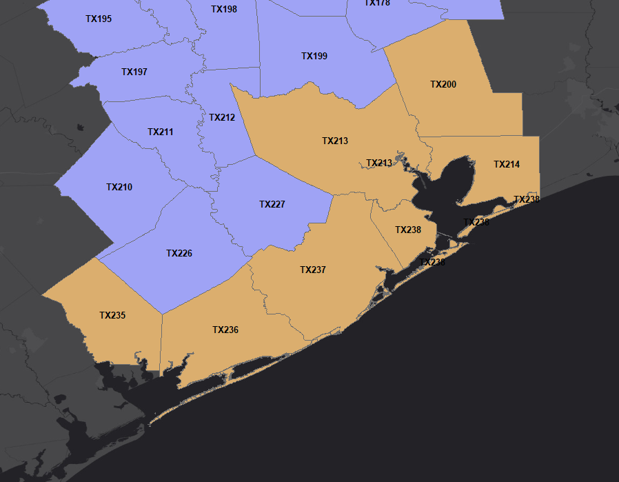
When the new zones take effect on May 1, you will see references to these new zones. The zones you may be familiar with will change to these new names. Click on the thumbnail image for an enlarged map of how each zone will change.
|
Liberty becomes Northern Liberty and Southern Liberty |
Harris becomes Inland Harris and Coastal Harris |
|
Jackson becomes Inland Jackson and Coastal Jackson |
Matagorda becomes Inland Matagorda, Coastal Matagorda, and Matagorda Islands |
|
Brazoria becomes Inland Brazoria, Coastal Brazoria, and Brazoria Islands |
Galveston becomes Inland Galveston, Coastal Galveston, as well as Galveston Island and Bolivar Peninsula |
For more details, see the official Service Change Notice (SCN) at http://www.nws.noaa.gov/os/notification/scn18-15hgx_zones.htm
CURRENT HAZARDS
-National Hurricane Center
-Storm Prediction Center
-Weather Prediction Center
-River Forecast Centers
-Aviation Weather Center
-Center Weather Service Units
-Spaceflight Meteorology Group
-Space Weather Prediction Center
CURRENT WEATHER
-Tides and Currents
-Observations
-Satellite
-Rainfall Reports
-Public Information Statement
-Galveston Beach Patrol (Flag Warning System)
FORECASTS
-Activity Planner
-Forecast Discussion
-Marine
-Tropical
-Aviation
-Fire
-Beach
-Models
-Drought
History
-Our Office
-National Weather Service
-NOAA
-Major Events
RADAR
-Houston/Galveston
-National
-Corpus Christi
-Lake Charles
-Austin/San Antonio
-Granger (Central Texas)
-Worldwide
-Education
Rivers/Lakes/Bayous
-Lower Colorado River Authority
-Harris County Flood Warning System
-Local
-National
-Jefferson County Drainage District 6
-Brazos River Authority
CLIMATE
-Houston Intercontinental
-Houston Hobby
-Galveston
-College Station
-Palacios
-Graphs
-Climate Summaries
-Local Data/Records
-Old Climate Page
-NCEI
-Storm Data
-Weather History
-Wind Roses
Education/Careers
-National Weather Service
-Careers
-Web Weather for Kids
-HGX Teacher Resources
-more
PREPAREDNESS/SAFETY
-Evacuation Planning
-Publications/Brochures
-StormReady
-2026 Hurricane Guide
-2026 Hurricane Guide (Spanish)
-SKYWARN Schedule
-FloodAware
-Weather Radio
-Evacuation ZipZone
-Evacuation Routes
-more
ADDITIONAL INFO
-Weather Ready Nation
-Weather Safety
-Severe Stats
-Air Now
-CoCoRaHS
-Miscellaneous Info
-Astronomical Info
-Frequent Products
-Find It Quick
-Watch, Warning, and Advisory Criteria
Tropical
-Preparedness Meetings
-Historical Tracks
-Education
-Climatology for SE TX
-Hurricane Harvey
-Hurricane Alicia
-Tropical Storm Imelda
-Local Page
US Dept of Commerce
National Oceanic and Atmospheric Administration
National Weather Service
Houston/Galveston, TX
1353 FM 646 Suite 202
Dickinson, TX 77539
281-337-5074
Comments? Questions? Please Contact Us.