National Weather Service United States Department of Commerce
Click a location below for detailed forecast.

Last Map Update: Mon, Jun 2, 2025 at 7:40:19 am CDT
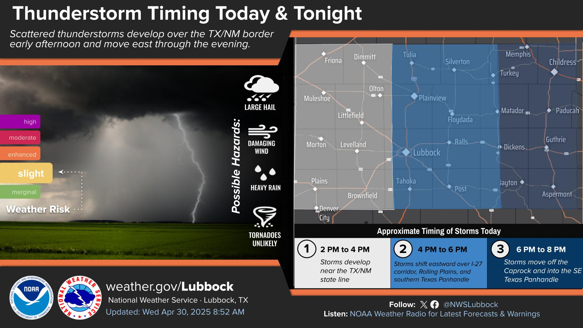
Severe thunderstorms will be possible across much of the area this afternoon through late evening. The primary hazards will be wind gusts up to 75 mph and hail up to the size of golf balls.
Numerous thunderstorms, some severe, are forecast to develop across much of the region this afternoon. Some storms may be severe, capable of producing damaging wind gusts up to 75 mph and hail up to the size of golf balls.
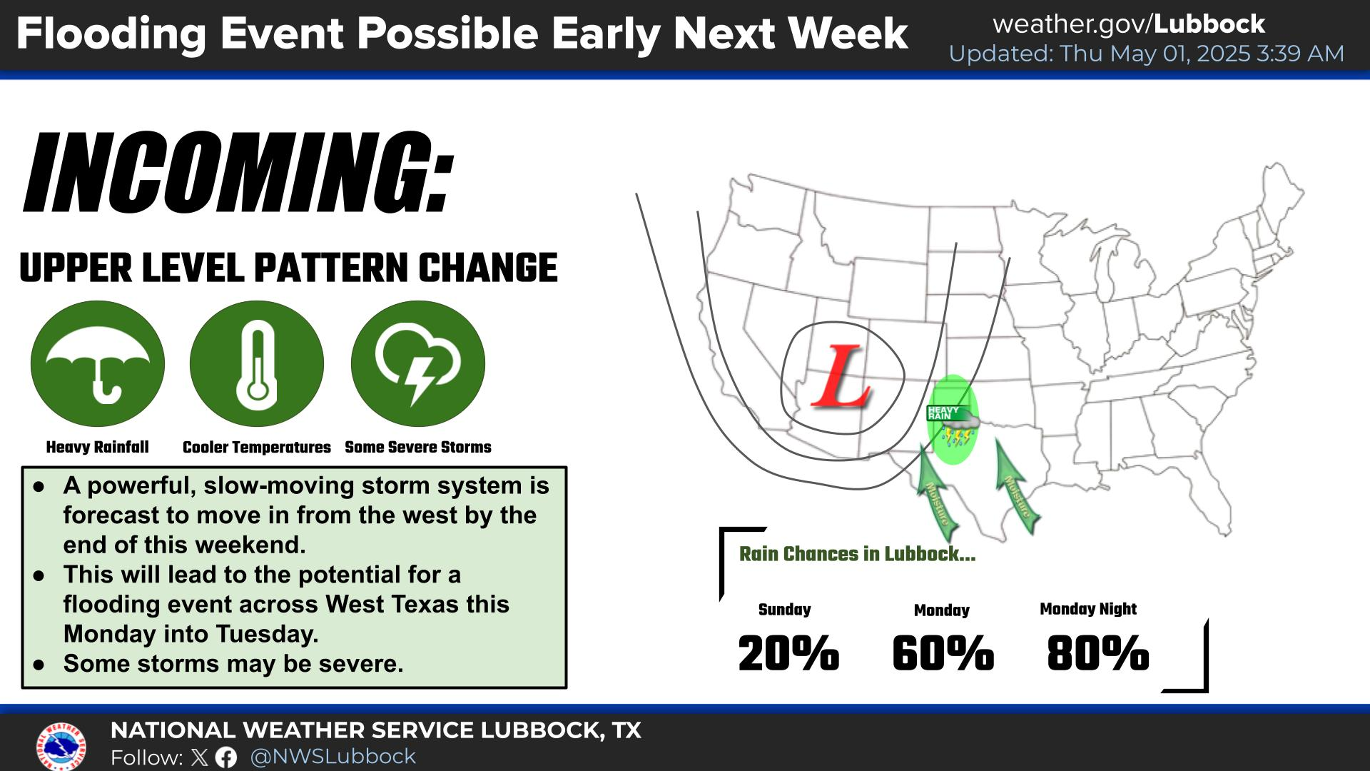
Showers and thunderstorms will continue into this evening, and then clear out early Tuesday morning.
Thunderstorms, some severe, will be possible Tuesday afternoon, particularly in the Rolling Plains. Damaging winds and large hail will be the primary hazards, in addition to locally heavy rainfall.
Daily chances for thunderstorms, some severe, will continue this week and into the weekend. A strong cold front will move through the region Tuesday, leading to a wide range in high temperatures (coolest in the far southern Texas Panhandle and warmest in the southern South and Rolling Plains).


Local Weather History For June 2nd...
1965: Five persons were killed and 76 injured late this evening when a long-lived F4 tornado cut a path of destruction
from near Spade directly through Hale Center covering a distance of at least 40 miles. This tornado was first observed
near Spade at 9 PM and it continued northeast before striking Hale Center at 9:25 PM. No information was provided
concerning where this tornado finally dissipated, but based on the severity of damage reports its likely the tornado
continued northeast of Hale Center for an unknown distance. The majority of residents were well aware of the tornado and
had taken shelter in advance