National Weather Service United States Department of Commerce
Click a location below for detailed forecast.

Last Map Update: Mon, Jun 29, 2026 at 4:10:49 pm EDT

Heat and humidity today will lead to dangerously hot feels like temperatures reaching as high as 110 degrees. Drink plenty of fluids, stay in an air-conditioned room, stay out of the sun, and check up on relatives and neighbors.
Locally heavy rainfall possible Tuesday afternoon and evening that could cause flooding of urban, low lying, and poor drainage areas.
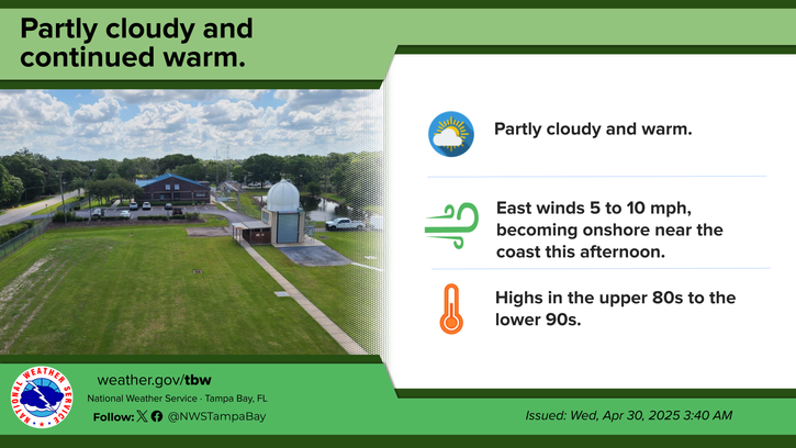
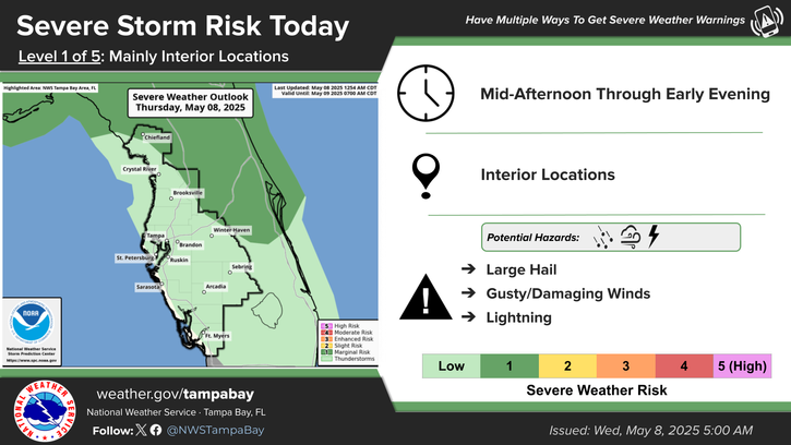
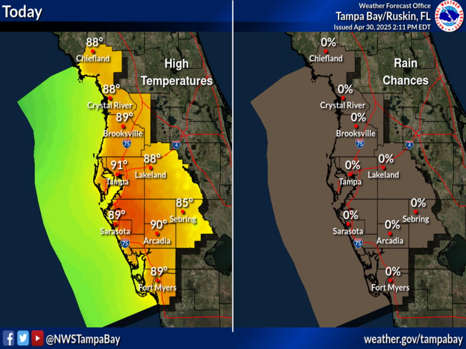
Partly to mostly sunny with scattered mainly afternoon and evening showers and thunderstorms. Highs in the upper 80s along the coast to mid 90s inland. Feels like temps 100-110 degrees.
Diminishing evening showers and thunderstorms. Lows in the mid 70s to around 80 degrees.
Partly sunny with scattered to numerous mainly afternoon and evening showers and thunderstorms. Highs in the upper 80s along the coast to mid 90s inland. Feels like temps 100-107 degrees.
Climate for today, June 29th. Long-term average highs and lows. Record highs and lows. Record rainfall.


Text Product Selector 


Radar
Radar
Current Weather
Current Weather
Rivers & Lakes
Rivers & Lakes
Satellite
Satellite
Weather Information Display
Weather Info Display
Forecast Maps
Forecast Maps
Hour by Hour Forecast
Wave Prediction
Weather Hazard Briefing
NOAA PORTS®
Forecaster's Discussion
Tropical Weather
Tropical
Marine Observations and Forecasts
Marine
Beach and Rip Current Forecast
Beach & Surf
Fire Weather
Fire Weather

 
Drought Page
Drought

 
NOAA Weather Radio
NOAA Weather Radio

 
NWS Skywarn Storm Spotter Program
Skywarn

 
Storm Report
Submit Storm Report