Widespread, life-threatening considerable flash flooding is expected in south-central Texas through at least Friday. Catastrophic river flooding and rapid rises on small streams, arroyos, and typically dry washes are expected in the Texas Hill Country. Wildfire smoke is impacting air quality across much of the Great Lakes region into the Northeast U.S. with Air Quality Alerts in effect. Read More >
| Hydro-Climate Context for December |
|
Updated November 26, 2014, Text valid for Nov 26 - Dec 22, 2014 |
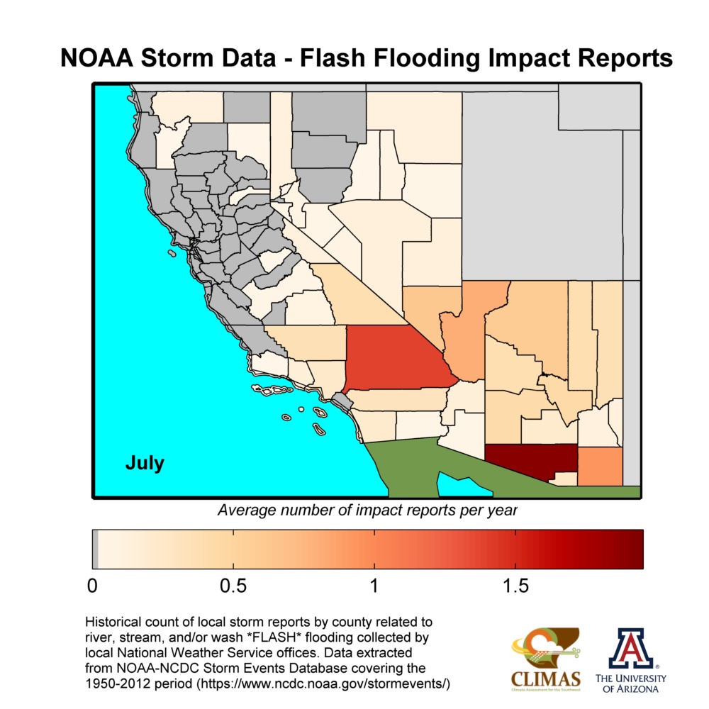
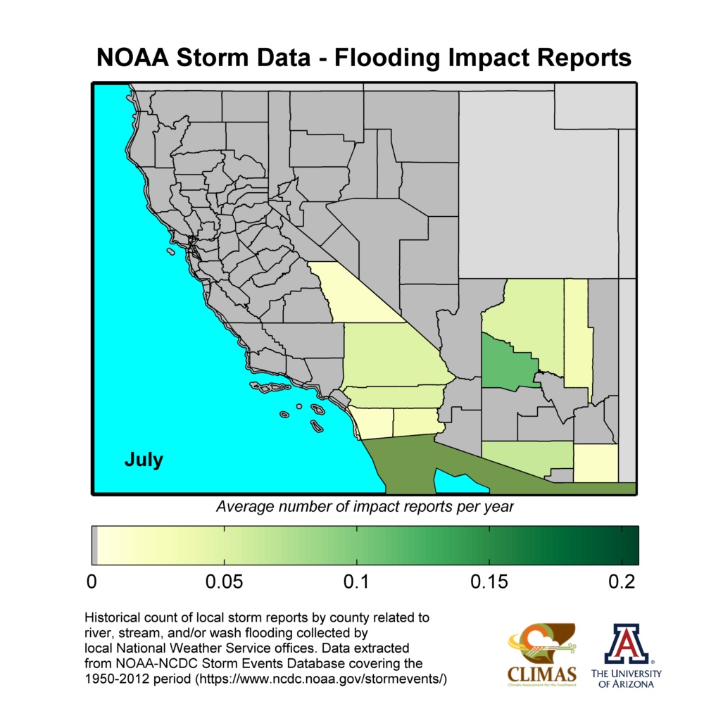
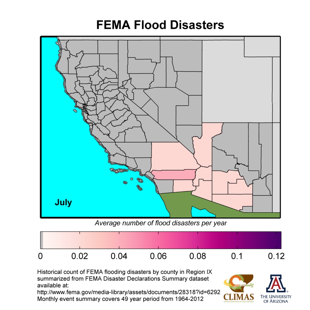
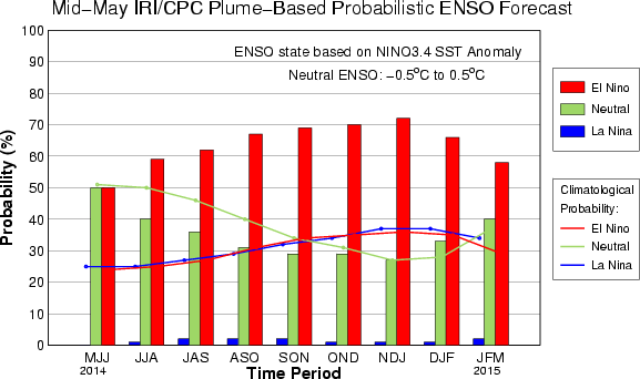
| The peak of the rainy season is upon us. December is the first of three consecutive months with peak rainfall in the West, especially across northern CA and the Sierra (Figure 1). History shows us that flash floods occur mainly in southern CA and southern NV (Figure 2) during December, while mainstem river flooding (Figure 3) and subsequent FEMA disaster declarations (Figure 4) have occurred throughout the region. Fall storms moving through the Pacific Northwest brushed across northern CA bringing near to slightly below average rainfall (70-100% percent of average) to that region (Figure 5). A few storms reached down into central CA bringing a small amount of rain to a few locations, which was climatologically above average. With a multi-year drought in place across the region, the near-average rainfall soaked into the soil and only ameliorated the long-term drought and did little to improve reservoir conditions overall (Figure 8). Meanwhile, once again little to no rainfall fell across the rest of the southwest U.S. during November, further adding to the drought stresses in that region of the country. While currently still in ENSO neutral, NOAA’s Climate Prediction Center (CPC) continues to forecast a weak El Niño to emerge during the winter months and continue through Spring 2015 (Figure 10). The latest 3-month outlook for precipitation favors above-average precipitation for Arizona, central/southern CA, and southern NV during the Dec-Jan-Feb season. Equal chances for above-, near-, or below-average precipitation is forecast across the northern third of CA and NV (Figure 11). Climatologically, El Niño does increase the risk of above-average rain and snow (and thus flooding) in the winter season. With a weak El Niño this is especially true across mainly AZ and parts of southern CA (Figure 9). |
https://www.climas.arizona.edu/content/fema-dashboard-2
|
Current Conditions: Conditioning Climate Risk
|
Climate Outlooks
|