|
|
|
|
|
|
| Heat Safety Information | |
| The State College NWS Office will issue Advisories and Warnings under the header "PHLNPWCTP (WWUS71 KCTP)" for the following: | |
|
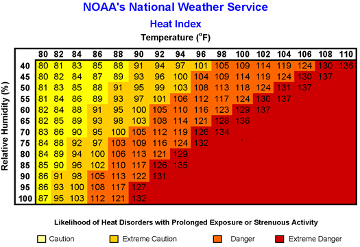
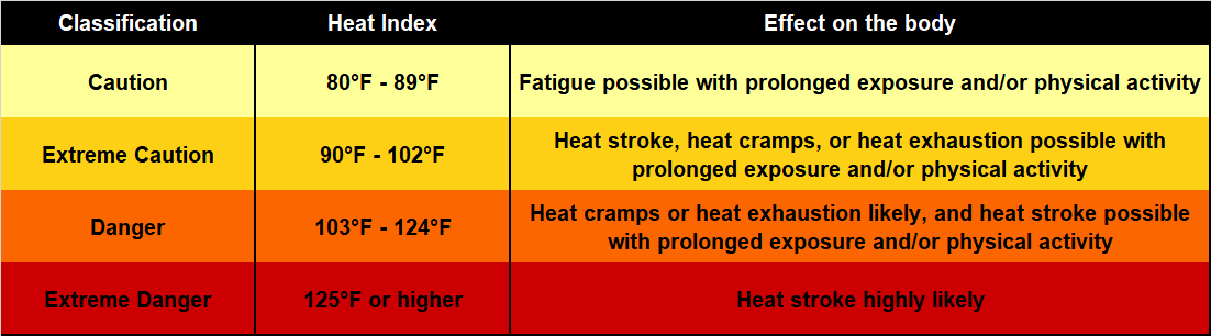
Extreme Heat Warning: Heat Index values will attain or exceed 105°F. Extreme Heat Watch: Possibility that Extreme Heat Warning Criteria may be met at longer ranges (12 to 48 hrs out). |
|
|
Heat Advisory: Heat Index will be equal to or greater than 100°F, but less than 105°F. |
|
|
|
|
|
|
 |
|
| Cold Weather Safety Information | |
| The State College NWS Office will issue Advisories and Warnings under the header "PHLNPWCTP (WWUS71 KCTP)" for the following: | |
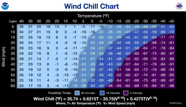
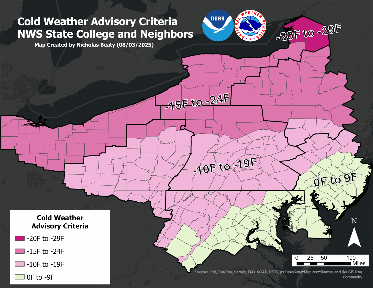
| Either wind chill or temperatures can meet these criteria (i.e. if there is light/no wind, temperatures alone can trigger these products) | |
|
Extreme Cold Warning Values of -20 F or colder along and south of I-80, and -25 F or colder for areas north of I-80 |
|
|
Cold Weather Advisory Values of -10 F or colder along and south of I-80, and -15 F or colder for areas north of I-80 |
|


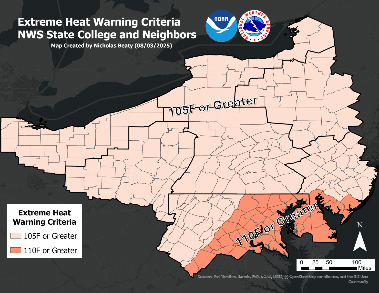 Map of Extreme Heat Warning Criteria
 Map of Heat Advisory Threshold
 Send Us a Report