 |
Houston/Galveston
Marine Weather Page
|
|
|
|
Link to Old Marine Page (not updated)
|
|
Beach Weather |
|
Experimental National Marine Weather Web Portal |
|
| |
|
| Marine Warnings |
| |
|
|
|
| |
|
| |
|
Tide Tables/Links for 2024 |
|
|
|
|
|
| Other Observations |
|
|
|
| NDBC Buoy Observations: Text Links |
|
|
| Other Links |
|
|
| Marine Forecasts |
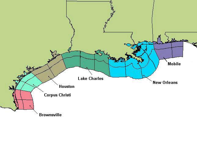
| Marine Zones: Text Forecasts |
|
Beaufort Wind Scale:
| Force |
Wind (kts) |
Classification |
| 0 |
<1 |
Calm |
| 1 |
1-3 |
Light Air |
| 2 |
4-6 |
Light Breeze |
| 3 |
7-10 |
Gentle Breeze |
| 4 |
11-16 |
Moderate Breeze |
| 5 |
17-21 |
Fresh Breeze |
| 6 |
22-27 |
Strong Breeze |
| 7 |
28-33 |
Near Gale |
| 8 |
34-40 |
Gale |
| 9 |
41-47 |
Strong Gale |
| 10 |
48-55 |
Storm |
| 11 |
56-63 |
Violent Storm |
| 12 |
<63 |
Hurricane |
|
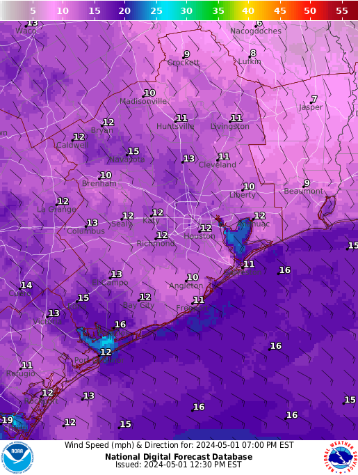
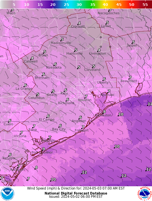
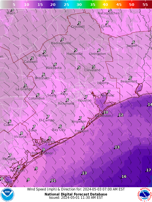
Marine Graphical Forecast: Wind |
|
|
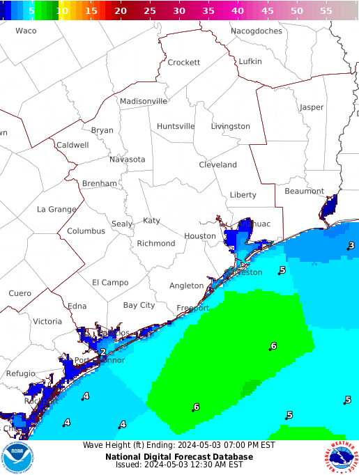
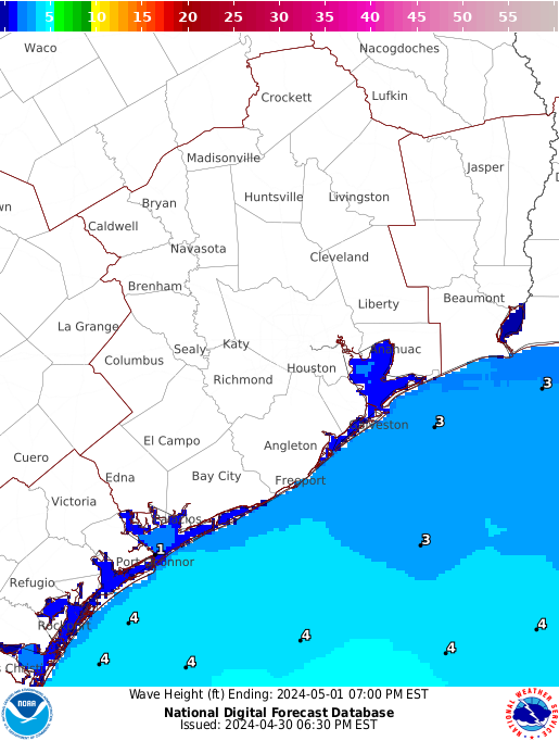
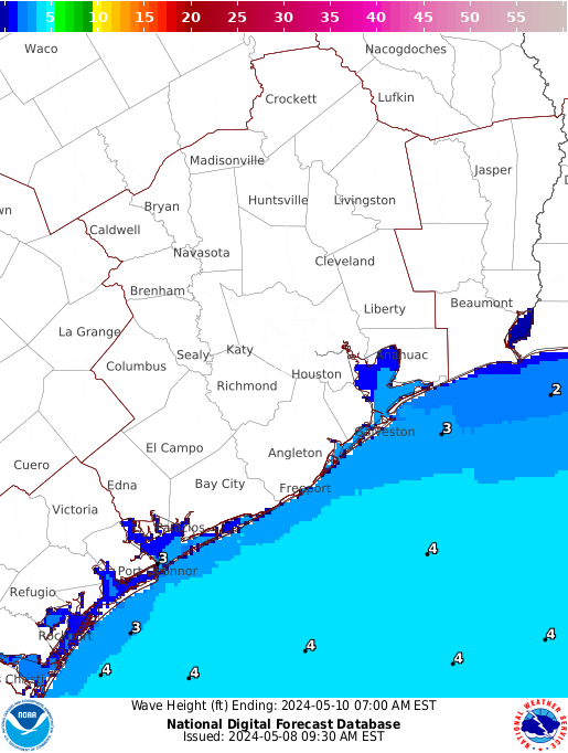
Marine Graphical Forecast: Wave |
|
|
| Miscellaneous Forecast Links |
|
|
| Marine Models |
|
|
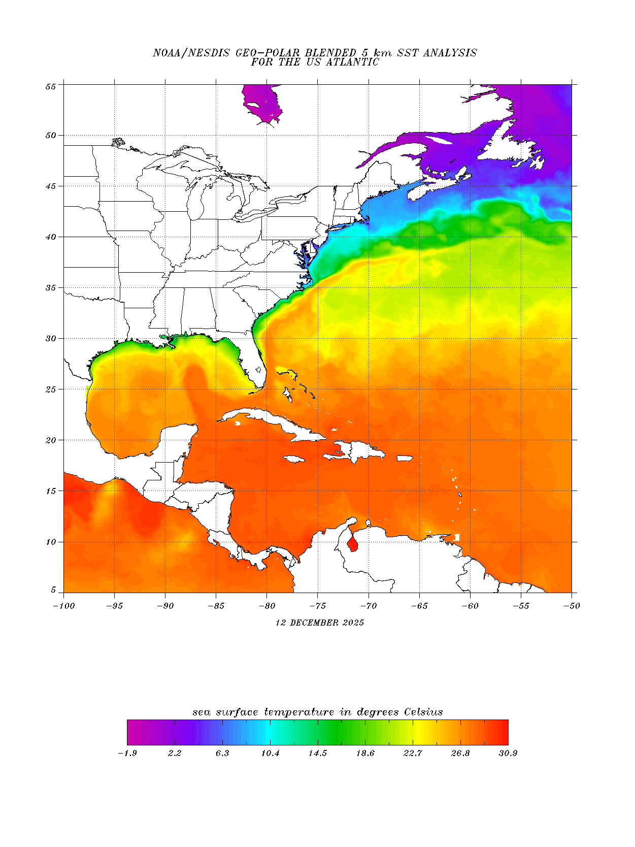
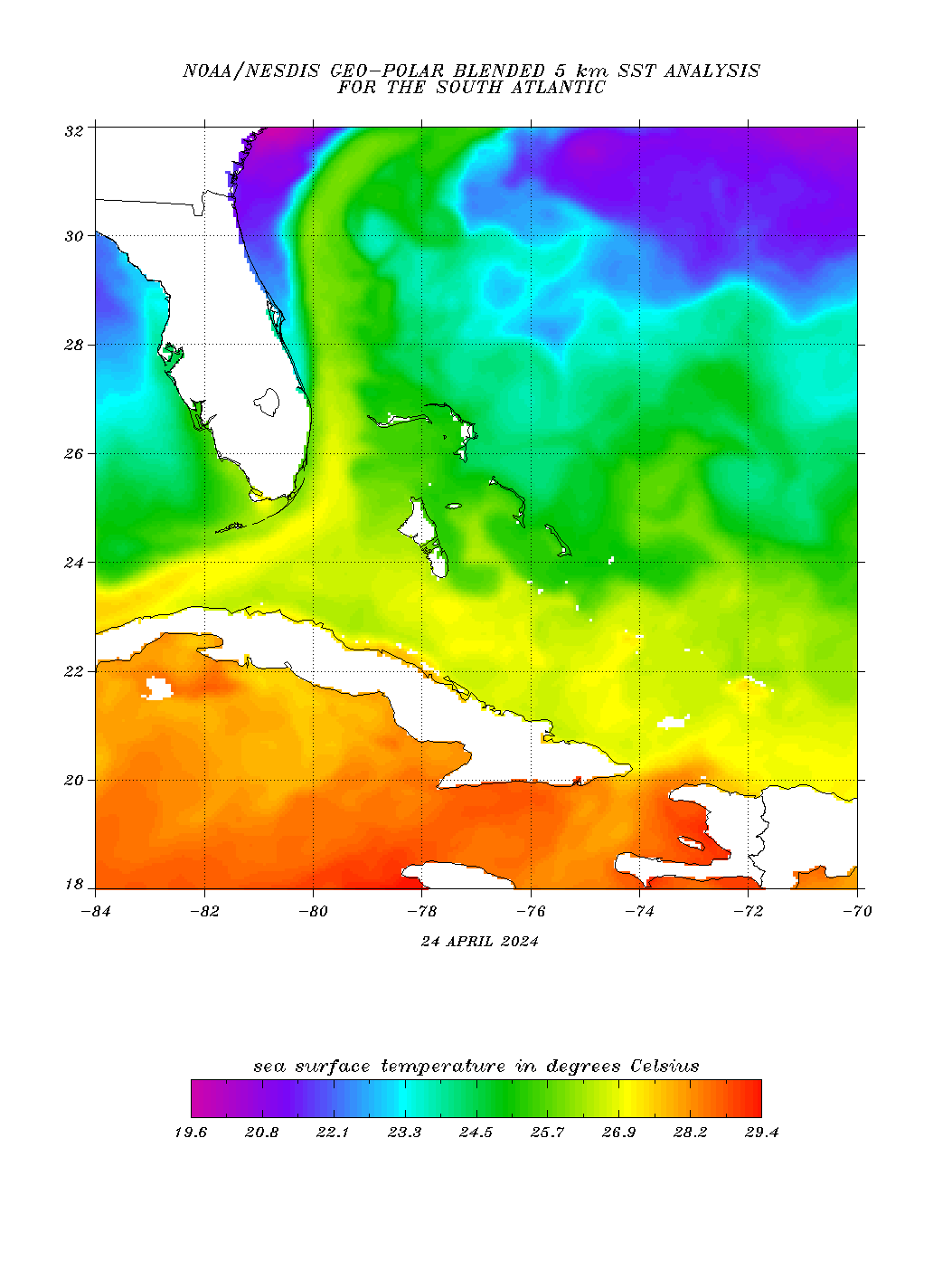
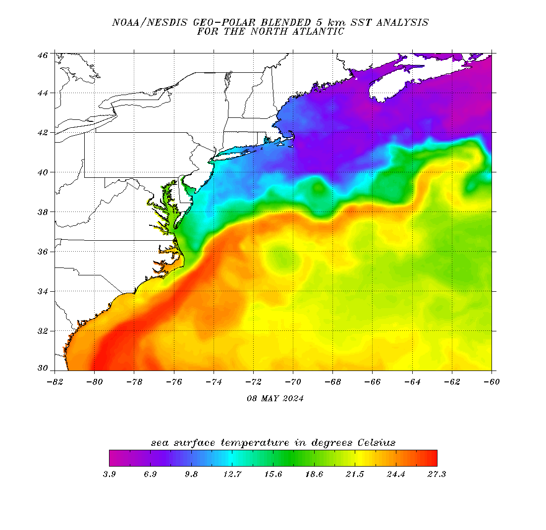
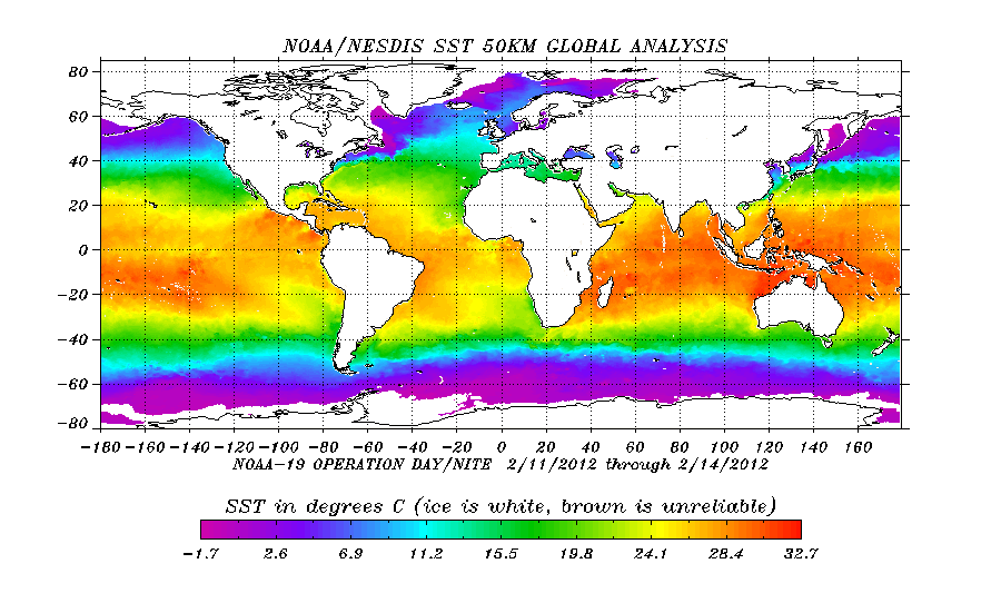
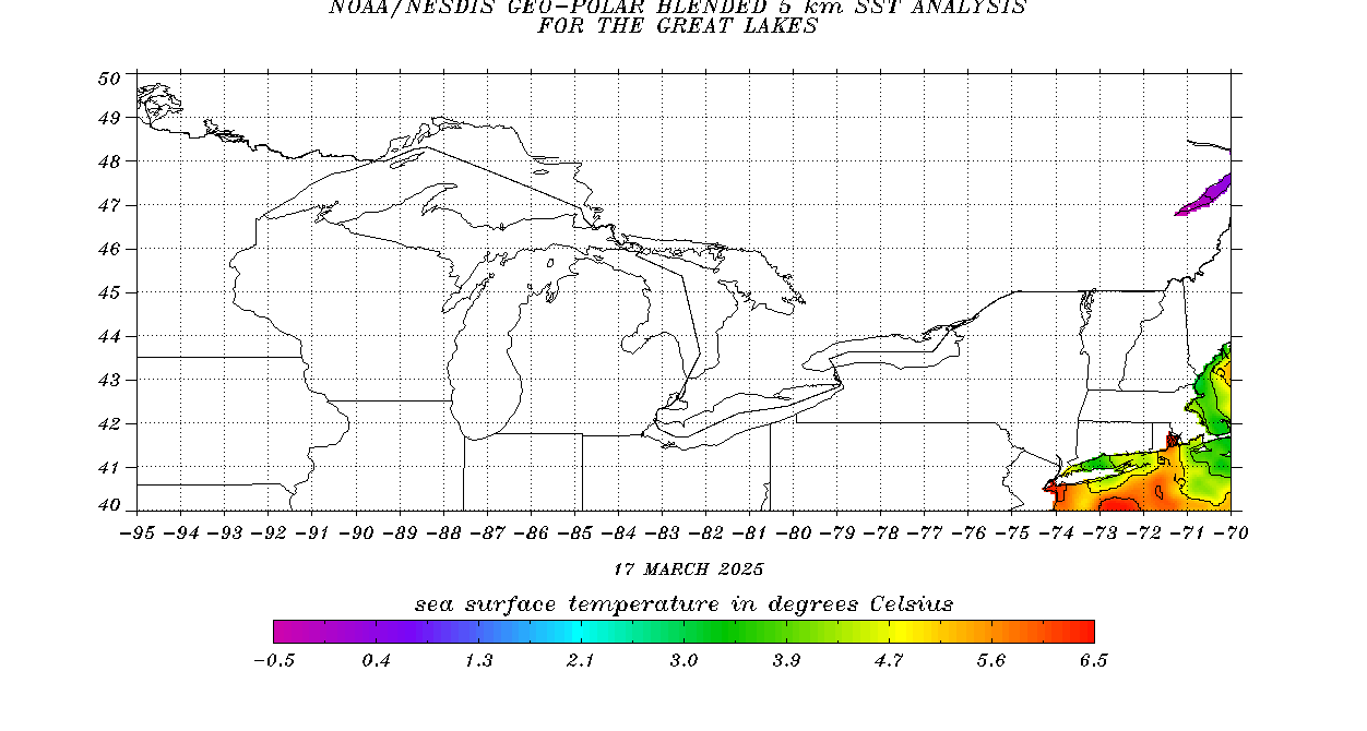
| Sea Surface Temperature |
|
|
| Educational/ Other Links |
| Marine Spotter Information |
Along with the Galveston Bay and Upper Texas Coast Nearshore forecasts, the Houston/Galveston National Weather Office is also responsible for the issuance of advisories and warnings for the thousands of mariners in this vicinity. By last count, there are over 100,000 registered boats/ships/etc that cruise the waterways of the upper Texas coastline. Here is some more information on becoming a marine spotter. |
| |
|
| Buoy Data |
|
|
| Port Meteorological Office |
|
|


 Follow us on YouTube