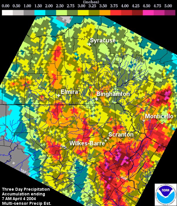
The graphics shown below is the Multisensor Precipitation Estimates, otherwise known as MPE data. The data used to produce this graphic is a combination of radar and precipitation gages. The image below is a three day total ending on April 4th, 2005 at 7 AM EDT.
When using MPE data, it is important to remember it is vulnerable to the same inaccuracies that can be caused by either radar or precipitation gages. For radar, problems would be: freezing or frozen precipitation, low topped convection, bright banding, the reflectivity/rainfall relationship in use, calibration of the radar, radar location and elevation, range degradation, and the radar's effective coverage. For precipitation gages, problems come from freezing precipitation, windy conditions, gage siting, undermeasurement by tipping bucket gages in high intensity rainfall, and gage maintenance.
The following are unofficial observations taken during the past 36 hours ending at 8 am April 4th, 2005 for the storm that has been affecting our region. Appreciation is extended to Highway Departments, Cooperative Observers, Skywarn spotters and Media for these reports.
********************STORM TOTAL RAINFALL********************

LOCATION          STORM TOTAL    TIME/DATE    COMMENTS
                     RAINFALL       OF
                     (INCHES)   MEASUREMENT


NEW YORK

...BROOME COUNTY...
   STILSON POND          2.58   819 AM   4/3
   KATTELVILLE           2.18   600 AM   4/3
   MAINE                 2.18   920 AM   4/4   NWS BINGHAMTON
   SANFRD/WINDSR         2.14   712 AM   4/3
   VESTAL                2.00  1135 AM   4/3
   BINGHAMTON_S          1.62  1008 PM   4/2

...CAYUGA COUNTY...
   CAYUGA                1.81   630 AM   4/3

...CHEMUNG COUNTY...
   BIG_FLATS             2.57   900 AM   4/4
   ELMIRA                2.48   929 AM   4/4   AIRPORT
   ELMIRA                2.42   812 AM   4/4
   ELMIRA                2.32   700 AM   4/3
   SOUTHPORT             2.05   640 AM   4/3
   ERIN                  1.88   850 AM   4/3
   ELMIRA                1.45   100 AM   4/3

...CHENANGO COUNTY...
   S_NEW_BERLIN          2.37  1130 AM   4/3
   GUILFORD              2.18   850 AM   4/3

...CORTLAND COUNTY...
   WILLET                2.42   110 AM   4/3

...DELAWARE COUNTY...
   DELHI                 2.70  1057 PM   4/3
   HAMDEN                2.70   820 PM   4/3
   LORDVILLE             2.40  1135 AM   4/3
   DAVENPORT             2.25   900 AM   4/3
   WEST DAVENPORT        2.25   855 AM   4/3
   MASONVILLE            2.12   812 AM   4/3
   ROXBURY               2.09   750 AM   4/4
   MARGARETVILLE         2.01   523 AM   4/4
   MERIDALE              1.75   700 AM   4/3

...MADISON COUNTY...
   CAZENOVIA             2.20   900 AM   4/3
   CAZENOVIA             1.95   741 AM   4/3
   CAZENOVIA             1.92  1130 AM   4/3
   HAMILTON              1.65   915 AM   4/3
   CAZENOVIA             1.16   920 AM   4/3
   CHITTENANGO           1.14   737 AM   4/3
   MUNNSVILLE            1.10   616 AM   4/3

...ONEIDA COUNTY...
   UTICA                 2.06   930 AM   4/4   AIRPORT
   FORESTPORT            1.65   900 AM   4/3
   POINT_ROCK            1.30   743 AM   4/3
   HOLLAND_PATENT        1.03   900 AM   4/3

...ONONDAGA COUNTY...
   SYRACUSE_WSO_AP       2.23   929 AM   4/4
   TULLY                 2.20   700 AM   4/3
   CICERO                2.32
   VAN_BUREN             1.90   100 AM   4/3
   MANLIUS               1.75   900 AM   4/3
   MANLIUS               1.75   900 PM   4/3
   CAMILLUS              2.71

...OTSEGO COUNTY...
   BUTTERNUTS            2.50  1100 AM   4/3
   SCHENEVUS             1.87   930 AM   4/3
   MIDDLEFIELD           1.78  1215 PM   4/3
   GILBERTVILLE          1.77   900 AM   4/3
   LAURENS               1.76   745 AM   4/3
   EDMESTON              1.60   900 AM   4/3
   HARTWICK              1.50   900 AM   4/3
   WORCESTER             1.00   704 AM   4/4

...SENECA COUNTY...
   ROMULUS               2.81  1000 AM   4/3

...STEUBEN COUNTY...
   CAMPBELL              3.33   500 AM   4/3
   CATON                 2.35   900 AM   4/3
   HORNELL               2.31   800 AM   4/3
   BIG_FLATS             2.12   800 AM   4/3
   AVOCA                 2.00   925 AM   4/3
   CORNING               1.86   100 AM   4/3
   URBANA                1.60   701 AM   4/3
   CANISTEO              1.35   220 PM   4/3

...SULLIVAN COUNTY...
   NORTH_BRANCH          3.74  1100 AM   4/3
   LIBERTY               3.69   700 AM   4/3
   LONG_EDDY             3.65   645 AM   4/3
   MONTICELLO            3.45   935 AM   4/4   AIRPORT

...TIOGA COUNTY...
   LOCKWOOD              2.54   630 PM   4/3
   OWEGO                 2.40   617 AM   4/3
   APALACHIN             1.96   801 AM   4/3
   APALACHIN             1.85  1027 AM   4/3
   SOUTH_OWEGO           1.02   923 AM   4/3

...TOMPKINS COUNTY...
   ITHACA                2.77   932 AM   4/4   GAME FARM ROAD
   CAROLINE_CENTER       2.50   900 AM   4/3

...YATES COUNTY...
   PENN YAN              3.08   930 AM   4/4   AIRPORT
   STARKEY               2.25   850 AM   4/3

PENNSYLVANIA

...BRADFORD COUNTY...
   SYLVANIA              2.65   818 AM   4/3
   ROME                  2.51   832 AM   4/3
   WYALUSING             2.15   700 AM   4/3

...LACKAWANNA COUNTY...
   FLEETVILLE            2.96   200 PM   4/3
   FLEETVILLE            2.96   230 PM   4/3
   CLARKS_SUMMIT         2.83   745 AM   4/3

...LUZERNE COUNTY...
   NESCOPECK             4.02   830 AM   4/3
   BUTLER_TWP            3.41   831 AM   4/3
   HARVEYS_LAKE          2.10   945 AM   4/3

...PIKE COUNTY...
   GREENTOWN             4.00  1030 AM   4/3
   MATAMORAS             3.46  1031 AM   4/3
   DINGMAN               3.00  1110 AM   4/3

...SUSQUEHANNA COUNTY...
   DIMOCK_TWP            2.18   655 AM   4/3
   BRACKNEY              2.13   723 AM   4/3
   THOMPSON              2.11   645 AM   4/3
   NORTH_JACKSON         1.95   731 AM   4/3

...WAYNE COUNTY...
   MILANVILLE            3.79   919 AM   4/4
   GOULDSBORO            3.74   840 AM   4/3
   STERLING_TWP          2.73   855 AM   4/3

...WYOMING COUNTY...
   TUNKHANNOCK           3.21   840 AM   4/3

$$
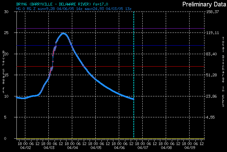
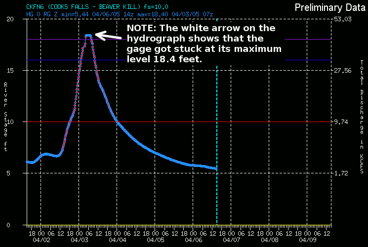
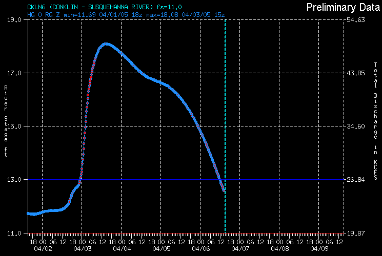
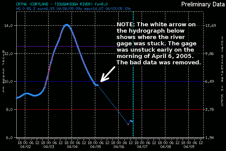
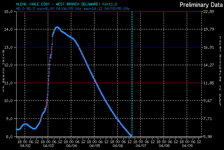
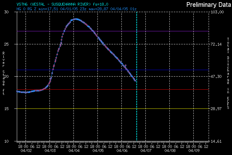
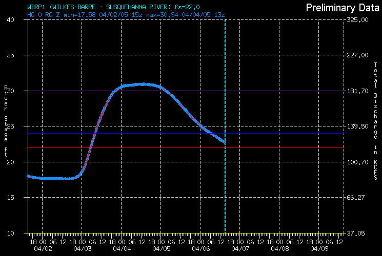
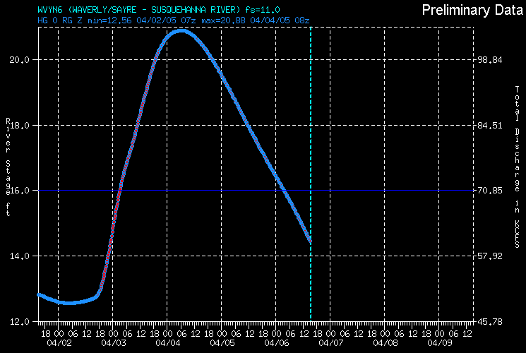
This section contains river data for some of the river gages across the NWS Binghamton county warning area. The data will include a hydrograph showing the river stage at that location before and after the flooding event. Please note the time and date of the data on each of these pages.
This is not realtime information.
The following data is preliminary. The data shown here is a snapshot of what the river stage was during the flooding event. For the latest stages, river forecasts and other information about this site, go to the National Water Prediction Center page.
What is a hydrograph? This type of graph shows how the river level changes over time at a specific location. Included with this graphic is the data used for the plot.
Addition river crest information can be found in this PDF document.
Times on the graphic are in Z time in a military or 24 hour time format. What is Z time?
|
|
|

|
|
|
|
|
|
Pictures of some of the flooding that occurred in the area.
| Click on an image to get a larger view | |||
|---|---|---|---|
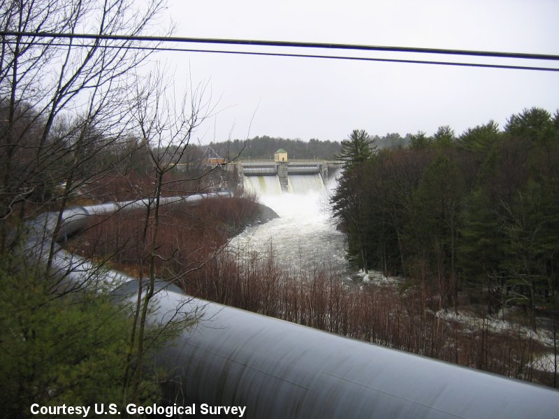 Lake Wallenpaupack project spillway - Wallenpaupack Creek. Courtesy USGS. |
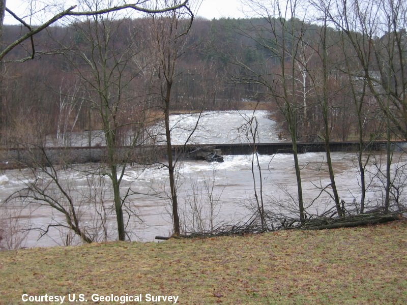 Wallenpaupack Creek - Train tracks getting eroded by water. Courtesy USGS. |
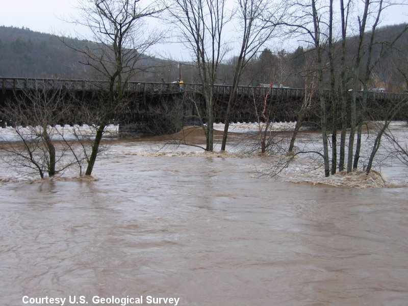 Roebling Bridge over the Delaware River at Lackawaxen, PA. Note the water piling up on one of the bridge supports. Courtesy USGS. |
 Routes 6 and 209 at the K-Mart Plaza, Matamoras, PA. Courtesy USGS. |
 Another shot of routes 6 and 209 at the K-Mart Plaza, Matamoras, PA. Courtesy USGS. |
 Port Jervis, NY as seen from Matamoras, PA. Courtesy USGS. |
 Access road to Milford Beach. Courtesy USGS. |
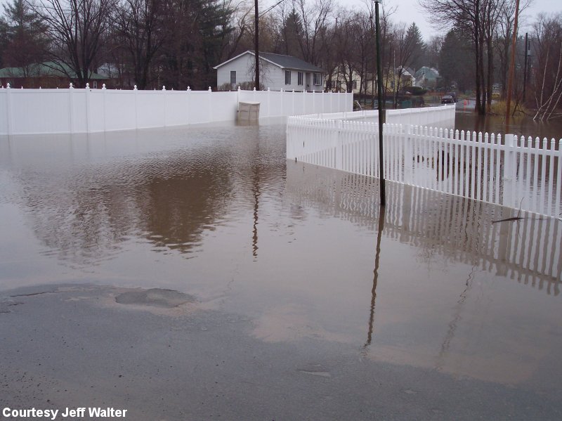 Greenview Avenue and Frasier Avenue, Monticello, NY. Courtesy Ira Walter/Jeff Walter. |
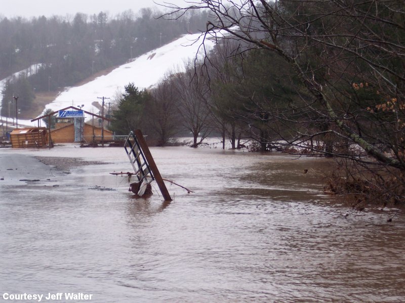 Taken on Holiday Mountain Road, Monticello, NY on 4/3/05. Holiday Mountain Ski and Fun Park, pictured here, sustained major damage. Courtesy Jeff Walter. |
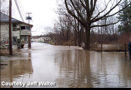 Taken on 4/3/05. Main street in Callicoon, NY. Courtesy Jeff Walter. |
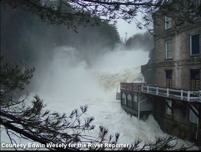 Old Mill Stream restaurant in Hawley, PA. Edwin Wesely for the River Reporter. |
|
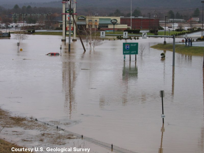
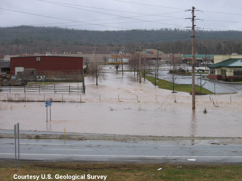
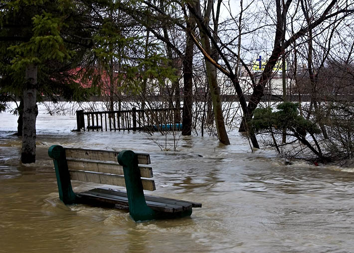
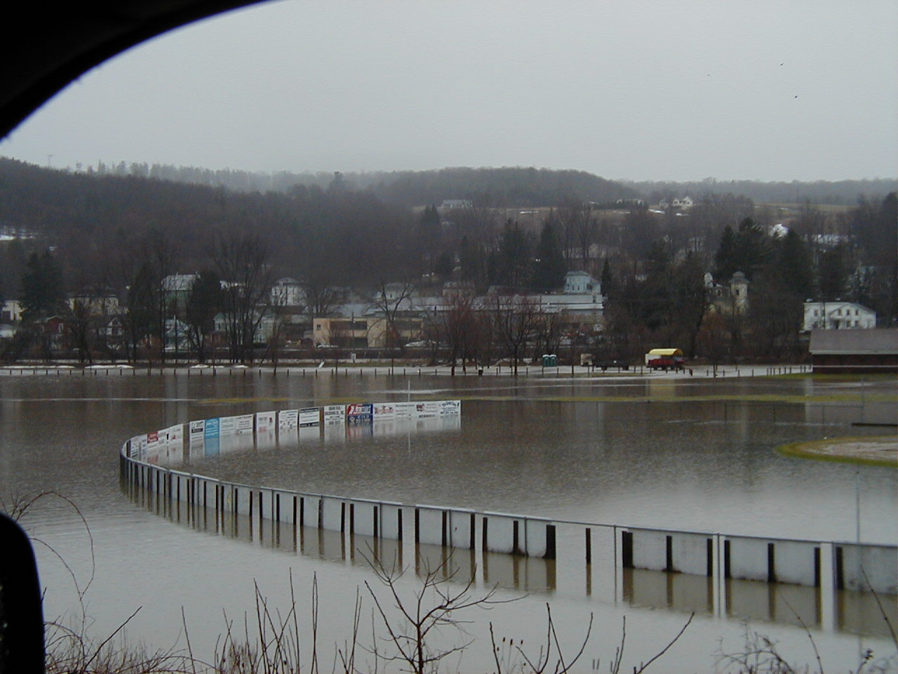
 Flooding at Gateway Park in Binghamton, NY. |
 Flooding at Hill Park Binghamton, NY. |
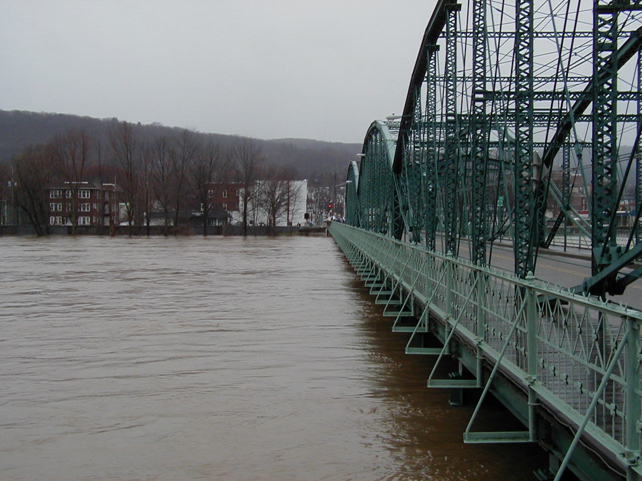
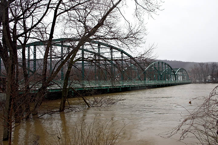 High water at the Pennsylvania Ave. Bridge Binghamton, NY. |
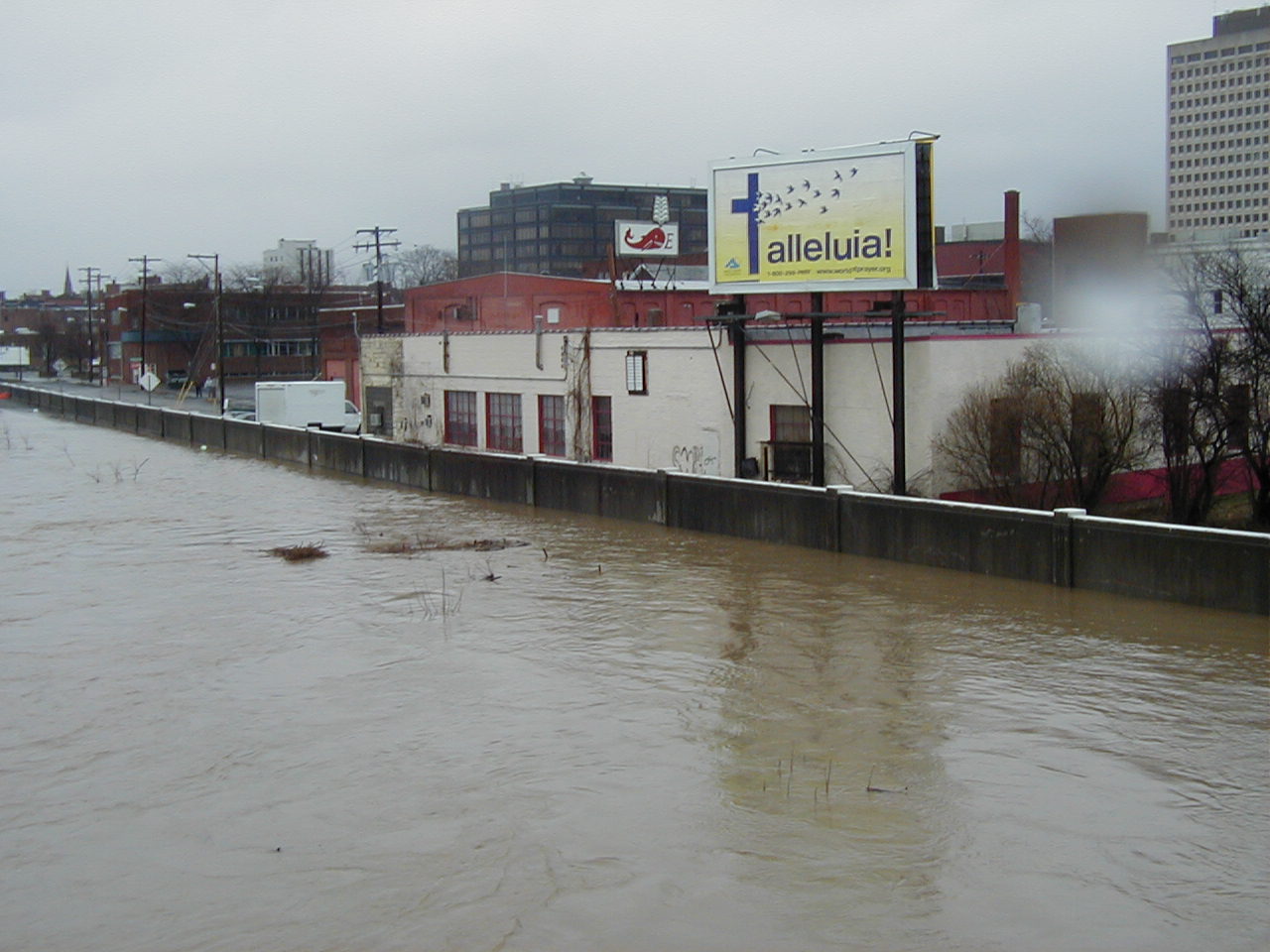
 Flooding at Riverside Drive Binghamton, NY. |
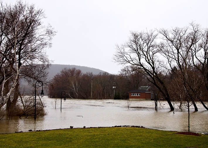
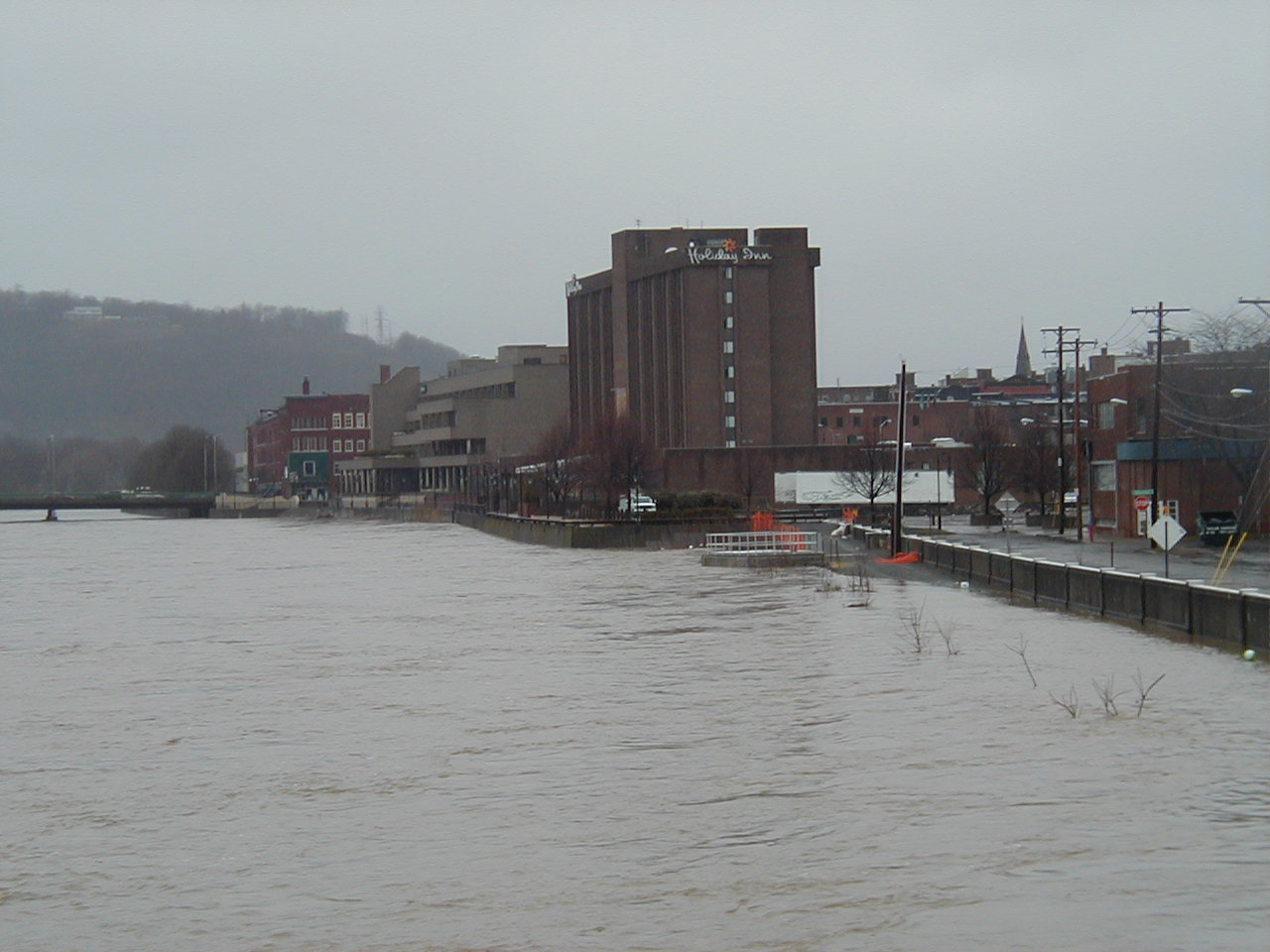
 Flooding on the Roberson Museum grounds Binghamton, NY. |
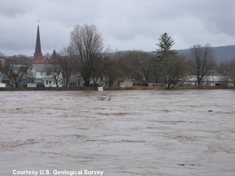
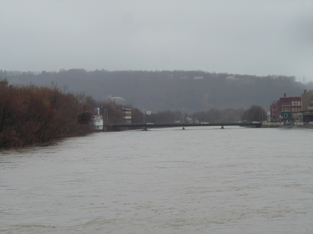
 Washington St. Bridge, Binghamton, NY |
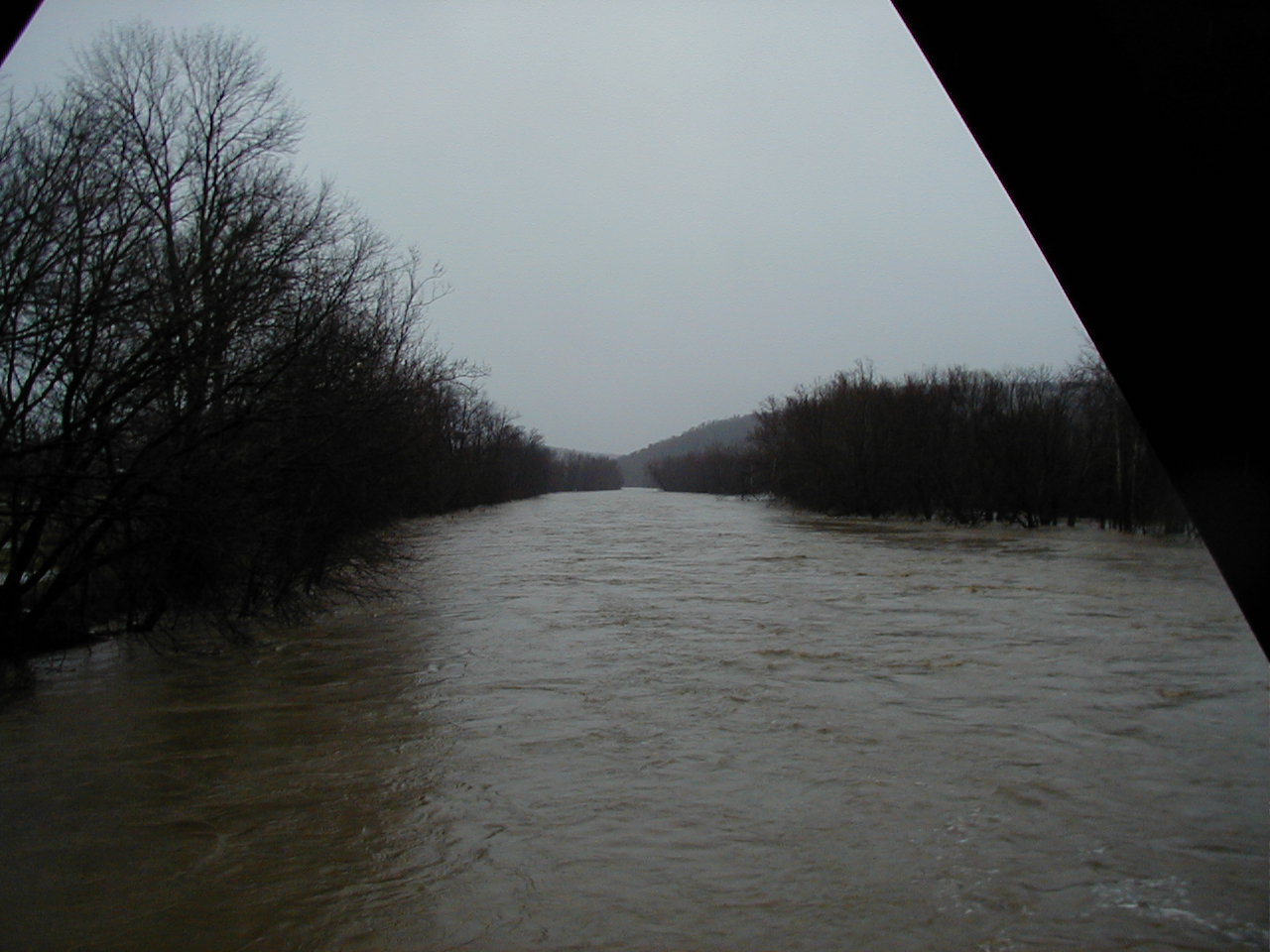
 Looking north on the Chenango River, Binghamton, NY |
 Another shot looking north on the Chenango River, Binghamton, NY |
 Chenango River looking at the Court St. Bridge, Binghamton, NY |
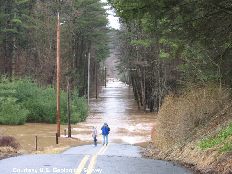
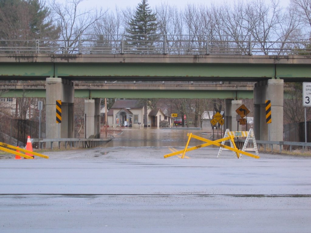
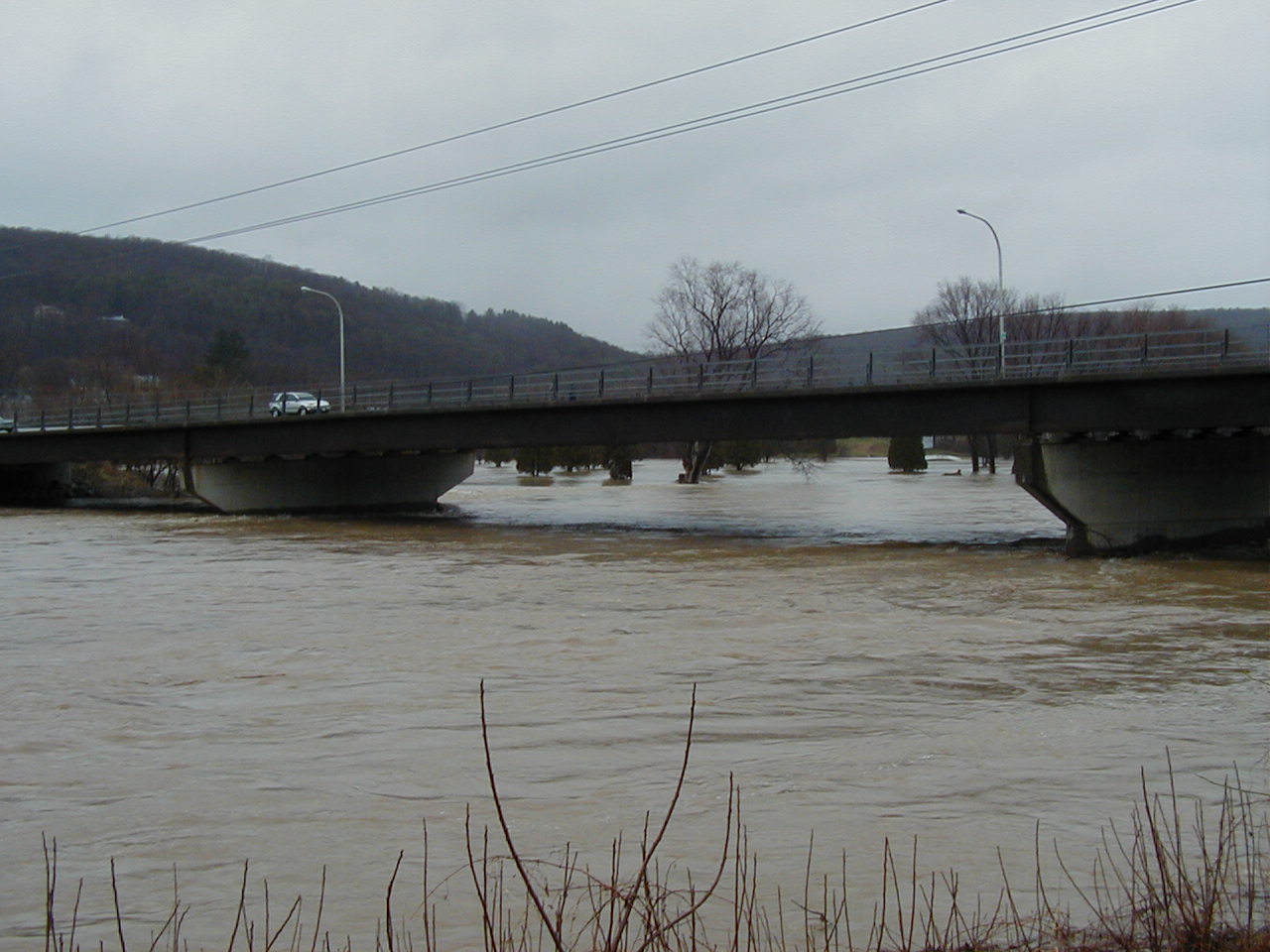 Route 12a in Chenango Bridge, NY. |
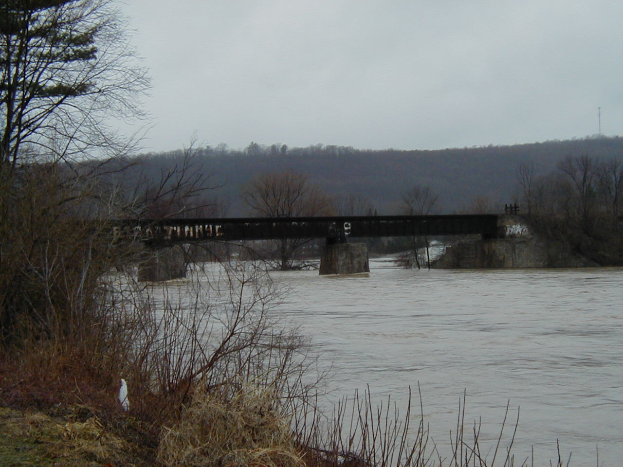 Train bridge Chenango Bridge, NY. |
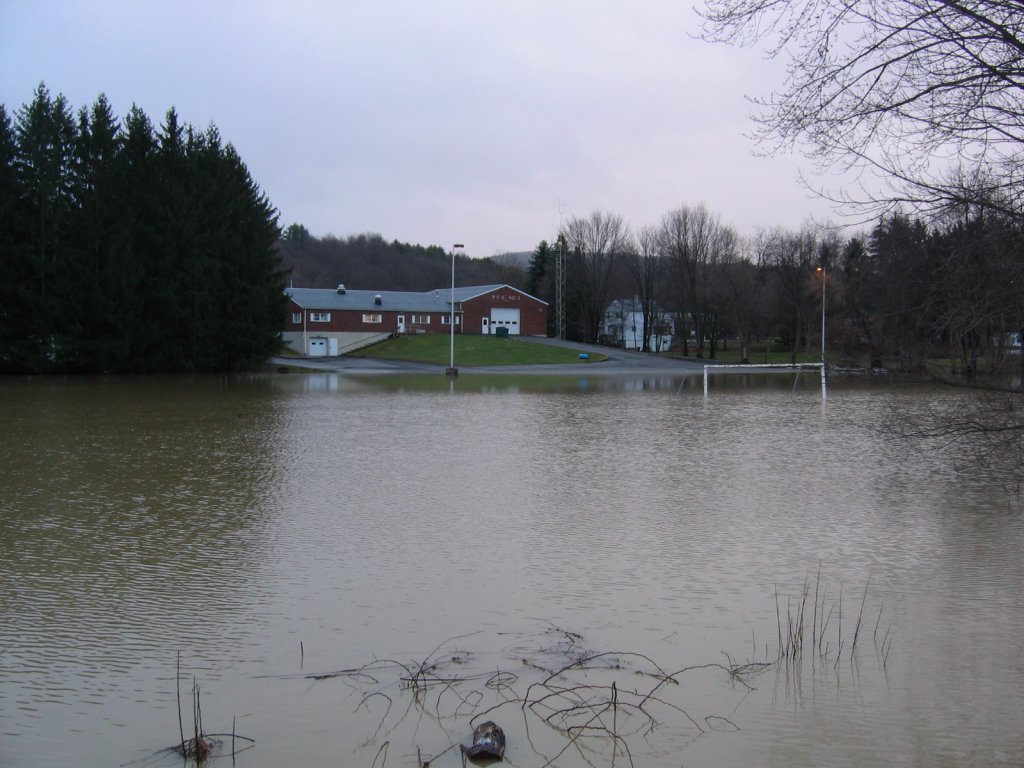
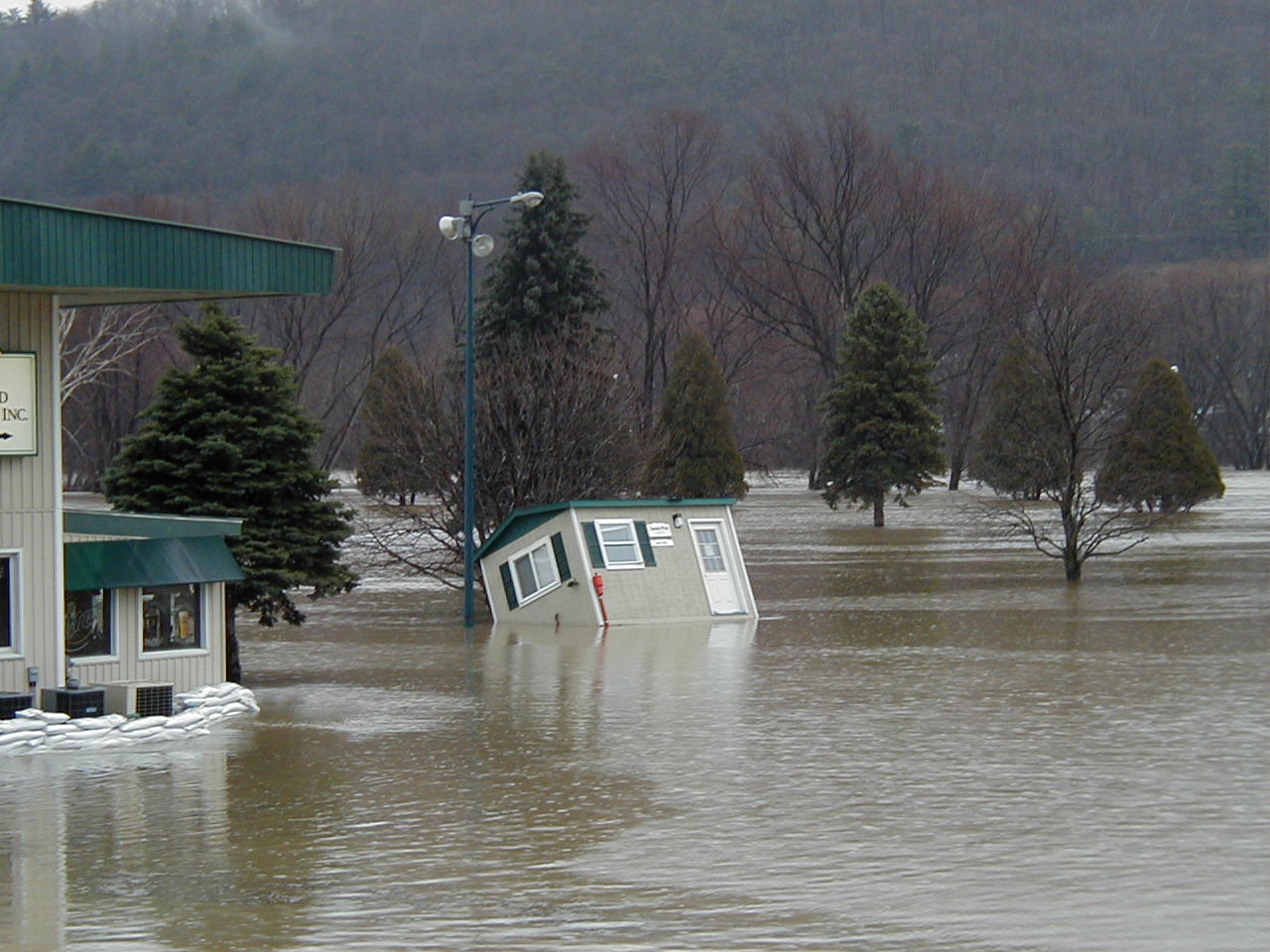 Golf course in Chenango Bridge, NY. |
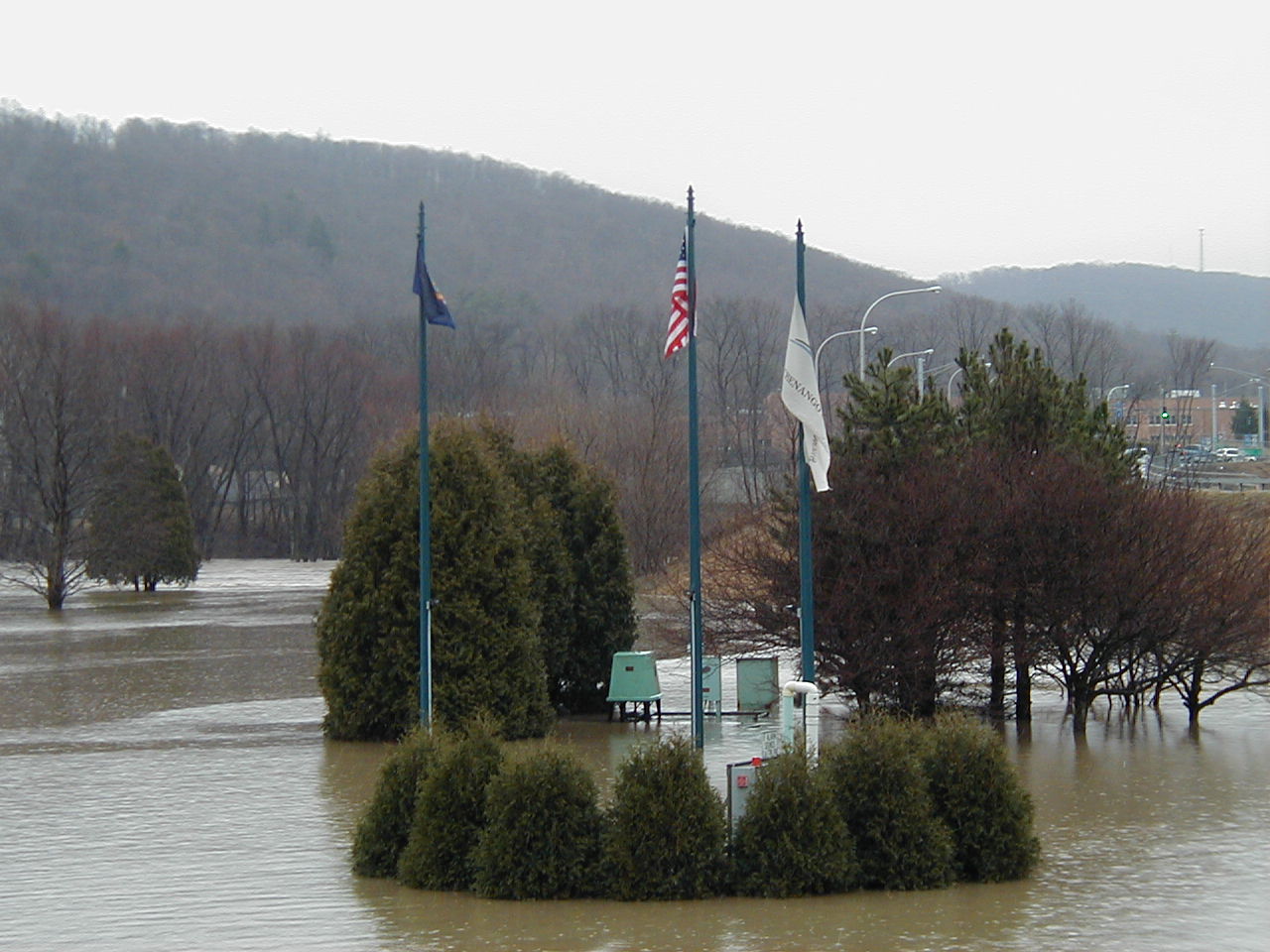 Flags at the golf course Chenango Bridge, NY. |
 Tioughnioga River near Itaska, NY. |
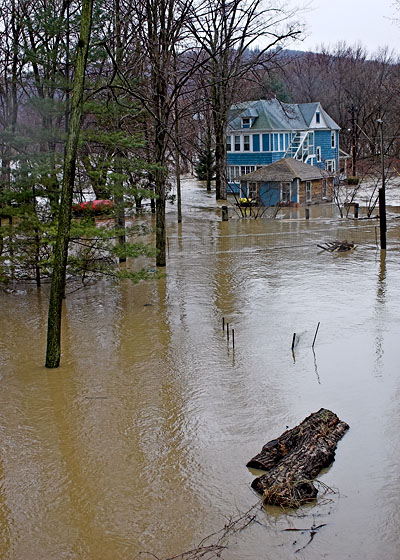
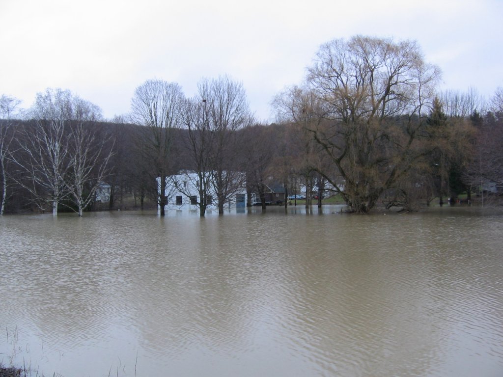
 House flooding in Marathon, NY. |
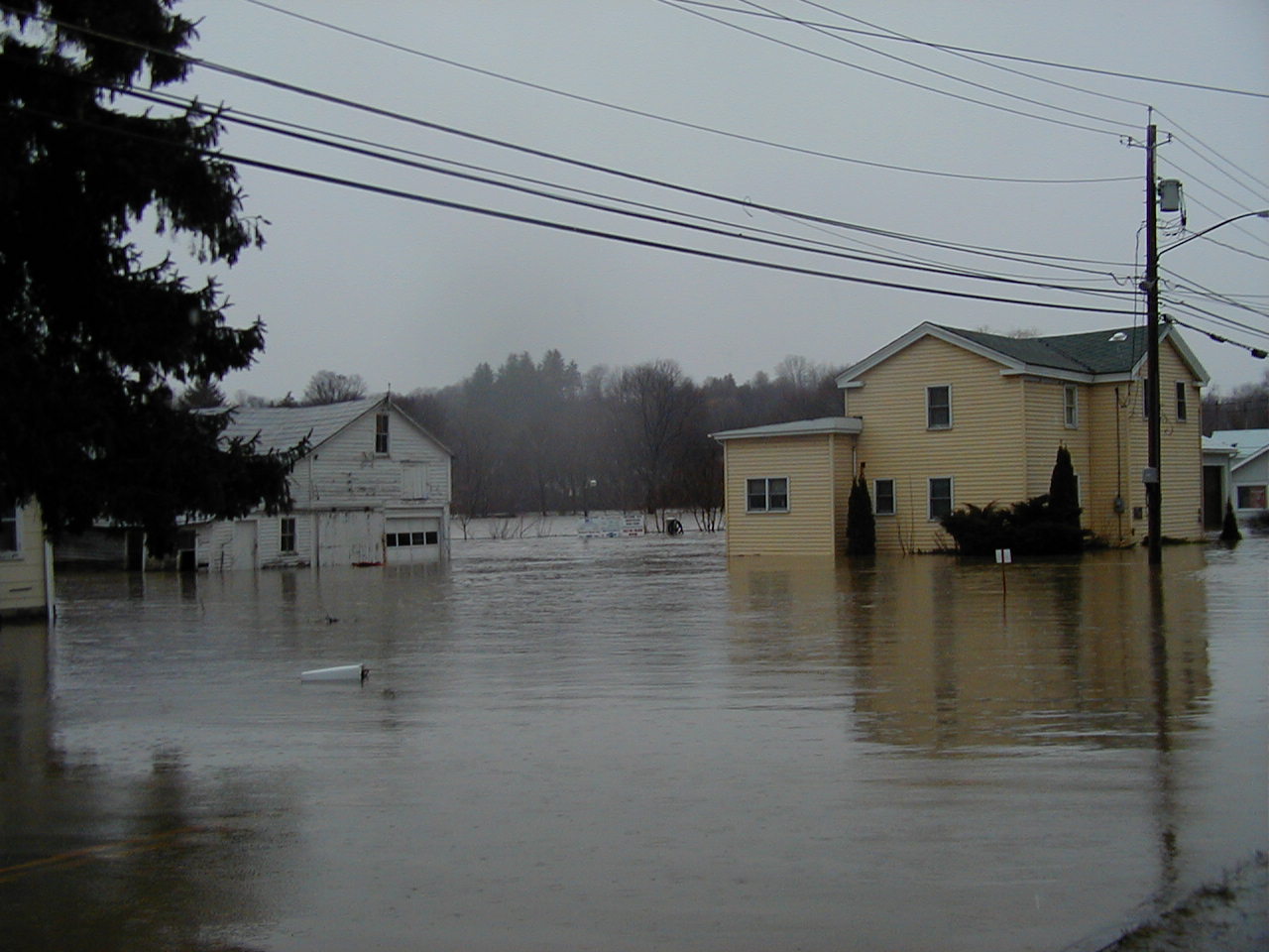 Another shot of house flooding in Marathon, NY. |
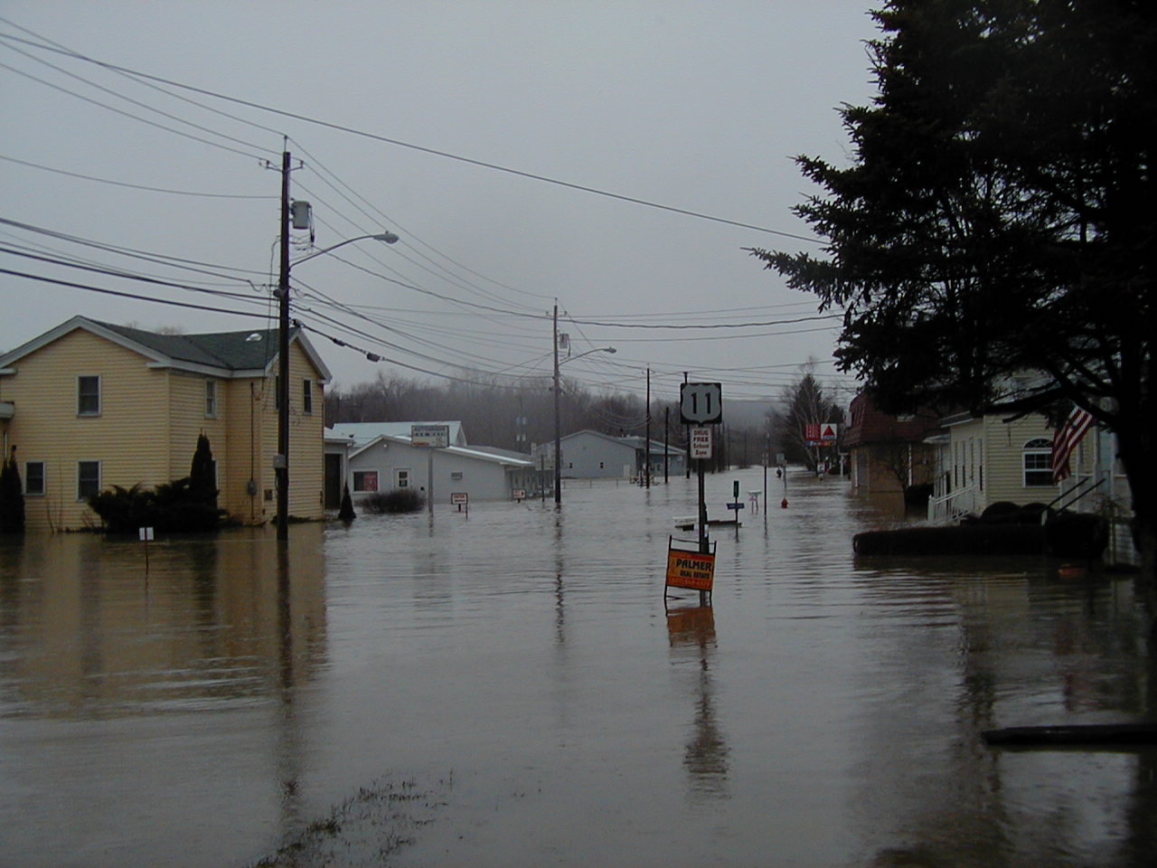
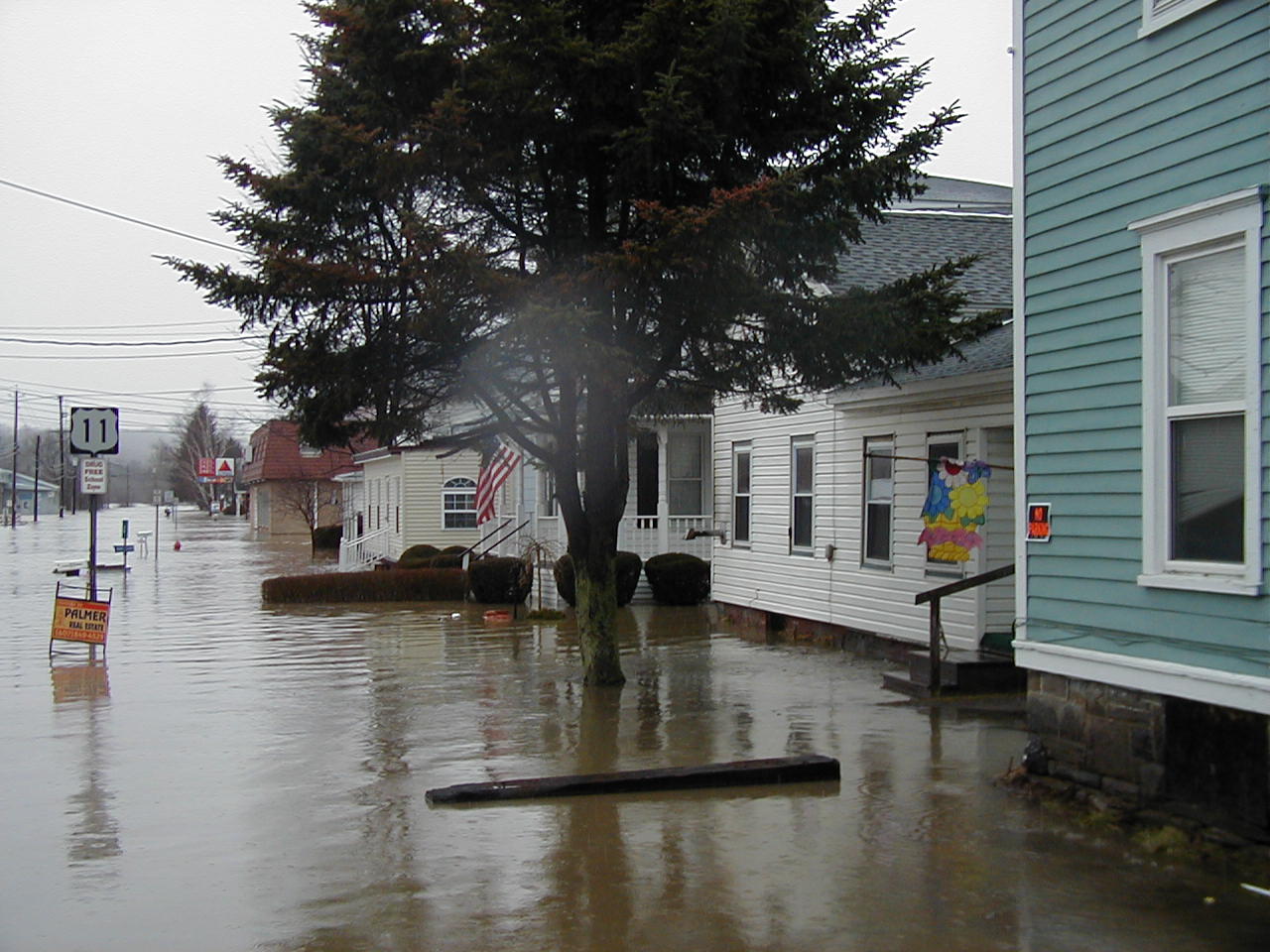 Flooding in Marathon, NY. |
 Street flooding in Marathon, NY. |
 Field flooding in Marathon, NY. |
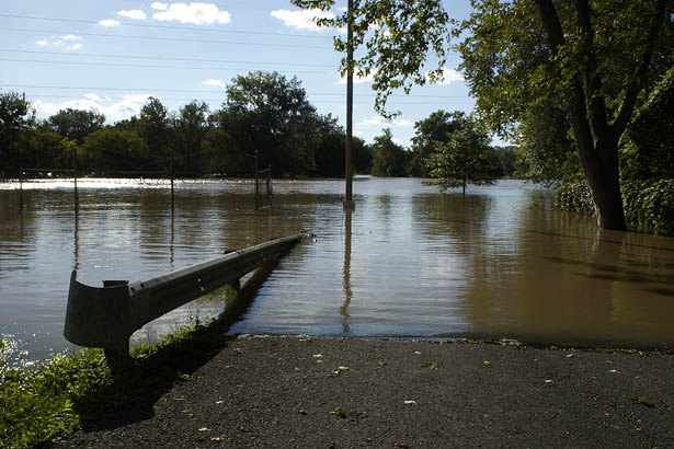
 Apalachin boat launch under water. Apalachin, NY. |
 Another shot of the Apalachin boat launch under water. Apalachin, NY. |
 Miller Beach Road looking towards the Susquehanna river. Owego, NY. |
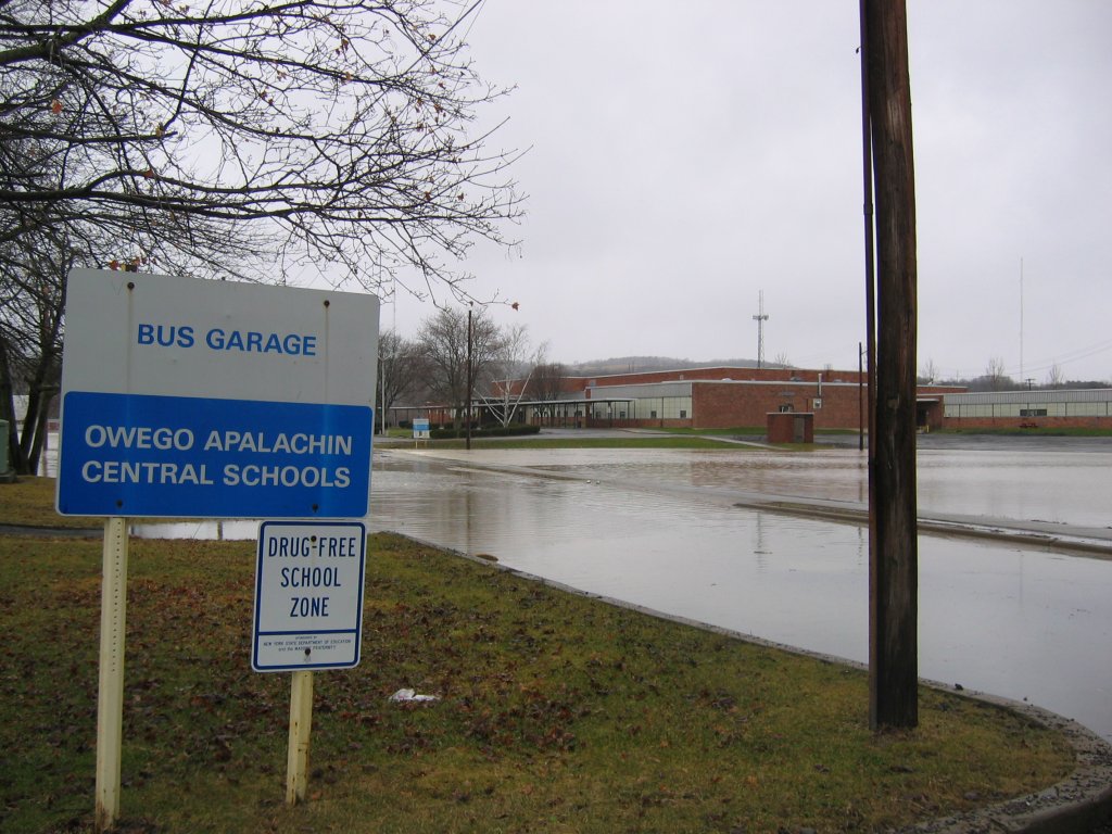 Owego/Apalachin School. Owego, NY. |
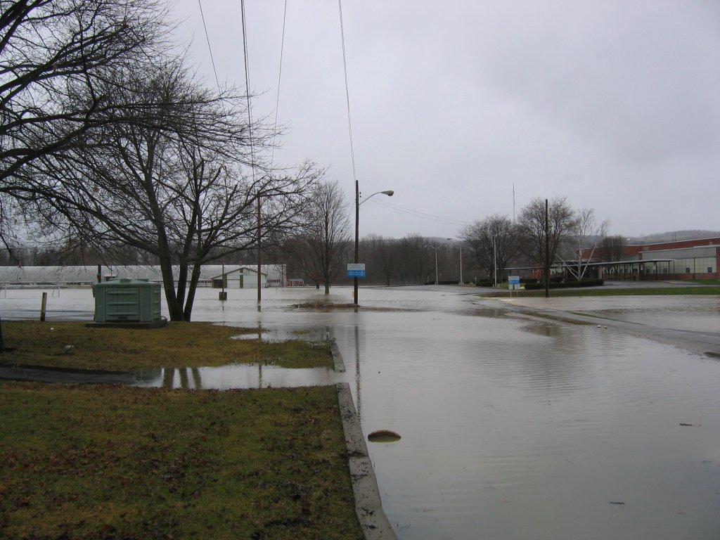 Owego/Apalachin School. Owego, NY. |
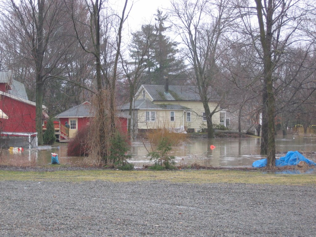 Homes flooded in Owego, NY. |
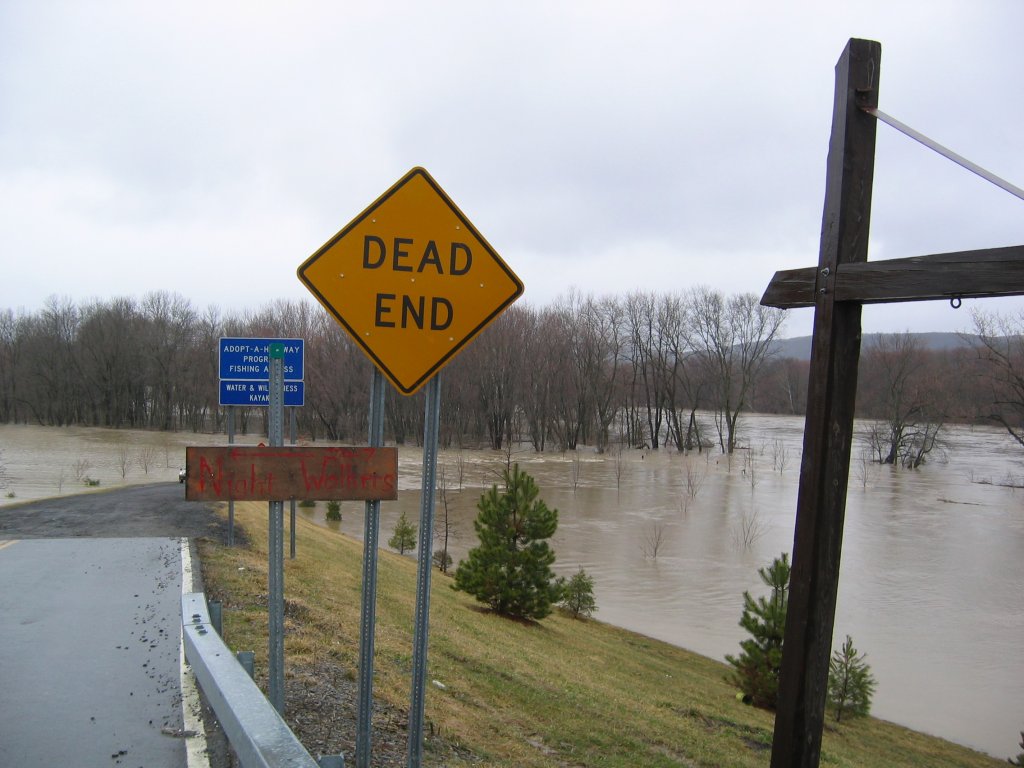
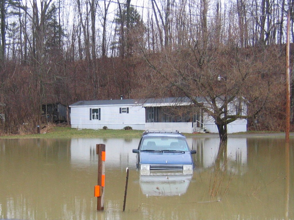 Near Tioga Center, NY. |
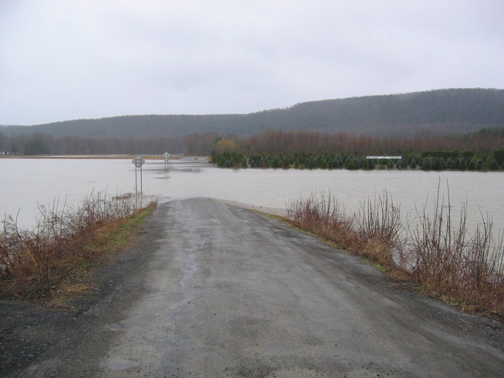
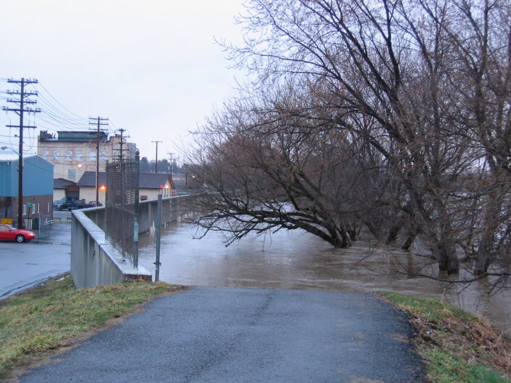 Susquehanna River near Vestal, NY. |
 Field flooding near Vestal, NY. |
 More field flooding near Vestal, NY. |
 Entrance to Castle Gardens from Rt. 434 in Vestal, NY. |
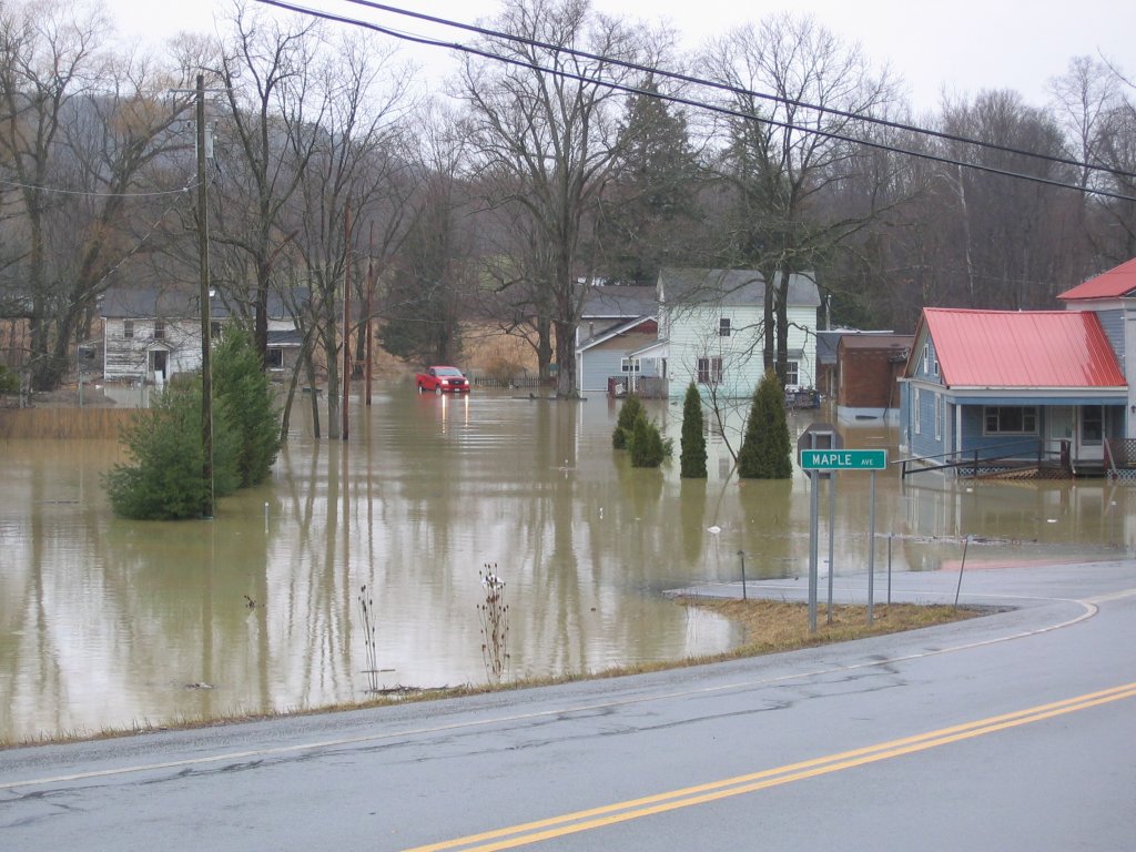 Near Maple Ave. Tioga Center, NY. |
|

