
For Moderate/High/Extreme hazard risk, more detailed information will be provided via emailed briefings to core partners.
 |
2 Day Total Snow ForecastShows forecasted snowfall accumulations for the first two days of the forecast. |
|
Probablistic Snow GuidanceProbabilistic snow forecasts. Good for discerning uncertainty. |
 |
24 Hour Total Precipitation ForecastShows forecasted precipitation for the first day of the forecast. |
|
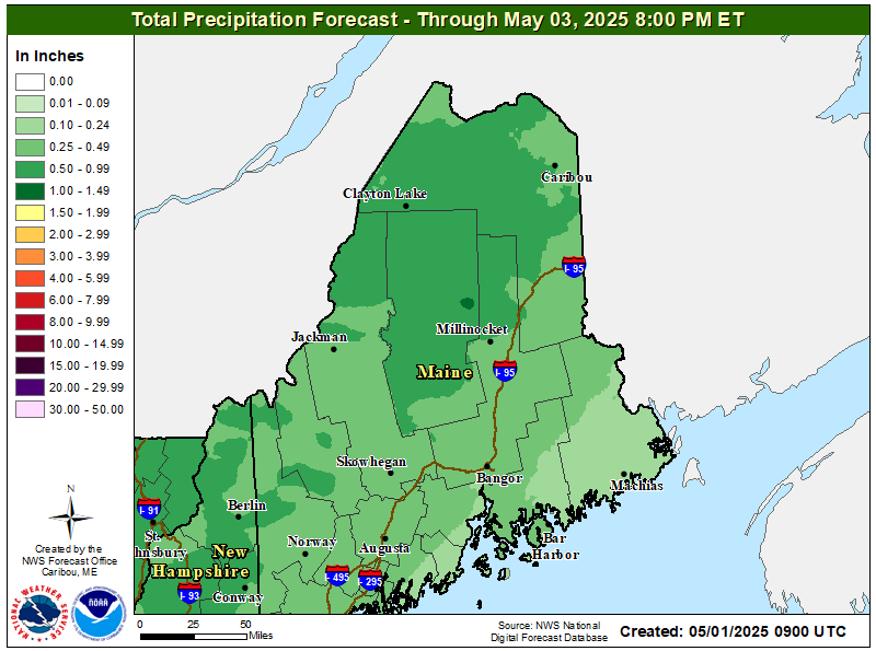
2.5 Day Total Precipitation ForecastShows forecasted precipitation for the first 2.5 days of the forecast. |
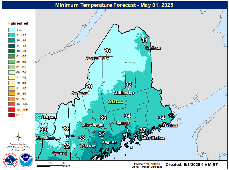 |
Minimum Temperature Day 1Shows forecasted minimum temperature for the first day of the forecast. |
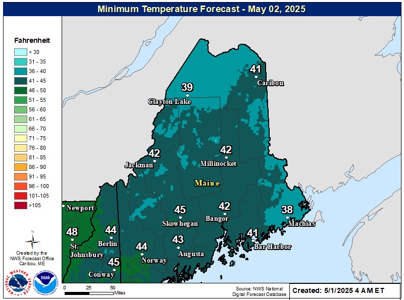 |
Minimum Temperature Day 2Shows forecasted minimum temperature for the second day of the forecast. |
|
|
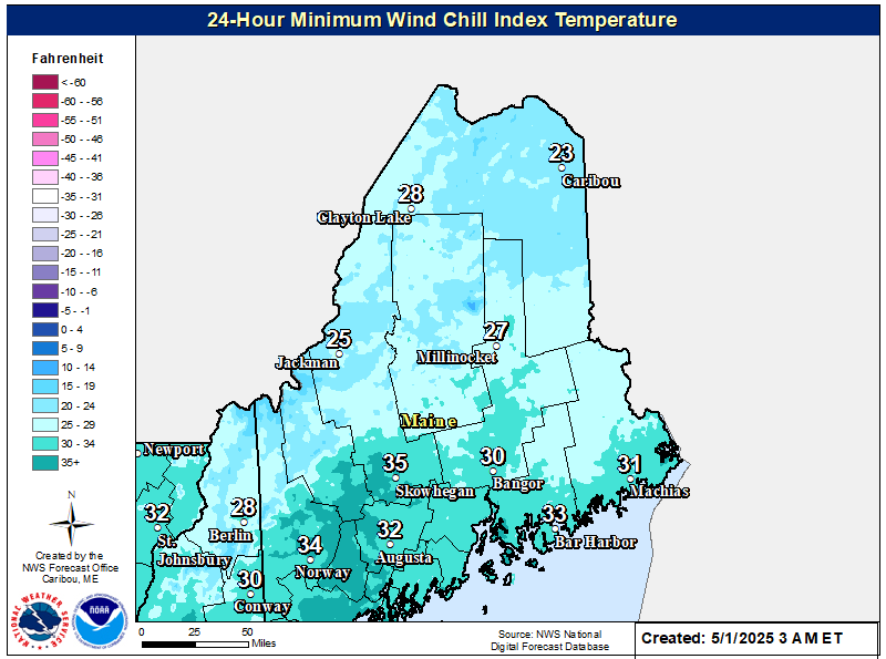
3-Day Minimum Wind Chill TemperatureShows forecasted minimum wind chill temperatures for the first three days of the forecast.
|
|
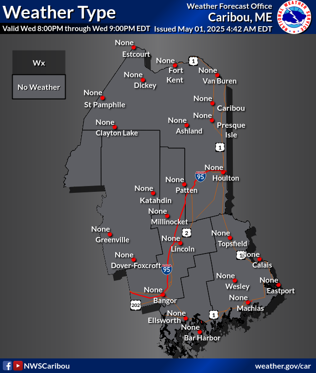
Weather Type GraphicsDisplays areas where mixed precipitation types are expected during winter weather events. |
|
|
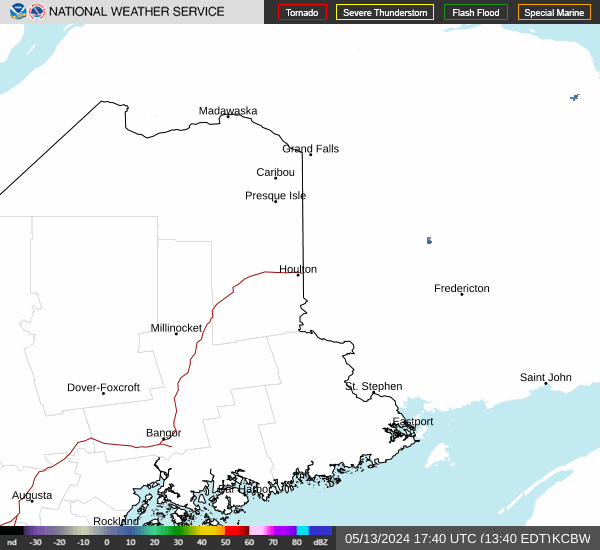
RadarWSR-88D Doppler Radar |
 |
Hourly Weather GraphShows hourly forecast information for any location in Maine. |
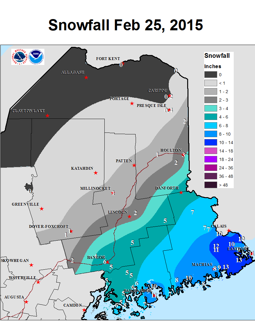 |
Latest Post-Storm Snowfall GraphicsShows snowfall from the latest snowfall events across Maine. |
|
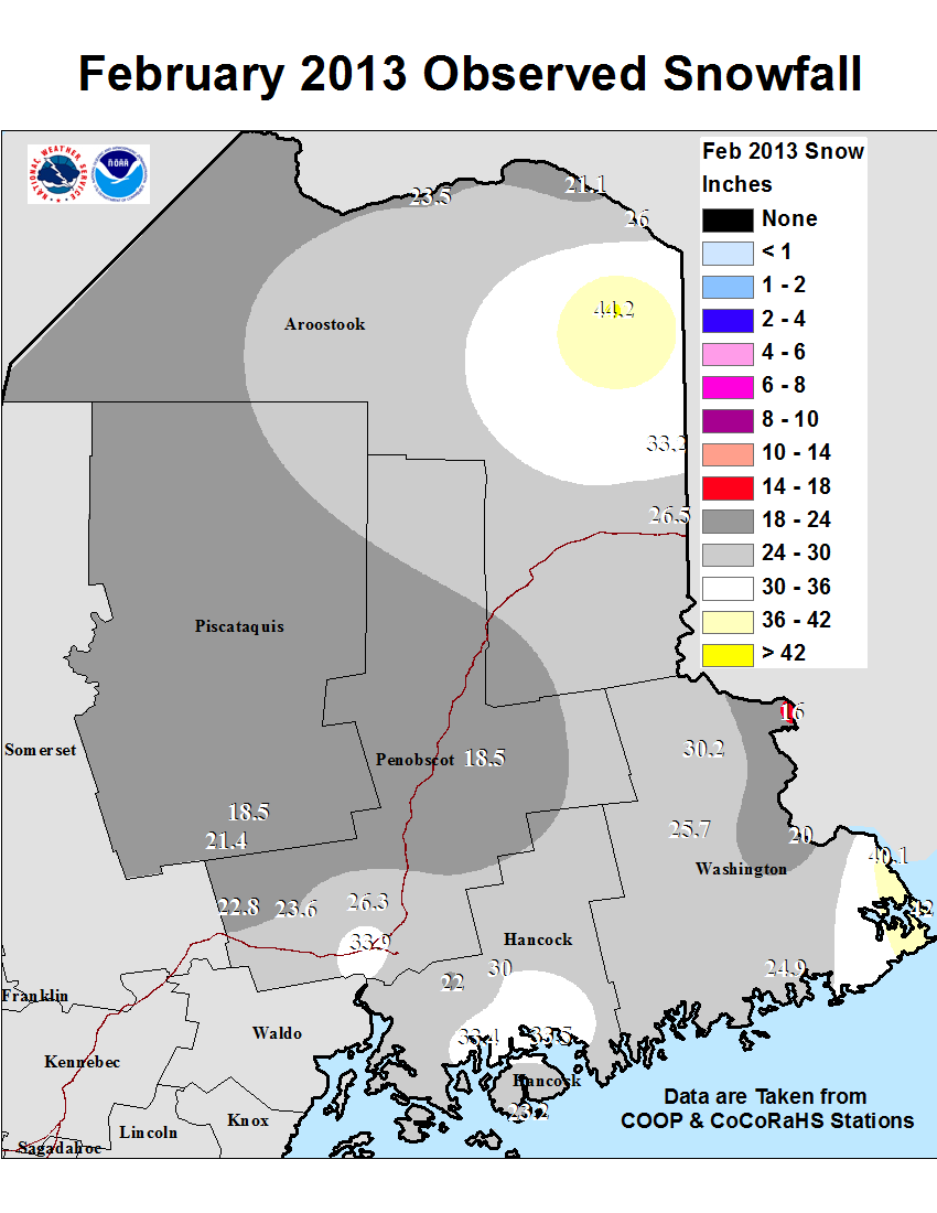
Monthly and Seasonal Snowfall MapsShows monthly and seasonal snowfall totals and departure from average.
|
|
|
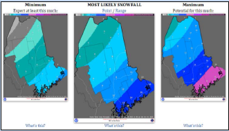
Snow Analyses
|
|
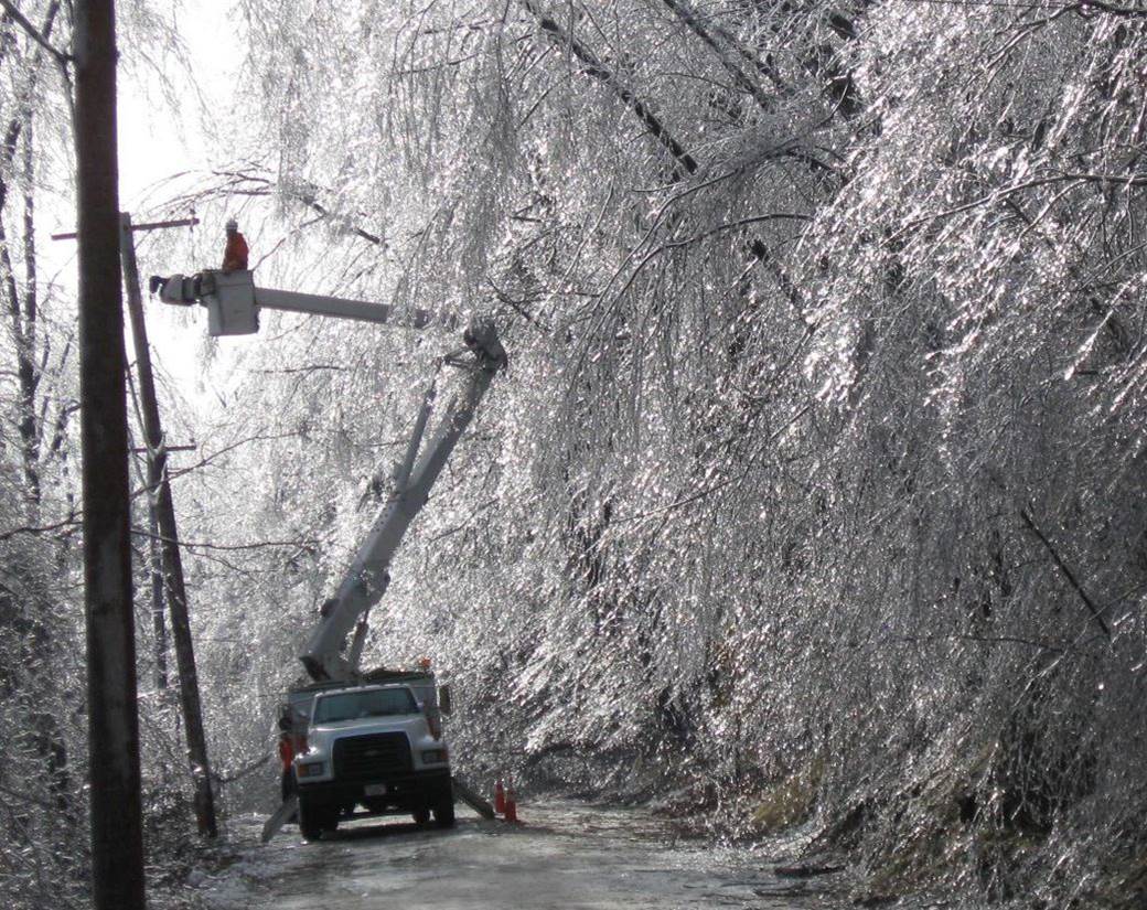
Radial/Line Ice Forecast GraphicThis graphic shows the expected radial or line ice forecast. Radial or line ice is the amount of ice that accumulates on a branch or powerline. If 1" accumulates on the top of a branch and 1/2" accumulates on the bottom, averaging the two gives 3/4" radial/line ice. This amount is the elevated flat surface ice accumulation multiplied by 0.394. NWS's traditional ice accumulation forecast is elevated flat surface, not the radial/line ice you see here. For more info, click here. |


 Coastal Flood