Increasing chances for showers/storms late Saturday into early Sunday as a cold front pushes into the area. A few storms may become strong to severe and be capable of producing locally heavy rainfall. Cooler temperatures prevail going into early next week, but rain chances continue on Monday as a coastal weather system develops and sweeps past the area.


 Local Radar
 Weather Map
 TX Satellite Imagery
 Monthly Hydrologic Reports
 Hurricane Preparedness
 CONUS Satellite Imagery
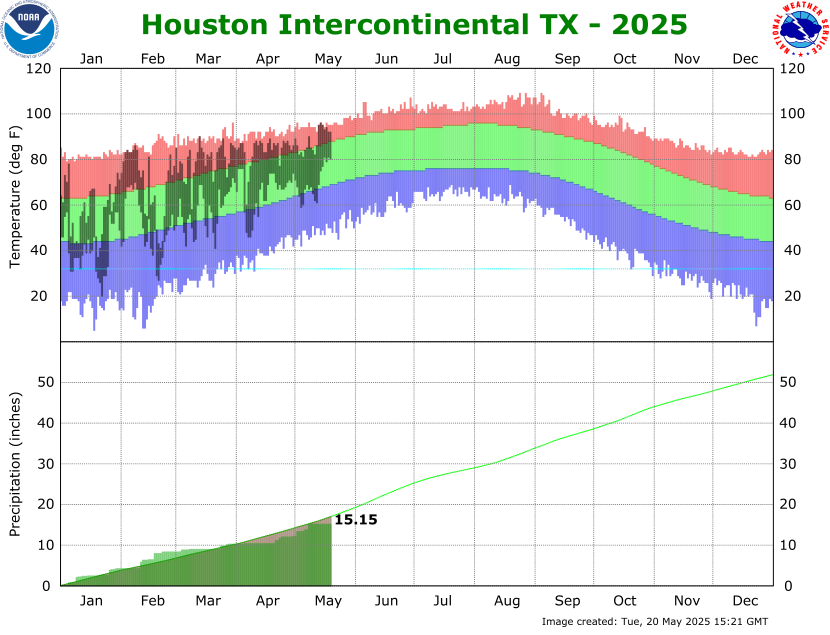 Climate Graphs
 Climate Summaries