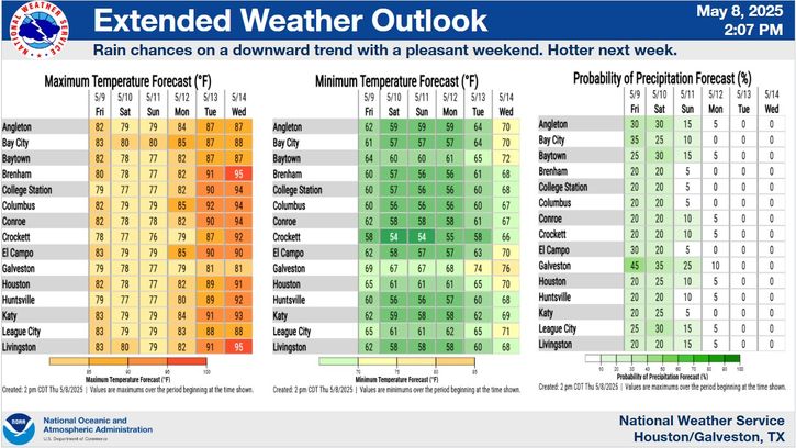
Heat continues into the weekend with highs generally in the 90s and heat indices over 100 degrees. Rain chances increase next week. Temperatures next week expected to be less hot., with highs mostly in the upper 80s after Monday.
There is a Slight Risk (Level 2 of 5) of severe thunderstorms across our northern county warning area on Memorial Day. Hail and damaging wind gusts are the primary concerns. Tornado is possible.


 Local Radar
 Weather Map
 TX Satellite Imagery
 Monthly Hydrologic Reports
 Hurricane Preparedness
 CONUS Satellite Imagery
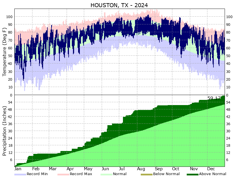 Climate Graphs
 Climate Summaries