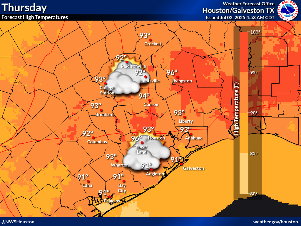
Temperatures will be warming through the end of the week, with high temperatures reaching the mid to upper 90s by the end of the week. There will also be lower rain chances on Thursday, but we still could see an isolated shower or thunderstorm in the afternoon, specially across our southwestern counties.


 Local Radar
 Weather Map
 TX Satellite Imagery
 Monthly Hydrologic Reports
 Hurricane Preparedness
 CONUS Satellite Imagery
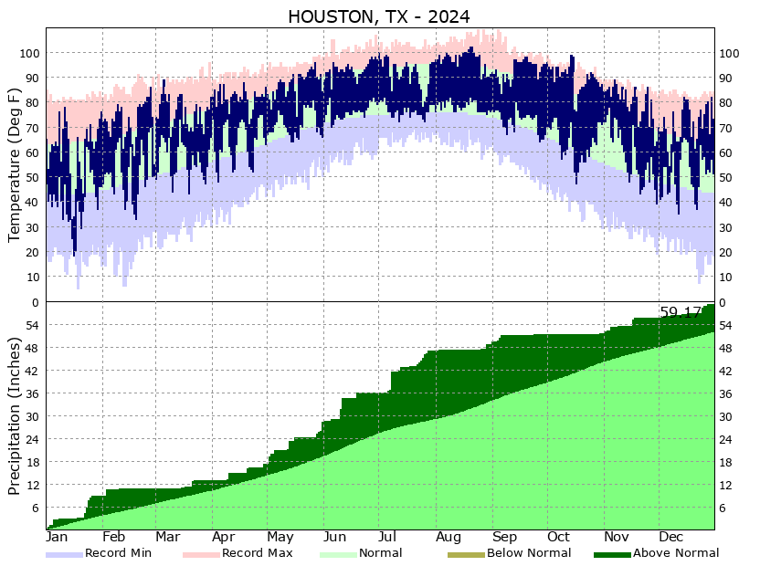 Climate Graphs
 Climate Summaries