Historical Rainfall Event for the Cape Fear Region
Overview | Surface Analysis | Water Vapor Imagery | Radar Imagery | Rainfall Totals Map | Event Summaries
MONDAY | TUESDAY | WEDNESDAY | THURSDAY
Wednesday, September 29th
| By Wednesday the 29th, heavy rain had moved back into the Eastern Carolinas as the anomalously deep upper trough allowed the upper low to sink further SE over AL, taking up residence in basically the same place as the original upper low. This brought the main moisture conveyor back across the coast and redeveloped significant rainfall over areas that had already seen up to a foot of rain since Sunday. In addition...Tropical Storm Nicole had become a named storm in the Caribbean...and she would soon send her moisture into the Carolinas as well. | |
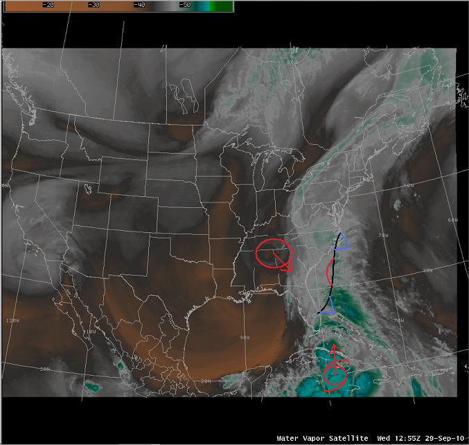 Water Vapor Imagery at 12z Wednesday Water Vapor Imagery at 12z Wednesday |
|
| The stationary boundary was pulled further west which refocused the axis of heavier rain across Brunswick, New Hanover, and Pender Counties. An area of low pressure developed along the SC coast which would ride along the surface boundary and enhance moisture even further. The placement of this boundary along the coast was nearly ideal, since a strengthening Low Level jet (LLJ) overrunning the boundary increased tropical moisture advection and isentropic lift, creating even heavier rainfall rates. | |
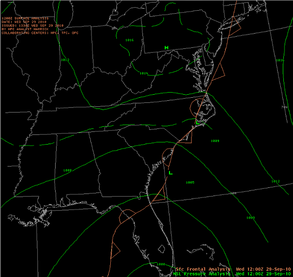 Surface Analysis at 12z Wednesday |
|
| By the afternoon of the 29th...very heavy rain was falling across most of the Cape Fear Region and many FFW's were in effect across Coastal NC. Roads were flooding and even washing out across the area as already saturated ground could not handle the additional heavy rain. If things did not seem bad enough, the upper trough began to take on a negative tilt which enhanced upper diffluence and further increased rain rates. Just after 7pm on the 29th...NESDIS issued an ominous SPENES Message outlining the even heavier rain expected to move into the area. Heavy rain continued through the night as the remnants of TS Nicole got caught up into the moisture fetch.
|
|
| Another widespread 6 to 10 inches of rain fell across Brunswick, New Hanover, and Pender counties on the 29th. This meant that more rain had fallen at Wilmington than during the benchmark flood event: Hurricane Floyd in 1999. The Wilmington WFO sent this Public Information Statement explaining the records that had been set...with more rain still expected on Thursday. |


 Coastal Flood