Historical Rainfall Event for the Cape Fear Region
Overview | Surface Analysis | Water Vapor Imagery | Radar Imagery | Rainfall Totals Map | Event Summaries
MONDAY | TUESDAY | WEDNESDAY | THURSDAY
Thursday, September 30th
| Thursday morning started fairly benign with only light rain showers falling over the hard-hit areas of the Cape Fear Coast. The warm front had moved well North of the region, and the stationary boundary had been pushed offshore by the passage of another wave of low pressure. However, as the upper low made one final SE push, the stationary boundary, and hence moisture conveyor, was pulled back westward one last time...focusing once again over the area. | |
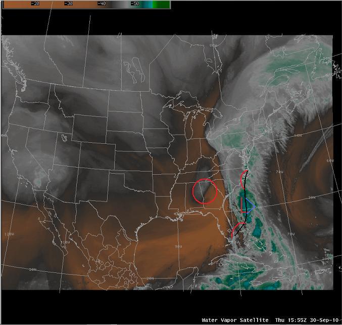 Water Vapor Imagery at 15z Thursday Water Vapor Imagery at 15z Thursday |
|
| At the same time, a final wave of low pressure developed below the remnants of TS Nicole and moved into Eastern NC. This allowed heavy rainfall to redevelop over areas that could not handle any more rain, and subsequently trigged more FFW's issued by WFO ILM, and resulted in even more flooded or washed out roadways.
|
|
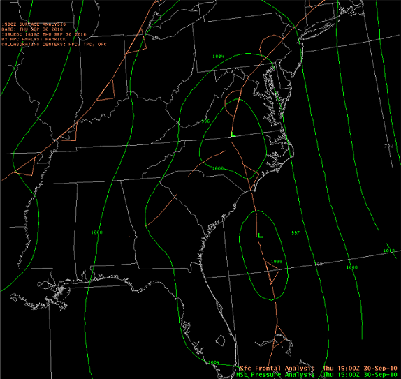 Surface Analysis at 15z Thursday |
|
| Rain finally ended by Thursday night...but the damage had been done. More than 20" of rain fell across much of New Hanover and Pender Counties, with 15" or more falling in Brunswick county. Although the NE parts of the ILM CWA were hit the hardest...all counties saw significant rainfall as evidenced by this Cumulative Rainfall Map. In addition, the ILM WFO issued two final Information Statements on the total rainfall across the area.
|
|
| Interesting Facts:
|


 Coastal Flood