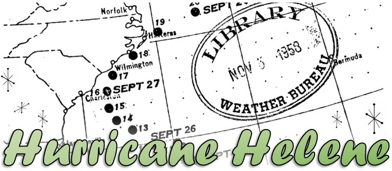
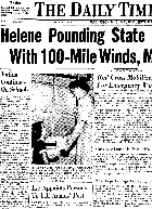
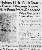
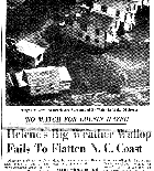
Hurricane Helene was a powerful hurricane that raked the coast of the Carolinas on September 27, 1958. Although the storm never made an official landfall, it produced exceptionally strong winds on land including a 135 mph gust at the Wilmington airport, the strongest ever measured at this location. Helene's offshore track is the only factor that spared the area from catastrophic damage rivaling or even exceeding that experienced just four years earlier during Hurricane Hazel's landfall. Due to early warnings and mandatory evacuation of coastal islands, Helene caused no direct fatalities and only one serious injury in the Carolinas.
Origin and approach
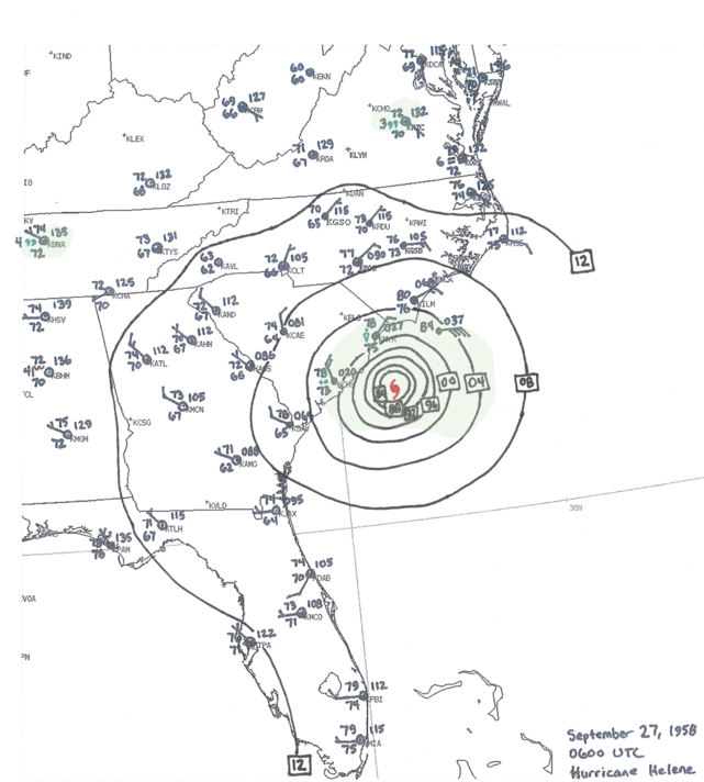
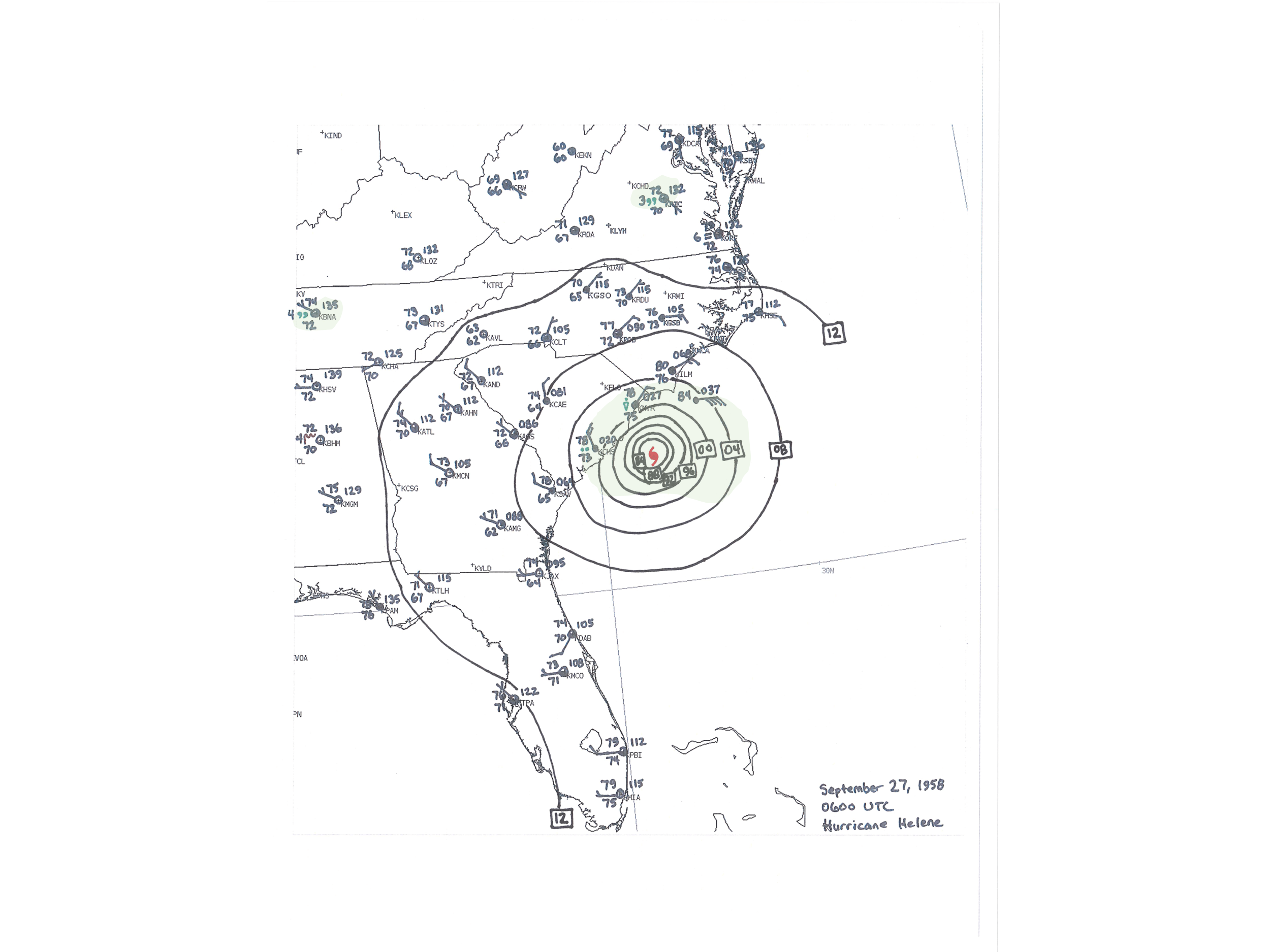
A tropical wave about 300 miles northeast of the Dominican Republic became a tropical storm named Helene on September 23, 1958. On September 24 Helene quickly strengthened into a hurricane and continued moving slowly toward the Southeast U.S. coast. Military aircraft flew almost continuous reconnaissance and research missions into the strengthening storm. At its peak intensity while over the Gulf Stream off the South Carolina coast, Helene was packing maximum sustained winds of 150 mph with a minimum pressure of 930 millibars or 27.46 inches of Mercury. Although the Saffir-Simpson scale wasn't used until the 1970s, Helene would have been categorized a strong category four storm.
Helene was still producing winds up to 140 mph when the eye passed within 20 miles of Cape Fear during the early afternoon hours of Saturday, September 27. Wind gusts of 100 mph or higher were reported along the beaches from Little River, SC through Cape Hatteras, NC and offshore at the Frying Pan Shoals Lightship. Helene recurved out to the northeast and moved away from the East Coast on September 28, and by the 29th was impacting Newfoundland, Canada as a strong non-tropical low pressure system.
|
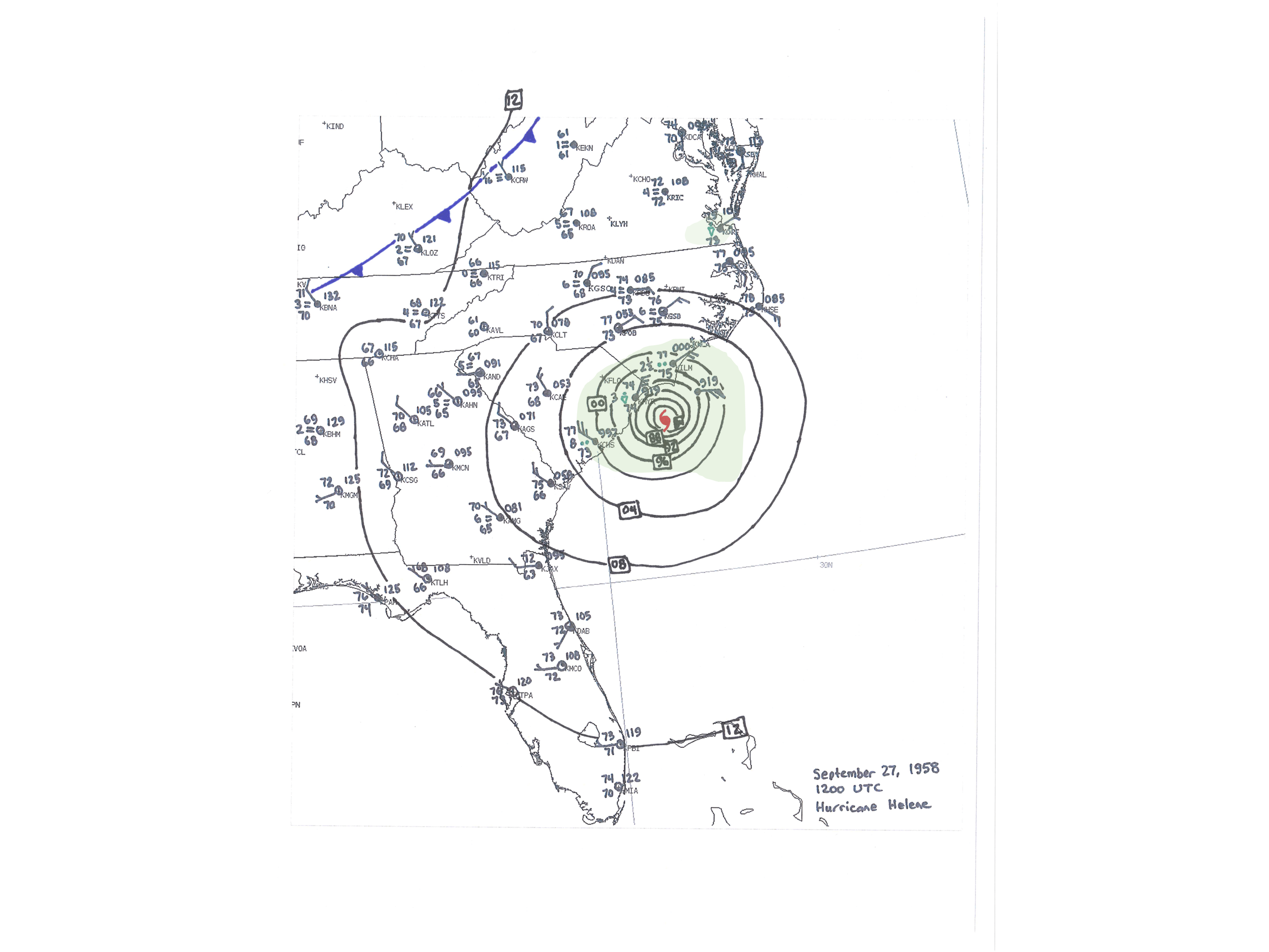
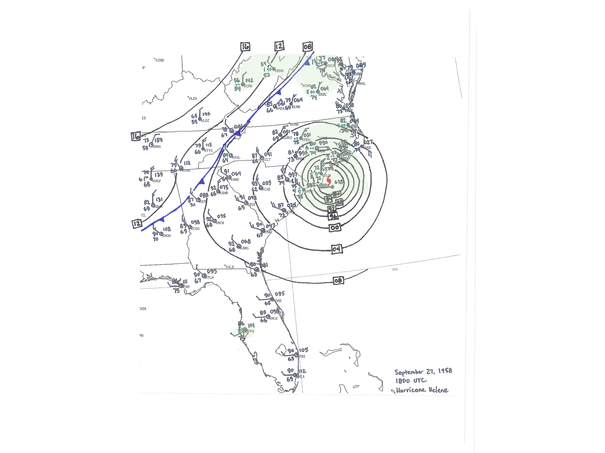
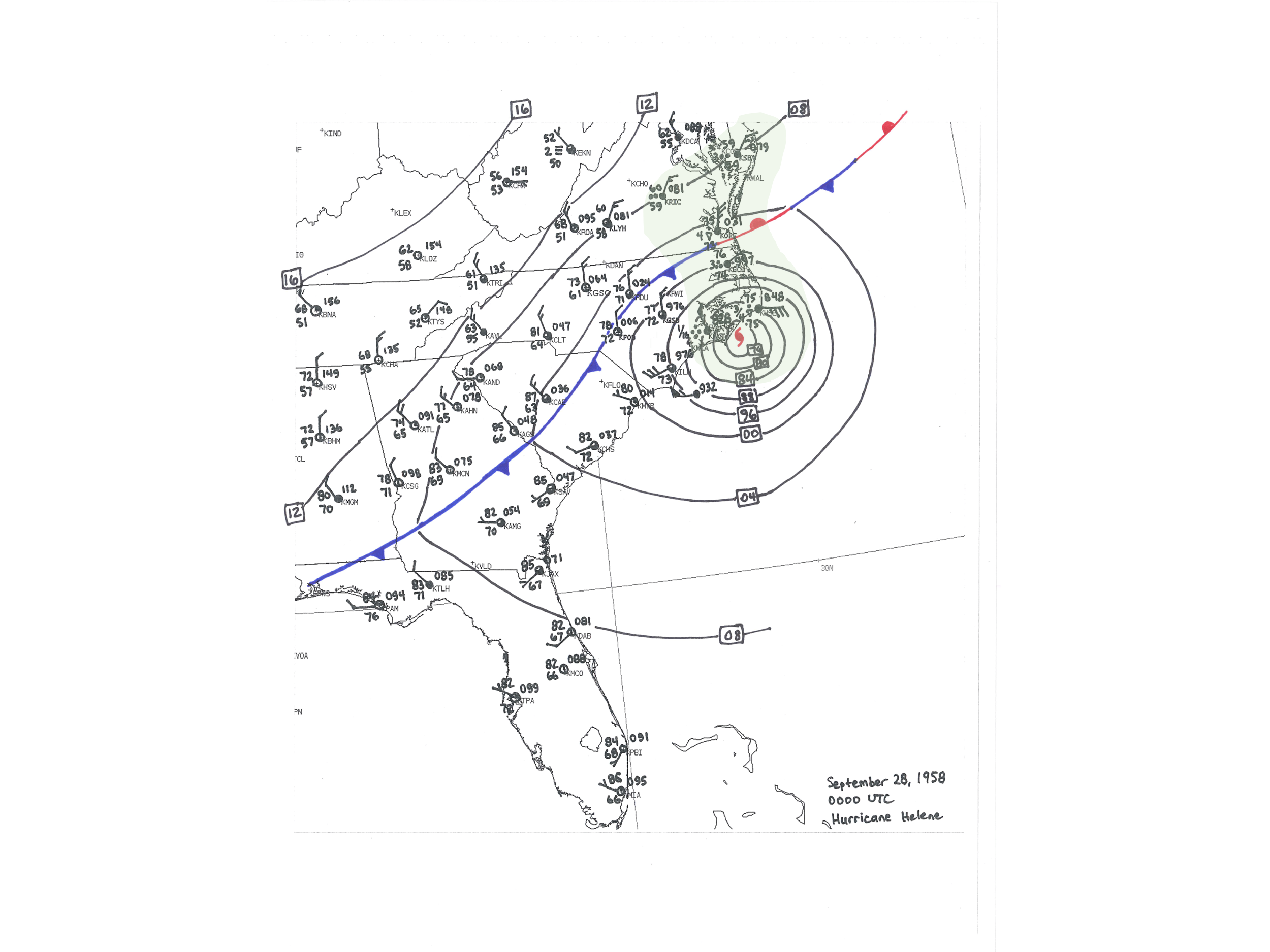
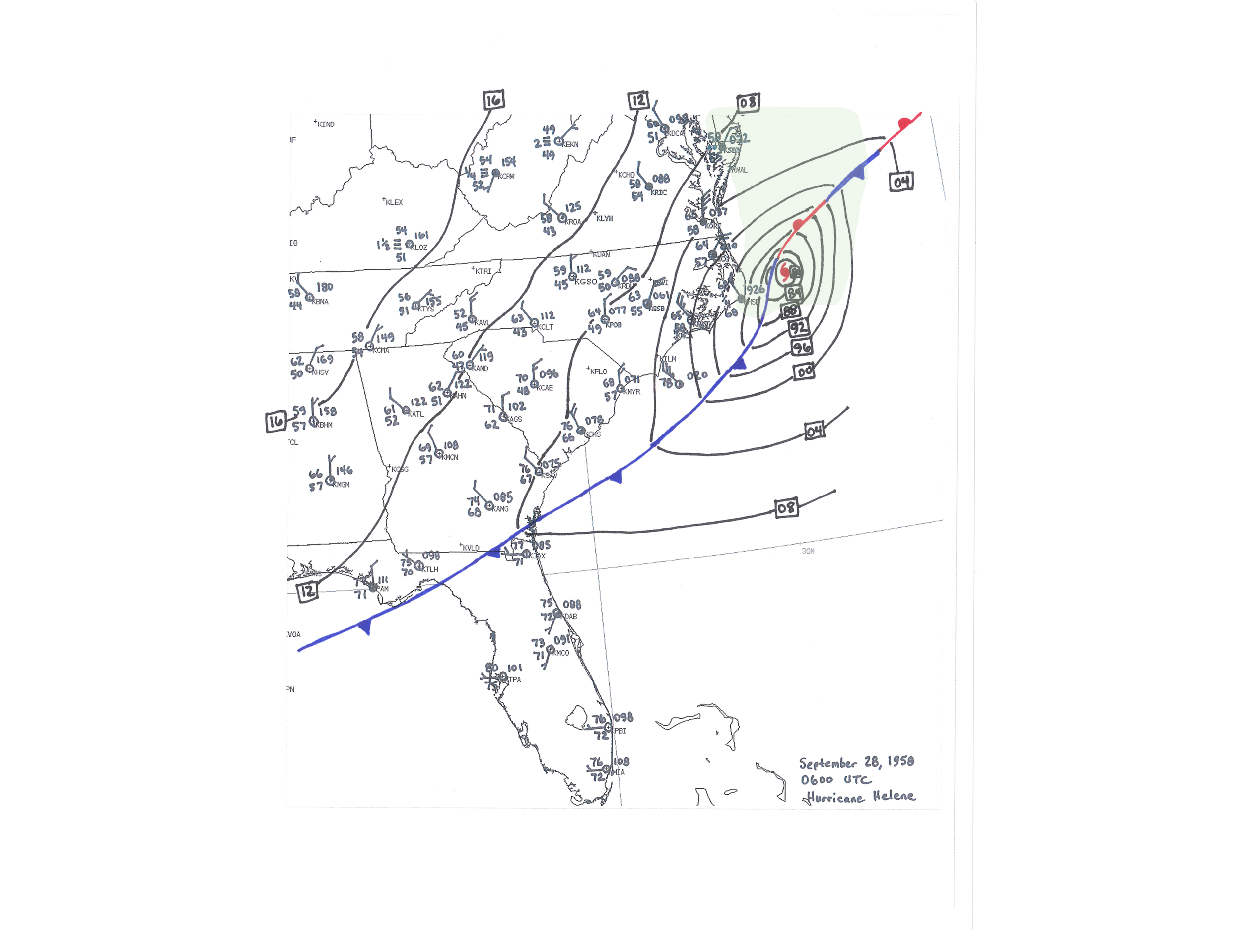
Animation of hand-drawn surface weather maps. These maps loop from 0600 UTC (2 a.m. EDT) September 27 through 0600 UTC (2 a.m. EDT) September 28, 1958. The center of Hurricane Helene passed between Cape Fear, NC and the Frying Pan Shoals Lightship early in the afternoon of September 27. |
|
Wind
|
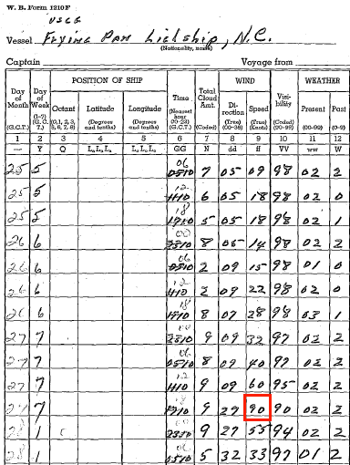
The red box highlights an observation of sustained winds of 90 knots (105 mph) on the Frying Pan Shoals Lightship |
Helene's winds were the strongest observed in coastal North Carolina since modern meteorological records began in the 1870s. The highest wind gusts were generally confined to within about 10 miles of the beaches. With the offshore track of the storm's center and with the closest approach to Cape Fear occurring near low tide, little storm surge flooding was observed.
Reports indicate roof and chimney damage were widespread within approximately ten miles of the coast, and some homes and small buildings were completely destroyed by just the force of the wind. Significant agricultural damage to corn fields occurred within approximately 40 miles of the coast. At the Wilmington airport a wind gust of 135 mph occurred at 12:41 p.m. on September 27, the strongest wind ever recorded in Wilmington.
Offshore at the Frying Pan Shoals Lightship, Coast Guard personnel making their routine weather observation at 2:00 pm on September 28 reported a sustained wind of 90 knots or 105 mph. A National Hurricane Research Project report later added that gusts at the lightship reached 127 mph. Gusts near Cape Fear reached 150-160 mph according to a report from the National Hurricane Center. The weather station at Cape Lookout, NC recorded a wind gust to 144 mph before the instrumentation was destroyed. A Weather Bureau memo issued several days after the storm mentions Helene also damaged anemometers at Oak Island, Carolina Beach, Sneads Ferry, and at Swansboro.
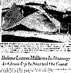
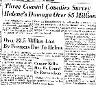
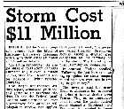
A report from the North Carolina State Climatologist estimated damage across the state near $11 million. (Unadjusted 1958 dollars) Across southeastern North Carolina, state agricultural officials estimated losses of $3.69 million, largely consisting of losses to corn and soybeans.
| Location | Sustained Wind | Highest Gust | Time of Gust | Min Pressure | Min Pressure | Storm Rainfall |
| mph | mph | EDT | millibars | In. Hg | inches | |
| Near Cape Fear, NC | 125 | 150-160 | ||||
| Cape Lookout, NC | ≥ 125 | ≥ 144 | 947.5 | 27.98 | ||
| Cape Lookout to Fort Macon, NC | 140 | |||||
| Wilmington, NC airport | 85 | 135 | 12:41 PM | 975.3 | 28.80 | 8.29 |
| Frying Pan Shoals Lightship, NC | 105 | 127 | 1:00 PM | |||
| Cape Hatteras, NC | 69 | 106 | 9:23 PM | 972.9 | 28.73 | 4.85 |
| Southport, NC | 100 | |||||
| Little River, SC | 100 | |||||
| Cherry Point, NC | 97 | 5:09 PM | 975.3 | 28.80 | 4.54 | |
| Briarcliff, SC | 90 | 10:30-11 AM | 986.1 | 29.12 | ||
| Oak Island, NC Coast Guard Station | 90 | 9:00 AM | ||||
| Cherry Grove Beach, SC | 85 | 983.7 | 29.05 | |||
| New Bern, NC | 52 | 83 | 5:01 PM | 985.8 | 29.11 | 4.35 |
| Shallotte, NC | 80 | 1:00 PM | ||||
| Oriental, NC | 80 | 8:00 PM | 971.2 | 28.68 | ||
| Georgetown, SC paper mill | 71 | 8:00 AM | 991.9 | 29.29 | ||
| Murrells Inlet, SC | 70 | 991.2 | 29.27 | 0.34 | ||
| Myrtle Beach, SC airport | 63 | 990.5 | 29.25 | |||
| Charleston, SC airport | 35 | 63 | 5:01 AM | 997.6 | 29.46 | 0.52 |
| Georgetown, SC | 60 | 8:00 AM | 991.2 | 29.27 | 2.52 | |
| Fort Fisher, NC | 60 | 7:00 AM | ||||
| Charleston, SC downtown | 60 | 996.6 | 29.43 | 0.52 | ||
| Sullivans Island, SC | 60 | 9:25 AM | 993.9 | 29.35 | ||
| Elizabeth City, NC | 35 | 52 | 10:00 PM | 999.3 | 29.51 | 0.58 |
| McClellanville, SC | 36-38 | 50 | 996.3 | 29.42 | ||
| Rocky Mount, NC | 25 | 44 | 9:00 PM | 999.7 | 29.52 | 0.08 |
| Tarboro, NC | 25 | 34 | 7:30 PM | 998.0 | 29.47 | 0.20 |
| Ahoskie, NC | 991.2 | 29.27 | ||||
| Folly Beach, SC | 995.6 | 29.40 | 0.73 |
Specific Impacts by County
New Hanover County, NC including Wilmington and Wrightsville Beach
The beach towns (Wrightsville, Carolina, and Kure Beach) were all evacuated before the storm. Exceptionally strong winds measured up to 135 mph at the Wilmington airport caused significant property damage. Trees, billboards, and plate glass windows in downtown storefront windows were destroyed, and a gas station building was pushed off its foundation. The upper 250 feet of a 600 foot tall LORAN radio tower was toppled in southern New Hanover County during the storm. (LORAN was a precursor to modern GPS)
In Kure Beach, the town's 600 foot long fishing pier lost 275 feet of its length to Helene's waves. Several businesses were destroyed and a few homes lost their roofs. Fort Fisher at the southern end of the county was one of the few locations to suffer considerable damage due to storm surge flooding and many of the dunes were destroyed.
|
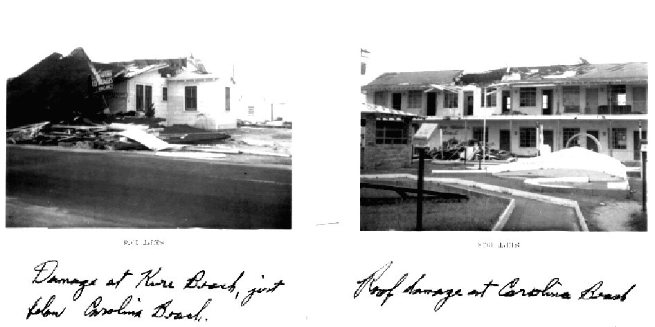
Significant wind damage to structures in Kure Beach (left) and Carolina Beach (right) from Hurricane Helene |
At Wrightsville Beach, Johnny Mercer's fishing pier, rebuilt after Hurricane Hazel’s destruction in 1954, suffered only limited damage. Porches and shingles on beach homes were damaged, some severely. Newspaper reports mentioned how tides were not particularly high for a storm of this magnitude and water only affected a few of the lowest streets on the island. Electrical service was lost to the entire island. Approximately half of the homes on Harbor Island had damage to their roofs.
An early damage estimate of $7.28 million for New Hanover county was printed in The Robesonian newspaper on September 30, 1958. Carolina Beach's mayor Glenn Tucker was quoted that damage in his town was at least $1.75 million. Southern Bell telephone company reported nearly 8,000 telephones were out of service across New Hanover County due to the storm.
Brunswick County, NC including Southport
|
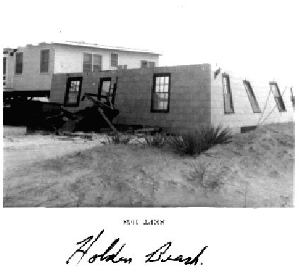
Blown-away roof and leaning walls on this building in Holden Beach, NC |
Southport's electricity, municipal water supply, and phone lines were knocked out by the hurricane, and damage estimates in town were between one-half and three-quarters of a million dollars. Electrical generators supplied by the U.S. Army were used to power the town's water pumps. A newspaper interview with Southport resident W. F. Huffam suggested "about 90 percent of the homes in town have been damaged to some extent..." The steeple on St. James Methodist Church was toppled, with newspaper photos showing severe damage to the building. Several sections of the city’s docks in Southport were damaged, and many of the large oaks at the waterfront park were toppled.
Pleasant Oaks Plantation, a former rice plantation location along NC 133 in eastern Brunswick County, was severely damaged. Newspaper reports indicated 400 trees were blown down, including 100 Live Oaks up to six feet in diameter. The damage was much worse than what occurred during Hurricane Hazel and was so extensive it was expected to take years before the gardens would reopen to the public.
Sand dunes at Long Beach were breached and the storm surge damaged some roads. Ocean Isle Beach's 300 foot long fishing pier was "smashed" according to an Associated Press newspaper article on September 29. In Yaupon Beach roofs were blown off two homes, but damage was otherwise minor.
On October 1, Brunswick County officials estimated damage across the county at $2.34 million.
Pender County, NC
Two houses were destroyed on Topsail Island. A newspaper article from October 1 reported Pender County officials estimated damage at $75,000 across the county.
Columbus County, NC
Over one million dollars of damage was reported from Columbus County, mainly due to agricultural losses to corn crops and hay fields. One indirect fatality attributed to Hurricane Helene occurred when a man driving in Whiteville skidded off a wet road and overturned his car.
Onslow County, NC including Jacksonville
Significant roof damage occurred to a number of homes and plate glass windows were blown out. A woman was slightly injured when a tree blew down on her residence.
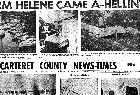
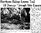
Carteret County, NC including Morehead City
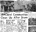
Soundside flooding occurred at Cedar Island where water entered a number of homes. In Morehead City a large boat shed lost its roof, and other structures suffered roof and window damage. After power lines were blown down, Morehead City's hospital was lit by candles until emergency generators brought in from the Marine base in Cherry Point were started. In Atlantic Beach a warehouse and concession stand were destroyed and two garages fell down with other structures suffering significant roof damage. The Atlantic Beach mayor estimated over half a million dollars in damage, mostly to porches and chimneys.
|
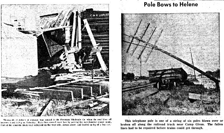
Thousands of dollars of damage was caused to Freeman Wholesale Co. when the roof blew off between 3 and 3:30 pm Saturday. Part of the concrete block wall collapsed on the west side, shown above, and landed on a box car. (left) This telephone pole is one of six poles blown over or broken off along the railroad track near Camp Glenn. (right) Both photos from the Carteret County News-Times. September 30, 1958. |
In Beaufort, NC, one home collapsed and many trees were blown over. The Ocean Park Drive-in Theater screen was damaged. The parking lot at Fort Macon State Park was flooded by storm surge about one foot deep and there was beach erosion. Damage also occurred to trees and roofs. At Harkers Island two boat construction buildings were destroyed. A man driving during the storm was injured slightly when the wind blew his truck over. A report by the State Climatologist for NC mentioned that a number of homes on Cedar Island suffered storm surge flooding.
A reporter with the Carteret County News-Times documented the following sequence of events in Morehead City.
|
Friday Afternoon: Party boats were forced to return early due to rough seas offshore. Friday Night: Most vessels along waterfronts throughout the county had been taken to protected harbors. Saturday 10 a.m.: Light rain in squalls, wind in light gusts Saturday 11:45 a.m.: Carolina Power and Light reported a few nuisance interruptions in power flow due to tree limbs hitting lines. Saturday Noon: Rain increased, wind blowing 25 mph Saturday 1 p.m.: Atlantic Beach, Salter Path, and all other Bogue Banks areas had been ordered evacuated. Wind was blowing 32 to 38 mph. Rain was no longer squally but was coming down steadily. Saturday 2:30 p.m.: Power in Beaufort/Morehead City area went off. Winds were of gale force. Before power went off, wires on Morehead City fire alarm systems were slapping together, causing periodic tolling of the fire alarm. |
Saturday 3:10 p.m.: Rain extremely heavy, being pushed horizontally by winds 55 mph. Gusts so heavy that persons in buildings had the feeling that doors and windows were being blown open. (some were) Saturday 3:20 p.m.: Day grew darker. Rain lashing against the windows sounded like sleet in a winter storm. Saturday 3:35 p.m.: Winds continue up to 75 mph in gusts. Homeowners kept busy mopping at sills and doors where wind blew rain through unpluggable cracks. Saturday 3:55 p.m.: Wind still to northeast, as it was all day. Saturday 4:20 p.m.: Wind continues to blow at better than 55 mph. Heavy, constant rain. Houses and buildings shake. Limbs torn off trees. Saturday 5:05 p.m.: Rain has let up slightly. Wind shifts slightly to north-northeast, indicating that storm is passing to the north (sic) |
Saturday 5:25 p.m.: Rain resumes heavily again, being pushed in wet clouds along streets and against buildings. Saturday 6 p.m.: Wind continues strong from the north. Eye of storm has passed offshore. Barometer had hit lowest point 28.65 and was rising slightly. Saturday 6:30 p.m.: Wind still to north, blowing at whole gale force. Rain pelting down. This was beginning of tail-end of storm, commonly known as "back-lash," which frequently brings more damage than first half of storm. 7 p.m.: Shingles blowing on roof sound as though someone is on roof jumping up and down. Houses tremble, rain heavy. 8 p.m.: High tide. This is full moon and very high tide even without storm conditions. Wind was still to north, however, which served to sweep back water from residential areas facing south. This same wind, however, caused water to sweep forward on areas facing north. |
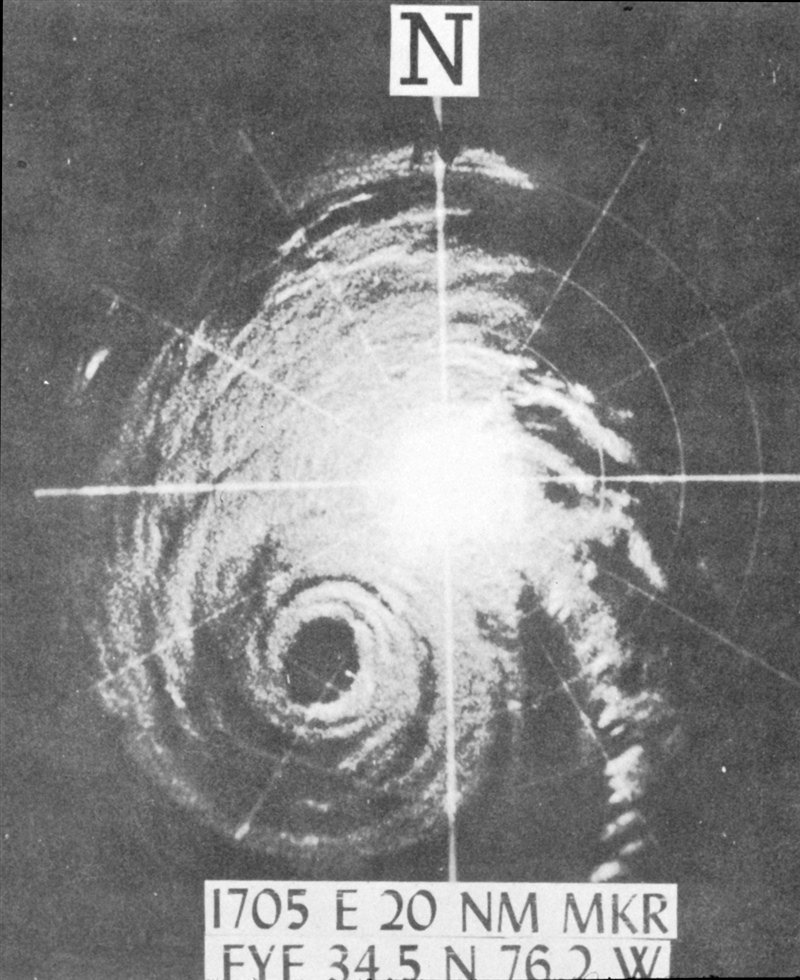
|
SP-1M radar image from Cape Hatteras, NC showing Hurricane Helene approaching from the southwest at 5:05 p.m. EDT September 27, 1958. The eye had a diameter of 20 nautical miles |
Dare County, NC including Hatteras and Buxton
A September 30, 1958 Associated Press article says the villages of Hatteras and Buxton suffered $100,000 damage from the storm.
Horry County, SC including Myrtle Beach
The strongest winds in the county occurred near Little River where gusts were estimated to 100 mph. Wind gusts 60 to 80 mph caused minor damage to homes along Ocean Drive Beach and Myrtle Beach. Waves were reported 10 to 12 feet high. In Cherry Grove Beach, both piers lost large sections due to large crashing surf. The pier at Ocean Drive Beach was destroyed. Garden City at the southern end of Horry County reported only minor damage to roofs along with minor beach erosion.
There were two reports of "tornado like storms" during Hurricane Helene: one in the Briarcliff community (today known as Briarcliff Acres), and another along Highway 17 north of Ocean Drive Beach (today part of North Myrtle Beach.) Today we know tornadoes often accompany landfalling tropical storms and hurricanes.
Georgetown County, SC
Pawley's Island was evacuated ahead of the storm. Fifty feet of the island's fishing pier was destroyed. Some damage occurred to roofs. There was minor beach erosion and some damage to sand dunes. The LaFayette “turntable” bridge that carried Highway 17 across the Waccamaw River just north of Georgetown was blown open. State employees were initially unable to move the bridge back to its closed position, cutting off a key access route from Georgetown to Myrtle Beach.
Other Documents and Newspaper Clippings
|
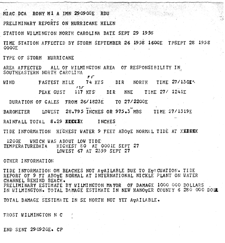
Hurricane Helene preliminary report from the Weather Bureau office in Wilmington, NC |
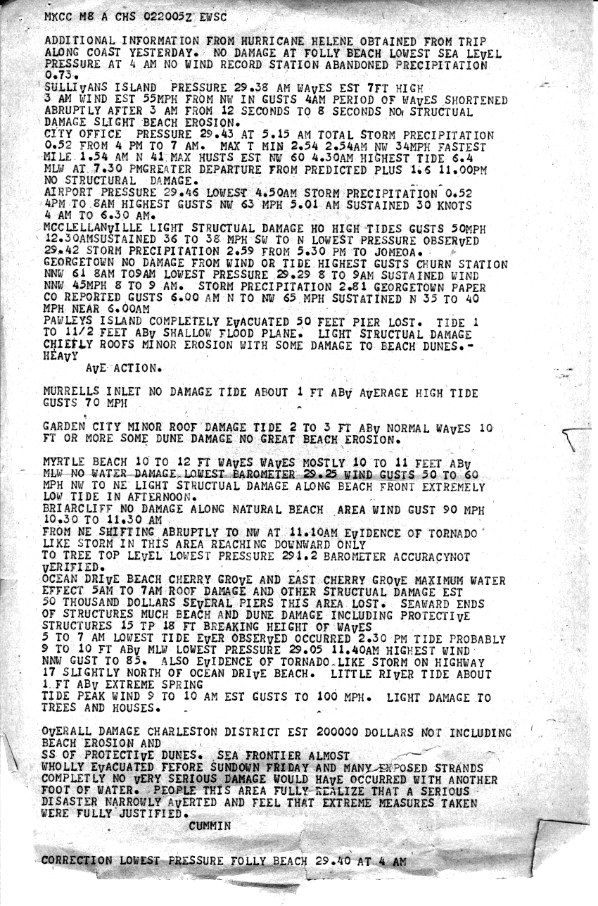
Hurricane Helene preliminary report from the Weather Bureau office in Charleston, SC |
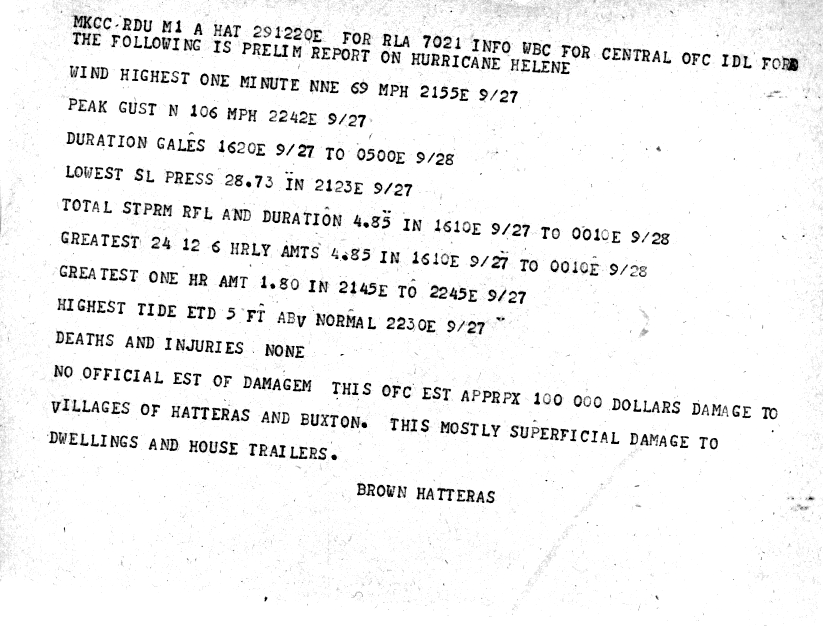
Hurricane Helene preliminary report from the Weather Bureau office in Cape Hatteras, NC |
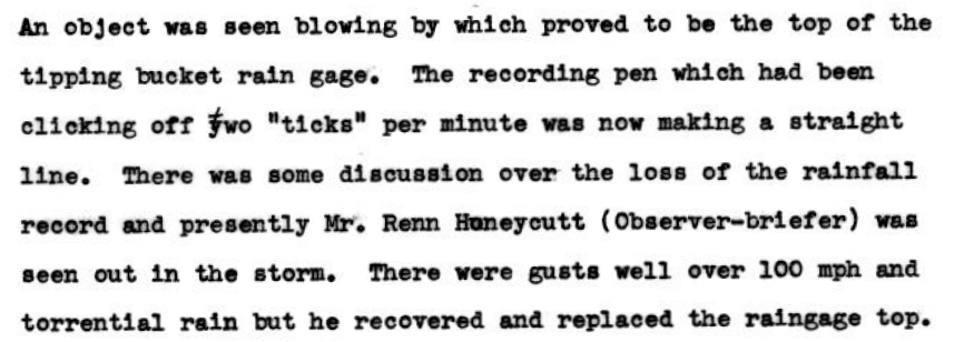
Robert Frost, Meteorologist-in-Charge of the Weather Bureau in Wilmington in 1958, wrote a detailed account of how the Wilmington office prepared for Hurricane Helene's arrival, what it was like working through the storm, and how the Wilmington area fared afterward. Mr. Frost's description of watching the anemometer reach 135 mph and how a weather observer ran out to fix the rain gauge twice during the storm provides interesting additions to the basic facts and statistics of this historic storm.
Also of interest in Mr. Frost's report is the name of the local Red Cross Hurricane Warning Committee chairman: Stanley Rehder. During Hurricane Helene, Mr. Rehder led a team of volunteers in the weather office for 28 straight hours helping to get warnings out via telephone to communities across southeastern North Carolina. Wilmington residents today may know his name from the Stanley Rehder Carnivorous Plant Garden, reflecting a passion he held throughout his life for the unique Venus Flytraps that grow wild in the Cape Fear area. Mr. Rehder died in 2012 at the age of 90.
Links to Additional Information
Newsreel of damage from Hurricane Helene along the South and North Carolina coast from British Pathé. Look for the Hughes Bros building shown 35 seconds into the video -- this iconic Art Deco structure was repaired following Hurricane Helene and still operates today along Market Street in Wilmington.
Research and Author: Tim Armstrong
Page Created: July 10, 2020
Last Updated: July 26, 2020


 Coastal Flood
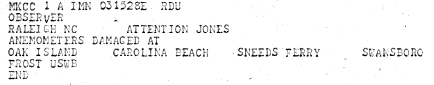