Summary
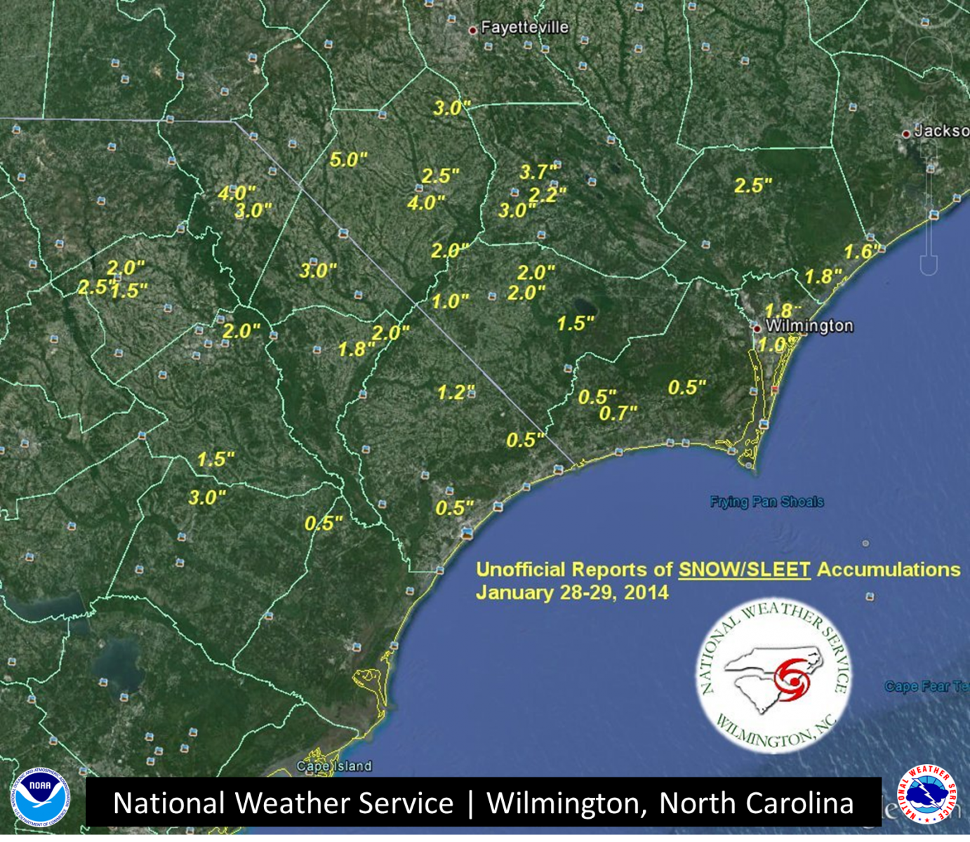
A rare and significant winter storm impacted southeast North Carolina and northeast South Carolina on January 28-29, 2014. This storm brought a combination of sleet, snow, and even some freezing rain to our area - resulting in significant accumulations and impacts that were felt for several days after the event. Snow and sleet accumulations of 2 to 4 inches were reported northwest of a line roughly extending from Kingstree, SC to Burgaw, NC. Accumulations were less than 2 inches closer to the coast. This was the first major winter storm to impact our forecast area since January 2011.
.jpg)
Photo credit: Tim Armstrong, NWS Wilmington NC
Meteorological discussion
An Arctic cold front pushed across the Carolinas during the early morning hours of January 28. A shallow layer of very cold, subfreezing air infiltrated the region during the day as the boundary stalled offshore. Meanwhile, upper level divergence ahead of an approaching shortwave trough supported the development of surface low pressure along the stalled front. Clouds and wintry precipitation developed over the eastern Carolinas as warmer, moist air from the Gulf of Mexico ascended over the frigid surface layer in place across the region.
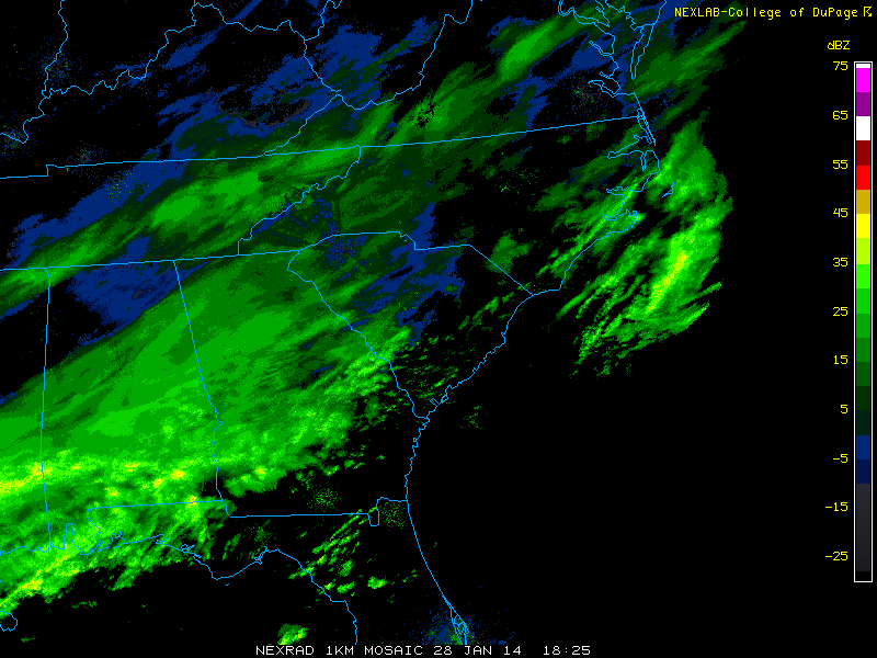
(Archived radar images via locust.mmm.ucar.edu)
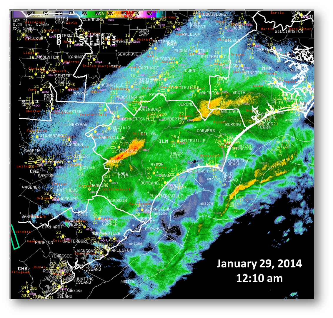
Although temperatures aloft were well above freezing for much of this event, subfreezing temperatures in the lowest levels allowed the melted snow to refreeze into sleet by the time it reached the surface. Eventually, precipitation transitioned to all snow (heaviest across our inland counties) before the event came to an end on the morning of January 29. The radar image below was captured just after midnight on January 29 as sleet and snow continued to fall within our area. The "bright band" feature denoted by higher reflectivities indicates the level where snow was melting aloft, but the subfreezing layer below allowed the precipitation to refreeze before it reached the surface. Note that temperatures were in the 20s across the region according to the surface plots in yellow. Most locations east of the enhanced reflectivities were seeing light to moderate sleet at this point. Further inland (west of a line extending from Lumberton, NC to Florence, SC), snow was the dominant precipitation type.
Local Impacts
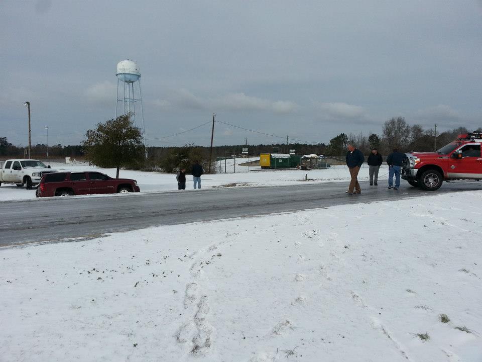
Although there was some light freezing rain over our coastal counties on January 28, sleet and snow were the dominant precipitation types during this event. Packed sleet over area roadways and other surfaces became the most significant impact as cold and cloudy conditions for the next couple days severely limited the melting process. Icy roads resulted in school and business closures for several days even after the precipitation had ended. New Hanover County 911 Center reported over 58 calls of slip and fall injuries due to icing.
 |
 |
| Snow/Sleet Accumulation Map | Ice Accumulation Map |
Unofficial Snow, Sleet, and Ice Accumulations
(click on tabs to view reports by county)
LOCATION          STORM TOTAL     TIME/DATE   COMMENTS
                     SNOWFALL           OF
                     /INCHES/   MEASUREMENT

   ELIZABETHTOWN 5 WNW    3.7   700 AM  1/29  COCORAHS
   BLADENBORO             3.0   525 AM  1/29  PUBLIC
   ELIZABETHTOWN 3 WSW    2.2   800 AM  1/29  SLEET AND SNOW
LOCATION          STORM TOTAL     TIME/DATE   COMMENTS
                     SNOWFALL           OF
                     /INCHES/   MEASUREMENT
   SHALLOTTE              0.7  1200 PM  1/29  CO-OP OBSERVER
   LONGWOOD 1 NNW         0.5   700 AM  1/29  SLEET AND SNOW
   BOLIVIA 8 SW           0.5   700 AM  1/29  COCORAHS
LOCATION          STORM TOTAL     TIME/DATE   COMMENTS
                          ICE           OF
                     /INCHES/   MEASUREMENT
OAK ISLAND 0.2 1012 PM 1/28 TRAINED SPOTTER
LOCATION          STORM TOTAL     TIME/DATE   COMMENTS
                     SNOWFALL           OF
                     /INCHES/   MEASUREMENT
   WHITEVILLE             2.0   351 AM  1/29  MEDIA
   WHITEVILLE 6 NNW       2.0   907 AM  1/29  TRAINED SPOTTER
   WHITEVILLE  SE         1.9   700 AM  1/29  COCORAHS
   LAKE WACCAMAW 3 SSW    1.5   800 AM  1/29  COCORAHS
   FAIR BLUFF 1 ESE       1.0   700 AM  1/29  COCORAHS
LOCATION          STORM TOTAL     TIME/DATE   COMMENTS
                          ICE           OF
                     /INCHES/   MEASUREMENT
   WHITEVILLE            0.50  1117 PM  1/28  FREEZING RAIN AND SLEET
   WHITEVILLE 6 NNW      0.10   718 PM  1/28  AMATEUR RADIO
LOCATION          STORM TOTAL     TIME/DATE   COMMENTS
                     SNOWFALL           OF
                     /INCHES/   MEASUREMENT
   WILMINGTON 2 ENE       1.8   739 AM  1/29  EMERGENCY MNGR
   WRIGHTSBORO 1 ESE      1.0   650 AM  1/29  NWS OFFICE
   MYRTLE GROVE 1 NNE     1.0   700 AM  1/29  MAINLY SLEET
   MASONBORO 2 WNW        1.0   820 AM  1/29  PUBLIC
   MASONBORO 1 ENE       0.75   400 AM  1/29  NWS EMPLOYEE
LOCATION          STORM TOTAL     TIME/DATE   COMMENTS
                          ICE           OF
                     /INCHES/   MEASUREMENT
   WINDEMERE 2 SW	 0.50	657 PM	1/28  EMERGENCY MNGR
   WINDEMERE 1 ENE	 0.25	614 PM	1/28  AMATEUR RADIO
LOCATION          STORM TOTAL     TIME/DATE   COMMENTS
                     SNOWFALL           OF
                     /INCHES/   MEASUREMENT
   WATHA                  2.5   912 AM  1/29  AMATEUR RADIO
   HAMPSTEAD 2 NNW        1.8   658 AM  1/29  NWS EMPLOYEE
   SURF CITY 2 NNW        1.6   800 AM  1/29  MAINLY SLEET
   HAMPSTEAD 2 NNW        0.8  1252 AM  1/29  NWS EMPLOYEE
LOCATION          STORM TOTAL     TIME/DATE   COMMENTS
                          ICE           OF
                     /INCHES/   MEASUREMENT
   WATHA                 0.50  1143 PM  1/28  FREEZING RAIN AND SLEET
   HAMPSTEAD 2 S         0.38   700 PM  1/28  NWS EMPLOYEE
   WATHA 3 SW            0.25   858 PM  1/28  AMATEUR RADIO
LOCATION          STORM TOTAL     TIME/DATE   COMMENTS
                     SNOWFALL           OF
                     /INCHES/   MEASUREMENT
   MAXTON                 5.0   510 AM  1/29  PUBLIC
   LUMBERTON              4.0   510 AM  1/29  PUBLIC
   LUMBERTON 3 SE         3.0   700 AM  1/29  SNOW AND SLEET
   ST. PAULS 3 ENE        3.0  1000 AM	1/29  SNOW
   LUMBERTON 2 NE         2.5   700 AM  1/29  COCORAHS
   LUMBER RIVER SP        2.0   800 AM  1/29  SLEET AND SNOW
LOCATION          STORM TOTAL     TIME/DATE   COMMENTS
                     SNOWFALL           OF
                     /INCHES/   MEASUREMENT
   HARTSVILLE 5 WSW       2.5   700 AM  1/29  COCORAHS
   HARTSVILLE 2 NE        2.0   700 AM  1/29  CO-OP OBSERVER
   HARTSVILLE             1.5   510 AM  1/29  PUBLIC
   DARLINGTON 1 WSW       0.5  1113 PM  1/28  EMERGENCY MNGR
LOCATION          STORM TOTAL     TIME/DATE   COMMENTS
                     SNOWFALL           OF
                     /INCHES/   MEASUREMENT
DILLON 3.0 510 AM 1/29 PUBLIC
LOCATION          STORM TOTAL     TIME/DATE   COMMENTS
                          ICE           OF
                     /INCHES/   MEASUREMENT
FORK 0.50 839 PM 1/28 AMATEUR RADIO
LOCATION          STORM TOTAL     TIME/DATE   COMMENTS
                     SNOWFALL           OF
                     /INCHES/   MEASUREMENT
   FLORENCE 4 NNW         2.0   846 AM  1/29  AMATEUR RADIO
   FLORENCE               2.0   510 AM  1/29  PUBLIC
   LAKE CITY              1.5   510 AM  1/29  PUBLIC
   FLORENCE 3 W           1.0   346 AM  1/29  MEDIA
LOCATION          STORM TOTAL     TIME/DATE   COMMENTS
                          ICE           OF
                     /INCHES/   MEASUREMENT
   FLORENCE 1 SW         0.12   948 PM  1/28  AMATEUR RADIO
   FLORENCE 1 WNW        0.12   745 PM  1/28  AMATEUR RADIO
   FLORENCE              0.12   740 PM  1/28  MEDIA
LOCATION          STORM TOTAL     TIME/DATE   COMMENTS
                     SNOWFALL           OF
                     /INCHES/   MEASUREMENT
LORIS 3 WSW 1.2 700 AM 1/29 COCORAHS
LOCATION          STORM TOTAL     TIME/DATE   COMMENTS
                          ICE           OF
                     /INCHES/   MEASUREMENT
   MYRTLE BEACH 7 NNW     0.5   800 AM  1/29  COCORAHS
   LONGS 1 NW             0.5   800 AM  1/29  COCORAHS
   GARDEN CITY 1 ENE      0.5   900 PM  1/28  EMERGENCY MNGR
   CONWAY                 0.3  1110 PM  1/28  EMERGENCY MNGR
   BAYBORO 5 S            0.3   840 PM  1/28  AMATEUR RADIO
   CONWAY 1 SSE           0.2   700 AM  1/29  CO-OP OBSERVER
   MYRTLE BEACH 1 ESE     0.1   621 PM  1/28  MEDIA
LOCATION          STORM TOTAL     TIME/DATE   COMMENTS
                     SNOWFALL           OF
                     /INCHES/   MEASUREMENT
   NICHOLS                2.0   616 AM  1/29  PUBLIC
   MULLINS 1 SSE          1.8   700 AM  1/29  CO-OP OBSERVER
LOCATION          STORM TOTAL     TIME/DATE   COMMENTS
                          ICE           OF
                     /INCHES/   MEASUREMENT
MARION 0.25 1111 PM 1/28 EMERGENCY MNGR
LOCATION          STORM TOTAL     TIME/DATE   COMMENTS
                     SNOWFALL           OF
                     /INCHES/   MEASUREMENT
   BENNETTSVILLE          4.0   510 AM  1/29  PUBLIC
   BENNETTSVILLE 4 SE     3.0   700 AM  1/29  COCORAHS
LOCATION          STORM TOTAL     TIME/DATE   COMMENTS
                     SNOWFALL           OF
                     /INCHES/   MEASUREMENT
CADES 4 WNW 3.0 700 AM 1/29 SLEET AND SNOW
LOCATION          STORM TOTAL     TIME/DATE   COMMENTS
                          ICE           OF
                     /INCHES/   MEASUREMENT
   GEORGETOWN 3 SW       0.30  1133 PM  1/28  EMERGENCY MNGR
   HEMINGWAY 8 ESE       0.50   755 AM  1/29  CO-OP OBSERVER
NOTE: Mixed precipitation types were observed across the area, and it is impossible to accurately distinguish between pure freezing rain reports & snow and/or sleet accumulations. In the table below, "Storm Total Snowfall" refers to snow/sleet accumulations, while "Storm Total Ice" includes reports of ice accretion due to freezing rain.
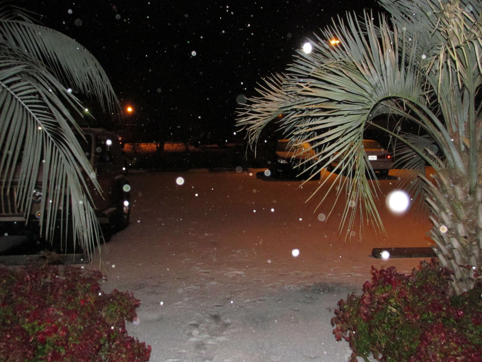
Event pictures
|
Sleet falling outside the NWS office near the Wilmington Airport. Photo credit: Brad Reinhart, NWS Wilmington NC |
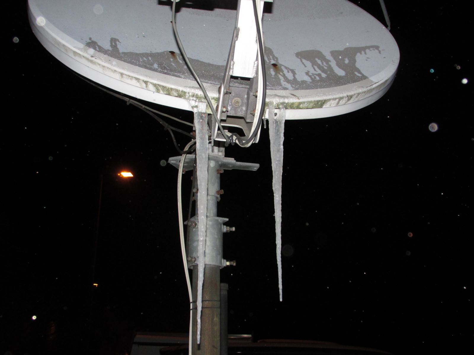
Icicles formed on the satellite dish outside the NWS office. Photo credit: Brad Reinhart, NWS Wilmington NC |
|
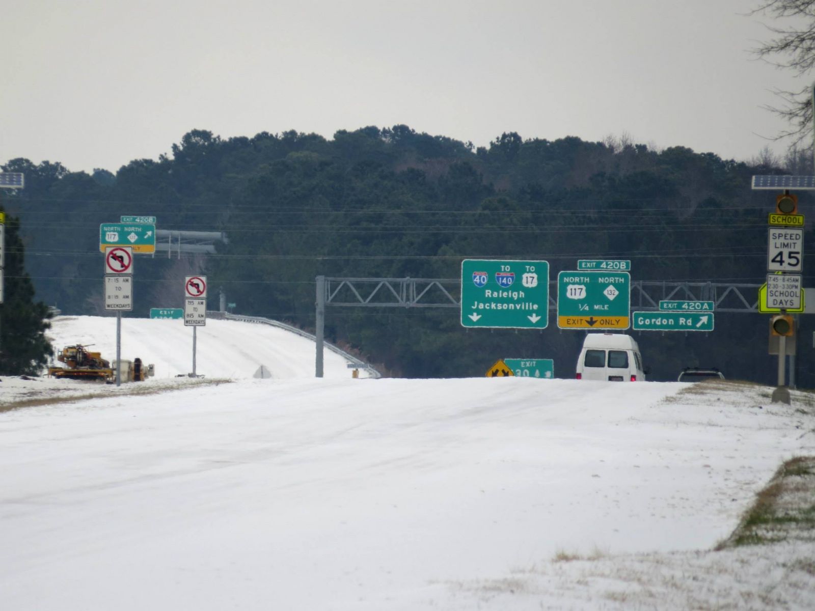
North College Road near the beginning of I-40 in Wilmington. Photo credit: Tim Armstrong, NWS Wilmington NC |
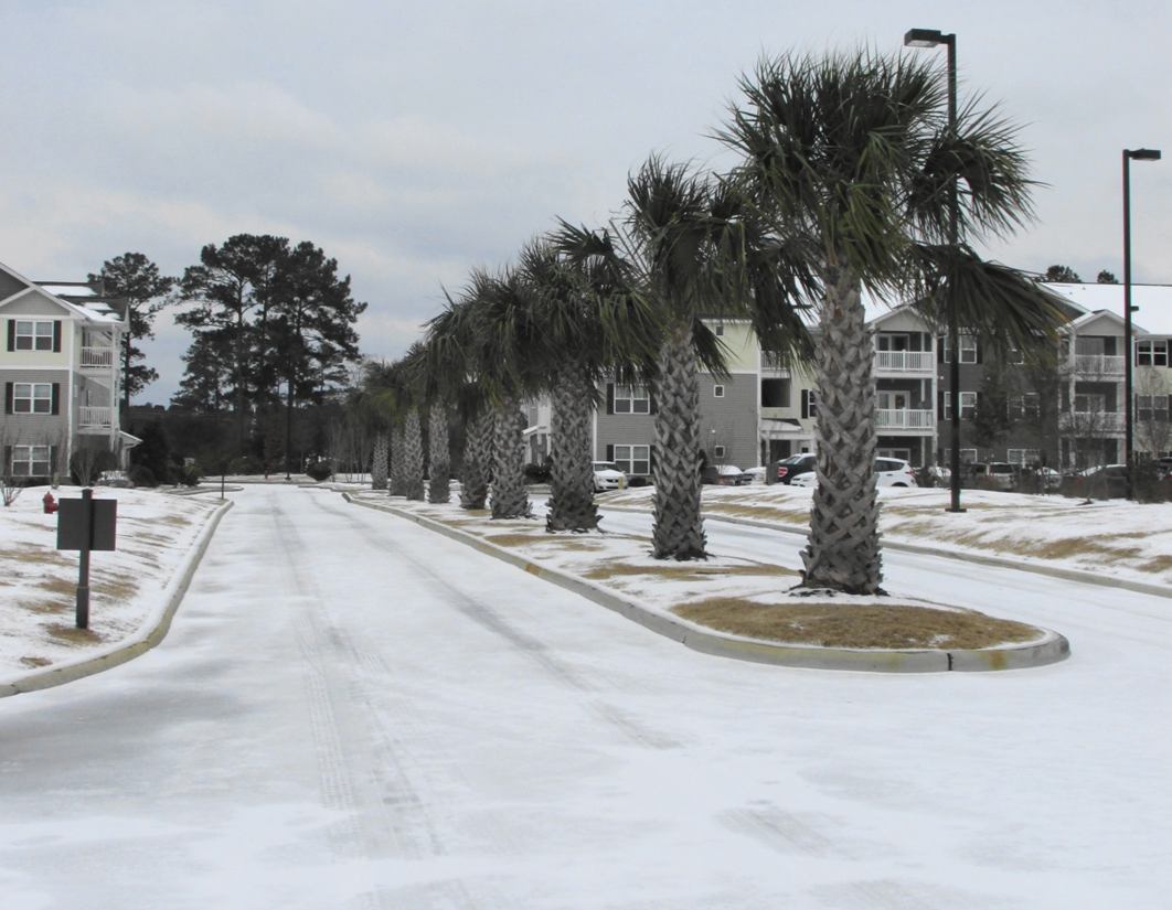
Roads and driveways remained frozen for a couple days after the storm. Photo credit: Brad Reinhart, NWS Wilmington NC |
|
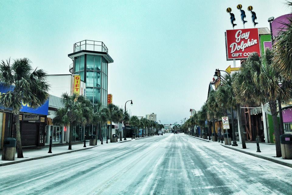
A frozen North Ocean Boulevard in Myrtle Beach, SC. |
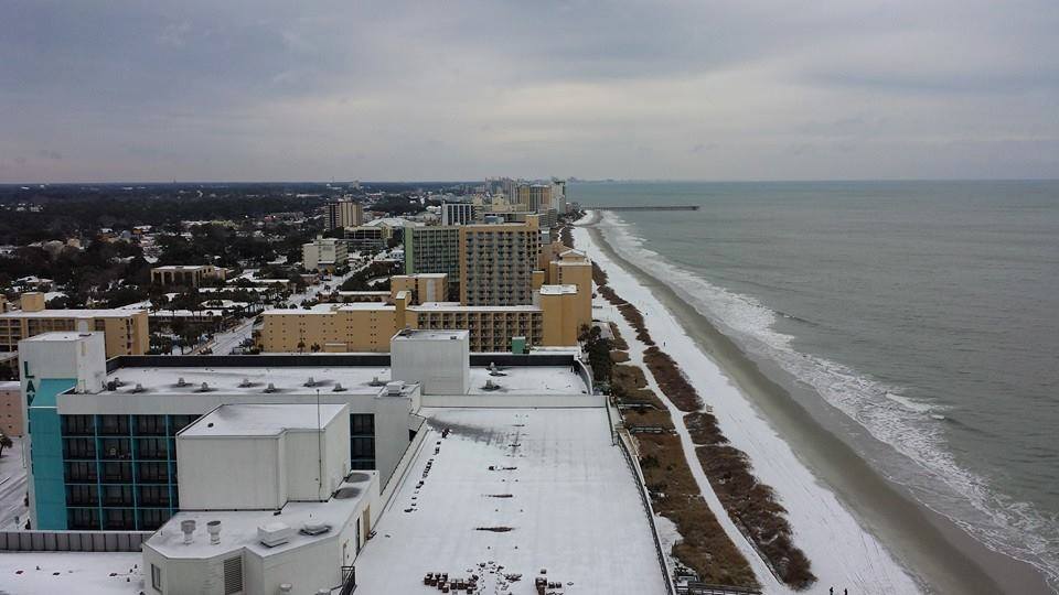
Aerial view of an icy Myrtle Beach, SC. Photo credit: Courtney Smith via Jamie Arnold, WMBF News |
|
Snowy and icy conditions in Florence, SC. Photo credit: Ken Baker via Jamie Arnold, WMBF News |
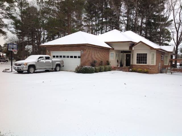
Snow covered yard in Marion, SC. Photo credit: Richard Simpson via Jamie Arnold, WMBF News |
other references
ICED OVER: Storm gone, but frozen impact still grips region - WWAY News Wilmington, NC
Grand Strand, Pee Dee roads covered in ice, sleet and snow - WMBF News Myrtle Beach, SC
Winter storm leaves Pee Dee roads covered in snow and ice - WBTW News Myrtle Beach, SC
Area winter storm was mostly a 'three-day inconvenience' - Wilmington Star News
Snow day at Wrightsville - Wrightsville Beach Lumina News
Page Author: Brad Reinhart
Last Updated: January 21, 2015


 Coastal Flood