Overview
Hurricane Beryl was the second tropical cyclone of the 2024 season in the Atlantic basin. It formed June 28 over the central Atlantic Ocean, and became the earliest-forming category 5 hurricane on record for the Atlantic Basin on July 2, in the Caribbean Sea. After landfalls in Grenada (July 1), passing very near Jamaica on July 3, and making landfall in Mexico's Yucatan Peninsula near Tulum on July 5, Beryl emerged into the Gulf of America later on July 5, heading west-northwest towards the western Gulf coast.
The first hurricane watches for the Texas Gulf Coast were issued at 4 pm on July 5 as the storm emerged over the Gulf waters. This watch included the Matagorda Bay area up to Sargent. The watch was extended up the coast to San Luis Pass at 10 pm. On July 6 at 4 pm, the first hurricane warnings were issued, with a hurricane warning including the Matagorda Bay area up to Sargent, and a tropical storm warning up the coast from Sargent to High Island. Warnings reached their maximum extent in Southeast Texas late on July 7, when a hurricane warning covered nearly the entire area's coastline from Mesquite Bay to Port Bolivar, and a tropical storm warning continuing up the coast from there to Sabine Pass. Inland, a hurricane warning included Jackson, Wharton, Matagorda, and Brazoria counties as well as Galveston Island, while a tropical storm warning was in place for the rest of Southeast Texas.
Beryl made landfall near Matagorda, TX at 4 am on July 8, as a Category 1 hurricane with peak over-water sustained winds at 80 mph. The storm crossed Southeast Texas through the day, exiting by Monday night. The tabbed sections below describe the various impacts of Beryl on Southeast Texas, within the forecasting area of the Houston/Galveston office. For impacts to other areas, please visit the websites of the other affected offices.
Storm History
Here is a space for a paragraph summary of your storm. Use CMS to create a title for your story in the HTML Title Tag field. For tornadoes, you can simply mention the number of tornadoes in this summary, use the tornado tab to list details of each tornado, or a mixture of both (i.e. only list the details of the most significant tornadoes).
| Image Caption 1 | Image Caption 2 | Image Caption 3 |
Useful Links
Local Post Tropical Cyclone Report.
National Weather Service Offices in Corpus Christi, Lake Charles, and Shreveport.
Wind
Insert summary here.

Wind Reports
...UNOFFICIAL HIGHEST WIND GUST REPORTS THROUGH 1030 AM, MONDAY JULY 8...

Location                     Speed     Time/Date       Provider

...Texas...

...Austin County...
San Felipe                   56 MPH    0823 AM 07/08   CWOP
New Ulm                      47 MPH    0845 AM 07/08   DAVIS

...Brazoria County...
Sh 36 At Brazos              97 MPH    0721 AM 07/08   MESOWEST
San Bernard Nwr              91 MPH    0429 AM 07/08   RAWS
Brazoria County Airport      85 MPH    0536 AM 07/08   ASOS
Brazoria Nwr                 79 MPH    0828 AM 07/08   RAWS
Manvel                       70 MPH    0915 AM 07/08   CWOP
Pearland                     70 MPH    0535 AM 07/08   ASOS
4330 Brazos At Sh 35         68 MPH    0822 AM 07/08   MESOWEST
Freeport                     64 MPH    0225 AM 07/08   CWOP
2.8 E Sweeny (UPR)           64 MPH    0337 AM 07/08   MESOWEST
2.7 NE Danbury (UPR)         60 MPH    0530 AM 07/08   MESOWEST
Iowa Colony                  50 MPH    0555 AM 07/08   CWOP
Manvel                       47 MPH    0725 AM 07/08   DAVIS
Alvin                        40 MPH    0445 AM 07/08   DAVIS
Brazoria                     39 MPH    0155 AM 07/08   DAVIS
Jones Creek                  39 MPH    0505 AM 07/08   DAVIS
Alvin                        39 MPH    0326 AM 07/08   CWOP
Alvin                        37 MPH    0838 AM 07/08   CWOP

...Brazos County...
Texas A&m Kyle Field         72 MPH    1010 AM 07/08   MESOWEST
Easterwood Field Airport     56 MPH    0918 AM 07/08   ASOS
Texas A&m West Campus Athlet 43 MPH    0940 AM 07/08   MESOWEST

...Burleson County...
1.9 NE Caldwell (WEATHERSTEM 39 MPH    0240 PM 07/07   MESOWEST
Caldwell                     38 MPH    0915 AM 07/08   AWOS

...Chambers County...
1710 Cedar Bayou At Sh 99    63 MPH    0759 AM 07/08   MESOWEST
Anahuac                      63 MPH    0912 AM 07/08   RAWS
Mont Belvieu                 45 MPH    0945 AM 07/08   DAVIS

...Colorado County...
12.4 SW Eagle Lake (TWDB)    75 MPH    0655 AM 07/08   MESOWEST
Attwater Nwr                 72 MPH    0735 AM 07/08   RAWS
Columbus                     54 MPH    0815 AM 07/08   AWOS
Columbus                     52 MPH    0755 AM 07/08   AWOS

...Fort Bend County...
ROSHARON                     59 MPH    0545 AM 07/08   CWOP
4530 Brazos At Us 99         59 MPH    0731 AM 07/08   MESOWEST
Thompsons                    57 MPH    0700 AM 07/08   CWOP
4020 Cangelosi At Texas Park 54 MPH    0742 AM 07/08   MESOWEST
Houston Sugar La             51 MPH    0412 AM 07/08   AWOS
Stafford                     50 MPH    0615 AM 07/08   CWOP
Houston Southwst             48 MPH    0455 AM 07/08   AWOS
Richmond                     45 MPH    0715 AM 07/08   CWOP
DAMON                        45 MPH    0410 AM 07/08   CWOP
Stafford                     43 MPH    0605 AM 07/08   CWOP
Richmond                     43 MPH    0549 AM 07/08   AWS
Weston Lakes                 40 MPH    0725 AM 07/08   DAVIS
Missouri City                38 MPH    0935 AM 07/08   DAVIS

...Galveston County...
Galveston                    78 MPH    0509 AM 07/08   ASOS
Levee                        73 MPH    0813 AM 07/08   WXFLOW
Jamaica Beach                72 MPH    0751 AM 07/08   MESOWEST
Crab Lake                    69 MPH    0705 AM 07/08   WXFLOW
Texas City                   64 MPH    0649 AM 07/08   WXFLOW
2.1 N Friendswood (HCFCD)    59 MPH    0844 AM 07/08   MESOWEST
7 ENE Galveston              56 MPH    0510 AM 07/08   AWS
Galveston                    55 MPH    0436 AM 07/08   CWOP
League City                  52 MPH    0745 AM 07/08   CWOP
San Leon                     50 MPH    0630 AM 07/08   CWOP
League City                  50 MPH    0858 AM 07/08   CWOP
Galveston                    49 MPH    0345 AM 07/08   DAVIS
13 S Stowell                 48 MPH    0830 AM 07/08   NDBC
Texas City                   47 MPH    0625 AM 07/08   DAVIS
Santa Fe                     47 MPH    0545 AM 07/08   CWOP
Galveston                    46 MPH    0645 AM 07/08   DAVIS
5050 Friendswood Public Safe 46 MPH    0804 AM 07/08   MESOWEST
18 E San Leon                45 MPH    0640 AM 07/08   AWS
League City                  45 MPH    0845 AM 07/08   DAVIS
Texas City                   44 MPH    0705 AM 07/08   CWOP
Santa Fe                     37 MPH    0718 AM 07/08   CWOP

...Grimes County...
2 SW Navasota                55 MPH    0955 AM 07/08   AWOS
Navasota                     54 MPH    0930 AM 07/08   CWOP
2 SW Navasota                38 MPH    0731 AM 07/08   AWOS
Navasota                     37 MPH    0945 AM 07/08   DAVIS

...Harris County...
Houston Univ                 89 MPH    0935 AM 07/08   AWOS
Houston Hobby                84 MPH    0902 AM 07/08   ASOS
Houston Dw Hooks             83 MPH    0936 AM 07/08   ASOS
Houston Intnl                83 MPH    0931 AM 07/08   ASOS
Morgans Point                78 MPH    0935 AM 07/08   AWS
2185 John Paul Landing       76 MPH    0802 AM 07/08   MESOWEST
Clear Lake Park              75 MPH    0918 AM 07/08   WXFLOW
2.1 SW La Porte (HCFCD)      74 MPH    0820 AM 07/08   MESOWEST
1 W La Porte                 74 MPH    0915 AM 07/08   AWOS
Webster                      73 MPH    0800 AM 07/08   CWOP
Cypress                      73 MPH    0830 AM 07/08   CWOP
4 SSW Pasadena               72 MPH    0854 AM 07/08   AWOS
650 Patricks Bayou At East 8 72 MPH    0858 AM 07/08   MESOWEST
2.0 SE Southside Place (HCFC 70 MPH    0954 AM 07/08   MESOWEST
Lake Houston At Fm 1960      69 MPH    1006 AM 07/08   MESOWEST
Houston                      64 MPH    0930 AM 07/08   CWOP
2.9 E Hilshire Village (HCFC 64 MPH    0913 AM 07/08   MESOWEST
Houston                      63 MPH    0906 AM 07/08   CWOP
2200 Houston Ship Channel At 62 MPH    0938 AM 07/08   MESOWEST
5.1 NE Jersey Village (HCFCD 61 MPH    0924 AM 07/08   MESOWEST
640 Lateral At Sens Road     60 MPH    0844 AM 07/08   MESOWEST
2.8 S Deer Park (HCFCD)      59 MPH    0653 AM 07/08   MESOWEST
Spring                       58 MPH    0953 AM 07/08   CWOP
Pasadena                     57 MPH    0935 AM 07/08   DAVIS
Houston                      57 MPH    0739 AM 07/08   CWOP
Harris County Flood Control  56 MPH    0940 AM 07/08   MESOWEST
1.5 SE La Porte (HCFCD)      55 MPH    0710 AM 07/08   MESOWEST
1.7 NW Highlands (HCFCD)     53 MPH    0942 AM 07/08   MESOWEST
2 WSW Galena Park            52 MPH    0900 AM 07/08   NDBC
Tomball                      50 MPH    0747 AM 07/08   CWOP
1.2 W Shoreacres (HCFCD)     47 MPH    0924 AM 07/08   MESOWEST
CYPRESS                      45 MPH    0735 AM 07/08   CWOP
Spring                       45 MPH    0935 AM 07/08   DAVIS
Deer Park                    45 MPH    0636 AM 07/08   CWOP
Houston                      43 MPH    0530 AM 07/08   CWOP
Spring                       42 MPH    0937 AM 07/08   CWOP
Houston                      42 MPH    0845 AM 07/08   CWOP
Shoreacres                   42 MPH    0849 AM 07/08   AWS
Humble                       41 MPH    0830 AM 07/08   CWOP
MorganS Point                41 MPH    0625 AM 07/08   DAVIS
2 SSW Houston                41 MPH    0928 AM 07/08   AWS
Webster                      41 MPH    0910 AM 07/08   AWS
Cypress                      40 MPH    0748 AM 07/08   CWOP
Cypress                      40 MPH    0800 AM 07/08   CWOP
Spring                       40 MPH    0940 AM 07/08   CWOP
2 E Hilshire Village         39 MPH    0926 AM 07/08   AWS
Houston                      37 MPH    0645 AM 07/08   CWOP
Houston                      37 MPH    0710 AM 07/08   CWOP
Houston                      37 MPH    0955 AM 07/08   DAVIS
Cypress                      37 MPH    0730 AM 07/08   CWOP

...Jackson County...
La Ward                      62 MPH    0426 AM 07/08   CWOP
La Ward                      57 MPH    0424 AM 07/08   CWOP
Edna                         56 MPH    0328 AM 07/08   CWOP
Vanderbilt                   54 MPH    0438 AM 07/08   CWOP
La Ward                      53 MPH    0425 AM 07/08   DAVIS
DAVIS 06142                  40 MPH    0425 AM 07/08   DAVIS

...Liberty County...
Dayton                       48 MPH    0922 AM 07/08   RAWS
3 NE Ames                    44 MPH    0915 AM 07/08   AWOS

...Matagorda County...
Palacios                     89 MPH    0423 AM 07/08   AWOS
Bay City                     64 MPH    0735 AM 07/08   AWOS
Markham                      46 MPH    0739 AM 07/08   CWOP

...Montgomery County...
Houston                      74 MPH    0949 AM 07/08   CWOP
Conroe                       69 MPH    0957 AM 07/08   ASOS
Conroe                       48 MPH    1003 AM 07/08   RAWS
Conroe                       47 MPH    1000 AM 07/08   CWOP
Tomball                      45 MPH    0955 AM 07/08   CWOP
Spring                       41 MPH    0814 AM 07/08   CWOP
Magnolia                     39 MPH    0849 AM 07/08   CWOP

...San Jacinto County...
Coldspring                   50 MPH    1003 AM 07/08   CWOP
Coldspring                   43 MPH    0945 AM 07/08   CWOP

...Walker County...
Huntsville                   59 MPH    1003 AM 07/08   ASOS
Huntsville                   48 MPH    1006 AM 07/08   RAWS

...Waller County...
4650 Hwy 6 At Sh290          69 MPH    1006 AM 07/08   MESOWEST
Houston Exec                 64 MPH    0755 AM 07/08   AWOS
Katy                         42 MPH    0725 AM 07/08   CWOP

...Washington County...
Sanda                        52 MPH    1000 AM 07/08   MESOWEST
Brenham                      42 MPH    1000 AM 07/08   CWOP
Brenham                      41 MPH    0915 AM 07/08   AWOS

...Wharton County...
Wharton                      56 MPH    0415 AM 07/08   AWOS
Wharton                      46 MPH    0255 AM 07/08   AWOS
El Campo                     37 MPH    0235 AM 07/08   DAVIS

...Maritime Stations...
1 SSW Surfside Beach         87 MPH    0718 AM 07/08   NDBC
Galveston Causeway           86 MPH    0741 AM 07/08   MESOWEST
Surfside Beach               85 MPH    0342 AM 07/08   WXFLOW
13 ESE Magnolia Beach        84 MPH    0200 AM 07/08   NDBC
18 S Bay City                82 MPH    0218 AM 07/08   NDBC
Galveston Bay Entrance, Nort 82 MPH    0718 AM 07/08   NOS-NWLON
Morgans Point, TX            79 MPH    0818 AM 07/08   NOS-PORTS
Matagorda Bay                78 MPH    0611 AM 07/08   WXFLOW
11 SW Jamaica Beach          77 MPH    0530 AM 07/08   NDBC
Port OConnor, TX             76 MPH    0206 AM 07/08   NOS-NWLON
70 S Quintana                74 MPH    1010 PM 07/07   NDBC
Galveston Bay                74 MPH    0812 AM 07/08   WXFLOW
G103 San Jacinto River At I- 72 MPH    0955 AM 07/08   MESOWEST
Texas Corinthian Yacht Club  69 MPH    0639 AM 07/08   WXFLOW
Eagle Point, TX              67 MPH    0800 AM 07/08   NOS-PORTS
28 E Galveston               63 MPH    0730 AM 07/08   NDBC
2 ESE Bayou Vista            61 MPH    0800 AM 07/08   NDBC
8 NE Galveston               57 MPH    0824 AM 07/08   NDBC
1 NNE Port Lavaca            52 MPH    0354 AM 07/08   NDBC
&&


Observations are collected from a variety of sources with varying
equipment and exposures. We thank all volunteer weather observers
for their dedication. Not all data listed are considered official.
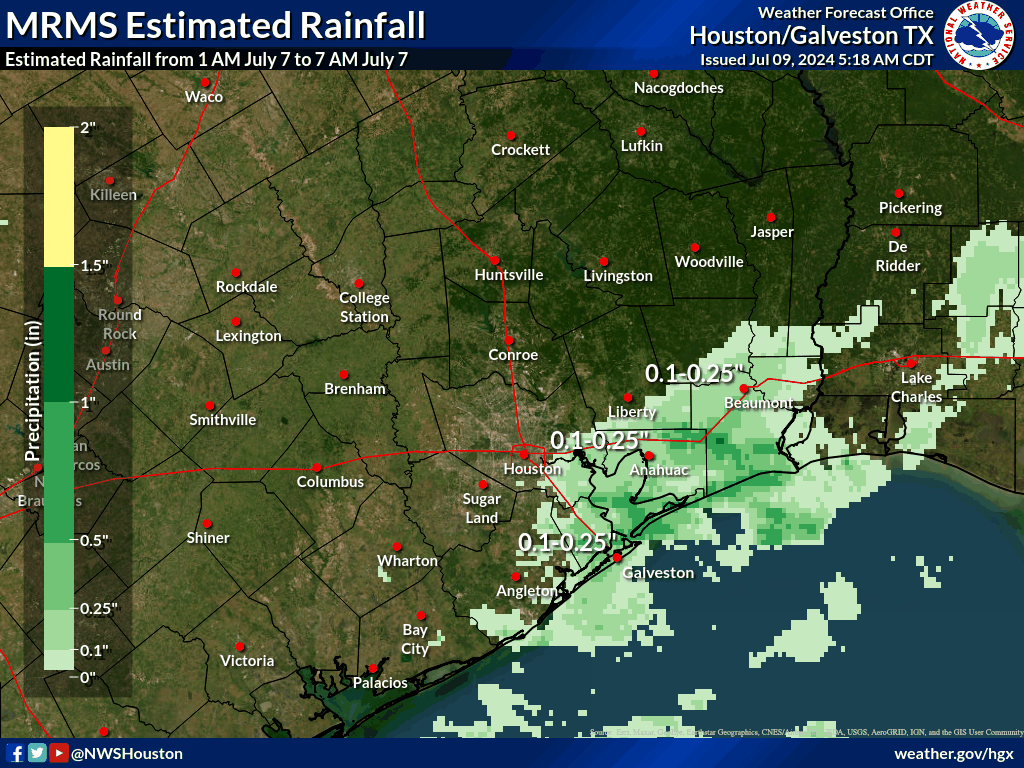
Rainfall

Rainfall Reports
...UNOFFICIAL 48 HOUR RAINFALL REPORTS THROUGH 1030 AM, MONDAY JULY 8...

Location                     Amount     Provider

...Texas...

...Austin County...
7.3 NE Eagle Lake            4.69 in    ALERT
Eagle Lake 7 NE              4.69 in    LCRA
San Felipe 1.0 WNW           3.30 in    COCORAHS
Cat Spring 3.7 N             3.17 in    COCORAHS
Sealy 0.3 WNW                3.08 in    COCORAHS
Bellville 1 SW               2.70 in    LCRA
Bellville 1 Sw               2.69 in    ALERT
Bellville 7.8 SSW            2.55 in    COCORAHS
Sealy 9.6 NW                 2.18 in    COCORAHS
7.2 NE Eagle Lake            1.84 in    HADS
Industry 3 W                 1.69 in    LCRA
8.8 NE Fayetteville          1.67 in    ALERT

...Brazoria County...
4.2 W Brookside Village (HCF 11.76 in   MESOWEST
4925 Country Place Ditch At  11.00 in   MESOWEST
Lake Jackson 2.3 NW          10.79 in   COCORAHS
1.2 E Brookside Village (HCF 10.52 in   MESOWEST
Lake Jackson 1.6 E           10.17 in   COCORAHS
4985 Mustang Bayou At Cr 48  9.96 in    MESOWEST
Marys Creek At Veterans Driv 9.76 in    MESOWEST
4980 Mustang Bayou At Sh 288 9.60 in    MESOWEST
Veterans At Hastings-Cannon  9.56 in    MESOWEST
4935 Cowart Creek Diversion  9.44 in    MESOWEST
Clear Creek At Pearland Park 9.24 in    MESOWEST
4942 Brazoria Drainage Distr 9.20 in    MESOWEST
Hickory Slough At Max Road   9.16 in    MESOWEST
4954 Rodeo Palms Ditch At Sh 9.12 in    MESOWEST
4955 Resoft Park Ditch At Sh 9.04 in    MESOWEST
1.3 E Pearland (HCFCD)       8.60 in    MESOWEST
4947 Hickory Slough At Sh 28 8.52 in    MESOWEST
Marys Creek At Fm 1128       8.48 in    MESOWEST
Cowarts Creek At Cloverfield 8.48 in    MESOWEST
Brazoria 4.2 W               8.44 in    COCORAHS
145 Clear Creek At Fm 1959   8.36 in    MESOWEST
Cowarts Creek At Dixie Farm  8.24 in    MESOWEST
West Columbia 2.5 ENE        8.19 in    COCORAHS
4952 West Fork Chocolate Bay 8.16 in    MESOWEST
Hickory Slough At Mykawa     8.00 in    MESOWEST
San Bernard Nwr              7.86 in    RAWS
Marys Creek At Longherridge  7.84 in    MESOWEST
4965 Leclaire Ditch At Hwy 3 7.60 in    MESOWEST
4960 Old Chigger Creek At Sh 7.24 in    MESOWEST
1.6 E Freeport               6.86 in    HADS
1.0 W Freeport               5.96 in    ALERT
Pearland                     5.92 in    ASOS
Brazoria Nwr                 5.59 in    RAWS
1.6 E Freeport               5.24 in    HADS
Damon 1 NNW                  4.80 in    LCRA
Brazoria County Airport      4.12 in    ASOS

...Chambers County...
Hackberry Gully At I-10      8.88 in    MESOWEST
Smith Gully At Sh 146        7.04 in    MESOWEST
Cotton Bayou At Lakes Of Cha 6.36 in    MESOWEST
Anahuac                      4.97 in    RAWS
Beach City 4.8 SSW           3.99 in    COCORAHS
7.4 N Anahuac                1.99 in    HADS

...Colorado County...
Attwater Nwr                 4.56 in    RAWS
10.5 NE Speaks (DATAWISE)    4.06 in    MESOWEST
13.5 S Columbus              3.12 in    ALERT
11.2 SW Eagle Lake (DATAWISE 3.11 in    MESOWEST
Colorado River at Columbus   2.93 in    LCRA
0.9 E Columbus               2.80 in    COOP
0.9 E Columbus               2.80 in    COOP
Colorado River near Altair   2.75 in    LCRA
14.4 S Columbus (DATAWISE)   2.60 in    MESOWEST
New Ulm 7.2 S                2.51 in    COCORAHS
7.9 SE Fayetteville          2.43 in    ALERT
Cummins Creek near Frelsburg 2.43 in    LCRA
Weimar 5.3 SW                2.31 in    COCORAHS
Weimar 10.8 SSE              2.01 in    COCORAHS
Weimar 4.8 ESE               1.99 in    COCORAHS
6.6 NE Eagle Lake            1.96 in    HADS
Weimar 5.0 E                 1.77 in    COCORAHS
Columbus 4.0 SSE             1.62 in    COCORAHS

...Fort Bend County...
2.2 SW Sugar Land            13.32 in   ALERT
4525 Ditch E At Austin Parkw 10.84 in   MESOWEST
First Colony                 10.80 in   ALERT
4130 Oyster Creek At Lexingt 10.52 in   MESOWEST
4680 New Territory Blvd      10.40 in   MESOWEST
4120 Oyster Creek At William 10.36 in   MESOWEST
4040 Stafford Run At Court R 10.28 in   MESOWEST
Oyster Creek At Dam Number 2 10.00 in   MESOWEST
Amil Gates At Sh 6           10.00 in   MESOWEST
4030 Lexington At Hunter?s T 9.92 in    MESOWEST
4575 Gates At Steep Bank Cre 9.88 in    MESOWEST
4545 Upper Ditch A At First  9.88 in    MESOWEST
4670 New Territory Pump Stat 9.76 in    MESOWEST
4010 Txdot Channel           9.72 in    MESOWEST
4512 Telfair North Pump Stat 9.64 in    MESOWEST
4025 North Ditch             9.60 in    MESOWEST
4514 Dawnington Place        9.56 in    MESOWEST
4655 New Territory Treatment 9.56 in    MESOWEST
4035 Ditch B-1               9.52 in    MESOWEST
4505 Ditch H At University B 9.40 in    MESOWEST
4645 Amherst Court           9.36 in    MESOWEST
4595 Bullhead Slough At East 9.36 in    MESOWEST
8004 Oyster Creek At Mason R 9.32 in    MESOWEST
Ditch A 22 At Burney Road    9.08 in    MESOWEST
4560 Ditch C At Ditch C1     8.92 in    MESOWEST
Oyster Creek At Sh 6         8.84 in    MESOWEST
Ditch H At Ditch F           8.76 in    MESOWEST
4630 Greatwood Parkway       8.64 in    MESOWEST
Richmond 2.6 SE              8.62 in    COCORAHS
8410 Flat Bank Creek At Sien 8.56 in    MESOWEST
4015 Cangelosi At Buffalo Ru 8.48 in    MESOWEST
4490 Covington Ditch At Jess 8.32 in    MESOWEST
4430 Siphon B At Ditch B     8.32 in    MESOWEST
4140 Jane Long Lake At Count 8.28 in    MESOWEST
4515 Alcorn Lake Outfall At  8.24 in    MESOWEST
4565 Lakes Of Austin Park    8.24 in    MESOWEST
8002 Flewellen Creek At Fm 1 8.20 in    MESOWEST
8003 Red Gully At West Airpo 8.08 in    MESOWEST
4150 Oyster Creek At Dulles  7.92 in    MESOWEST
Ditch 90 A At Eldridge Road  7.84 in    MESOWEST
Ditch B At Dulles Road       7.80 in    MESOWEST
4495 Ditch A-22 At Jess Pirt 7.76 in    MESOWEST
4620 Winding Brook Dr        7.72 in    MESOWEST
4540 Ditch C At Austin Parkw 7.68 in    MESOWEST
4760 Big Creek At Fm 1994    7.60 in    MESOWEST
8510 Bessies Creek At Fm 109 7.52 in    MESOWEST
8001 Rabbs Bayou At Del Webb 7.52 in    MESOWEST
8250 Dutch John Creek At Bra 7.48 in    MESOWEST
Missouri City 5.1 SSE        7.36 in    COCORAHS
4005 Willow At Cravens       7.32 in    MESOWEST
4000 Willow At Gessner       7.32 in    MESOWEST
Houston Southwst             7.13 in    AWOS
4110 Ditch A 22 At Bournwood 7.04 in    MESOWEST
2 NNW Richmond               7.04 in    COCORAHS
Richmond 2.7 NNE             6.93 in    COCORAHS
4450 East Sugar Creek Ditch  6.92 in    MESOWEST
Keegans Bayou At Rocky Valle 6.84 in    MESOWEST
8280 Coon Creek At Kroesche  6.84 in    MESOWEST
4160 Northwest Detention Pon 6.84 in    MESOWEST
Clodine Ditch At Grand Missi 6.76 in    MESOWEST
8610 Jones Creek At Fm 723   6.72 in    MESOWEST
8030 Brazos River At Fm 1489 6.16 in    MESOWEST
0.9 S Katy (HCFCD)           5.92 in    MESOWEST
4170 Northwest Detention Pon 5.92 in    MESOWEST
8270 Seaborne Creek At Sh 36 5.88 in    MESOWEST
Ditch A Outfall              5.84 in    MESOWEST
8000 Fairchilds Creek At Fm  5.68 in    MESOWEST
8005 Willow Fork Diversion A 5.44 in    MESOWEST
Houston Sugar La             3.78 in    AWOS

...Galveston County...
2.0 SW Friendswood (HCFCD)   10.20 in   MESOWEST
1.2 E Friendswood (HCFCD)    10.16 in   MESOWEST
5100 Chigger Creek At South  9.36 in    MESOWEST
5240 Magnolia Creek At Bay A 9.20 in    MESOWEST
5230 Landing Ditch At West M 9.12 in    MESOWEST
5150 Cowarts Creek At West C 8.56 in    MESOWEST
9020 Ditch 6 At Cowan Road   8.16 in    MESOWEST
2.5 NW Friendswood (HCFCD)   8.12 in    MESOWEST
1.8 N Friendswood            8.04 in    ALERT
Texas City 3.5 W             7.87 in    COCORAHS
1.2 E Friendswood            7.84 in    ALERT
1.5 W Friendswood (HCFCD)    7.64 in    MESOWEST
9030 Dickinson Bayou At Fm 6 7.52 in    MESOWEST
9040 Cloud Bayou At Highland 7.12 in    MESOWEST
Friendswood 0.2 NNW          6.80 in    COCORAHS
5340 Bordens Gully At Hughes 6.56 in    MESOWEST
9050 Willow Bayou At Baker S 6.24 in    MESOWEST
League City 2.7 NE           6.05 in    COCORAHS
9010 Highland Bayou At Avenu 6.00 in    MESOWEST
2.6 SE Bacliff               5.84 in    ALERT
4270 21st Street At Harborsi 5.84 in    MESOWEST
5350 Dickinson Bayou At Hwy  5.32 in    MESOWEST
5330 Benson Bayou At Fm 646  5.08 in    MESOWEST
5220 Robinson Bayou At Egret 5.04 in    MESOWEST
Dickinson 0.4 SSW            5.01 in    COCORAHS
3.1 SE San Leon              4.86 in    HADS
5320 Gum Bayou At Fm 646     4.48 in    MESOWEST
La Marque 1.8 E              4.40 in    COCORAHS
League City 2.4 ENE          3.61 in    COCORAHS
Galveston                    2.62 in    ASOS
Galveston 5.6 NE             2.60 in    COCORAHS
2.1 NW Bayou Vista           2.34 in    HADS

...Grimes County...
Mill Creek At Fm 1774        4.16 in    MESOWEST

...Harris County...
2.8 E Hilshire Village       14.88 in   ALERT
Houston 3.5 WSW              13.55 in   COCORAHS
Hilshire Village 2.7 NNE     13.41 in   COCORAHS
5.5 N Hilshire Village (HCFC 11.96 in   MESOWEST
3070 Sh 288 At Loop 610      11.76 in   MESOWEST
2.4 E West University Place  11.68 in   MESOWEST
1.9 SE Southside Place       11.08 in   ALERT
8.0 N Mission Bend           11.00 in   ALERT
1.4 W Houston (HCFCD)        10.80 in   MESOWEST
0.6 NE Spring Valley (HCFCD) 10.76 in   MESOWEST
380 Sims Bayou At Hiram Clar 10.72 in   MESOWEST
5.2 NW Brookside Village (HC 10.64 in   MESOWEST
Ih10 At Silber               10.44 in   MESOWEST
1.9 SW Aldine (HCFCD)        10.40 in   MESOWEST
Briar Branch At Campbell Roa 10.16 in   MESOWEST
Willow Water Hole At Landsdo 10.16 in   MESOWEST
2.8 NE Hilshire Village (HCF 10.12 in   MESOWEST
6.3 N Mission Bend           10.12 in   ALERT
Ih10 Uprr Eof 610            10.08 in   MESOWEST
Sh-59 At Mcgowen             9.96 in    MESOWEST
0.9 SE Piney Point Village ( 9.92 in    MESOWEST
1.3 S Southside Place (HCFCD 9.92 in    MESOWEST
2.7 S Bellaire (HCFCD)       9.88 in    MESOWEST
4.2 NE Hilshire Village (HCF 9.84 in    MESOWEST
2.5 E Friendswood (HCFCD)    9.76 in    MESOWEST
4.3 SE Aldine (HCFCD)        9.72 in    MESOWEST
6.6 N Hilshire Village (HCFC 9.72 in    MESOWEST
5.6 N Hilshire Village (HCFC 9.72 in    MESOWEST
1.5 E Houston (HCFCD)        9.68 in    MESOWEST
8.1 SW Jersey Village (HCFCD 9.68 in    MESOWEST
2.3 SE Houston               9.64 in    ALERT
Houston 2.8 SSW              9.64 in    COCORAHS
2.7 S Bellaire               9.64 in    ALERT
7.7 W Jersey Village (HCFCD) 9.60 in    MESOWEST
3.5 NW Houston (HCFCD)       9.56 in    MESOWEST
2.0 NE Houston (HCFCD)       9.40 in    MESOWEST
Brickhouse Gully At Holliste 9.32 in    MESOWEST
4.2 E Aldine (HCFCD)         9.28 in    MESOWEST
2.5 W Bunker Hill Village (H 9.24 in    MESOWEST
3.9 NE Hilshire Village (HCF 9.24 in    MESOWEST
Buttermilk Creek At Moorberr 9.16 in    MESOWEST
3620 Ih 45 At Hov North Trav 9.12 in    MESOWEST
4.9 S Aldine (HCFCD)         9.12 in    MESOWEST
2245 Buffalo Bayou At Woodwa 9.12 in    MESOWEST
1.8 S Bellaire (HCFCD)       9.04 in    MESOWEST
4.0 W Jersey Village (HCFCD) 9.04 in    MESOWEST
0.7 E Jersey Village (HCFCD) 8.88 in    MESOWEST
1.4 NW South Houston         8.84 in    ALERT
2.7 E Jersey Village (HCFCD) 8.84 in    MESOWEST
4.0 N Brookside Village (HCF 8.84 in    MESOWEST
6.2 NE Katy (HCFCD)          8.80 in    MESOWEST
Cedar Bayou At Fm1942        8.64 in    MESOWEST
1.5 SW Humble                8.64 in    ALERT
2.1 S Humble (HCFCD)         8.64 in    MESOWEST
1.6 SE Southside Place (HCFC 8.60 in    MESOWEST
3010 Sh 288 At Macgregor     8.52 in    MESOWEST
8.1 NW Jersey Village (HCFCD 8.52 in    MESOWEST
1695 P138 At Aldine Westfiel 8.52 in    MESOWEST
1.9 W Barrett (HCFCD)        8.48 in    MESOWEST
South Mayde Creek At Morton  8.44 in    MESOWEST
4.4 SE Aldine                8.36 in    ALERT
4.0 NE Stafford (HCFCD)      8.28 in    MESOWEST
8.8 NE Jersey Village (HCFCD 8.24 in    MESOWEST
5.0 N Jacinto City (HCFCD)   8.20 in    MESOWEST
6.3 NW Jacinto City (HCFCD)  8.20 in    MESOWEST
7.3 S Humble (HCFCD)         8.20 in    MESOWEST
1.4 NW South Houston (HCFCD) 8.04 in    MESOWEST
4.2 E Aldine                 8.04 in    HADS
2.2 SW Sheldon (HCFCD)       8.00 in    MESOWEST
4.6 SE Humble (HCFCD)        8.00 in    MESOWEST
5.5 NW Cloverleaf (HCFCD)    8.00 in    MESOWEST
3.3 SE Galena Park           8.00 in    ALERT
West University Place 0.4 WN 7.96 in    COCORAHS
4.5 W Galena Park (HCFCD)    7.80 in    MESOWEST
2.3 NW Jersey Village (HCFCD 7.76 in    MESOWEST
1.8 NE Cloverleaf (HCFCD)    7.72 in    MESOWEST
4820 I-10 At Wayside         7.72 in    MESOWEST
4.1 NE Pearland              7.64 in    ALERT
1.8 SE Cloverleaf (HCFCD)    7.64 in    MESOWEST
1.6 SW Bellaire              7.61 in    COOP
Bunker Hill Village 3.9 WNW  7.60 in    COCORAHS
4.7 NE Katy (HCFCD)          7.56 in    MESOWEST
4.1 NE Pearland (HCFCD)      7.56 in    MESOWEST
5.9 NE Jersey Village (HCFCD 7.56 in    MESOWEST
4.0 N Meadows (HCFCD)        7.56 in    MESOWEST
0.6 NW Pasadena              7.56 in    ALERT
2.3 NE Aldine (HCFCD)        7.44 in    MESOWEST
6.3 NW Jacinto City          7.44 in    ALERT
1.1 NW Meadows (HCFCD)       7.44 in    MESOWEST
3.4 SE Galena Park (HCFCD)   7.44 in    MESOWEST
2.5 NW Pasadena (HCFCD)      7.44 in    MESOWEST
3.5 NE Meadows (HCFCD)       7.36 in    MESOWEST
6.7 N Jersey Village (HCFCD) 7.28 in    MESOWEST
6.3 NW Mission Bend (HCFCD)  7.28 in    MESOWEST
Hedwig Village 2.0 SW        7.18 in    COCORAHS
South Houston (HCFCD)        7.16 in    MESOWEST
2.5 NW Jacinto City (HCFCD)  7.16 in    MESOWEST
North Fork Greens Bayou At E 7.16 in    MESOWEST
1.7 N League City (HCFCD)    7.12 in    MESOWEST
South Houston                7.08 in    ALERT
2.2 SW Sheldon               7.08 in    ALERT
2.5 NW Jacinto City          7.08 in    ALERT
0.6 S Taylor Lake Village (H 7.08 in    MESOWEST
2.5 SW Spring                7.04 in    ALERT
2.5 SW Spring (HCFCD)        7.04 in    MESOWEST
3.0 SE Pasadena (HCFCD)      7.00 in    MESOWEST
5.0 N Friendswood            7.00 in    ALERT
5.2 NW Jacinto City (HCFCD)  6.92 in    MESOWEST
1.0 SW Taylor Lake Village ( 6.88 in    MESOWEST
Cane Island Branch At Clay R 6.88 in    MESOWEST
1.7 W Crosby                 6.88 in    ALERT
5.3 W Bunker Hill Village    6.88 in    ALERT
Ih10 At Eldridge             6.88 in    MESOWEST
7.8 N Mission Bend (HCFCD)   6.88 in    MESOWEST
6.2 N Jersey Village (HCFCD) 6.80 in    MESOWEST
3.5 E Baytown (HCFCD)        6.80 in    MESOWEST
4.5 W Bunker Hill Village (H 6.72 in    MESOWEST
660 Boggy Bayou At San Augus 6.72 in    MESOWEST
Cypress Creek At Eldridge Pa 6.72 in    MESOWEST
4.9 N Jacinto City           6.72 in    ALERT
6.3 NW Jersey Village (HCFCD 6.72 in    MESOWEST
1.6 SE Pasadena              6.72 in    ALERT
South Houston 3.0 S          6.70 in    COCORAHS
3.8 NW Aldine (HCFCD)        6.68 in    MESOWEST
3.3 NW Taylor Lake Village   6.64 in    ALERT
Ih10 At Sh6                  6.56 in    MESOWEST
Houston 2.1 SSW              6.56 in    COCORAHS
3.9 N Sheldon                6.53 in    HADS
1.9 NE Mission Bend (HCFCD)  6.52 in    MESOWEST
7.2 NW Jersey Village (HCFCD 6.52 in    MESOWEST
3.1 SE Waller                6.52 in    ALERT
1.9 W Barrett                6.52 in    ALERT
245 Armand Bayou At Space Ce 6.48 in    MESOWEST
5.0 N Friendswood (HCFCD)    6.48 in    MESOWEST
910 Vince Bayou At Fairmont  6.48 in    MESOWEST
3.2 SW Spring (HCFCD)        6.48 in    MESOWEST
3060 Ih 10 At Normandy       6.44 in    MESOWEST
1.7 SW Cloverleaf            6.44 in    ALERT
3.3 S Oak Ridge North (HCFCD 6.44 in    MESOWEST
2.4 NW Baytown (HCFCD)       6.40 in    MESOWEST
6.1 W Spring (HCFCD)         6.32 in    MESOWEST
3.2 SW Spring                6.28 in    ALERT
0.9 NE Jacinto City (HCFCD)  6.24 in    MESOWEST
3.4 S Oak Ridge North        6.24 in    HADS
1550 Goose Creek At I-10     6.20 in    MESOWEST
3.9 SE Spring                6.16 in    ALERT
3.9 SE Spring (HCFCD)        6.12 in    MESOWEST
4.6 SE Humble                6.12 in    HADS
Houston 5 E                  6.12 in    COOP
5.5 NW Cloverleaf            6.08 in    ALERT
2.8 N Nassau Bay (HCFCD)     6.08 in    MESOWEST
Spring Creek At Cypress Rose 6.04 in    MESOWEST
1.9 W Crosby (HCFCD)         6.00 in    MESOWEST
2.2 W Cloverleaf (HCFCD)     6.00 in    MESOWEST
8.5 N Katy                   6.00 in    HADS
3.2 SW Spring                6.00 in    ALERT
0.8 NE Jacinto City          5.96 in    ALERT
Bunker Hill Village 3.6 NNW  5.95 in    COCORAHS
3.2 W Jacinto City (HCFCD)   5.92 in    MESOWEST
3.8 N Meadows (HCFCD)        5.80 in    MESOWEST
Tomball Repeater             5.72 in    MESOWEST
2.2 N Humble                 5.60 in    ALERT
4.2 E Tomball (HCFCD)        5.52 in    MESOWEST
Jersey Village 8.5 NW        5.46 in    COCORAHS
Houston Hobby                5.45 in    ASOS
4810 I-10 At 610             5.40 in    MESOWEST
7.7 E Waller (HCFCD)         5.40 in    MESOWEST
4.2 E Tomball                5.40 in    ALERT
2.4 S Tomball (HCFCD)        5.32 in    MESOWEST
Bellaire 3.1 W               5.22 in    COCORAHS
Houston 7.7 W                5.20 in    COCORAHS
2.4 N South Houston (HCFCD)  5.12 in    MESOWEST
2.4 N South Houston          5.04 in    HADS
Houston Intnl                5.01 in    ASOS
Houston Dw Hooks             4.97 in    ASOS
1.7 E Cloverleaf             4.92 in    ALERT
0.7 S Nassau Bay (HCFCD)     4.84 in    MESOWEST
Hunters Creek Village        4.84 in    URBANET
10.5 N Katy (HCFCD)          4.84 in    MESOWEST
0.8 NW Houston (HCFCD)       4.64 in    MESOWEST
7.4 SW Tomball (HCFCD)       4.60 in    MESOWEST
5.2 E Waller (HCFCD)         4.60 in    MESOWEST
5 N Fresno                   4.60 in    URBANET
5.8 W Bunker Hill Village (H 4.52 in    MESOWEST
5.2 E Waller                 4.40 in    ALERT
5.3 E Kingwood (HCFCD)       4.36 in    MESOWEST
Huffman Repeater             4.08 in    MESOWEST
Pasadena 4.4 WNW             4.06 in    COCORAHS
1745 Cedar Bayou At Fm 1960  3.96 in    MESOWEST
610 At Ship Channel          3.88 in    MESOWEST
Houston 5.9 SW               3.65 in    COCORAHS
2.2 S Kingwood (HCFCD)       3.52 in    MESOWEST
4830 Kelly At 59             3.08 in    MESOWEST
Hockley 2.5 ESE              3.08 in    COCORAHS
City of Pasadena - Pasaden P 3.04 in    URBANET
2.0 SE Southside Place (HCFC 2.68 in    MESOWEST
4 NNE Fresno                 2.64 in    URBANET
4800 Clinton                 2.40 in    MESOWEST
4.7 SE Houston               2.32 in    ALERT
Harris County Flood Control  2.20 in    MESOWEST
1.3 NW Houston               1.96 in    HADS
4.9 N Jacinto City           1.72 in    ALERT
1 W La Porte                 1.68 in    AWOS
0.6 NE Spring Valley         1.56 in    ALERT
605 Taylor Lake At Port Road 1.56 in    MESOWEST

...Jackson County...
Ganado 1.5 W                 8.45 in    COCORAHS
7.0 S Ganado (DATAWISE)      5.82 in    MESOWEST
3.9 NW Ganado (DATAWISE)     5.08 in    MESOWEST
8.4 N Ganado (DATAWISE)      3.94 in    MESOWEST
7.0 NW Ganado (DATAWISE)     3.23 in    MESOWEST
7.2 N Edna (DATAWISE)        2.52 in    MESOWEST
7.0 W La Ward (DATAWISE)     2.52 in    MESOWEST
7.1 SE Edna (DATAWISE)       2.36 in    MESOWEST
6.4 SE Edna (DATAWISE)       2.01 in    MESOWEST
2.5 W Edna (DATAWISE)        1.89 in    MESOWEST
2.8 N Edna (DATAWISE)        1.77 in    MESOWEST
Edna (DATAWISE)              1.50 in    MESOWEST

...Liberty County...
6.0 NE Crosby (HCFCD)        4.60 in    MESOWEST
1.6 W Cleveland              4.32 in    HADS
1960 Luce Bayou At Sh 321    4.20 in    MESOWEST
Dayton                       4.09 in    RAWS
East Fork San Jacinto At Fm  3.28 in    MESOWEST
10.1 SE Shepherd             2.43 in    HADS

...Matagorda County...
7.0 W Markham (DATAWISE)     8.15 in    MESOWEST
Palacios                     7.84 in    AWOS
2.9 W Bay City               6.94 in    HADS
Colorado River at Bay City   6.94 in    LCRA
Palacios 11.5 NNE            6.65 in    COCORAHS
Bay City                     6.41 in    AWOS
14.6 S Sweeny                5.85 in    ALERT
Sargent 1 ENE                5.85 in    LCRA
Midfield                     5.32 in    LCRA

...Montgomery County...
Woodlands Parkway Nr Mcbeth  6.36 in    MESOWEST
3.2 W The Woodlands (HCFCD)  6.08 in    MESOWEST
Bear Branch At 2978          5.92 in    MESOWEST
3.2 W The Woodlands          5.92 in    ALERT
2.8 NE Tomball (HCFCD)       5.92 in    MESOWEST
3.2 W The Woodlands          5.84 in    ALERT
Grogans Point Rd Nr Red Sabl 5.80 in    MESOWEST
2.3 NW Tomball (HCFCD)       5.80 in    MESOWEST
Bear Branch At Kuykendahl    5.72 in    MESOWEST
Mill Creek At Fm 149         5.72 in    MESOWEST
Wjpa Field Office Nr Researc 5.48 in    MESOWEST
770 San Jacinto River At Sh  5.40 in    MESOWEST
Alden Branch At Alden Bridge 5.16 in    MESOWEST
2.4 NW Tomball               5.16 in    USGS
3.1 SE Roman Forest          5.04 in    HADS
Grogans Mill Road Nr Researc 4.88 in    MESOWEST
Walnut Creek At Nichols Sawm 4.88 in    MESOWEST
0.9 W Willis                 4.56 in    ALERT
1.9 W Shenandoah             4.53 in    HADS
The Woodlands 2.9 SSE        4.47 in    COCORAHS
Panther Branch At 1488       4.40 in    MESOWEST
Conroe                       4.33 in    RAWS
Mill Creek At Fm 1486        4.32 in    MESOWEST
3.1 SE Roman Forest (HCFCD)  4.28 in    MESOWEST
Lake Creek At Egypt          4.28 in    MESOWEST
Splendora                    4.20 in    HADS
6.3 SE Cut And Shoot         4.16 in    ALERT
Flamingo Lake                3.92 in    MESOWEST
Campbell                     3.56 in    MESOWEST
Conroe                       3.44 in    ASOS
Lake Creek At Dobbin         3.12 in    MESOWEST
Willis 4.4 E                 3.10 in    COCORAHS
West Caney Creek At 1375     2.68 in    MESOWEST
Willis 2.2 SW                2.56 in    COCORAHS
1.8 SE The Woodlands         2.53 in    HADS
Union Grove                  2.52 in    MESOWEST
Conroe 3.7 S                 2.33 in    COCORAHS
Spring 5.7 N                 2.25 in    COCORAHS
5 WSW Stagecoach             2.22 in    COCORAHS
4.6 W Montgomery             2.02 in    HADS
3 W Stagecoach               2.01 in    COCORAHS
Spring 4.2 N                 1.77 in    COCORAHS
The Woodlands 4.6 NNW        1.73 in    COCORAHS
The Woodlands 5.0 NW         1.69 in    COCORAHS
Lewis Creek                  1.64 in    MESOWEST
Fm 1097at Lk Conroe          1.56 in    MESOWEST
6 WNW Willis                 1.50 in    COCORAHS

...Polk County...
Tra Kickapoo Creek At Onalas 3.24 in    MESOWEST
1.4 W Livingston             1.66 in    HADS

...San Jacinto County...
Coldsprings                  4.08 in    RAWS
Tra Wolf Creek Park          3.92 in    MESOWEST

...Trinity County...
8.6 SW Groveton              2.36 in    ALERT
Tra Chita Backup Repeater    2.20 in    MESOWEST

...Walker County...
West Sandy Creek             2.88 in    MESOWEST
Lake Conroe At 1375          2.72 in    MESOWEST
Wcfg                         2.56 in    MESOWEST
West Fork San Jacinto At Hwy 2.52 in    MESOWEST
Elkins Lake                  2.48 in    MESOWEST
Huntsville                   2.03 in    RAWS
Huntsville                   1.74 in    ASOS
Loma                         1.64 in    MESOWEST
10.8 W Riverside             1.64 in    ALERT

...Waller County...
3.7 S Waller (HCFCD)         7.04 in    MESOWEST
2520 Bessie Creek At Fm 359  6.76 in    MESOWEST
2510 Brookshire Creek At Us  6.60 in    MESOWEST
Willow Fork Creek At Pederso 6.60 in    MESOWEST
Brookshire Katy Drainage Dis 5.96 in    MESOWEST
4610 Brazos River At I-10    5.72 in    MESOWEST
Walnut Creek At Joseph Road  5.36 in    MESOWEST
Mound Creek At Fm 362        5.08 in    MESOWEST
Birch Creek At Riley Road    5.04 in    MESOWEST
Threemile Creek At Joseph Ro 4.32 in    MESOWEST
2560 Irons Creek At Fm 529   3.84 in    MESOWEST
2595 Clear Creek At Us 290 B 3.84 in    MESOWEST
2580 Clear Creek At Fm 1887  3.68 in    MESOWEST
Threemile Creek At Fm 362    2.32 in    MESOWEST

...Washington County...
Brenham 1.3 ESE              1.81 in    COCORAHS

...Wharton County...
Colorado River near Lane Cit 7.86 in    LCRA
6.0 E Ganado (DATAWISE)      7.79 in    MESOWEST
El Campo 2 NW                5.77 in    LCRA
1.7 NW El Campo              5.76 in    ALERT
0.6 SW Wharton               5.73 in    COOP
Colorado River at Wharton    5.72 in    LCRA
0.6 SW Wharton               5.70 in    COOP
El Campo 4.9 SSE             5.66 in    COCORAHS
10.6 NW El Campo             5.63 in    ALERT
San Bernard River at East Be 5.48 in    LCRA
El Campo 15 WSW              5.45 in    LCRA
Colorado River near Glen Flo 4.05 in    LCRA
6.1 W Wharton                4.04 in    ALERT
7.5 NW El Campo (DATAWISE)   3.46 in    MESOWEST
10.3 NW El Campo (DATAWISE)  3.27 in    MESOWEST

...Maritime Stations...
O100 1520 Goose Creek @ Sh 1 6.32 in    MESOWEST
Matagorda 1 S                5.90 in    LCRA

Observations are collected from a variety of sources with varying
equipment and exposures. We thank all volunteer weather observers
for their dedication. Not all data listed are considered official.
Photos & Video
Header
| Caption (source) |
Caption (source) |
Caption (source) |
Caption (source) |
Storm Surge
Here is a space for a brief description of the storm surge impacts of the storm. Be sure to mention where the highest surge was!
| Caption 1 - Maybe a Storm Surge Map |
Caption 2 | Caption 3 - Try a coastal hydrograph |
Caption 4 |
SURGE REPORTS
| Site Name | Latitude | Longitude | County | Max Water Level (ft) | Datum | Time (UTC) |
| Galveston Bay Entrance | 29.3600 | -94.7200 | Galveston | 3.52 | MHHW | 1148 |
| Rollover Pass | 29.5200 | -94.5100 | Galveston | 4.98 | MHHW | 1930 |
| High Island | 29.5900 | -94.3900 | Galveston | 3.13 | MHHW | 2006 |
| Morgans Point | 29.6800 | -94.9800 | Harris | 5.54 | MHHW | 1342 |
| Manchester | 29.7300 | -95.2700 | Harris | 8.79 | MHHW | 1518 |
| Eagle Point | 29.4800 | -94.9183 | Harris | 3.57 | MHHW | 1130 |
| Galveston Pier 21 | 29.3100 | -94.7930 | Galveston | 3.38 | MHHW | 1236 |
| Galveston Railroad Bridge | 29.3000 | -94.9000 | Galveston | 3.82 | MHHW | 1318 |
| San Luis Pass | 29.0900 | -95.1100 | Brazoria | 3.50 | MHHW | 1200 |
| Freeport Harbor | 28.9300 | -95.3000 | Brazoria | |||
| Sargent | 28.7700 | -95.6200 | Matagorda | |||
| Matagorda City | 28.7100 | -95.9100 | Matagorda | 3.09 | MHHW | 0754 |
| Matagorda Bay Entrance | 28.4300 | -96.3300 | Matagorda | 2.76 | MHHW | 0730 |
Tornadoes:
|
Tornado - LOCATION
Track Map 
Downloadable KMZ File |
||||||||||||||||
The Enhanced Fujita (EF) Scale classifies tornadoes into the following categories:
| EF0 Weak 65-85 mph |
EF1 Moderate 86-110 mph |
EF2 Significant 111-135 mph |
EF3 Severe 136-165 mph |
EF4 Extreme 166-200 mph |
EF5 Catastrophic 200+ mph |
 |
|||||
Radar & Satellite Imagery
Header
 |
.gif) |
||
| Loop of 6-hour Estimated Rainfall from Beryl |
Radar loop of Beryl's landfall |
Caption | Caption |
Photos & Video
Header
| Caption (source) |
Caption (source) |
Caption (source) |
Caption (source) |
 |
Media use of NWS Web News Stories is encouraged! Please acknowledge the NWS as the source of any news information accessed from this site. |
|

