Downbursts are relatively small areas of strong, often damaging winds produced by air rapidly descending in a thunderstorm. When the descending air reaches the ground it spreads in straights lines from the point of contact.
Downbursts are sometimes described as a microburst when it covers an area of less the 2.5 square miles and last 3-7 minutes, or macroburst when they cover larger areas or last for more than 7 minutes. On rare occasions, downbursts can have wind speeds in excess of 150 mph.
Downbursts, can be either considered as "wet" or "dry".
There are several visual signs that a downburst is either underway or about to occur.
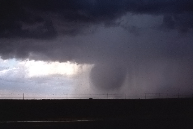
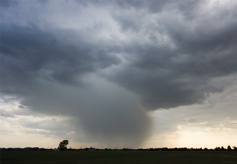
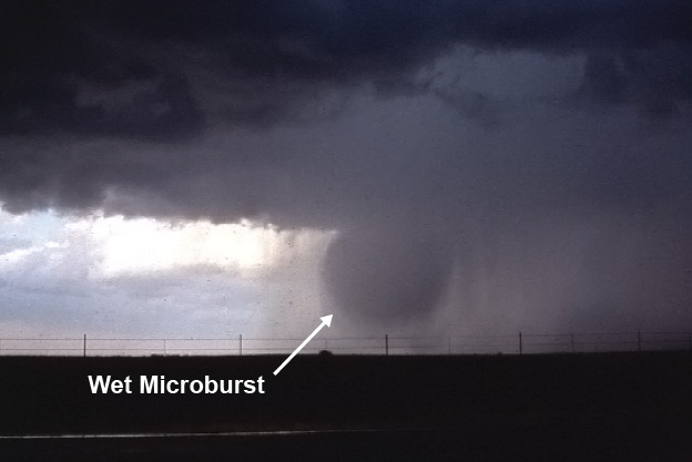
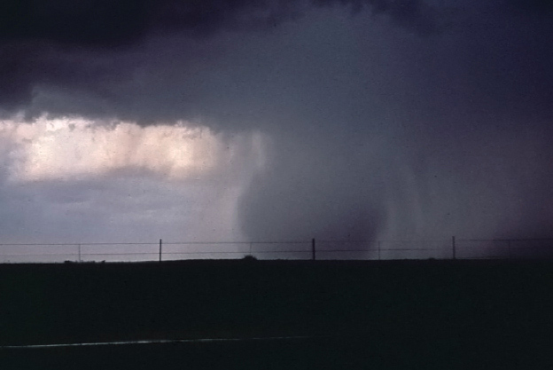
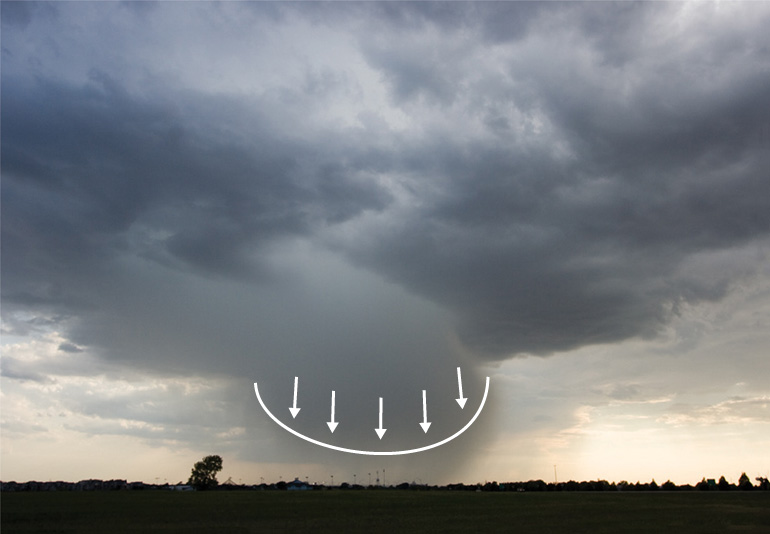
Wet downbursts appear as rapidly descending rounded balls of rain. The balls of rain appear opaque with semi-transparancy visibility below the falling downbursts.
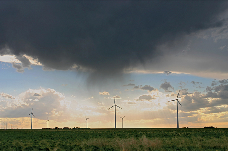
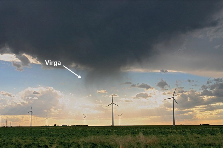
Precipitation falling from the cloud, but does not reach the ground. The atmosphere below the clouds tends to be very dry and rainfall evaporates before it touches the ground.
This cools the air, increasing the air's density, with gravity pulling the dense air toward the surface. Gusty winds occur in the area of the virga.
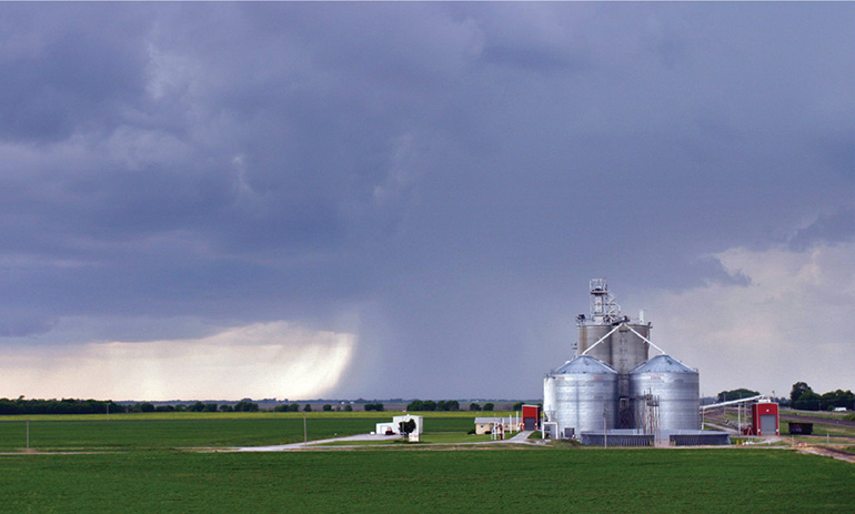
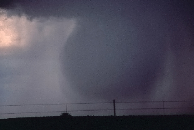
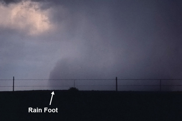
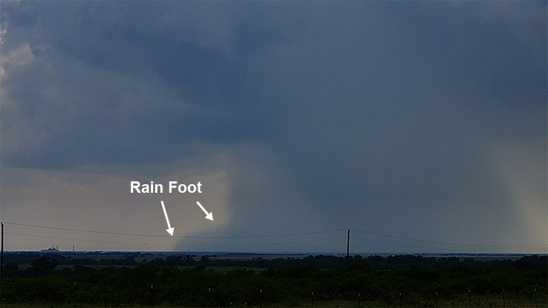
The rain foot is a pronounced outward bend of the precipitation area near the ground, marking an area of strong outflow winds.
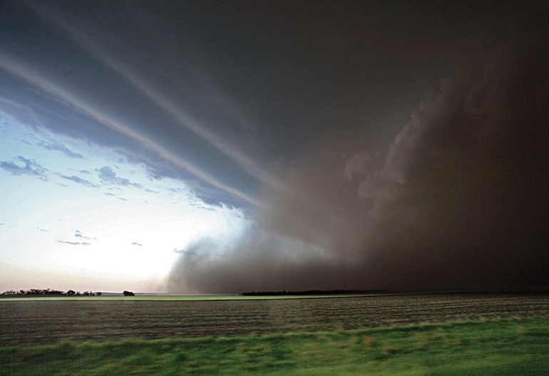
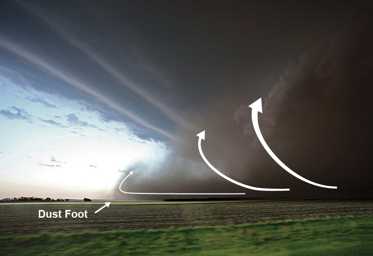
A plume of dust/dirt that is raised as the downburst reaches the ground and moves away from the impact point.
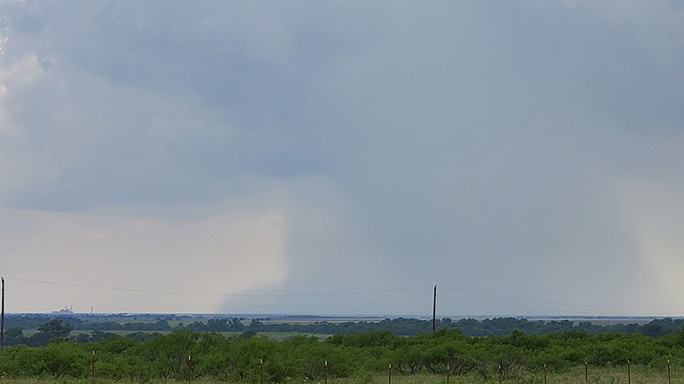
While many of these photos were taken on days with pristine visibility, many time the skies will be hazy making storm spotting difficult.
Remain vigilant even on days when there is poor contrast between storms and the background environment.