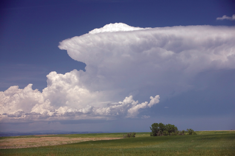
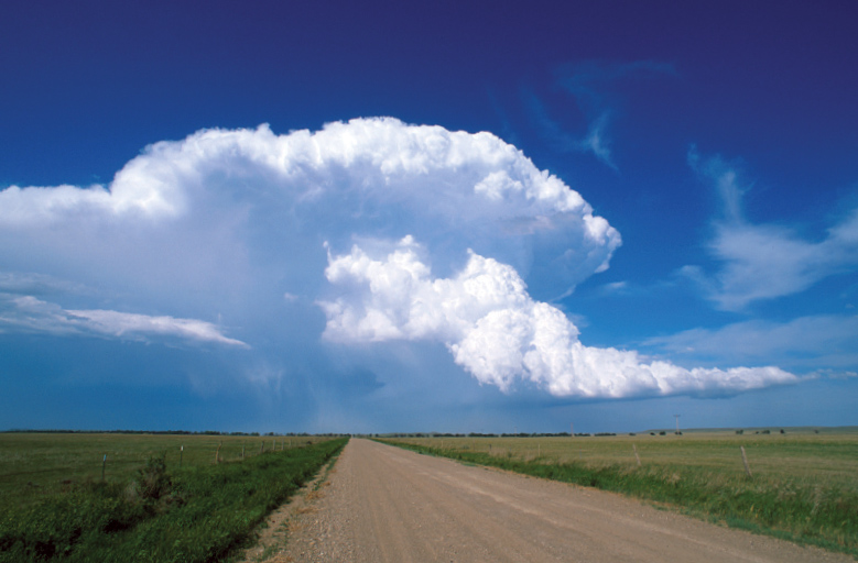
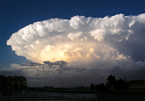
The fifth type of thunderstorm, the supercell, is a highly organized storm. Nearly all supercells produce some sort of severe weather (large hail or damaging winds) yet only 30 percent or less produce tornadoes.
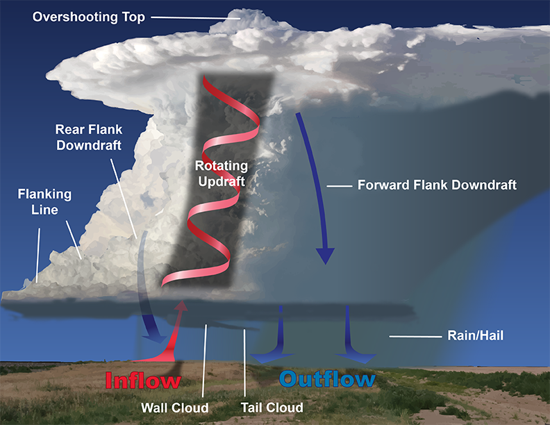
Supercells are not defined by their size as they can be large or small, tall or short. What sets them apart is the updraft rotates counterclockwise. Updraft rotation helps these storms prolong their lifetime which can be measured in hours instead of minutes.
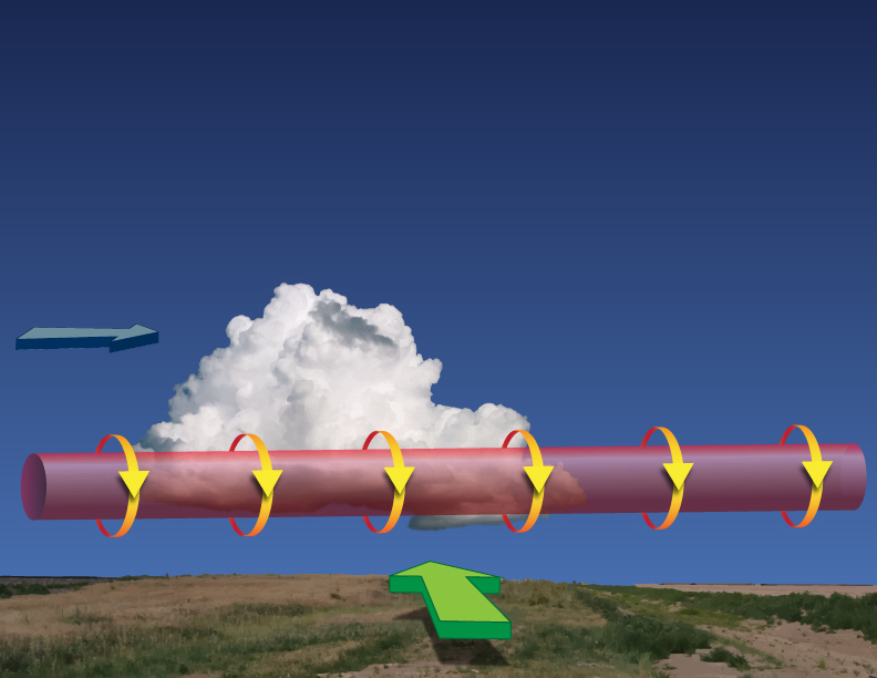
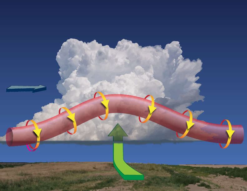
The rotation of the updraft comes from an additional ingredient, besides moisture, lift and instability mentioned earlier, called wind shear. Wind shear is the change in the wind’s speed and/or direction with height.
For supercell formation, the meteorologists focus’ on how the wind’s speed increases with height AND the direction the wind changes with height.
Increasing wind speed with height, called speed shear, helps to tilt the supercell’s updraft. This shifts any precipitation created downwind preventing it from falling back into the updraft which would diminish the storm.
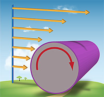
But speed shear alone will usually not cause a thunderstorm to rotate. The second type of wind shear, called directional shear, is what enables rotation. Specifically, the direction change needs to be in a clockwise motion, called veering winds.
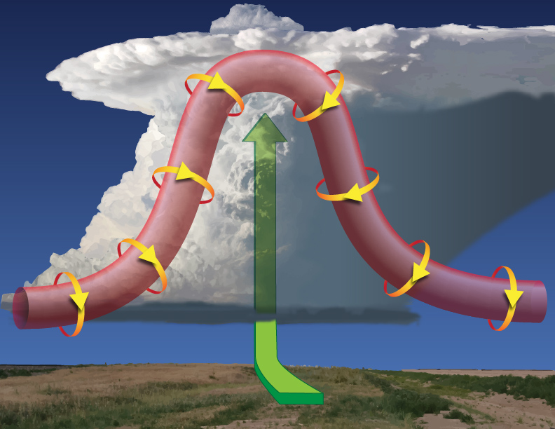
Working together, speed shear and directional shear induce a rolling motion to the lower atmosphere similar to a paper towel tube. When an updraft is initiated, the rising air lift this rolling tube, called a vortex tube, into a vertical position.
It is the left side of the rotating tube (cyclonic rotation) that dominates causing the cumulonimbus cloud to rotate and become a supercell.
Updrafts in supercell can attain speeds more than 100 mph (160 km/h). Such velocities are able to support the formation of very large hail up to size of grapefruit.
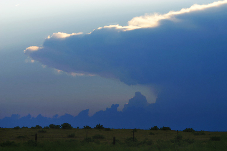
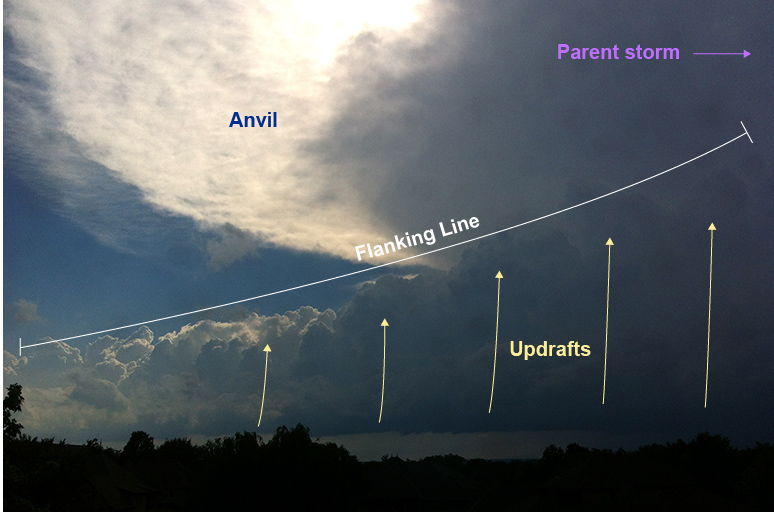
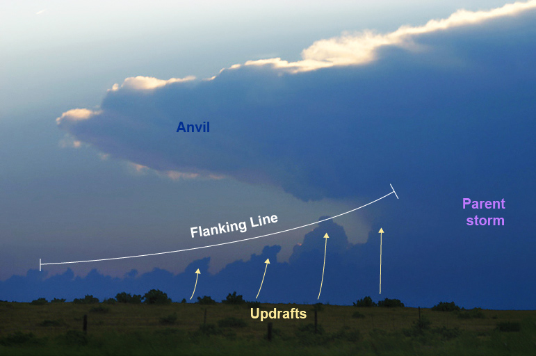
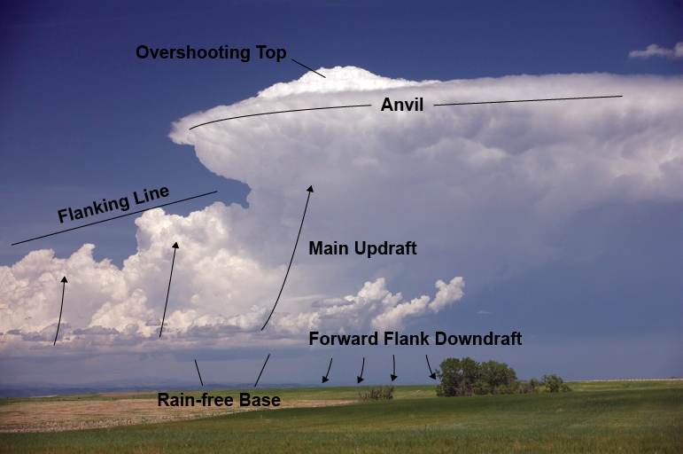
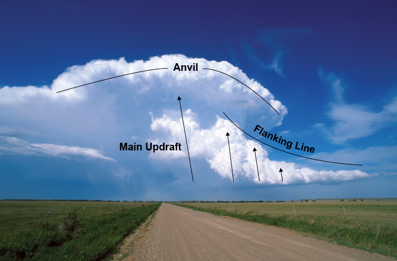
Extending south or southwest of the storm, the flanking line is a series or line of new updrafts merging into the updraft. This is a persistent source of updraft/energy that promotes supercell longevity.
If you observed a series of cumuliform towers rising into the parent thunderstorm there is good potential for the supercell to persist for several hours. Robust flanking lines are instrumental for some of the more significant tornadoes in history.
If conditions warrant, as the main updraft completes its lifecycle (with or without severe weather), the next updraft in the flanking line resupplies the supercell with a fresh supply of moisture and instability.
This repeating resupply of energy makes for cyclic supercells where the storm "spins up" (produces severe weather and/or tornado) then seems to weaken, only to strengthen again (more severe weather/new tornado) with the next new updraft from the flanking line.
Supercells can produce extremely large hail and strong, violent, tornadoes and produce damaging outflow winds in excess of 100 mph. As a spotter, it is essential to become familiar with the visual aspects underneath these intense thunderstorms.